Coire Fearna

Valley in Stirlingshire

Scotland

Coire Fearna

Loch Lomond Looking north-east, with the Inversnaid Hotel on the opposite bank
Loch Lomond Credit: Eirian Evans

The requested URL returned error: 429 Too Many Requests

If you have any feedback on the listing, please let us know in the comments section below.
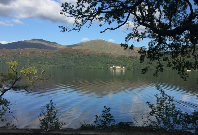
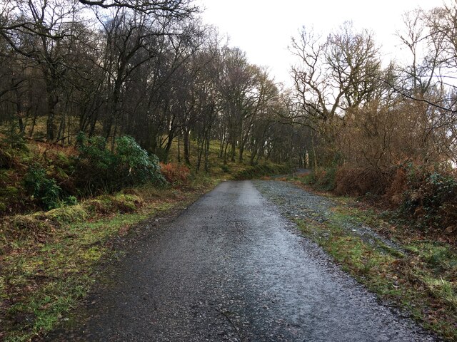
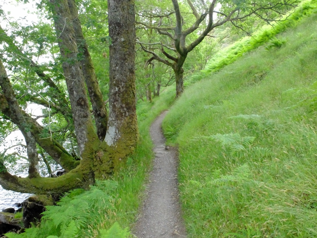
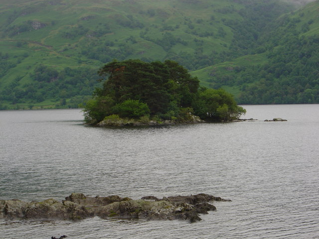
Coire Fearna Images

Images are sourced within 2km of 56.232025/-4.6702664 or Grid Reference NN3407. Thanks to Geograph Open Source API. All images are credited.

Loch Lomond Looking north-east, with the Inversnaid Hotel on the opposite bank
Loch Lomond
Looking north-east, with the Inversnaid Hotel on the opposite bank
West shore of Loch Lomond below Kenmore Wood The view northwards along the west side of Loch Lomond. The stretch of the loch in view ahead is between Inveruglas and Inversnaid. The A82 can be seen at the left side of the image.
West shore of Loch Lomond below Kenmore Wood
The view northwards along the west side of Loch Lomond. The stretch of the loch in view ahead is between Inveruglas and Inversnaid. The A82 can be seen at the left side of the image.
A82 along the west shore of Loch Lomond
Track into Kenmore Wood, Loch Lomond
Glen Arklet - Minor road descending towards Inversnaid and Loch Lomond Looking south-westward.
Glen Arklet - Minor road descending towards Inversnaid and Loch Lomond
Looking south-westward.
Glen Arklet - Minor road climbing away from Inversnaid and Loch Lomond Looking north-eastward.
Glen Arklet - Minor road climbing away from Inversnaid and Loch Lomond
Looking north-eastward.
Loch Lomond Looking southward from Inversnaid Harbour.
Loch Lomond
Looking southward from Inversnaid Harbour.
Minor road climbing out of Inversnaid Looking north-eastward. At this point the West Highland Way has been re-routed along the road and the orange barrier ahead is an access point to re-join the main route.
Minor road climbing out of Inversnaid
Looking north-eastward. At this point the West Highland Way has been re-routed along the road and the orange barrier ahead is an access point to re-join the main route.
Ordnance Survey Cut Mark with Rivet This mark and rived can be found on top of the parapet of the road bridge spanning Snaid Burn at Inversnaid.
The recorded details give a height of 115.889 metres above seal level.
For more detail see : <span class="nowrap"><a title="https://www.bench-marks.org.uk/bm179874" rel="nofollow ugc noopener" href="https://www.bench-marks.org.uk/bm179874">Link</a><img style="margin-left:2px;" alt="External link" title="External link - shift click to open in new window" src="https://s1.geograph.org.uk/img/external.png" width="10" height="10"/></span>
Ordnance Survey Cut Mark with Rivet
This mark and rived can be found on top of the parapet of the road bridge spanning Snaid Burn at Inversnaid. The recorded details give a height of 115.889 metres above seal level. For more detail see : LinkExternal link
Memorial to Loch Lomond fatality Mid morning on Sunday 23 November 1975, a party of walkers got into trouble whilst trying to wade through an in-spate Cailness Burn. This burn is approximately 2 km south of Inversnaid on the West Highland Way long distance walk. At that time there was no foot-bridge across the burn; the previous one had been washed away in July of that year. Three of the walkers were swept out into Loch Lomond and their leader, 6ft 5in Bill Lobban, waded in to the water to try and rescue them.
All this was witnessed by 68 year old John Groome from nearby Caillnes Cottage. John launched his motorised ten foot open dinghy and managed to rescue three of those in trouble, but there was no sign of Bill Lobban, his body was never recovered.
The full story is available as part of John Groome’s Diaries. These are available via the Friends of Loch Lomond’s website. <span class="nowrap"><a title="https://www.lochlomondtrossachs.org.uk/john-groome-diaries" rel="nofollow ugc noopener" href="https://www.lochlomondtrossachs.org.uk/john-groome-diaries">Link</a><img style="margin-left:2px;" alt="External link" title="External link - shift click to open in new window" src="https://s1.geograph.org.uk/img/external.png" width="10" height="10"/></span>
Memorial to Loch Lomond fatality
Mid morning on Sunday 23 November 1975, a party of walkers got into trouble whilst trying to wade through an in-spate Cailness Burn. This burn is approximately 2 km south of Inversnaid on the West Highland Way long distance walk. At that time there was no foot-bridge across the burn; the previous one had been washed away in July of that year. Three of the walkers were swept out into Loch Lomond and their leader, 6ft 5in Bill Lobban, waded in to the water to try and rescue them. All this was witnessed by 68 year old John Groome from nearby Caillnes Cottage. John launched his motorised ten foot open dinghy and managed to rescue three of those in trouble, but there was no sign of Bill Lobban, his body was never recovered. The full story is available as part of John Groome’s Diaries. These are available via the Friends of Loch Lomond’s website. LinkExternal link
Pier at Inversnaid
Pier at Inversnaid
Inversnaid pier, Loch Lomond
Boulder by the West Highland Way The West Highland Way is a long distance footpath, running for 154km (96miles) between Milngavie and Fort William. 
It passes through countryside north of Glasgow, follows the east shore of Loch Lomond to Glen Falloch and Strathfillan, crosses Rannoch Moor to the head of Glencoe, climbs the Devil’s Staircase and descends to Loch Leven, before crossing the Lairigmor and Glen Nevis to finish in Gordon Square, Fort William.
Boulder by the West Highland Way
The West Highland Way is a long distance footpath, running for 154km (96miles) between Milngavie and Fort William. It passes through countryside north of Glasgow, follows the east shore of Loch Lomond to Glen Falloch and Strathfillan, crosses Rannoch Moor to the head of Glencoe, climbs the Devil’s Staircase and descends to Loch Leven, before crossing the Lairigmor and Glen Nevis to finish in Gordon Square, Fort William.
The Cailness Burn Viewed from the West Highland Way footbridge.
The Cailness Burn
Viewed from the West Highland Way footbridge.
Cailness Truly remote living on the east side of Loch Lomond.
Cailness
Truly remote living on the east side of Loch Lomond.
East shore of Loch Lomond South of Inversnaid on the West Highland Way.
East shore of Loch Lomond
South of Inversnaid on the West Highland Way.
The West Highland Way below Ashlan Heading north towards Inversnaid.
The West Highland Way below Ashlan
Heading north towards Inversnaid.
Show me another place!

Coire Fearna is located at Grid Ref: NN3407 (Lat: 56.232025, Lng: -4.6702664)

Unitary Authority: Stirling

Police Authority: Forth Valley

What 3 Words

///taxi.condensed.quicker. Near Garelochhead, Argyll & Bute

Nearby Locations

Coire Fearna

Related Wikis

Inversnaid Falls

Inversnaid Falls is a waterfall of Scotland. == See also == Waterfalls of Scotland == References == Media related to Inversnaid Falls at Wikimedia Commons

Inversnaid

Inversnaid (Scottish Gaelic: Inbhir Snàthaid) is a small rural community on the east bank of Loch Lomond in Scotland, near the north end of the loch....

Tarbet Isle

Tarbet Isle is an island in Loch Lomond, Scotland. It is off Tarbet on the mainland. It is 10 feet (3.0 m) at its highest point, and 80 metres (260 ft...

Wallace's Isle

Wallace's Isle is an island in Loch Lomond, Scotland.Wallace's Isle is a low, flat island in the mouth of Inveruglas Water, just south of Inveruglas and...

Have you been to Coire Fearna?

Leave your review of Coire Fearna below (or comments, questions and feedback).