Glen Luss

Valley in Dunbartonshire

Scotland

Glen Luss

Village shop and Post Office Luss
Village shop and Post Office Luss Credit: John Ferguson

Glen Luss is a picturesque valley located in Dunbartonshire, Scotland. Situated on the western shores of Loch Lomond, it is renowned for its stunning natural beauty and tranquil atmosphere. The valley is surrounded by rolling hills and dense forests, creating an idyllic setting for outdoor enthusiasts and nature lovers.

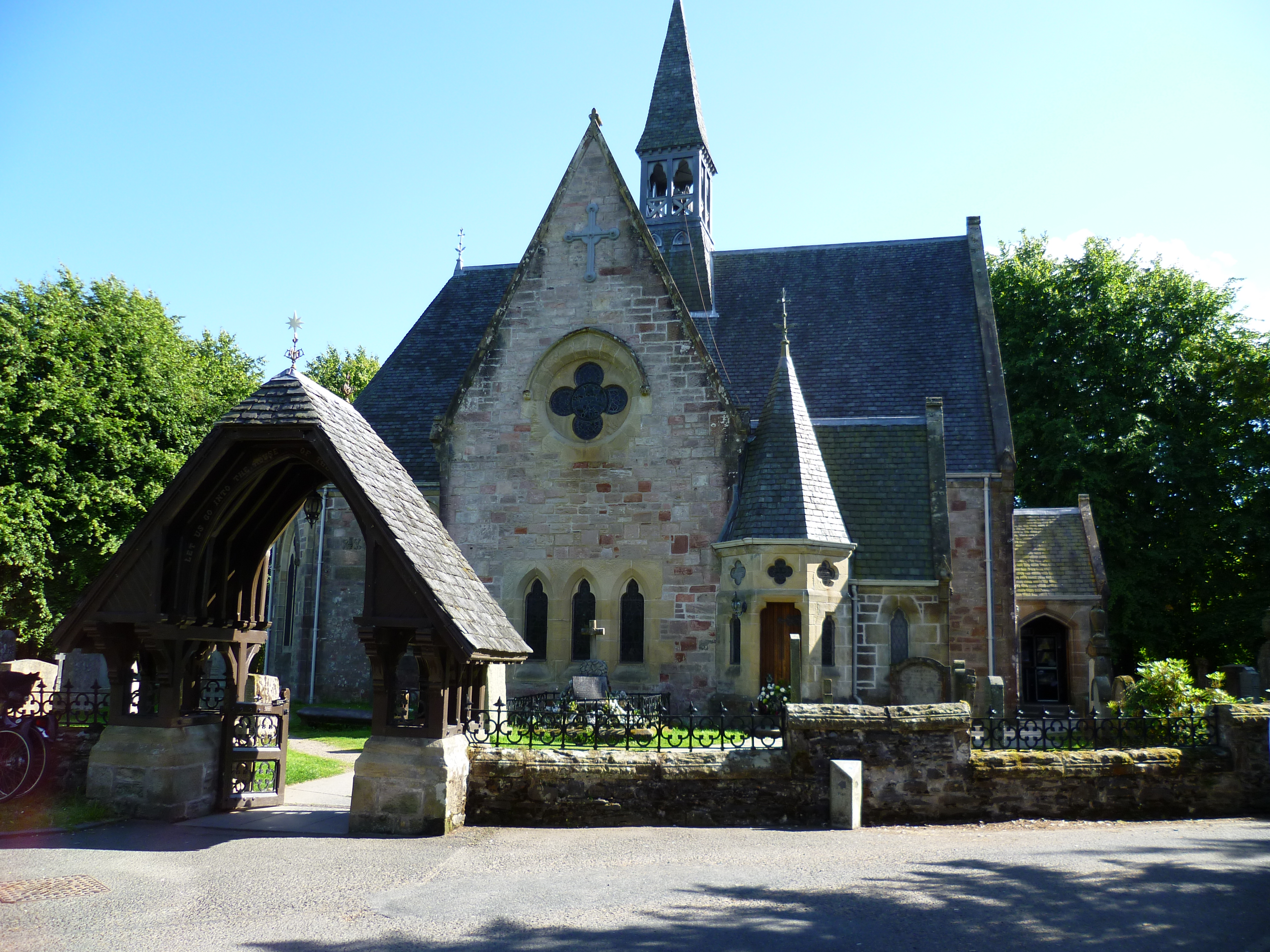
The small village of Luss is nestled within Glen Luss and serves as a gateway to the valley. With its traditional stone cottages and charming streets, Luss exudes a quaint and welcoming ambiance. Visitors can explore the village and discover its rich history, including the famous Luss Parish Church, which dates back to the 19th century.

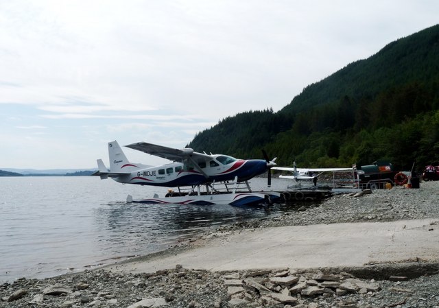
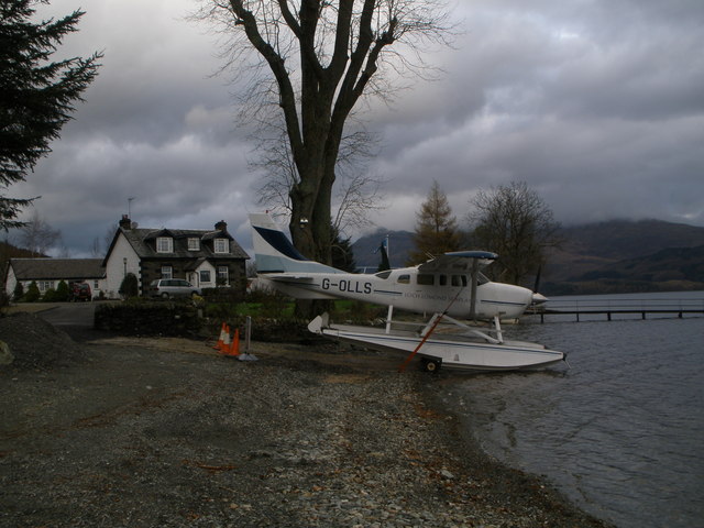
One of the main attractions in Glen Luss is the Loch Lomond and The Trossachs National Park, which encompasses the entire valley. The park offers a myriad of outdoor activities, such as hiking, cycling, and wildlife spotting. The area is home to various species of birds, deer, and other wildlife, making it a paradise for nature enthusiasts.

Another highlight of Glen Luss is the Loch Lomond Shores, a popular retail and leisure complex located on the shores of the loch. Here, visitors can enjoy shopping, dining, and even take a cruise on the loch to admire the breathtaking scenery.

Glen Luss is easily accessible by car, with ample parking available in the village and at Loch Lomond Shores. The valley also benefits from regular bus services, making it convenient for those without private transportation.

Overall, Glen Luss is a hidden gem in Dunbartonshire, offering visitors a peaceful escape amidst stunning natural landscapes. Whether you seek outdoor adventures or simply wish to relax and unwind, this valley is sure to captivate your senses.

If you have any feedback on the listing, please let us know in the comments section below.

Glen Luss Images

Images are sourced within 2km of 56.105135/-4.6625946 or Grid Reference NS3493. Thanks to Geograph Open Source API. All images are credited.

Village shop and Post Office Luss
Foxglove among bracken Bracken low down on the Glen Luss hillside has died down and been flattened by winter. The ground is covered in dry, brittle bracken except where new foxgloves have sprouted.
Foxglove among bracken
Bracken low down on the Glen Luss hillside has died down and been flattened by winter. The ground is covered in dry, brittle bracken except where new foxgloves have sprouted.
Gate onto the hill
Gate onto the hill
Fell runners descending from Beinn Dubh The runners are following the popular path that takes walkers to and from Luss village. Loch Lomond with Inchlonaig island lies beyond.
Fell runners descending from Beinn Dubh
The runners are following the popular path that takes walkers to and from Luss village. Loch Lomond with Inchlonaig island lies beyond.
Looking towards Loch Lomond from Creag an t-Seilich The featureless hillside in the foreground typifies the terrain of the Luss Hills. An indistinct path leads walkers over Creag an t-Seilich towards the top of Beinn Dubh. Islands of Loch Lomond lie behind: Fraoch Eilean small in the foreground, Inchtavannach and Inchconnachan behind it, Inchmoan and Inchruin behind them at the left.
Looking towards Loch Lomond from Creag an t-Seilich
The featureless hillside in the foreground typifies the terrain of the Luss Hills. An indistinct path leads walkers over Creag an t-Seilich towards the top of Beinn Dubh. Islands of Loch Lomond lie behind: Fraoch Eilean small in the foreground, Inchtavannach and Inchconnachan behind it, Inchmoan and Inchruin behind them at the left.
Boggy terrain on Beinn Dubh On the same path, looking in the same direction as <a href="https://www.geograph.org.uk/photo/934033">NS3494 : Path to Beinn Dubh</a>, the picture here shows how much damper the ground generally is in early Spring.
Boggy terrain on Beinn Dubh
On the same path, looking in the same direction as NS3494 : Path to Beinn Dubh, the picture here shows how much damper the ground generally is in early Spring.
Hillside above Glen Luss The picture looks roughly east along the side of the hill above Glen Luss. Loch Lomond lies in the distance.
Hillside above Glen Luss
The picture looks roughly east along the side of the hill above Glen Luss. Loch Lomond lies in the distance.
The Luss Highland Gathering Ground In front of the grandstand can be seen the memorial to Sir Ian Colquhoun chieftain of the Luss Highland Gathering
The Luss Highland Gathering Ground
In front of the grandstand can be seen the memorial to Sir Ian Colquhoun chieftain of the Luss Highland Gathering
Eagle Sculpture outside Luss Visitor centre
Luss Visitor Centre in the rain By car park in Luss
Luss Visitor Centre in the rain
By car park in Luss
Headland at Rhu wood across Luss Bay Taken just north of Pier. Ben Lomond in background
Headland at Rhu wood across Luss Bay
Taken just north of Pier. Ben Lomond in background
Loch Lomond Seaplane base G-MDJE ready for takeoff
Loch Lomond Seaplane base
G-MDJE ready for takeoff
Pier road from corner of Church Road
Looking towards Luss Pier
Glendarroch Tearoom Glendarroch was the fictional placename of Luss, the outside set for the Scottish TV daytime soap "Take The High Road". But the Glendarroch Tearoom (as opposed to tea room at a later date) was very much real, but was closed when we got there.
Glendarroch Tearoom
Glendarroch was the fictional placename of Luss, the outside set for the Scottish TV daytime soap "Take The High Road". But the Glendarroch Tearoom (as opposed to tea room at a later date) was very much real, but was closed when we got there.
Luss beach, looking towards the jetty
Sea-plane on the banks of Loch Lomond at Culag
Rhu Wood Woodland on the west side of Loch Lomond, seen from the old alignment of the A82.
Rhu Wood
Woodland on the west side of Loch Lomond, seen from the old alignment of the A82.
Show me another place!

Glen Luss is located at Grid Ref: NS3493 (Lat: 56.105135, Lng: -4.6625946)

Unitary Authority: Argyll and Bute

Police Authority: Argyll and West Dunbartonshire

What 3 Words

///forehand.filed.uttering. Near Garelochhead, Argyll & Bute

Nearby Locations

Glen Luss

Related Wikis

Luss

Luss (Lus, 'herb' in Gaelic) is a village in Argyll and Bute, Scotland, on the west bank of Loch Lomond. The village is within the Loch Lomond and The...

Alderdale

Alderdale is a building in Luss, Argyll and Bute, Scotland. It is a Category C listed structure dating from the early-to-mid 19th century.The building...

West Loch Lomond Cycle Path

The West Loch Lomond Cycle Path is a cycle path that runs from Arrochar and Tarbet railway station, at the upper end of Loch Lomond in Scotland, to Balloch...

Holly Cottage (Luss)

Holly Cottage is a building in Luss, Argyll and Bute, Scotland. It is a Category B listed structure dating from the early-to-mid 19th century.The building...

Nearby Amenities

Located within 500m of 56.105135,-4.6625946
Falls of Luss
Rapids: 6
Waterway: waterfall
Lat/Long: 56.1071513/-4.668824
Tyneshandon
Place: isolated_dwelling
Lat/Long: 56.107829/-4.6626735
The data included in this document is from www.openstreetmap.org. The data is made available under ODbL.

Have you been to Glen Luss?

Leave your review of Glen Luss below (or comments, questions and feedback).