Bake Bottoms

Valley in Cornwall

England

Bake Bottoms

Railway Bridge over the A38 at Trerulefoot The A38 is a major A-class trunk route. When first designated in 1922, it ran from Derby to Plymouth but it was later extended at both ends so that it now runs for 292 miles from Mansfield in Nottinghamshire to Bodmin in Cornwall.

Prior to the opening of the M5 motorway in the 1960s and 1970s, the A38 formed the main "holiday route" from the Midlands to Somerset, Devon and Cornwall and the south-western section was notorious at holiday times for the congestion. Nowadays, for most of the southern section, the A38 is a fairly quiet road shadowing the M5 extremely closely; often running alongside the motorway as a single carriageway road. The section between Exeter and Plymouth is, however, a busy dual carriageway which serves as the southern extension of the M5 and is known as “the Devon Expressway”.

More information at <span class="nowrap"><a title="http://en.wikipedia.org/wiki/A38_road" rel="nofollow ugc noopener" href="http://en.wikipedia.org/wiki/A38_road">Link</a><img style="margin-left:2px;" alt="External link" title="External link - shift click to open in new window" src="https://s1.geograph.org.uk/img/external.png" width="10" height="10"/></span>  (Wikipedia) and <span class="nowrap"><a title="http://www.sabre-roads.org.uk/wiki/index.php?title=A38" rel="nofollow ugc noopener" href="http://www.sabre-roads.org.uk/wiki/index.php?title=A38">Link</a><img style="margin-left:2px;" alt="External link" title="External link - shift click to open in new window" src="https://s1.geograph.org.uk/img/external.png" width="10" height="10"/></span>  (SABRE).
Railway Bridge over the A38 at Trerulefoot Credit: David Dixon

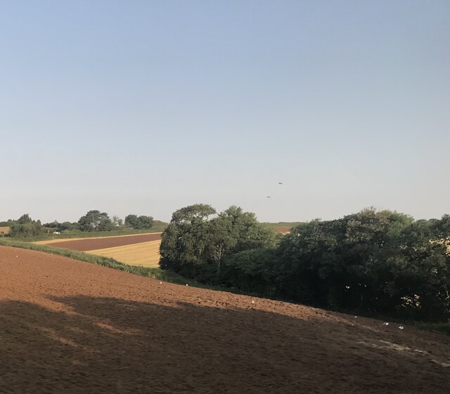
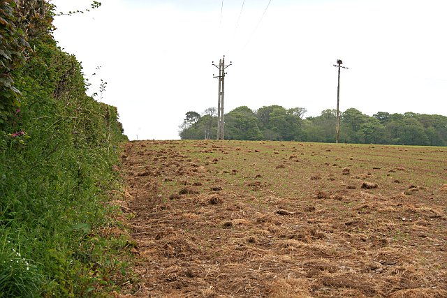
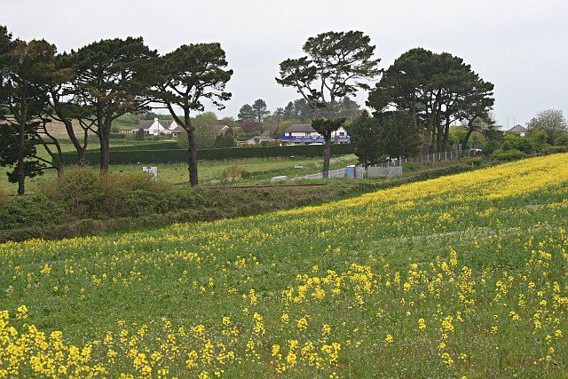
Bake Bottoms, Cornwall (Valley) is a charming village located in the southwestern part of England. Situated in the beautiful county of Cornwall, it is nestled in a picturesque valley, surrounded by rolling hills and lush greenery. The village is known for its idyllic countryside setting and tranquil atmosphere, making it a popular destination for those seeking a peaceful getaway.

Bake Bottoms is home to a close-knit community, with friendly locals who take pride in preserving the village's heritage and natural beauty. The architecture in the village reflects its rich history, with traditional stone cottages and buildings dating back several centuries. The village church, St. Mary's, is a notable landmark and a testament to the village's long-standing presence.

Nature enthusiasts will be delighted by the abundance of walking trails and scenic spots in and around Bake Bottoms. The valley is crisscrossed with footpaths, offering breathtaking views of the surrounding countryside. One of the highlights is the Bake Bottoms Nature Reserve, which is home to a diverse range of wildlife and provides a peaceful retreat for birdwatchers and nature lovers.

Despite its small size, Bake Bottoms boasts a few local amenities, including a cozy pub serving delicious traditional cuisine and a village shop that caters to the daily needs of its residents. The village also hosts various community events throughout the year, such as summer fairs and Christmas markets, which bring together locals and visitors alike.

In conclusion, Bake Bottoms, Cornwall (Valley) is a quaint village that charms visitors with its stunning natural scenery, warm community spirit, and historical charm. It offers a perfect escape from the hustle and bustle of city life, providing a haven of peace and tranquility for all who visit.

If you have any feedback on the listing, please let us know in the comments section below.
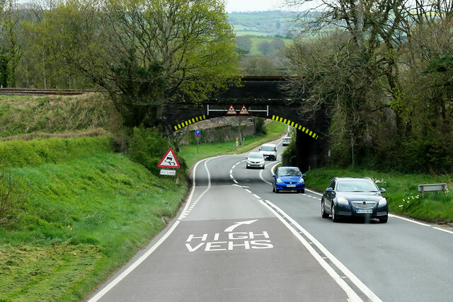
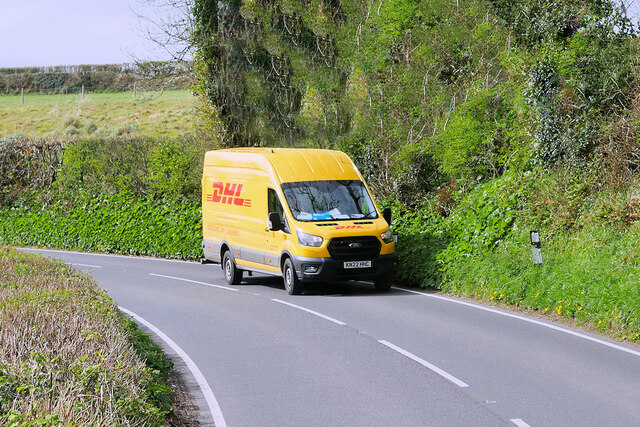
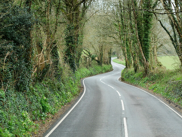
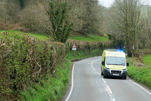
Bake Bottoms Images

Images are sourced within 2km of 50.397394/-4.3510236 or Grid Reference SX3357. Thanks to Geograph Open Source API. All images are credited.

Railway Bridge over the A38 at Trerulefoot The A38 is a major A-class trunk route. When first designated in 1922, it ran from Derby to Plymouth but it was later extended at both ends so that it now runs for 292 miles from Mansfield in Nottinghamshire to Bodmin in Cornwall.

Prior to the opening of the M5 motorway in the 1960s and 1970s, the A38 formed the main "holiday route" from the Midlands to Somerset, Devon and Cornwall and the south-western section was notorious at holiday times for the congestion. Nowadays, for most of the southern section, the A38 is a fairly quiet road shadowing the M5 extremely closely; often running alongside the motorway as a single carriageway road. The section between Exeter and Plymouth is, however, a busy dual carriageway which serves as the southern extension of the M5 and is known as “the Devon Expressway”.

More information at <span class="nowrap"><a title="http://en.wikipedia.org/wiki/A38_road" rel="nofollow ugc noopener" href="http://en.wikipedia.org/wiki/A38_road">Link</a><img style="margin-left:2px;" alt="External link" title="External link - shift click to open in new window" src="https://s1.geograph.org.uk/img/external.png" width="10" height="10"/></span>  (Wikipedia) and <span class="nowrap"><a title="http://www.sabre-roads.org.uk/wiki/index.php?title=A38" rel="nofollow ugc noopener" href="http://www.sabre-roads.org.uk/wiki/index.php?title=A38">Link</a><img style="margin-left:2px;" alt="External link" title="External link - shift click to open in new window" src="https://s1.geograph.org.uk/img/external.png" width="10" height="10"/></span>  (SABRE).
Railway Bridge over the A38 at Trerulefoot
The A38 is a major A-class trunk route. When first designated in 1922, it ran from Derby to Plymouth but it was later extended at both ends so that it now runs for 292 miles from Mansfield in Nottinghamshire to Bodmin in Cornwall. Prior to the opening of the M5 motorway in the 1960s and 1970s, the A38 formed the main "holiday route" from the Midlands to Somerset, Devon and Cornwall and the south-western section was notorious at holiday times for the congestion. Nowadays, for most of the southern section, the A38 is a fairly quiet road shadowing the M5 extremely closely; often running alongside the motorway as a single carriageway road. The section between Exeter and Plymouth is, however, a busy dual carriageway which serves as the southern extension of the M5 and is known as “the Devon Expressway”. More information at LinkExternal link (Wikipedia) and LinkExternal link (SABRE).
Layby on the A374 at Trerulefoot The A374 is the former route of the A38 between Marsh Mills and Trerulefoot by way of Plymouth city centre and the Torpoint Ferry. It is 16 miles long
<span class="nowrap"><a title="http://www.sabre-roads.org.uk/wiki/index.php?title=A374" rel="nofollow ugc noopener" href="http://www.sabre-roads.org.uk/wiki/index.php?title=A374">Link</a><img style="margin-left:2px;" alt="External link" title="External link - shift click to open in new window" src="https://s1.geograph.org.uk/img/external.png" width="10" height="10"/></span>
Layby on the A374 at Trerulefoot
The A374 is the former route of the A38 between Marsh Mills and Trerulefoot by way of Plymouth city centre and the Torpoint Ferry. It is 16 miles long LinkExternal link
A374 south of Trerulefoot The A374 is the former route of the A38 between Marsh Mills and Trerulefoot by way of Plymouth city centre and the Torpoint Ferry. It is 16 miles long
<span class="nowrap"><a title="http://www.sabre-roads.org.uk/wiki/index.php?title=A374" rel="nofollow ugc noopener" href="http://www.sabre-roads.org.uk/wiki/index.php?title=A374">Link</a><img style="margin-left:2px;" alt="External link" title="External link - shift click to open in new window" src="https://s1.geograph.org.uk/img/external.png" width="10" height="10"/></span>
A374 south of Trerulefoot
The A374 is the former route of the A38 between Marsh Mills and Trerulefoot by way of Plymouth city centre and the Torpoint Ferry. It is 16 miles long LinkExternal link
A387, Haywell Wood The A387 is a 12.5 mile long road in SE Cornwall, between Polbathic and Crumplehorn (Polperro) <a href="https://www.geograph.org.uk/photo/5559278">SX2051 : Mini-roundabout, Crumplehorn</a>, via Looe.
<span class="nowrap"><a title="https://www.sabre-roads.org.uk/wiki/index.php?title=A387" rel="nofollow ugc noopener" href="https://www.sabre-roads.org.uk/wiki/index.php?title=A387">Link</a><img style="margin-left:2px;" alt="External link" title="External link - shift click to open in new window" src="https://s1.geograph.org.uk/img/external.png" width="10" height="10"/></span>
A387, Haywell Wood
The A387 is a 12.5 mile long road in SE Cornwall, between Polbathic and Crumplehorn (Polperro) SX2051 : Mini-roundabout, Crumplehorn, via Looe. LinkExternal link
Trerulefoot, Windy Ridge Trerulefoot is a village in southeast Cornwall, located approximately halfway between the towns of Saltash and Liskeard. The village has a farm shop, two cafés and a petrol filling station.
Trerulefoot, Windy Ridge
Trerulefoot is a village in southeast Cornwall, located approximately halfway between the towns of Saltash and Liskeard. The village has a farm shop, two cafés and a petrol filling station.
Trerulefoot, A374 Trerulefoot is a village in southeast Cornwall, located approximately halfway between the towns of Saltash and Liskeard. The village has a farm shop, two cafés and a petrol filling station.
Trerulefoot, A374
Trerulefoot is a village in southeast Cornwall, located approximately halfway between the towns of Saltash and Liskeard. The village has a farm shop, two cafés and a petrol filling station.
A387 near Carracawn Farm The A387 is a 12.5 mile long road in SE Cornwall, between Polbathic and Crumplehorn (Polperro) <a href="https://www.geograph.org.uk/photo/5559278">SX2051 : Mini-roundabout, Crumplehorn</a>, via Looe.
<span class="nowrap"><a title="https://www.sabre-roads.org.uk/wiki/index.php?title=A387" rel="nofollow ugc noopener" href="https://www.sabre-roads.org.uk/wiki/index.php?title=A387">Link</a><img style="margin-left:2px;" alt="External link" title="External link - shift click to open in new window" src="https://s1.geograph.org.uk/img/external.png" width="10" height="10"/></span>
A387 near Carracawn Farm
The A387 is a 12.5 mile long road in SE Cornwall, between Polbathic and Crumplehorn (Polperro) SX2051 : Mini-roundabout, Crumplehorn, via Looe. LinkExternal link
Delivery Van on the A387 The A387 is a 12.5 mile long road in SE Cornwall, between Polbathic and Crumplehorn (Polperro) <a href="https://www.geograph.org.uk/photo/5559278">SX2051 : Mini-roundabout, Crumplehorn</a>, via Looe.
<span class="nowrap"><a title="https://www.sabre-roads.org.uk/wiki/index.php?title=A387" rel="nofollow ugc noopener" href="https://www.sabre-roads.org.uk/wiki/index.php?title=A387">Link</a><img style="margin-left:2px;" alt="External link" title="External link - shift click to open in new window" src="https://s1.geograph.org.uk/img/external.png" width="10" height="10"/></span>
Delivery Van on the A387
The A387 is a 12.5 mile long road in SE Cornwall, between Polbathic and Crumplehorn (Polperro) SX2051 : Mini-roundabout, Crumplehorn, via Looe. LinkExternal link
A387 near Carracawn Plantation The A387 is a 12.5 mile long road in SE Cornwall, between Polbathic and Crumplehorn (Polperro) <a href="https://www.geograph.org.uk/photo/5559278">SX2051 : Mini-roundabout, Crumplehorn</a>, via Looe.
<span class="nowrap"><a title="https://www.sabre-roads.org.uk/wiki/index.php?title=A387" rel="nofollow ugc noopener" href="https://www.sabre-roads.org.uk/wiki/index.php?title=A387">Link</a><img style="margin-left:2px;" alt="External link" title="External link - shift click to open in new window" src="https://s1.geograph.org.uk/img/external.png" width="10" height="10"/></span>
A387 near Carracawn Plantation
The A387 is a 12.5 mile long road in SE Cornwall, between Polbathic and Crumplehorn (Polperro) SX2051 : Mini-roundabout, Crumplehorn, via Looe. LinkExternal link
A387, Carracawn Down The A387 is a 12.5 mile long road in SE Cornwall, between Polbathic and Crumplehorn (Polperro) <a href="https://www.geograph.org.uk/photo/5559278">SX2051 : Mini-roundabout, Crumplehorn</a>, via Looe.
<span class="nowrap"><a title="https://www.sabre-roads.org.uk/wiki/index.php?title=A387" rel="nofollow ugc noopener" href="https://www.sabre-roads.org.uk/wiki/index.php?title=A387">Link</a><img style="margin-left:2px;" alt="External link" title="External link - shift click to open in new window" src="https://s1.geograph.org.uk/img/external.png" width="10" height="10"/></span>
A387, Carracawn Down
The A387 is a 12.5 mile long road in SE Cornwall, between Polbathic and Crumplehorn (Polperro) SX2051 : Mini-roundabout, Crumplehorn, via Looe. LinkExternal link
Ambulance on the A387 at Carracawn Down The A387 is a 12.5 mile long road in SE Cornwall, between Polbathic and Crumplehorn (Polperro) <a href="https://www.geograph.org.uk/photo/5559278">SX2051 : Mini-roundabout, Crumplehorn</a>, via Looe.
<span class="nowrap"><a title="https://www.sabre-roads.org.uk/wiki/index.php?title=A387" rel="nofollow ugc noopener" href="https://www.sabre-roads.org.uk/wiki/index.php?title=A387">Link</a><img style="margin-left:2px;" alt="External link" title="External link - shift click to open in new window" src="https://s1.geograph.org.uk/img/external.png" width="10" height="10"/></span>
Ambulance on the A387 at Carracawn Down
The A387 is a 12.5 mile long road in SE Cornwall, between Polbathic and Crumplehorn (Polperro) SX2051 : Mini-roundabout, Crumplehorn, via Looe. LinkExternal link
Farmland near Milladon
Fields to the north of Trerulefoot
Meadow and Farmhouse Pasture land to the west of the village of St Germans.
Meadow and Farmhouse
Pasture land to the west of the village of St Germans.
Roadside Verge It is May and this verge is bright with Bluebells and Red Campion but the bracken stalks are growing fast.
Roadside Verge
It is May and this verge is bright with Bluebells and Red Campion but the bracken stalks are growing fast.
New Crops Green shoots are peppering this ploughed field.
New Crops
Green shoots are peppering this ploughed field.
A Field of Oilseed Rape The bright yellow flowers of Oilseed Rape have become a common sight in arable areas in the spring.  As well as providing vegetable oil, this crop makes a good 'break crop', improving the soil for wheat or barley in the following years.  Oilseed Rape cannot be grown frequently in any field due to the build up of diseases in the soil.  This may change however if farmers are allowed to plant disease resistant genetically engineered crops.
A Field of Oilseed Rape
The bright yellow flowers of Oilseed Rape have become a common sight in arable areas in the spring. As well as providing vegetable oil, this crop makes a good 'break crop', improving the soil for wheat or barley in the following years. Oilseed Rape cannot be grown frequently in any field due to the build up of diseases in the soil. This may change however if farmers are allowed to plant disease resistant genetically engineered crops.
Towards Trerulefoot Looking across a field of oilseed rape, railway line, pine trees and one of the roads which meet at Trerulefoot junction.
Towards Trerulefoot
Looking across a field of oilseed rape, railway line, pine trees and one of the roads which meet at Trerulefoot junction.
Show me another place!

Bake Bottoms is located at Grid Ref: SX3357 (Lat: 50.397394, Lng: -4.3510236)

Unitary Authority: Cornwall

Police Authority: Devon and Cornwall

What 3 Words

///already.dads.mistaking. Near Landrake, Cornwall

Related Wikis

Trerulefoot

Trerulefoot (pronounced , Cornish: Bentreriwall) is a village in southeast Cornwall, England, United Kingdom. It is located on the A38 trunk road approximately...

Bake, Cornwall

Bake (Cornish: Pobas) is a hamlet in south-east Cornwall, England, United Kingdom. It is 5 kilometres (3.1 mi) west of St Germans at grid reference SX...

Bake Fishing Lakes

Bake Fishing Lakes (grid reference SX318587); also known as Bake Lakes, Bake Farm Lakes or Bake Pools; is the name for a group of lakes at Bake Farm, near...

Budge's Shop

Budge's Shop is a hamlet in Cornwall, England. It is half a mile northwest of Trerulefoot. According to the Post Office the 2011 census population was...

Have you been to Bake Bottoms?

Leave your review of Bake Bottoms below (or comments, questions and feedback).