Glen Striddle

Valley in Dunbartonshire

Scotland

Glen Striddle

Fell runners descending from Beinn Dubh The runners are following the popular path that takes walkers to and from Luss village. Loch Lomond with Inchlonaig island lies beyond.
Fell runners descending from Beinn Dubh Credit: Alec MacKinnon

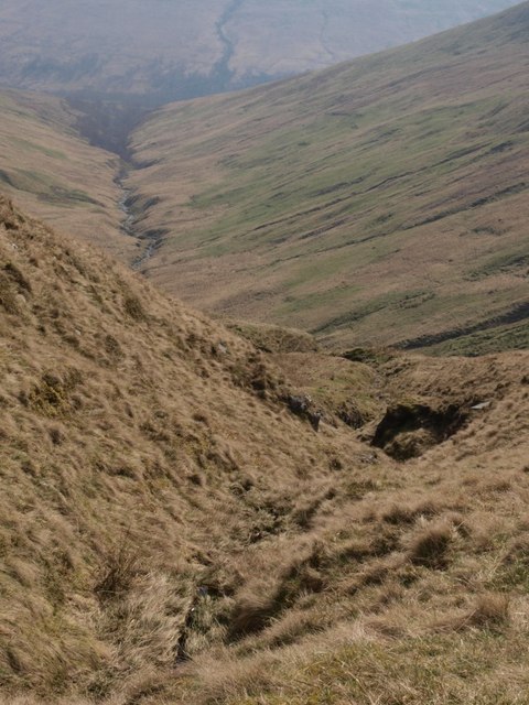
Glen Striddle is a picturesque valley located in Dunbartonshire, Scotland. Situated amidst the stunning Scottish countryside, the valley is known for its natural beauty and tranquil atmosphere. The valley is nestled between rolling hills, offering breathtaking views of the surrounding landscapes.

One of the prominent features of Glen Striddle is the River Leven, which flows through the valley, adding to its charm. The river is a popular spot for fishing and attracts anglers from far and wide. Its crystal-clear waters are home to various species of fish, including salmon and trout, making it a haven for fishing enthusiasts.

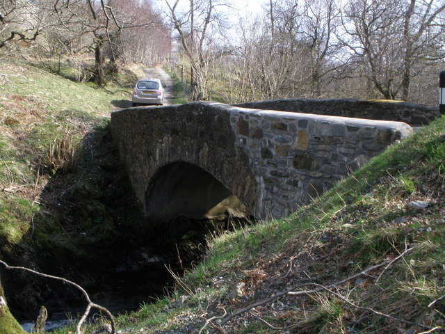
The valley is also renowned for its hiking trails, which provide opportunities for outdoor enthusiasts to explore the scenic surroundings. The trails vary in difficulty, catering to both novice and experienced hikers. Along the way, visitors can discover the diverse flora and fauna that inhabit the area, adding to the allure of Glen Striddle.

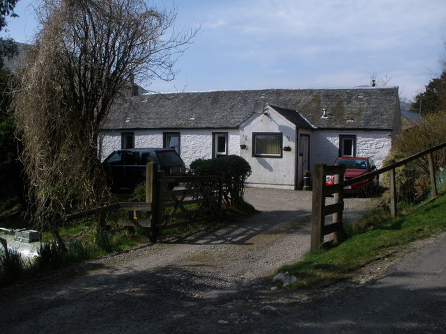
For those seeking a peaceful retreat, Glen Striddle offers a range of accommodation options. From cozy cottages to charming bed and breakfasts, visitors can find comfortable places to stay and experience the warm hospitality of the locals.

In addition to its natural beauty, Glen Striddle is located within close proximity to several notable attractions. The nearby Loch Lomond and The Trossachs National Park provide opportunities for boating, wildlife spotting, and exploring the rugged Scottish Highlands.

Overall, Glen Striddle in Dunbartonshire is a hidden gem of Scotland, offering visitors a chance to immerse themselves in the breathtaking landscapes and enjoy a peaceful retreat in the heart of nature.

If you have any feedback on the listing, please let us know in the comments section below.

Glen Striddle Images

Images are sourced within 2km of 56.116481/-4.6881388 or Grid Reference NS3294. Thanks to Geograph Open Source API. All images are credited.

Fell runners descending from Beinn Dubh The runners are following the popular path that takes walkers to and from Luss village. Loch Lomond with Inchlonaig island lies beyond.
Fell runners descending from Beinn Dubh
The runners are following the popular path that takes walkers to and from Luss village. Loch Lomond with Inchlonaig island lies beyond.
Looking towards Loch Lomond from Creag an t-Seilich The featureless hillside in the foreground typifies the terrain of the Luss Hills. An indistinct path leads walkers over Creag an t-Seilich towards the top of Beinn Dubh. Islands of Loch Lomond lie behind: Fraoch Eilean small in the foreground, Inchtavannach and Inchconnachan behind it, Inchmoan and Inchruin behind them at the left.
Looking towards Loch Lomond from Creag an t-Seilich
The featureless hillside in the foreground typifies the terrain of the Luss Hills. An indistinct path leads walkers over Creag an t-Seilich towards the top of Beinn Dubh. Islands of Loch Lomond lie behind: Fraoch Eilean small in the foreground, Inchtavannach and Inchconnachan behind it, Inchmoan and Inchruin behind them at the left.
Boggy terrain on Beinn Dubh On the same path, looking in the same direction as <a href="https://www.geograph.org.uk/photo/934033">NS3494 : Path to Beinn Dubh</a>, the picture here shows how much damper the ground generally is in early Spring.
Boggy terrain on Beinn Dubh
On the same path, looking in the same direction as NS3494 : Path to Beinn Dubh, the picture here shows how much damper the ground generally is in early Spring.
Peat hags on Beinn Dubh The peat hags lie on the north side of the very broad, flat ridge that runs north-west from the summit of Beinn Dubh. Although the day was hazy, Loch Lomond and Ben Lomond can be seen behind.
Peat hags on Beinn Dubh
The peat hags lie on the north side of the very broad, flat ridge that runs north-west from the summit of Beinn Dubh. Although the day was hazy, Loch Lomond and Ben Lomond can be seen behind.
Burn high up above Glen Striddle In the foreground is one of the wee burns shown on the map. Beyond is the big burn that runs along the floor of the glen, into which the foreground burn runs.
Burn high up above Glen Striddle
In the foreground is one of the wee burns shown on the map. Beyond is the big burn that runs along the floor of the glen, into which the foreground burn runs.
Wee waterfall in Glen Striddle burn One of the burns that falls steeply into Glen Striddle passes over some rocks here and has developed a wee waterfall (maybe fifteen feet high). The skyline where the burn has its origins can just be seen beyond the top of the waterfall.
Wee waterfall in Glen Striddle burn
One of the burns that falls steeply into Glen Striddle passes over some rocks here and has developed a wee waterfall (maybe fifteen feet high). The skyline where the burn has its origins can just be seen beyond the top of the waterfall.
Tributary flows into Glen Striddle burn I was unable to track down a name for the burn that runs along the floor of Glen Striddle - Allt Glen Striddle? Anyway this shows the point where one of the tributaries that run down the steep hillside from Beinn Dubh meet this burn.
Tributary flows into Glen Striddle burn
I was unable to track down a name for the burn that runs along the floor of Glen Striddle - Allt Glen Striddle? Anyway this shows the point where one of the tributaries that run down the steep hillside from Beinn Dubh meet this burn.
Looking up Glen Striddle
Hillside above Glen Luss The picture looks roughly east along the side of the hill above Glen Luss. Loch Lomond lies in the distance.
Hillside above Glen Luss
The picture looks roughly east along the side of the hill above Glen Luss. Loch Lomond lies in the distance.
Roadside cottage in Glen Luss
Bridge over Mollochan Burn Glen Luss
Bridge over Glen Striddle Burn
Beinn Dubh ('black hill') One of the drier parts of the otherwise rather damp Luss Hills.
Beinn Dubh ('black hill')
One of the drier parts of the otherwise rather damp Luss Hills.
Loch Lomond from Beinn Dubh Some of the loch's islands are visible through the haze as a squally shower passes through.
Loch Lomond from Beinn Dubh
Some of the loch's islands are visible through the haze as a squally shower passes through.
Wet path on Beinn Dubh Looking towards the 'Arrochar Alps' of The Cobbler, Beinn Ime and Beinn Narnain.
Wet path on Beinn Dubh
Looking towards the 'Arrochar Alps' of The Cobbler, Beinn Ime and Beinn Narnain.
Coire na h-Eanachan A corrie north west of Beinn Dubh.  Ben Lomond can be seen on the opposite side of Loch Lomond.
Coire na h-Eanachan
A corrie north west of Beinn Dubh. Ben Lomond can be seen on the opposite side of Loch Lomond.
Beinn Dubh summit A tiny cairn marks the high point of 657 metres.  The double-topped Doune Hill is in the background.
Beinn Dubh summit
A tiny cairn marks the high point of 657 metres. The double-topped Doune Hill is in the background.
Show me another place!

Glen Striddle is located at Grid Ref: NS3294 (Lat: 56.116481, Lng: -4.6881388)

Unitary Authority: Argyll and Bute

Police Authority: Argyll and West Dunbartonshire

What 3 Words

///dignify.waggled.carver. Near Garelochhead, Argyll & Bute

Nearby Locations

Glen Striddle

Related Wikis

Edentaggart

Edentaggart is a settlement of a few houses in Argyll and Bute, Scotland. It is located near the town of Alexandria. The area is made up of Sheep farms...

West Loch Lomond Cycle Path

The West Loch Lomond Cycle Path is a cycle path that runs from Arrochar and Tarbet railway station, at the upper end of Loch Lomond in Scotland, to Balloch...

Luss

Luss (Lus, 'herb' in Gaelic) is a village in Argyll and Bute, Scotland, on the west bank of Loch Lomond. The village is within the Loch Lomond and The...

Alderdale

Alderdale is a building in Luss, Argyll and Bute, Scotland. It is a Category C listed structure dating from the early-to-mid 19th century.The building...

Nearby Amenities

Located within 500m of 56.116481,-4.6881388
Glen Striddle
Place: locality
Lat/Long: 56.1189901/-4.6857586
Barrier: stile
Lat/Long: 56.1169666/-4.6906032
The data included in this document is from www.openstreetmap.org. The data is made available under ODbL.

Have you been to Glen Striddle?

Leave your review of Glen Striddle below (or comments, questions and feedback).