Barnt Green

Settlement in Worcestershire Bromsgrove

England

Barnt Green

Bridleway at Cofton Hill At this point a public footpath intersects the bridleway which contours around Cofton Hill.
Bridleway at Cofton Hill Credit: Paul Collins

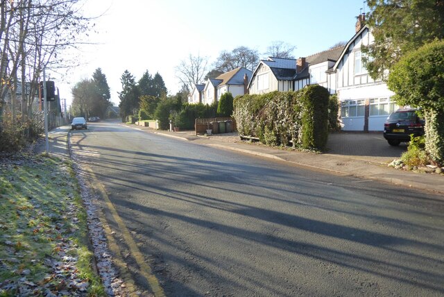
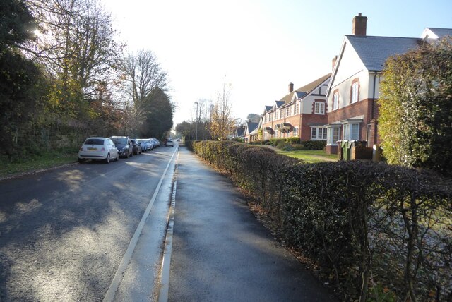
Barnt Green is a charming village situated in Worcestershire, England. Located just 10 miles south of Birmingham, it is a popular residential area with a population of around 5,000 people. The village is nestled between the Lickey Hills and the picturesque Worcester and Birmingham Canal, offering stunning views and a tranquil atmosphere.

Barnt Green has a rich history that dates back to the 19th century, with many of its buildings reflecting its Victorian heritage. The village boasts a variety of architectural styles, from traditional cottages to more modern developments. Its well-preserved character and attractive surroundings make it an appealing place to live.

The village center features a range of amenities, including local shops, a post office, and a library. There are also several pubs and restaurants, providing residents with a selection of dining options. Barnt Green is known for its strong sense of community, with various clubs and societies offering opportunities for socializing and engagement.

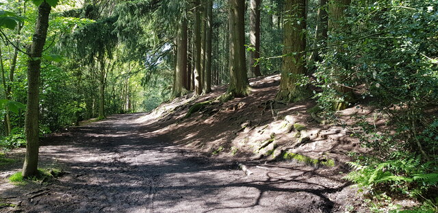
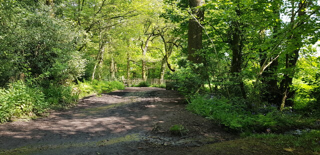
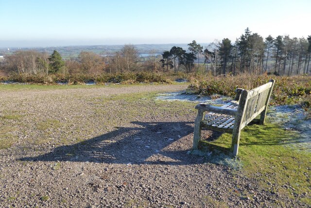
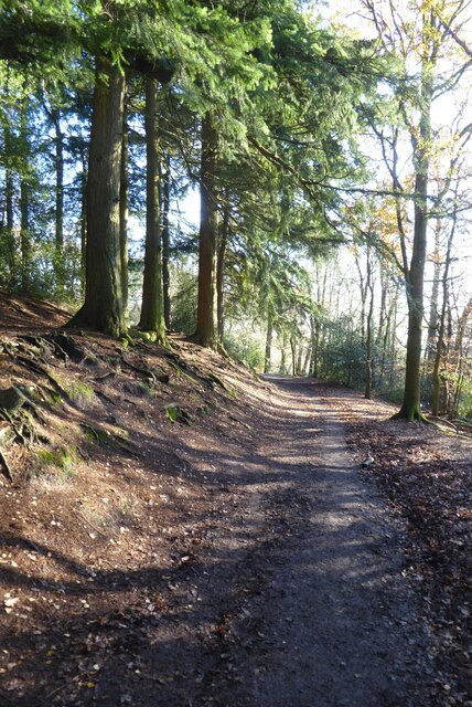
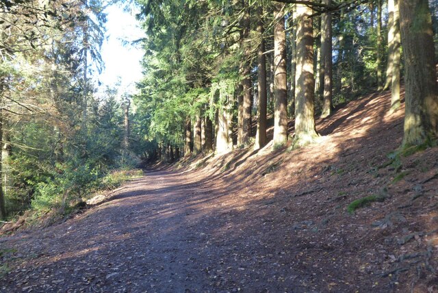
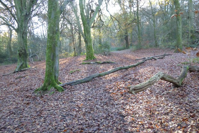
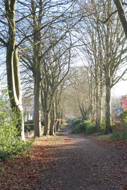
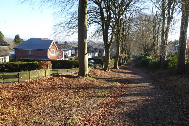
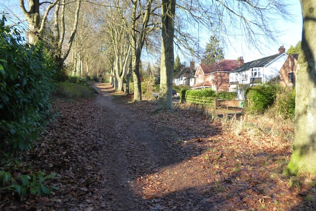
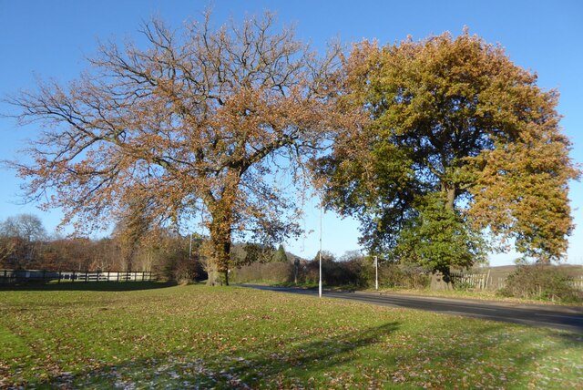
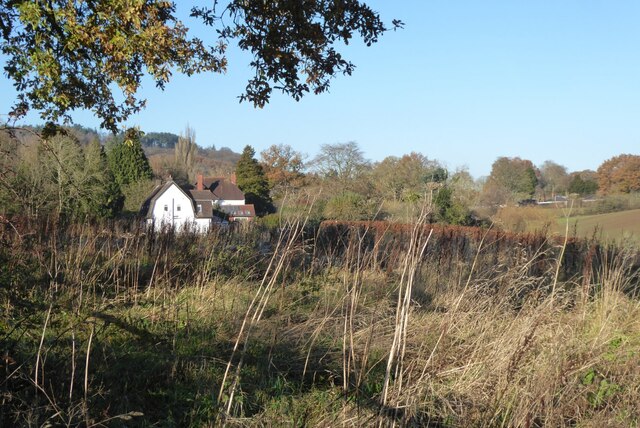
Nature enthusiasts will find plenty to explore in the surrounding countryside. The Lickey Hills, a designated Area of Outstanding Natural Beauty, offers extensive woodland walks and panoramic views of the Worcestershire countryside. The Worcester and Birmingham Canal provides a tranquil setting for leisurely strolls and boating activities.

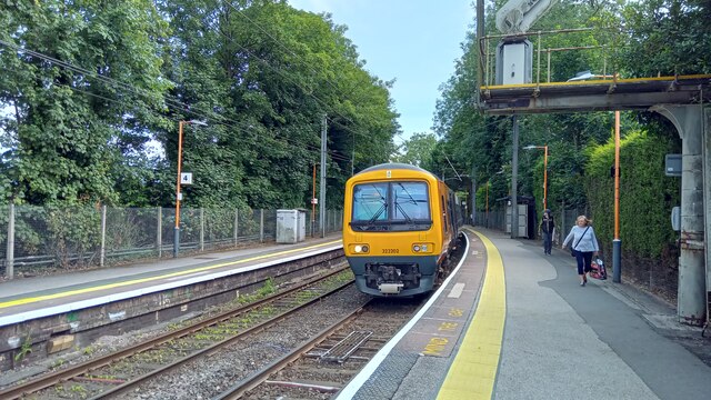
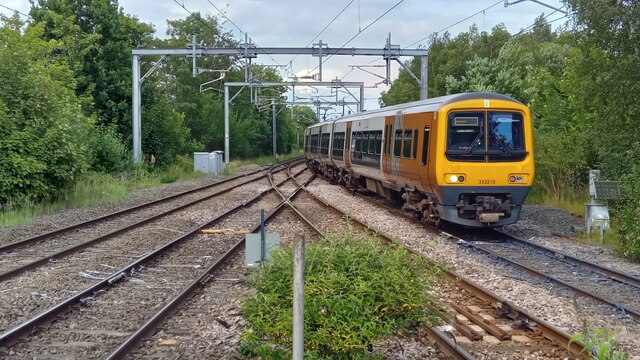
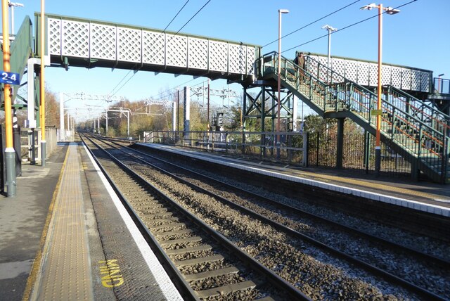
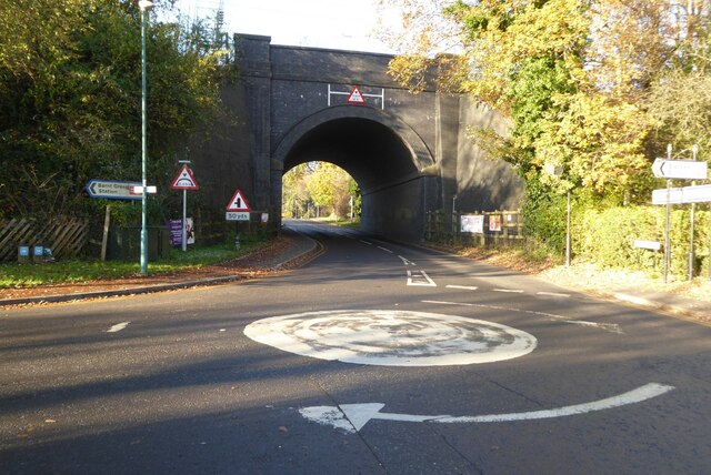
Barnt Green benefits from excellent transport links, with a train station connecting it to Birmingham, Worcester, and other nearby towns. The village is also conveniently located near major road networks, making it easily accessible for commuters.

Overall, Barnt Green offers a perfect blend of natural beauty, community spirit, and convenient amenities, making it an increasingly sought-after location for both residents and visitors.

If you have any feedback on the listing, please let us know in the comments section below.

Barnt Green Images

Images are sourced within 2km of 52.359437/-2.008485 or Grid Reference SO9973. Thanks to Geograph Open Source API. All images are credited.

Bridleway at Cofton Hill At this point a public footpath intersects the bridleway which contours around Cofton Hill.
Bridleway at Cofton Hill
At this point a public footpath intersects the bridleway which contours around Cofton Hill.
Bridleway at Cofton Hill Here, the bridleway contours around Cofton Hill at the edge of the woods.
Bridleway at Cofton Hill
Here, the bridleway contours around Cofton Hill at the edge of the woods.
Barnt Green station - the Redditch platforms The 16.31 Redditch - Lichfield Trent Valley via Birmingham New St all-stations service is almost ready to depart.
Barnt Green station - the Redditch platforms
The 16.31 Redditch - Lichfield Trent Valley via Birmingham New St all-stations service is almost ready to depart.
Barnt Green station junction A train for Redditch is passing through the junction, about to call at Barnt Green.
Barnt Green station junction
A train for Redditch is passing through the junction, about to call at Barnt Green.
Seat on Cofton Hill Seat on Cofton Hill in the Lickey Hills.
Seat on Cofton Hill
Seat on Cofton Hill in the Lickey Hills.
Woodland footpath Woodland footpath on the southern slopes of Cofton Hill in the Lickey Hills.
Woodland footpath
Woodland footpath on the southern slopes of Cofton Hill in the Lickey Hills.
Woodland path Woodland path on southern slopes of the Cofton Hill in the Lickey Hills.
Woodland path
Woodland path on southern slopes of the Cofton Hill in the Lickey Hills.
Pinfields Wood Trees in Pinfields Wood in the Lickey Hills.
Pinfields Wood
Trees in Pinfields Wood in the Lickey Hills.
Beech trees on the Fordrough This tree-line path connects Fiery Hill Road with Cherry Hill Road in Barnt Green; it is called The Fordrough and was bought by Birmingham City Council from Lord Plymouth in 1919 to provide access from the railway station to the Lickey Hills.
Beech trees on the Fordrough
This tree-line path connects Fiery Hill Road with Cherry Hill Road in Barnt Green; it is called The Fordrough and was bought by Birmingham City Council from Lord Plymouth in 1919 to provide access from the railway station to the Lickey Hills.
Leafy Barnt Green Leafy Barnt Green, well perhaps a little less so at the beginning of December with almost all this year's leaves shed.  This path is known as The Fordrough.  This tree-line path connects Fiery Hill Road with Cherry Hill Road in Barnt Green; it was bought by Birmingham City Council from Lord Plymouth in 1919 to provide access from the railway station to the Lickey Hills.
Leafy Barnt Green
Leafy Barnt Green, well perhaps a little less so at the beginning of December with almost all this year's leaves shed. This path is known as The Fordrough. This tree-line path connects Fiery Hill Road with Cherry Hill Road in Barnt Green; it was bought by Birmingham City Council from Lord Plymouth in 1919 to provide access from the railway station to the Lickey Hills.
The Fordrough This path is known as The Fordrough and this tree-line path connects Fiery Hill Road with Cherry Hill Road in Barnt Green; it was bought by Birmingham City Council from Lord Plymouth in 1919 to provide access from the railway station to the Lickey Hills.
The Fordrough
This path is known as The Fordrough and this tree-line path connects Fiery Hill Road with Cherry Hill Road in Barnt Green; it was bought by Birmingham City Council from Lord Plymouth in 1919 to provide access from the railway station to the Lickey Hills.
Barnt Green Railway Junction The line coming out of Birmingham splits at Barnt Green with the main line continuing to Bromsgrove and beyond to Bristol and the south-west, while a branch line on the other side goes to Redditch.
Barnt Green Railway Junction
The line coming out of Birmingham splits at Barnt Green with the main line continuing to Bromsgrove and beyond to Bristol and the south-west, while a branch line on the other side goes to Redditch.
Houses on Fiery Hill Road, Barnt Green
Modern housing on Fiery Hill Road These houses on Fiery Hill Road have been built in the last ten years.  The railway is behind the hedge on the left.
Modern housing on Fiery Hill Road
These houses on Fiery Hill Road have been built in the last ten years. The railway is behind the hedge on the left.
Modern housing at Barnt Green These houses on the corner of Fiery Hill Road and Kendal Old Road have been built during the last ten years.
Modern housing at Barnt Green
These houses on the corner of Fiery Hill Road and Kendal Old Road have been built during the last ten years.
Oak trees Oak trees on the junction of Fiery Hill Road and Kendal Old Road.
Oak trees
Oak trees on the junction of Fiery Hill Road and Kendal Old Road.
House and farmland A house with a gandrel roof beside farmland in Barnt Green.
House and farmland
A house with a gandrel roof beside farmland in Barnt Green.
Mini-roundabout and railway bridge Mini-roundabout and railway bridge at Barnt Green.
Mini-roundabout and railway bridge
Mini-roundabout and railway bridge at Barnt Green.
Show me another place!

Barnt Green is located at Grid Ref: SO9973 (Lat: 52.359437, Lng: -2.008485)

Administrative County: Worcestershire

District: Bromsgrove

Police Authority: West Mercia

What 3 Words

///post.span.divisions. Near Barnt Green, Worcestershire

Nearby Locations

Barnt Green

Related Wikis

Barnt Green

Barnt Green is a village and civil parish in the Bromsgrove District of Worcestershire, England, situated 10 miles (16 km) south of Birmingham city centre...

Apes Dale

Apes Dale is a hamlet situated in the parish of Lickey and Blackwell, in the Bromsgrove district of Worcestershire, England. == References ==

Barnt Green railway station

Barnt Green railway station serves the village of Barnt Green, North Worcestershire, England. It is situated 9+1⁄2 miles (15.3 km) south west of Birmingham...

Blackwell, Worcestershire

Blackwell is a village located in the North-East of Worcestershire and comes under the jurisdiction of Lickey and Blackwell Parish Council. Nearby large...

Nearby Amenities

Located within 500m of 52.359437,-2.008485
Post Box
Ref: B45 604
Source: survey
Lat/Long: 52.3605289/-2.0045142
Bus Stop
Cherry Hill Road
Bus: yes
Naptan AtcoCode: 2000G026300
Naptan Bearing: SE
Naptan CommonName: Cherry Hill Road
Naptan Crossing: Cherry Hill Road
Naptan Indicator: adj
Naptan NaptanCode: wocdwdtd
Naptan Street: Twatling Road
Naptan Verified: no
Public Transport: platform
Source: naptan_import
Lat/Long: 52.3611121/-2.0040677
Bus Stop
Fiery Hill Road
Bus: yes
Naptan AtcoCode: 2000G026301
Naptan Bearing: W
Naptan CommonName: Fiery Hill Road
Naptan Indicator: adj
Naptan NaptanCode: wocdadtd
Naptan Street: Fiery Hill Road
Naptan Verified: no
Public Transport: platform
Source: naptan_import
Lat/Long: 52.3605187/-2.0039502
Turning Loop
Lat/Long: 52.3613932/-2.0138175
Turning Loop
Lat/Long: 52.3595459/-2.0054692
Generator Method: photovoltaic
Generator Output Electricity: yes
Generator Source: solar
Generator Type: solar_photovoltaic_panel
Location: roof
Power: generator
Lat/Long: 52.3626394/-2.0090081
The data included in this document is from www.openstreetmap.org. The data is made available under ODbL.

Have you been to Barnt Green?

Leave your review of Barnt Green below (or comments, questions and feedback).