Glen Nevis

Valley in Inverness-shire

Scotland

Glen Nevis

The Glen Nevis Road on a Summer Evening, Scotland The road in the popular Glen Nevis, near Fort William in the Scottish Highlands.
The Glen Nevis Road on a Summer Evening, Scotland Credit: Andrew Tryon

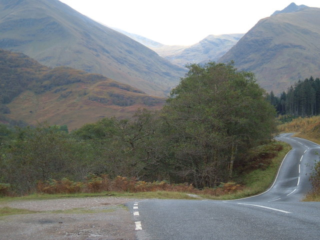
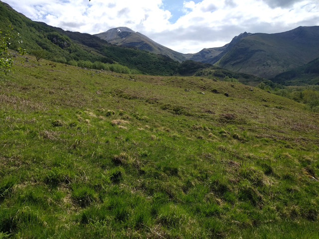
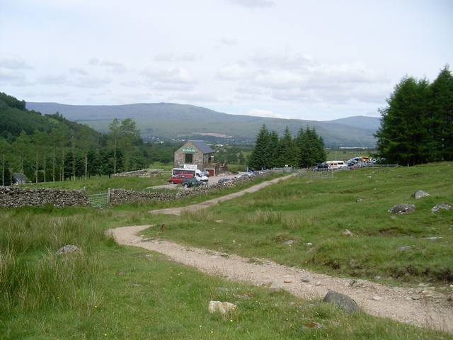
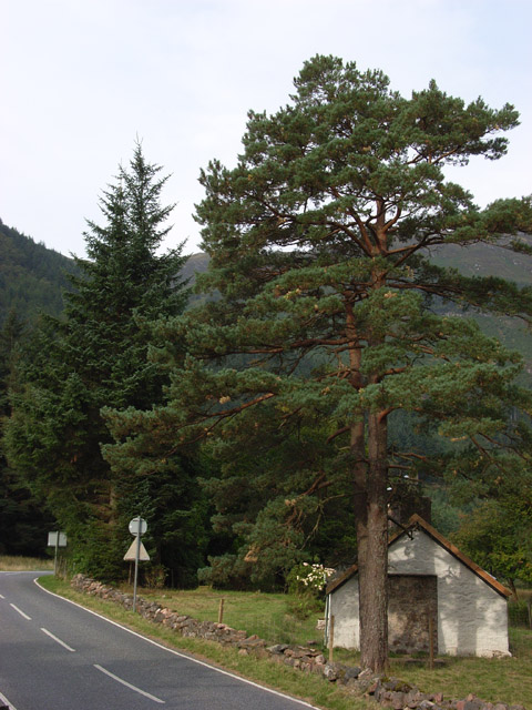
Glen Nevis is a picturesque valley located in the Inverness-shire region of Scotland. It is situated at the foot of Ben Nevis, the highest mountain in the British Isles. The valley is known for its stunning natural beauty, with lush greenery, sparkling streams, and rugged mountain peaks surrounding the area.

Glen Nevis is a popular destination for outdoor enthusiasts, offering a range of activities such as hiking, mountain biking, and rock climbing. The valley is crisscrossed with numerous hiking trails, including the famous West Highland Way, which passes through the area.

Visitors to Glen Nevis can also explore the nearby Nevis Gorge, which is home to the impressive Steall Falls, one of the highest waterfalls in Scotland. The valley is also home to a variety of wildlife, including red deer, golden eagles, and otters.

In addition to its natural beauty, Glen Nevis is also steeped in history, with numerous archaeological sites dating back thousands of years. Overall, Glen Nevis is a stunning and diverse landscape that offers something for everyone to enjoy.

If you have any feedback on the listing, please let us know in the comments section below.

Glen Nevis Images

Images are sourced within 2km of 56.795142/-5.0624424 or Grid Reference NN1371. Thanks to Geograph Open Source API. All images are credited.

The Glen Nevis Road on a Summer Evening, Scotland The road in the popular Glen Nevis, near Fort William in the Scottish Highlands.
The Glen Nevis Road on a Summer Evening, Scotland
The road in the popular Glen Nevis, near Fort William in the Scottish Highlands.
Low cloud in Glen Nevis
Glen Nevis: Ben Nevis mountainside Looking down the glen on the western side of Britain's highest mountain.
Glen Nevis: Ben Nevis mountainside
Looking down the glen on the western side of Britain's highest mountain.
Glen Nevis Drive through Glen Nevis from Fort William
Glen Nevis
Drive through Glen Nevis from Fort William
West Highland Way near Dun Deardail
View towards Stob Bàn Looking down the Glen Nevis road towards the distant mountain. The summit itself isn't visible from here.
View towards Stob Bàn
Looking down the Glen Nevis road towards the distant mountain. The summit itself isn't visible from here.
From the road in Glen Nevis
West Highland Way West Highland Way heading below Sgorr Chalum
West Highland Way
West Highland Way heading below Sgorr Chalum
West Highland Way in the Nevis Forest (3) Another climb awaits rubbery legged walkers upon the trail heading for Fort William.
A section of felled forest shows the way ahead in sharp detail, under a hot sun. The iron age hill fort of Dùn Deardail can be seen to the right - with the guidebook suggesting an off route diversion to visit the tumulus.
West Highland Way in the Nevis Forest (3)
Another climb awaits rubbery legged walkers upon the trail heading for Fort William. A section of felled forest shows the way ahead in sharp detail, under a hot sun. The iron age hill fort of Dùn Deardail can be seen to the right - with the guidebook suggesting an off route diversion to visit the tumulus.
West Highland Way in the Nevis Forest (4)
Glen Nevis Glen Nevis looking north with the slope of Ben Nevis rising to the right and Meall an t-Suidhe, its satellite peak, beyond.
Glen Nevis
Glen Nevis looking north with the slope of Ben Nevis rising to the right and Meall an t-Suidhe, its satellite peak, beyond.
Towards the Mamores
Towards the Mamores
West Highland Way below Dun Deardail The last uphill section of the Way before it descends into Glen Nevis.
West Highland Way below Dun Deardail
The last uphill section of the Way before it descends into Glen Nevis.
Cleared section of Nevis Forest
The C1162 in Glen Nevis
Glen Nevis.
Glen Nevis.
Glen Nevis. Rolls Royce visiting the glen.
Glen Nevis.
Rolls Royce visiting the glen.
Boulder Strewn Gully Below Sgorr Chalum Somewhere under the boulders a small stream was running.
Boulder Strewn Gully Below Sgorr Chalum
Somewhere under the boulders a small stream was running.
Show me another place!

Glen Nevis is located at Grid Ref: NN1371 (Lat: 56.795142, Lng: -5.0624424)

Unitary Authority: Highland

Police Authority: Highlands and Islands

What 3 Words

///dock.strumming.inversely. Near Fort William, Highland

Nearby Locations

Glen Nevis

Related Wikis

Achintee, Fort William

Achintee (Scottish Gaelic: Achadh an t-Suidhe) is a location in Glen Nevis in the Highland council area of Scotland. It is around 2 km south-east of Fort...

Meall an t-Suidhe

The Meall an t-Suidhe is a mountain in Scotland, located close to the Ben Nevis. == Etymology == Meall an t-Suidhe is a gaelic toponym which can be translated...

Achriabhach

Achriabhach (Scottish Gaelic: An t-Achadh Riabhach) is a hamlet in Glen Nevis, Lochaber, Highland, Scotland.Achriabhach is adjacent to the Ben Nevis Site...

Glen Nevis

Glen Nevis (Scottish Gaelic: Gleann Nibheis) is a glen in Lochaber, Highland, Scotland, with Fort William at its foot. It is bordered to the south by the...

Nearby Amenities

Located within 500m of 56.795142,-5.0624424
Barrier: cattle_grid
Lat/Long: 56.7956999/-5.0643843
Ford: yes
Lat/Long: 56.795132/-5.0605845
Ford: yes
Lat/Long: 56.7974857/-5.0633199
Ford: yes
Lat/Long: 56.794499/-5.0595674
Ford: yes
Lat/Long: 56.7921142/-5.0575148
Ford: yes
Lat/Long: 56.7984682/-5.0641205
Ford: yes
Lat/Long: 56.7987575/-5.0648493
The data included in this document is from www.openstreetmap.org. The data is made available under ODbL.

Have you been to Glen Nevis?

Leave your review of Glen Nevis below (or comments, questions and feedback).