Srath Mhuilich

Valley in Ross-shire

Scotland

Srath Mhuilich

South-east ridge of Bidean an Eoin Deirg A view up the south-east ridge of Bidean an Eoin Deirg. It is not a separate Munro, but is a Munro top (3428 feet / 1045 metres). This fine long ridge rises in stages, leading all the way to the summit. There is a short scrambling section on the narrow, final part which requires some care but is not technically difficult in summer conditions (left of centre in top-half of image).
South-east ridge of Bidean an Eoin Deirg Credit: Andrew McMahon

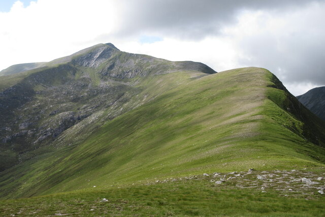
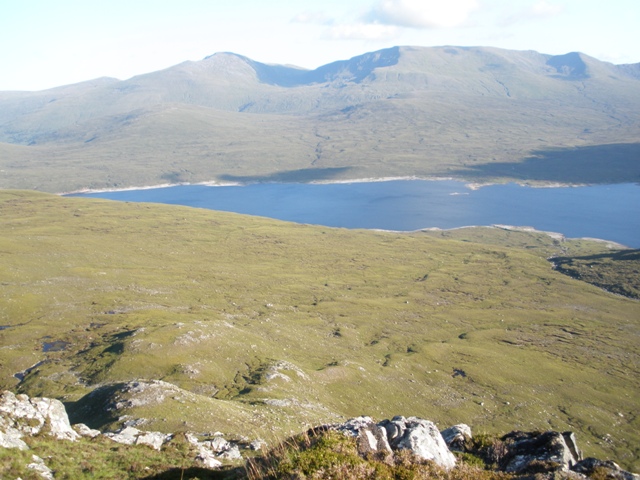
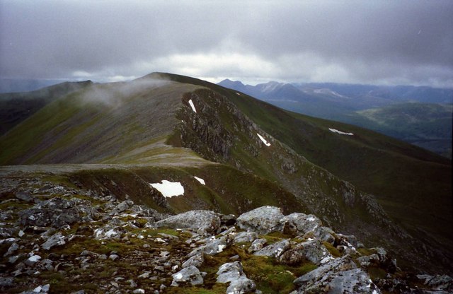
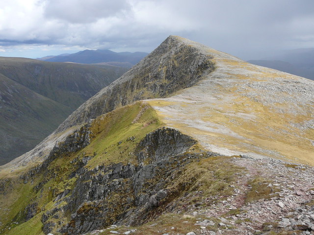
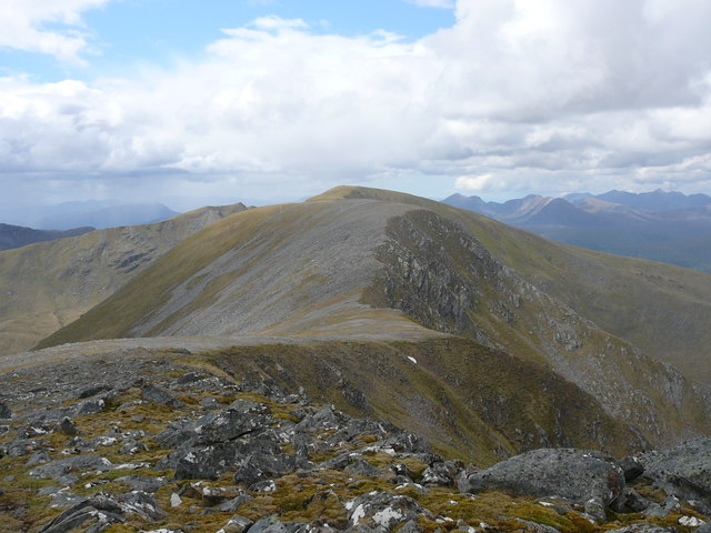
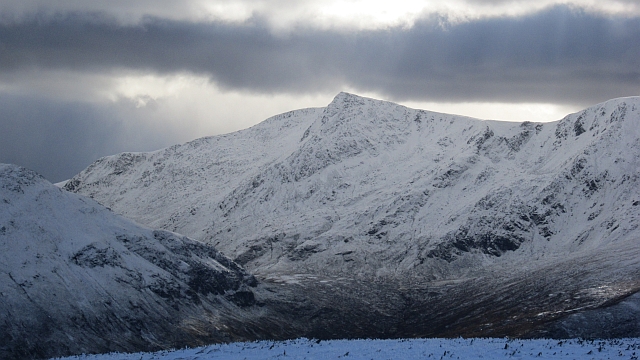
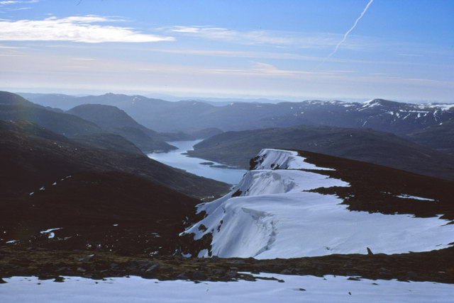
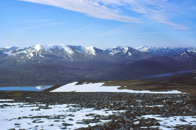
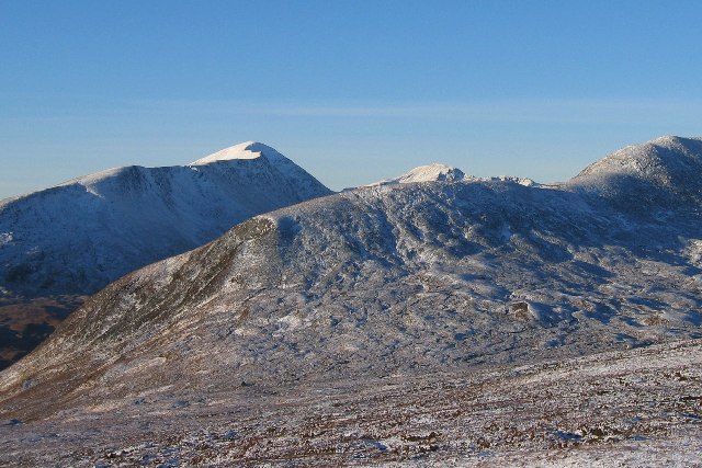
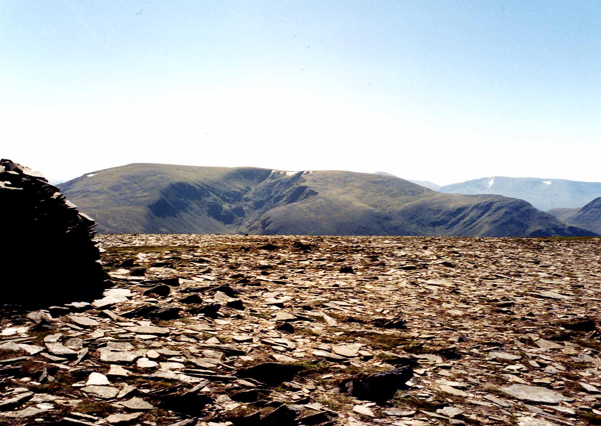
Srath Mhuilich, also known as Strath Muick, is a scenic valley located in Ross-shire, Scotland. Situated in the Scottish Highlands, the valley stretches for approximately 12 miles and is flanked by majestic mountains, including Beinn Dearg and Beinn a' Chlaidheimh.

The valley is renowned for its stunning natural beauty and diverse wildlife. Its picturesque landscapes are characterized by rolling hills, lush green meadows, and crystal-clear streams that meander through the valley. The area is rich in flora and fauna, with an abundance of wildflowers, heather, and native trees such as birch and oak. It is also home to various bird species, including golden eagles and red grouse, as well as mammals like red deer and mountain hares.

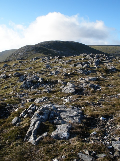
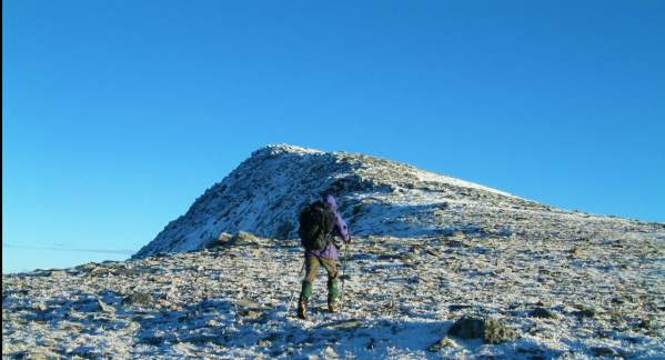
Srath Mhuilich offers a range of outdoor activities for nature enthusiasts and adventurers. Hiking and hillwalking trails crisscross the valley, providing opportunities to explore its scenic wonders and enjoy breathtaking views from the mountain summits. The valley is also a popular destination for fishing, with its rivers and lochs teeming with salmon and trout.

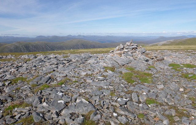
In addition to its natural attractions, Srath Mhuilich has historical significance. The valley is dotted with remnants of ancient settlements and structures, including cairns and stone circles, which offer a glimpse into the area's past.

Overall, Srath Mhuilich is a haven of tranquility and natural splendor, offering visitors a chance to immerse themselves in the rugged beauty of the Scottish Highlands.

If you have any feedback on the listing, please let us know in the comments section below.

Srath Mhuilich Images

Images are sourced within 2km of 57.446226/-5.1345269 or Grid Reference NH1243. Thanks to Geograph Open Source API. All images are credited.

South-east ridge of Bidean an Eoin Deirg A view up the south-east ridge of Bidean an Eoin Deirg. It is not a separate Munro, but is a Munro top (3428 feet / 1045 metres). This fine long ridge rises in stages, leading all the way to the summit. There is a short scrambling section on the narrow, final part which requires some care but is not technically difficult in summer conditions (left of centre in top-half of image).
South-east ridge of Bidean an Eoin Deirg
A view up the south-east ridge of Bidean an Eoin Deirg. It is not a separate Munro, but is a Munro top (3428 feet / 1045 metres). This fine long ridge rises in stages, leading all the way to the summit. There is a short scrambling section on the narrow, final part which requires some care but is not technically difficult in summer conditions (left of centre in top-half of image).
Loch Monar from the North Shore
View south east from Creag an Dubh-thuill View south east from Creag an Dubh-thuill, looking down the ridge and across Loch Monar towards Beinn Dubh and Meallan Odhar
View south east from Creag an Dubh-thuill
View south east from Creag an Dubh-thuill, looking down the ridge and across Loch Monar towards Beinn Dubh and Meallan Odhar
Creag an Dubh-thuill Looking up the ridge as the slope eases, Creag Toll a' Choin in the distance beyond the ridge
Creag an Dubh-thuill
Looking up the ridge as the slope eases, Creag Toll a' Choin in the distance beyond the ridge
View west from Bidean an Eòinn Deirg Towards Sgùrr a' Chaorachain.
View west from Bidean an Eòinn Deirg
Towards Sgùrr a' Chaorachain.
View along ridge to Bidean an Eoin Deirg
View west along the ridge from the summit of Bidean an Eoin Dearg
Bidean an Eòin  Deirg A landmark peak in a remote area between Gleann Fhiodhaig and Strathmore. The eastern ridge is actually quite easy and has the merit of finishing with a scramble to the foot of the summit cairn.
Bidean an Eòin Deirg
A landmark peak in a remote area between Gleann Fhiodhaig and Strathmore. The eastern ridge is actually quite easy and has the merit of finishing with a scramble to the foot of the summit cairn.
Slopes of Creag Toll a' Choin The southern slopes of Creag Toll a' Choin - mostly grass and rock covered, a bit boggy in places.
Looking towards Loch Monar.
Slopes of Creag Toll a' Choin
The southern slopes of Creag Toll a' Choin - mostly grass and rock covered, a bit boggy in places. Looking towards Loch Monar.
Summit of Carn nam Fiaclan A cairn marks the summit on this rocky plateau.
Looking northeast across Fuar-Tholl Mòr and Gleann Fhiodhaig, great views towards distant mountains.
Summit of Carn nam Fiaclan
A cairn marks the summit on this rocky plateau. Looking northeast across Fuar-Tholl Mòr and Gleann Fhiodhaig, great views towards distant mountains.
Down Toll a' Choin Looking down the steep rocky slopes of Toll a' Choin, a large corrie on the side of Maoile Lunndaidh. 
The eastern end of Loch Monar is visible in the distance
Down Toll a' Choin
Looking down the steep rocky slopes of Toll a' Choin, a large corrie on the side of Maoile Lunndaidh. The eastern end of Loch Monar is visible in the distance
Loch Monar from Maoile Lunndaidh Looking down the Creag toll a Choinn ridge
Loch Monar from Maoile Lunndaidh
Looking down the Creag toll a Choinn ridge
An Riabhachan from Maoile Lunndaidh Looking South over Loch Monar to An Riabhachan <a href="https://www.geograph.org.uk/gridref/NH1233">NH1233</a>
An Riabhachan from Maoile Lunndaidh
Looking South over Loch Monar to An Riabhachan NH1233
Bidean an Eòin Dearg
Remote Country Out of grid shot! This grid square is the ground from the bottom of the glen to the second rise in the immediate ridge.
The magnificent looking hill in the background is the very remote Munro Bidein a' Choire Sheasgaich.
Remote Country
Out of grid shot! This grid square is the ground from the bottom of the glen to the second rise in the immediate ridge. The magnificent looking hill in the background is the very remote Munro Bidein a' Choire Sheasgaich.
Steep ground. The steep south western side of Maoile Lunndaidh.
The prominent ridge on the left skyline is Liathach.
Steep ground.
The steep south western side of Maoile Lunndaidh. The prominent ridge on the left skyline is Liathach.
Summit View. Taken from the summit of "Carn nan Fiaclan" (western top of Maoile Lunndiadh). Looking NW to Torridon. The immediate snow covered hill is the Munro "Sgurr nan Ceannaichean" to the left is "Beinn Liath Mhor" and the horizon is the mighty Liathach.
Summit View.
Taken from the summit of "Carn nan Fiaclan" (western top of Maoile Lunndiadh). Looking NW to Torridon. The immediate snow covered hill is the Munro "Sgurr nan Ceannaichean" to the left is "Beinn Liath Mhor" and the horizon is the mighty Liathach.
Show me another place!

Srath Mhuilich is located at Grid Ref: NH1243 (Lat: 57.446226, Lng: -5.1345269)

Unitary Authority: Highland

Police Authority: Highlands and Islands

What 3 Words

///carpeted.prickly.gates. Near Achnasheen, Highland

Related Wikis

Maoile Lunndaidh

Maoile Lunndaidh or Maoil Lunndaidh is a Scottish mountain situated 13 km south of Achnasheen in the Ross and Cromarty district of the Highland council...

Sgurr a' Chaorachain (Munro)

Sgurr a' Chaorachain (Scottish Gaelic: Sgùrr a' Chaorthachain) is a mountain with a height of 1,053 metres (3,455 ft) in the Northwest Highlands, Scotland...

Loch Monar

Loch Monar is a freshwater loch situated at the head of Glen Strathfarrar, in the West Highlands of Scotland. Since the 1960s, it has been dammed as part...

Sgùrr Choinnich

Sgùrr Choinnich is a mountain with a height of 999 metres (3,278 ft) in the Northwest Highlands of Scotland. Classed as a Munro, it is in the Achnashellach...

Have you been to Srath Mhuilich?

Leave your review of Srath Mhuilich below (or comments, questions and feedback).