Vixen Gully
Valley in Argyllshire
Scotland
Vixen Gully

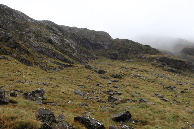
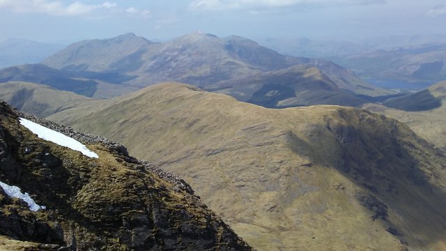
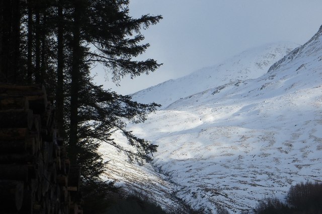
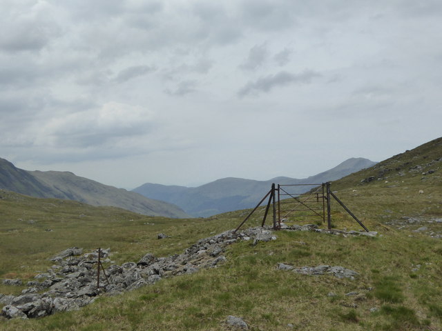
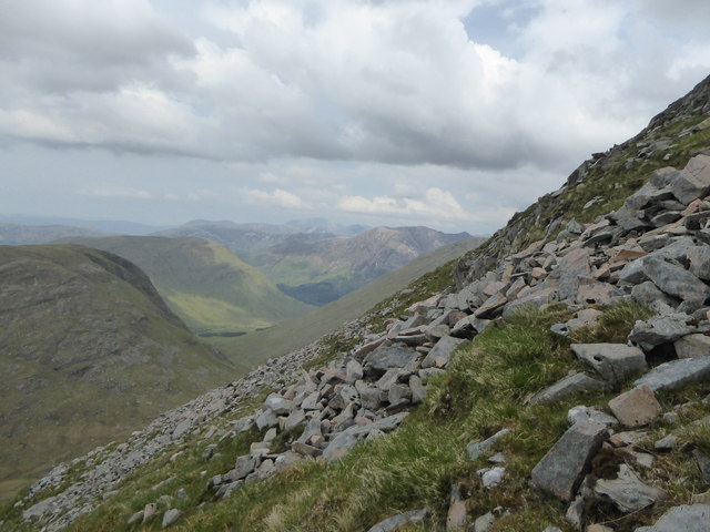
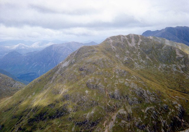
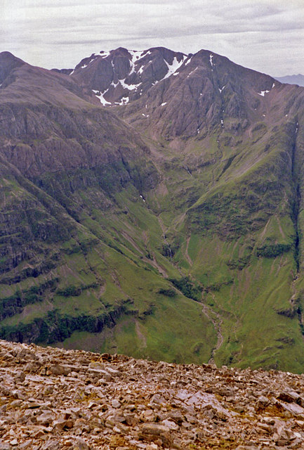
Vixen Gully is a picturesque valley located in the region of Argyllshire, Scotland. Nestled amidst the stunning Scottish Highlands, this scenic valley is renowned for its natural beauty and captivating landscapes. The gully stretches for approximately 2 miles and is characterized by its steep sides and lush greenery.
The valley is named after the abundance of red foxes (Vulpes vulpes) that inhabit the area. These majestic creatures can often be spotted darting through the undergrowth or exploring the surrounding hillsides. The presence of these foxes adds to the charm and allure of Vixen Gully, attracting nature enthusiasts and wildlife photographers from far and wide.
The gully is also home to a diverse range of flora and fauna. The valley's fertile soil supports a variety of plant life, including heather, ferns, and mosses. This rich vegetation provides a habitat for many species of birds, such as buzzards, golden eagles, and owls, which can be seen soaring through the skies above the valley.
Vixen Gully offers numerous opportunities for outdoor activities and exploration. Hiking and walking trails wind their way through the valley, allowing visitors to immerse themselves in the breathtaking scenery and discover hidden gems along the way. The gully is also intersected by a crystal-clear stream, providing a tranquil setting for picnics or a moment of relaxation.
Overall, Vixen Gully is a captivating destination in Argyllshire, offering visitors a chance to connect with nature and experience the untamed beauty of the Scottish Highlands.
If you have any feedback on the listing, please let us know in the comments section below.
Vixen Gully Images
Images are sourced within 2km of 56.620851/-5.0809615 or Grid Reference NN1151. Thanks to Geograph Open Source API. All images are credited.


Vixen Gully is located at Grid Ref: NN1151 (Lat: 56.620851, Lng: -5.0809615)
Unitary Authority: Highland
Police Authority: Highlands and Islands
What 3 Words
///nuns.vowel.status. Near Glencoe, Highland
Nearby Locations
Related Wikis
Sgùrr na h-Ulaidh
Sgùrr na h-Ulaidh (also Sgòr na h-Ulaidh) ("Peak of the Treasure") is a mountain lying to the south of the village of Glencoe in the Scottish Highlands...

Beinn Fhionnlaidh (Creran)
Beinn Fhionnlaidh is a mountain in the West Highlands of Scotland. It is situated between Glen Etive and Glen Creran, to the south of Glen Coe. == References ==
Bidean nam Bian
Bidean nam Bian (Scottish Gaelic: Bidean nam Beann, 'peak of the mountains') is the highest peak in a group of mountains south of Glen Coe and north of...

Meall Mor (Glen Coe)
Meall Mor (676 m) is a mountain in the Grampian Mountains of Scotland. It lies above the Glencoe village at the foot of Glen Coe in Lochaber, Scotland...

Stob Coire Sgreamhach
Stob Coire Sgreamhach (Scottish Gaelic for 'peak of the dreadful corrie') is a mountain in Lorn, south of Glen Coe in the Scottish Highlands. Its height...

Clachaig Inn
The Clachaig Inn is a hotel and pub in Glen Coe, Lochaber, Highland, Scotland. It is popular with walkers and climbers who come to visit the surrounding...

Glen Etive
Glen Etive (Scottish Gaelic: Gleann Èite) is a glen in the Highlands of Scotland. The River Etive (Scottish Gaelic: Abhainn Èite) rises on the peaks surrounding...

Ben Nevis and Glen Coe National Scenic Area
Ben Nevis and Glen Coe is a national scenic area (NSA) covering part of the Highlands of Scotland surrounding Ben Nevis and Glen Coe, in which certain...
Nearby Amenities
Located within 500m of 56.620851,-5.0809615Have you been to Vixen Gully?
Leave your review of Vixen Gully below (or comments, questions and feedback).