Maggie's Glen

Valley in Wigtownshire

Scotland

Maggie's Glen

Southbound on the Rhins of Galloway Rockhopping on the way into the mouth of Clanyard bay
Southbound on the Rhins of Galloway Credit: Tony Page

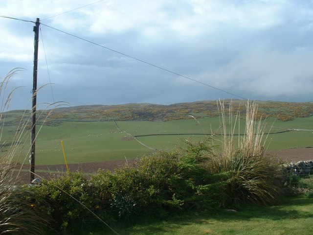
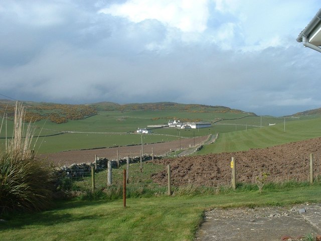
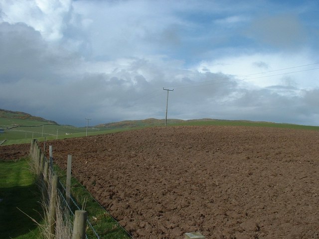
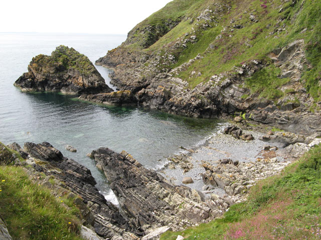
Maggie's Glen is a picturesque valley located in Wigtownshire, Scotland. Nestled between rolling hills and surrounded by lush greenery, this serene destination offers visitors a tranquil escape from the hustle and bustle of everyday life.

The glen is named after Maggie, a local folklore character who was said to have lived in the area many years ago. Legend has it that she possessed mystical powers and could communicate with animals and plants. This enchanting tale adds to the allure and charm of the valley.

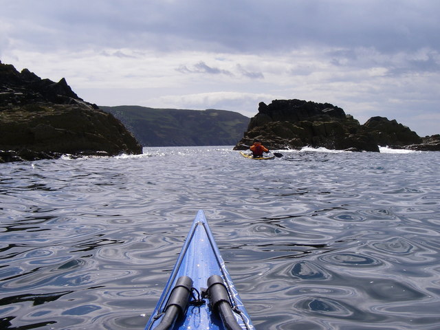
Maggie's Glen boasts stunning natural beauty, with a meandering river that flows through the heart of the valley. The crystal-clear waters create a soothing soundtrack as they cascade over rocks and through the dense vegetation. The glen is also home to an abundance of wildlife, including deer, rabbits, and various species of birds, making it a paradise for nature lovers and photographers.

The valley offers several walking trails that allow visitors to explore its hidden treasures. The paths wind through ancient woodlands, carpeted with vibrant wildflowers and moss-covered trees. Along the way, visitors can discover hidden waterfalls and secluded picnic spots, perfect for enjoying a peaceful lunch amidst the serenity of the glen.

Maggie's Glen is not only a haven for nature enthusiasts but also a place of historical significance. Ruins of old cottages and stone walls can be found scattered throughout the valley, providing a glimpse into the past and the rural way of life.

In conclusion, Maggie's Glen in Wigtownshire is a truly magical place, where nature, folklore, and history intertwine to create an unforgettable experience for all who visit.

If you have any feedback on the listing, please let us know in the comments section below.

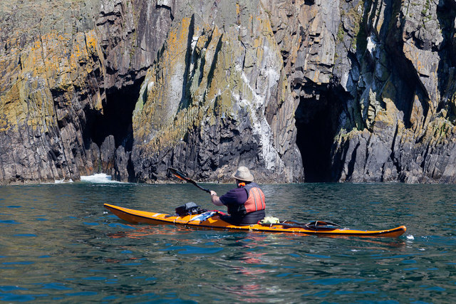
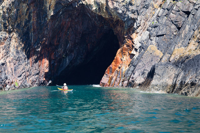
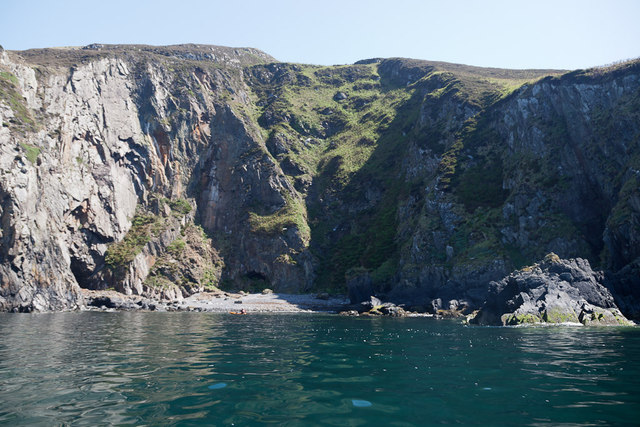
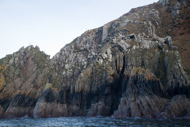
Maggie's Glen Images

Images are sourced within 2km of 54.695224/-4.9468691 or Grid Reference NX1037. Thanks to Geograph Open Source API. All images are credited.

Southbound on the Rhins of Galloway Rockhopping on the way into the mouth of Clanyard bay
Southbound on the Rhins of Galloway
Rockhopping on the way into the mouth of Clanyard bay
Towards Barncorkrie Moor The gorse on the hillside glows brightly against the new spring grass in the sheep pasture.
Towards Barncorkrie Moor
The gorse on the hillside glows brightly against the new spring grass in the sheep pasture.
Barncorkrie Farm With Barncorkrie Moor behind and the minor road to Inshanks Fell in front.
Barncorkrie Farm
With Barncorkrie Moor behind and the minor road to Inshanks Fell in front.
Fields towards Cairn Fell With Barncorkrie Moor to left.
Fields towards Cairn Fell
With Barncorkrie Moor to left.
Yellow Horse caves, Laggantalluch Head Yellow Horse caves, Laggantalluch Head, taken on a sea kayaking trip from East Tarbet to Port Logan.
Yellow Horse caves, Laggantalluch Head
Yellow Horse caves, Laggantalluch Head, taken on a sea kayaking trip from East Tarbet to Port Logan.
Cave of the Saddle, Gounie Head Cave of the Saddle, Gounie Head, taken on a sea kayaking trip from East Tarbet to Port Logan.
Cave of the Saddle, Gounie Head
Cave of the Saddle, Gounie Head, taken on a sea kayaking trip from East Tarbet to Port Logan.
Breddock Bay Breddock Bay taken on a sea kayak trip from East Tarbet to port Logan
Breddock Bay
Breddock Bay taken on a sea kayak trip from East Tarbet to port Logan
Craig of Dolt Craig of Dolt is composed of vertical and folded strata of greywacke, a sedimentary rock. The photo was taken in the vicinity of a delightfully named Gobawhilkin, while on a sea kayaking trip from East Tarbet to Port Logan.
Craig of Dolt
Craig of Dolt is composed of vertical and folded strata of greywacke, a sedimentary rock. The photo was taken in the vicinity of a delightfully named Gobawhilkin, while on a sea kayaking trip from East Tarbet to Port Logan.
Cairn, Barncorkrie Moor A rather neat cairn on the summit of the moor overlooking Barncorkrie. Another, nearby, is named the Cairn of Dolt, but I didn't go there.
Cairn, Barncorkrie Moor
A rather neat cairn on the summit of the moor overlooking Barncorkrie. Another, nearby, is named the Cairn of Dolt, but I didn't go there.
Carlin House Bay A small bay eroded along the strike of the rather deformed rocks of the turbiditic greywackes of the Clanyard Bay Formation (Gala Group, Silurian). Much interest attaches to the deformation style and stratigraphy of this area, but I did not climb down from the grassy col between the larger and smaller bays.
Carlin House Bay
A small bay eroded along the strike of the rather deformed rocks of the turbiditic greywackes of the Clanyard Bay Formation (Gala Group, Silurian). Much interest attaches to the deformation style and stratigraphy of this area, but I did not climb down from the grassy col between the larger and smaller bays.
Barncorkrie sheds and house Looking up the farm road past the sheds.
Barncorkrie sheds and house
Looking up the farm road past the sheds.
Farm track Looking up the farm track towards the col of Balloch, with Cairn fell in the right background.
Farm track
Looking up the farm track towards the col of Balloch, with Cairn fell in the right background.
Sheep fanks Looking down onto the sheep fanks at Balloch, with Cairn Fell in the background.
Sheep fanks
Looking down onto the sheep fanks at Balloch, with Cairn Fell in the background.
Grazing divide This fence obviously marks a farm boundary on Barncorkrie Moor, with grazed moor to the right and undisturbed heather to the left.
Grazing divide
This fence obviously marks a farm boundary on Barncorkrie Moor, with grazed moor to the right and undisturbed heather to the left.
Granite outcrop Heading west on Barncorkrie Moor the geology changes to granite and quite quickly the heather begins to dominate the moorland pasture.
Granite outcrop
Heading west on Barncorkrie Moor the geology changes to granite and quite quickly the heather begins to dominate the moorland pasture.
Track to Clanyard Beyond the limit of fields belonging to Cowans, the track sees little use, but it is a fine walking route. Barncorkrie Moor and Cairn Fell make the far horizon.
Track to Clanyard
Beyond the limit of fields belonging to Cowans, the track sees little use, but it is a fine walking route. Barncorkrie Moor and Cairn Fell make the far horizon.
Track to Port Logan Looking towards Port Logan on the waymarked track that is the old road from Inshanks and Clanyard. Here it just clips the corner of another square as it makes its lonely way through the fields.
Track to Port Logan
Looking towards Port Logan on the waymarked track that is the old road from Inshanks and Clanyard. Here it just clips the corner of another square as it makes its lonely way through the fields.
Deformed rocks An outcrop of highly deformed greywacke which is intruded by felsite dykes. These rugged rocks drop steeply to the sea from a pronounced feature known as Carlin House.
Deformed rocks
An outcrop of highly deformed greywacke which is intruded by felsite dykes. These rugged rocks drop steeply to the sea from a pronounced feature known as Carlin House.
Show me another place!

Maggie's Glen is located at Grid Ref: NX1037 (Lat: 54.695224, Lng: -4.9468691)

Unitary Authority: Dumfries and Galloway

Police Authority: Dumfries and Galloway

What 3 Words

///tallest.novel.lends. Near Drummore, Dumfries & Galloway

Nearby Locations

Maggie's Glen Clanyard

Related Wikis

Kirkmaiden (village)

Kirkmaiden (sometimes Maidenkirk; Scottish Gaelic: Cill M'Eudan) is a small settlement in Galloway, Scotland, located approximately 17 miles (27 km) south...

Kirkmaiden

Kirkmaiden is a parish in the Rhins of Galloway, the most southerly in Scotland; the present Church of Scotland parish has the same name as and is approximately...

Port Logan

Port Logan, formerly Port Nessock, is a small village in the parish of Kirkmaiden in the Rhins of Galloway in Wigtownshire. The Gaelic name is Port Neasaig...

Drummore

Drummore (drum-ORE; (from Gaelic An Druim Mòr meaning "the great ridge") is the southernmost village in Scotland, located at the southern end of the Rhins...

Nearby Amenities

Located within 500m of 54.695224,-4.9468691
Source: PGS
Lat/Long: 54.6996553/-4.9480204
Source: PGS
Lat/Long: 54.6989204/-4.9485506
Source: PGS
Lat/Long: 54.6987056/-4.9490918
Source: PGS
Lat/Long: 54.6988312/-4.9497863
Source: PGS
Lat/Long: 54.6987916/-4.9505402
Source: PGS
Lat/Long: 54.6985687/-4.9512962
Source: PGS
Lat/Long: 54.6983169/-4.952231
The data included in this document is from www.openstreetmap.org. The data is made available under ODbL.

Have you been to Maggie's Glen?

Leave your review of Maggie's Glen below (or comments, questions and feedback).