Strath Beag

Valley in Cromartyshire

Scotland

Strath Beag

Boulders and rock slab on slope The slope rises to Meall Garbh, a ridge of An Teallach, from near to a path rising that way, a variant of the main route rising from Dundonnell. The distant peak is Beinn nam Bàn.
Boulders and rock slab on slope Credit: Trevor Littlewood

Strath Beag is a picturesque valley located in the region of Cromartyshire, Scotland. Situated in the northern part of the country, it is known for its stunning natural beauty and tranquil atmosphere. The valley stretches for approximately 10 miles, encompassing a variety of landscapes and habitats.

One of the defining features of Strath Beag is its lush greenery, with rolling hills and dense forests covering the surrounding slopes. The valley is intersected by a meandering river, which adds to its charm and provides a source of life for the local flora and fauna.

The valley is home to a diverse range of wildlife, including red deer, otters, and a wide variety of bird species. Nature enthusiasts will find ample opportunities for birdwatching and wildlife spotting in the area.

Strath Beag also boasts a rich history, with evidence of human settlement dating back thousands of years. Ruins of ancient settlements and burial sites can still be found scattered throughout the valley, offering a glimpse into its past.

For visitors looking to explore the valley, there are several walking trails and hiking routes available, catering to different levels of difficulty. These paths provide breathtaking views of the surrounding landscape and allow visitors to immerse themselves in the tranquility of Strath Beag.

Overall, Strath Beag is a captivating destination for nature lovers and history enthusiasts alike. Its stunning natural scenery, abundant wildlife, and rich cultural heritage make it a must-visit location in Cromartyshire, Scotland.

If you have any feedback on the listing, please let us know in the comments section below.
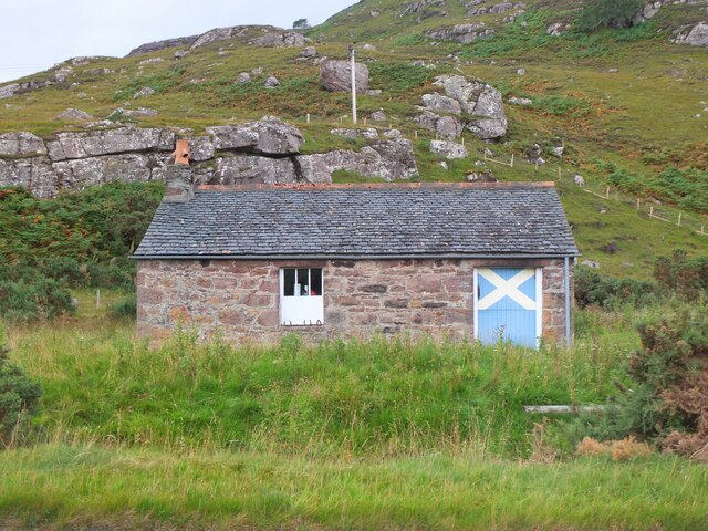
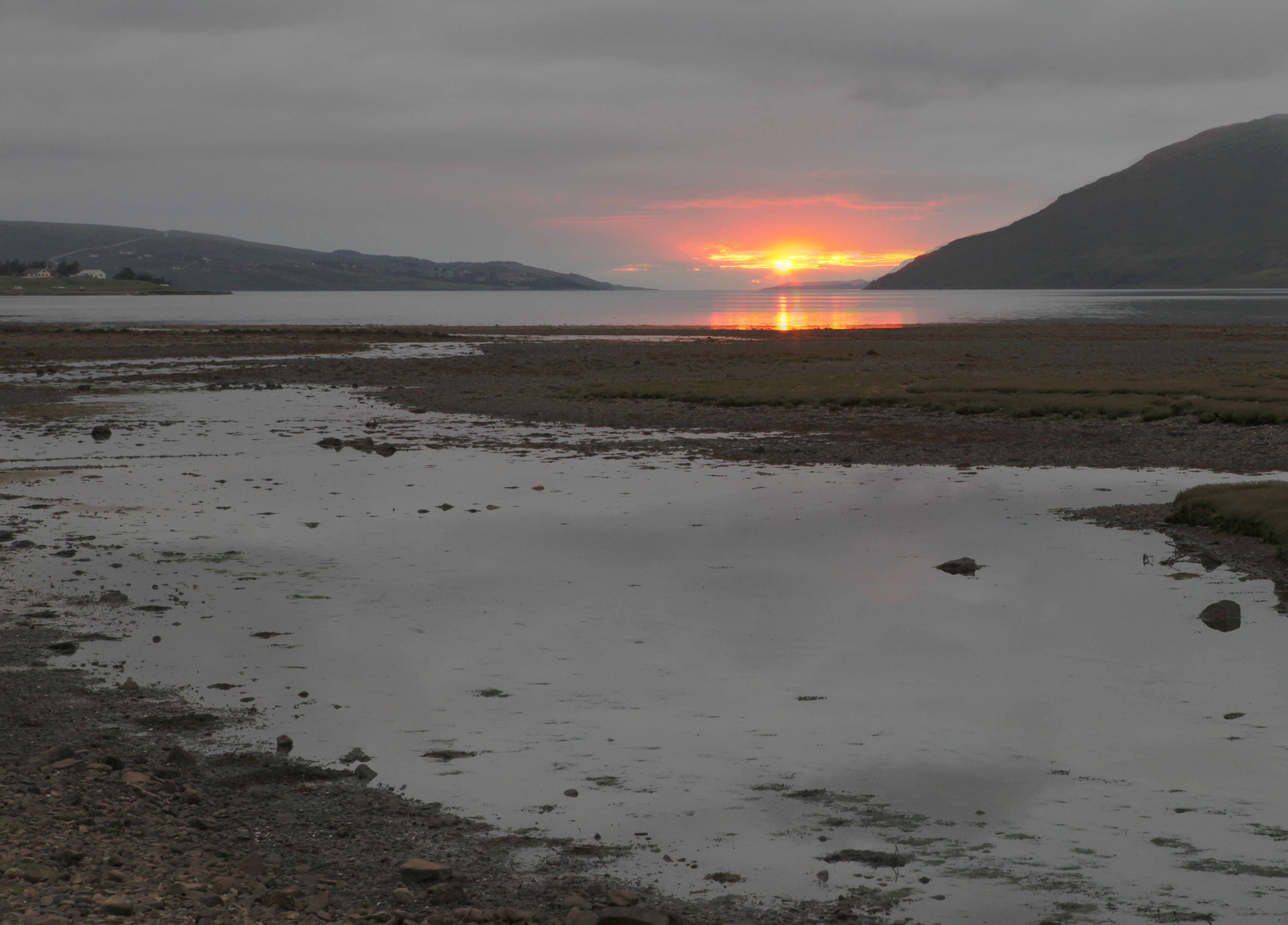
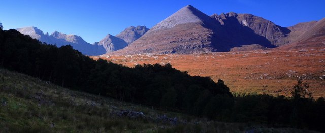
Strath Beag Images

Images are sourced within 2km of 57.836495/-5.1996888 or Grid Reference NH1087. Thanks to Geograph Open Source API. All images are credited.

Boulders and rock slab on slope The slope rises to Meall Garbh, a ridge of An Teallach, from near to a path rising that way, a variant of the main route rising from Dundonnell. The distant peak is Beinn nam Bàn.
Boulders and rock slab on slope
The slope rises to Meall Garbh, a ridge of An Teallach, from near to a path rising that way, a variant of the main route rising from Dundonnell. The distant peak is Beinn nam Bàn.
Steading at Keppoch Farm, Dundonnell
The  Dundonnell  Hotel  and  the  Broombeg  Bar On the A832, the building in the foreground is the bar
The Dundonnell Hotel and the Broombeg Bar
On the A832, the building in the foreground is the bar
Head  of  Little  Loch  Broom  from  near  Dundonnell  Hotel The A832 runs along the lefthand side of the loch. The Dundonnell River enters the loch here
Head of Little Loch Broom from near Dundonnell Hotel
The A832 runs along the lefthand side of the loch. The Dundonnell River enters the loch here
Dundonnell Mountain Rescue Team base This is the base for Dundonnell Mountain Rescue Team (Sgioba Teasairginn Bheanntan Dhùn Dòmhnaill). <span class="nowrap"><a title="http://www.dmrt.org.uk/" rel="nofollow ugc noopener" href="http://www.dmrt.org.uk/">Link</a><img style="margin-left:2px;" alt="External link" title="External link - shift click to open in new window" src="https://s1.geograph.org.uk/img/external.png" width="10" height="10"/></span>

The building on the right is used by the MoD Joint Service Mountain Training Centre.
Dundonnell Mountain Rescue Team base
This is the base for Dundonnell Mountain Rescue Team (Sgioba Teasairginn Bheanntan Dhùn Dòmhnaill). LinkExternal link The building on the right is used by the MoD Joint Service Mountain Training Centre.
At the head of Little Loch Broom
Dundonnell House
Dundonnell House
The Badrallach road in October
Cattle grazing in Strath Beag With An Teallach providing the backdrop.
Cattle grazing in Strath Beag
With An Teallach providing the backdrop.
Garbh Allt Descending from An Teallach via Coir' a' Ghuibhsachain
Garbh Allt
Descending from An Teallach via Coir' a' Ghuibhsachain
Tide's in at Dundonnell The tidal flats at the head of Little Loch Broom.
Tide's in at Dundonnell
The tidal flats at the head of Little Loch Broom.
The Dundonnell Hotel On the A832 by Little Loch Broom, near some fine mountain country.
The Dundonnell Hotel
On the A832 by Little Loch Broom, near some fine mountain country.
Motorcyclists, Dundonnell Motorcyclists making ready for the next stage of their North Coast 500 tour outside the Dundonnell Hotel.
Motorcyclists, Dundonnell
Motorcyclists making ready for the next stage of their North Coast 500 tour outside the Dundonnell Hotel.
A832 at Dundonnell Near the track to Kappoch farm.
A832 at Dundonnell
Near the track to Kappoch farm.
Derelict farm building, Dundonnell A farm building with former cart sheds or stables on the ground floor. The right-hand part of the roof has fallen in.
Derelict farm building, Dundonnell
A farm building with former cart sheds or stables on the ground floor. The right-hand part of the roof has fallen in.
Farm track, Dundonnell On the flat floor of the valley of the Dundonnell River near the tidal marshes of Little Loch Broom.
Farm track, Dundonnell
On the flat floor of the valley of the Dundonnell River near the tidal marshes of Little Loch Broom.
Dundonnell Hotel from the east Looking across the fields from the footbridge to the hotel backed by the wall of hillside by Little Loch Broom.
Dundonnell Hotel from the east
Looking across the fields from the footbridge to the hotel backed by the wall of hillside by Little Loch Broom.
The Smiddy, Dundonnell The old smithy was converted for use as a climbing hut for the Junior Mountaineering Club of Scotland, and is available for use by other climbing clubs. See <a href="https://www.geograph.org.uk/photo/4214840">NH0987 : The Smiddy at Dundonnell</a> by Ian S for a close-up of the plaque by the door.
The Smiddy, Dundonnell
The old smithy was converted for use as a climbing hut for the Junior Mountaineering Club of Scotland, and is available for use by other climbing clubs. See NH0987 : The Smiddy at Dundonnell by Ian S for a close-up of the plaque by the door.
Show me another place!

Strath Beag is located at Grid Ref: NH1087 (Lat: 57.836495, Lng: -5.1996888)

Unitary Authority: Highland

Police Authority: Highlands and Islands

What 3 Words

///dumpling.known.disputes. Near Ullapool, Highland

Nearby Locations

Strath Beag

Related Wikis

Dundonnell

Dundonnell (Gaelic: Achadh Dà Dhòmhnaill) is a village in Ross and Cromarty, Scotland, on the south side of Little Loch Broom and at the foot of An Teallach...

Camusnagaul

Camusnagaul (Scottish Gaelic: Camas nan Gall) is a village on the south shore of the sea loch, Little Loch Broom in Wester Ross, Scottish Highlands and...

An Teallach

An Teallach (Scottish Gaelic for 'the forge' or 'the anvil') is a mountain group in Wester Ross, in the Northwest Highlands of Scotland. It lies west of...

Badrallach

Badrallach (Scottish Gaelic: Am Bad Ràilleach or Am Bad Tràilleach) is a village on the north shore of Little Loch Broom in Wester Ross, in the Highland...

Ardindrean

Ardindrean (Scottish Gaelic: Àird an Dreaghainn) is a small hamlet, located on the west shore of Loch Broom in Garve, Ross-shire and is within the Highland...

Ardessie

Ardessie (Scottish Gaelic: Àird Easaidh) is a small hamlet on the south western shore of Little Loch Broom 2 miles northwest of Dundonnell, in Garve, Ross...

Blarnalearoch

Blarnalearoch is a remote crofting township situated on the west shore of Loch Broom in Garve, Ross-shire, Scottish Highlands and is in the Scottish council...

Rhiroy

Rhiroy is a remote crofting township situated on the west shore of Loch Broom in Garve, Ross-shire, Scottish Highlands and is in the Scottish council area...

Nearby Amenities

Located within 500m of 57.836495,-5.1996888
Power: pole
Lat/Long: 57.8378048/-5.2073704
Power: pole
Lat/Long: 57.8380732/-5.2062315
Power: pole
Lat/Long: 57.8384919/-5.2044873
Power: pole
Lat/Long: 57.838894/-5.2027313
Power: pole
Lat/Long: 57.8392867/-5.2010367
Power: pole
Lat/Long: 57.8396825/-5.1993781
Power: pole
Lat/Long: 57.8399758/-5.1981399
Power: pole
Lat/Long: 57.8403934/-5.1963431
The data included in this document is from www.openstreetmap.org. The data is made available under ODbL.

Have you been to Strath Beag?

Leave your review of Strath Beag below (or comments, questions and feedback).