Ladybank

Settlement in Fife

Scotland

Ladybank

The Pitlessie Road The Pitlessie Road heading west towards Ladybank near The Common.
The Pitlessie Road Credit: Scott Cormie

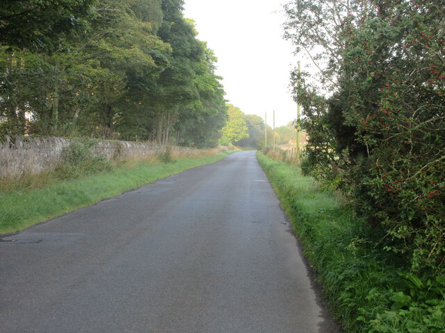
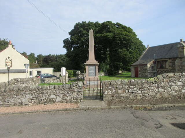
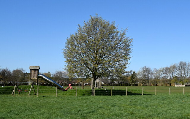
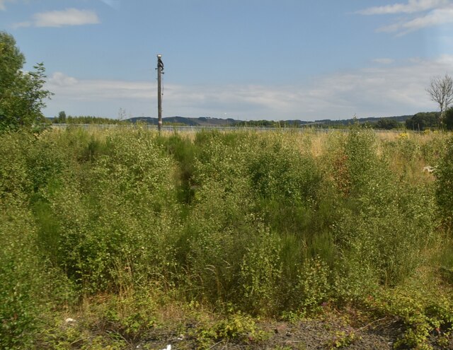
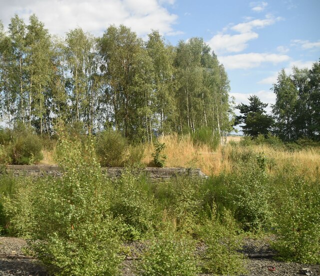
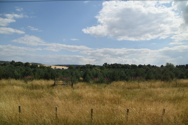
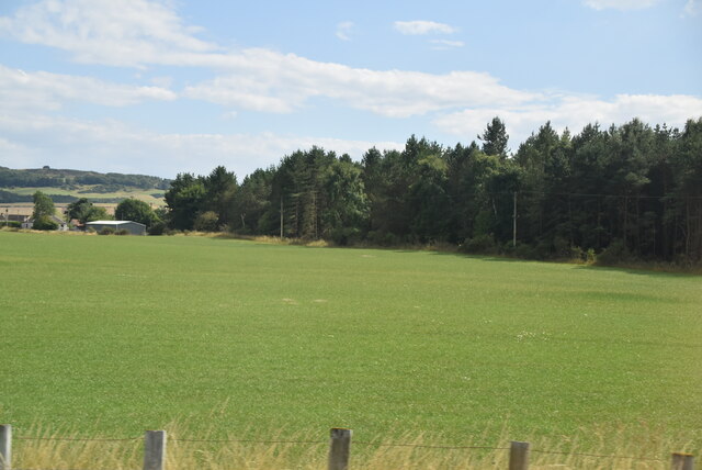
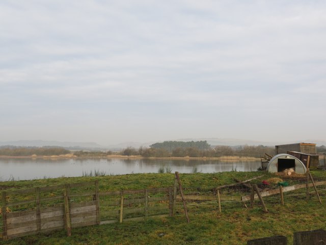
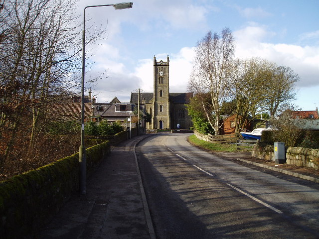
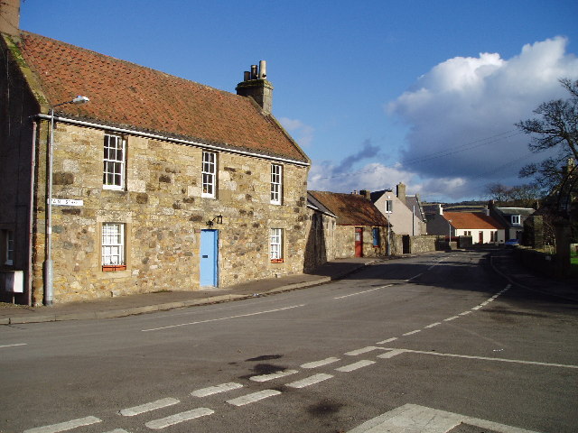
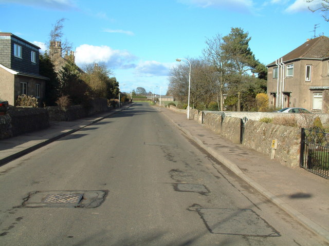
Ladybank is a small village located in the region of Fife, Scotland. Situated approximately 12 miles southeast of Cupar and 5 miles north of Glenrothes, it lies within the heart of the Kingdom of Fife. Ladybank is known for its picturesque rural setting, surrounded by lush green fields and rolling hills.

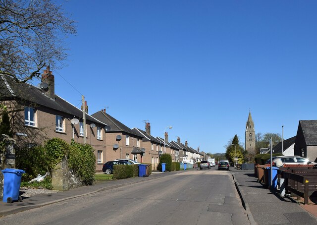
The village has a population of around 1,500 residents and boasts a close-knit community atmosphere. It offers a range of amenities, including a primary school, a post office, a few local shops, and a pub. Additionally, there is a railway station, providing convenient access to Edinburgh, Dundee, and other major cities in the area.

Ladybank is particularly renowned for its golfing facilities. The Ladybank Golf Club, founded in 1879, is a prestigious 18-hole course that has hosted many professional tournaments. The area's natural landscape and well-maintained fairways attract golfers from far and wide, making Ladybank a popular destination for the sport.

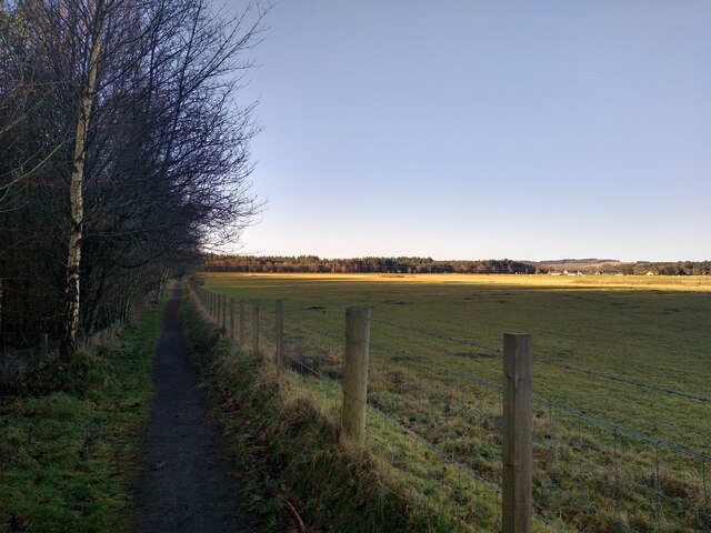
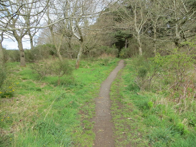
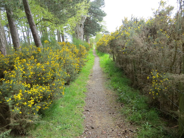
Surrounded by beautiful countryside, Ladybank offers opportunities for outdoor activities such as hiking and cycling. The nearby Tentsmuir Forest and Lomond Hills Regional Park provide stunning landscapes and scenic trails for nature enthusiasts to explore.

Overall, Ladybank is a charming village with a rich history and natural beauty. Its tranquil ambiance, combined with its convenient location and excellent golfing facilities, makes it an attractive place to live or visit for those seeking a peaceful retreat in the Scottish countryside.

If you have any feedback on the listing, please let us know in the comments section below.

Ladybank Images

Images are sourced within 2km of 56.274439/-3.122709 or Grid Reference NO3009. Thanks to Geograph Open Source API. All images are credited.

The Pitlessie Road The Pitlessie Road heading west towards Ladybank near The Common.
The Pitlessie Road
The Pitlessie Road heading west towards Ladybank near The Common.
Giffordstown War Memorial The Giffordstown and District War Memorial at Charlottetown.
Giffordstown War Memorial
The Giffordstown and District War Memorial at Charlottetown.
Footpath to Edenstown Edenstown is not really a town. It's not even a village. But nice network of footpaths through the woodland.
Footpath to Edenstown
Edenstown is not really a town. It's not even a village. But nice network of footpaths through the woodland.
Council houses, Church Street, Ladybank
Play area, Beech Street, Ladybank
Trackside vegetation near Ladybank
Near Gravelpit Wood
Near Gravelpit Wood
Near Pitlessie Common
Field by Heggie's Muir Wood
Pig sty at Angle Park pond
Woodland path at Cairnfield Muir Looking north-eastward.
Woodland path at Cairnfield Muir
Looking north-eastward.
Gorse and tree enclosed path at Cairnfield Muir Looking south-eastward.
Gorse and tree enclosed path at Cairnfield Muir
Looking south-eastward.
Edenstown. Houses in the woods of Edensmuir, a Forestry Commission holding on gravel soils near Ladybank. Looking out, south towards the road from within the forest.
Edenstown.
Houses in the woods of Edensmuir, a Forestry Commission holding on gravel soils near Ladybank. Looking out, south towards the road from within the forest.
Howe of Fife Parish Church, Kingskettle View west along main road towards the church which stands on the western edge of this grid square, The church was built in 1853 and is a very fine and attractive building which can be seen from afar and which lies within a very attractive small village.
Howe of Fife Parish Church, Kingskettle
View west along main road towards the church which stands on the western edge of this grid square, The church was built in 1853 and is a very fine and attractive building which can be seen from afar and which lies within a very attractive small village.
Kingskettle An attractive village in Fife locally known as Kettle which developed in an area which once belonged to the Crown and where an unrecorded battle or Cathel took place, this is how the name Kingskettle came about. The village developed in the 19th century with the opening of the turnpike road and with the development of mining and weaving.
Kingskettle
An attractive village in Fife locally known as Kettle which developed in an area which once belonged to the Crown and where an unrecorded battle or Cathel took place, this is how the name Kingskettle came about. The village developed in the 19th century with the opening of the turnpike road and with the development of mining and weaving.
Cottages in Ladybank, Fife
Ladybank, Fife Ladybank developed in the late 19th century around a railway junction which is still in use today.
Ladybank, Fife
Ladybank developed in the late 19th century around a railway junction which is still in use today.
Kettlebridge Main street (Rumdewan) in the village of Kettlebridge
Kettlebridge
Main street (Rumdewan) in the village of Kettlebridge
Show me another place!

Ladybank is located at Grid Ref: NO3009 (Lat: 56.274439, Lng: -3.122709)

Unitary Authority: Fife

Police Authority: Fife

What 3 Words

///registry.perplexed.deranged. Near Ladybank, Fife

Nearby Locations

Ladybank Monkstown Fife

Related Wikis

Ladybank

Ladybank () is a village and former burgh of Fife, Scotland. It is about 62 kilometres (39 mi) north of Edinburgh, 8 kilometres (5.0 mi) southwest of Cupar...

Ladybank railway station

Ladybank railway station serves the town of Ladybank in Fife, Scotland. == History == The station was opened in 1847 by the Edinburgh and Northern Railway...

Kingskettle

Kingskettle or often simply Kettle is a village and parish in Fife, Scotland. Encompassed by the Howe of Fife, the village is approximately 5.5 miles...

Kingskettle railway station

Kingskettle railway station served the village of Kingskettle, Fife, Scotland, from 1847 to 1967 on the Edinburgh and Northern Railway. == History == The...

Howe of Fife

The Howe of Fife is the broad, low-lying valley of the River Eden, lying between the Ochil Hills and the Lomond Hills in Fife, Scotland. Howe, in Scots...

A92 road

The A92 is a major road that runs through Fife, Dundee, Angus, Aberdeenshire, and Aberdeen City in Scotland. From south to north, it runs from Dunfermline...

Balmalcolm

Balmalcolm is a small village in the Kettle parish of Fife, Scotland. Encompassed by the low-lying Howe of Fife, the village is roughly 5+1⁄2 miles (9...

Daftmill distillery

Daftmill distillery is a single malt Scotch whisky distillery, located in a converted barn at Daftmill Farm in the Howe of Fife. The distillery was granted...

Nearby Amenities

Located within 500m of 56.274439,-3.122709
Ladybank
Name Ga: Leathad Bog
Name Gd: Leathad Bog
Name Sco: Leddybank
Place: village
Population: 1582
Wikidata: Q659588
Wikipedia: en:Ladybank
Lat/Long: 56.2781959/-3.1255066
Ladybank
Naptan AtcoCode: 9100LADYBNK
Network: National Rail
Network Website: https://www.nationalrail.co.uk/stations/ldy/
Network Wikidata: Q26334
Operator: ScotRail
Public Transport: station
Railway: station
Ref Crs: LDY
Source: NPE
Train: yes
Wheelchair: yes
Wikidata: Q980212
Wikipedia: en:Ladybank railway station
Lat/Long: 56.2742464/-3.1215949
Railway: switch
Lat/Long: 56.2756529/-3.1219898
Telephone
Booth: K6
Covered: booth
Operator: BT
Lat/Long: 56.2743278/-3.1240452
Traffic Calming: cushion
Lat/Long: 56.2741375/-3.1254227
Mini Roundabout
Lat/Long: 56.2768344/-3.1278609
Historic: monument
Lat/Long: 56.2742502/-3.1223929
Traffic Calming: cushion
Lat/Long: 56.275385/-3.1220806
Traffic Calming: cushion
Lat/Long: 56.2780314/-3.1248274
Give Way
Direction: forward
Lat/Long: 56.2733463/-3.1205626
Traffic Calming: cushion
Lat/Long: 56.2740112/-3.1267897
Crossing Barrier: gate
Crossing Bell: yes
Crossing Light: yes
Crossing On Demand: yes
Railway: level_crossing
Lat/Long: 56.2786862/-3.1228984
Give Way
Direction: forward
Lat/Long: 56.2783424/-3.1256992
Traffic Calming: cushion
Lat/Long: 56.2775799/-3.1234016
Give Way
Direction: backward
Lat/Long: 56.2751561/-3.1264598
Give Way
Direction: backward
Lat/Long: 56.2754461/-3.1266863
Traffic Calming: cushion
Lat/Long: 56.2765818/-3.1224687
Bicycle Parking
Bicycle Parking: lockers
Capacity: 4
Lat/Long: 56.2743004/-3.1219004
Bicycle Parking
Bicycle Parking: stands
Capacity: 10
Covered: no
Lat/Long: 56.2743158/-3.1219033
Railway: switch
Lat/Long: 56.2751836/-3.1218539
Traffic Calming: cushion
Lat/Long: 56.2742274/-3.1244772
Traffic Calming: cushion
Lat/Long: 56.2743564/-3.1230211
Give Way
Direction: forward
Lat/Long: 56.2738985/-3.1207822
Traffic Signals
Traffic Signals: signal
Traffic Signals Direction: forward
Lat/Long: 56.2734347/-3.1216411
Traffic Signals
Traffic Signals: signal
Traffic Signals Direction: backward
Lat/Long: 56.273391/-3.1209327
Crossing Barrier: gate
Crossing On Demand: yes
Railway: level_crossing
Lat/Long: 56.2714904/-3.1207705
Crossing Barrier: gate
Crossing On Demand: yes
Railway: level_crossing
Lat/Long: 56.2714911/-3.1208443
Railway: switch
Lat/Long: 56.2725816/-3.1211538
Railway: switch
Lat/Long: 56.271883/-3.1208792
Wellwood
Place: isolated_dwelling
Source: Survey Jul 2016
Lat/Long: 56.2714345/-3.1184988
Railway: switch
Lat/Long: 56.2760463/-3.1221014
Railway: switch
Lat/Long: 56.2763941/-3.1222102
Crossing Barrier: gate
Crossing Bell: yes
Crossing Light: yes
Crossing On Demand: yes
Railway: level_crossing
Lat/Long: 56.2786798/-3.1229472
Railway: buffer_stop
Lat/Long: 56.2785687/-3.1229578
Railway: switch
Lat/Long: 56.2783276/-3.1206343
Railway: switch
Lat/Long: 56.2779513/-3.1211132
Railway: switch
Lat/Long: 56.2750396/-3.1216703
Cafe
The Kiltmakers Coffee Shop
Lat/Long: 56.2741428/-3.122797
Ladybank
Public Transport: stop_position
Railway: stop
Train: yes
Lat/Long: 56.2741952/-3.1216185
Ladybank Junction
Railway: junction
Lat/Long: 56.2751846/-3.1218251
Post Box
Brand: Royal Mail
Brand Wikidata: Q638098
Brand Wikipedia: en:Royal Mail
Collection Times: Mo-Fr 16:00; Sa 11:45
Operator: Royal Mail
Operator Wikidata: Q638098
Post Box Type: lamp
Ref: KY15 301
Royal Cypher: scottish_crown
Lat/Long: 56.2743087/-3.1245877
Bench
Lat/Long: 56.2740892/-3.1225073
Bench
Lat/Long: 56.2741175/-3.1222015
Bench
Lat/Long: 56.2740937/-3.1224
Give Way
Direction: backward
Lat/Long: 56.2737239/-3.1299878
Lanes: 1
Priority: forward
Traffic Calming: choker
Lat/Long: 56.2737076/-3.1301724
Give Way
Direction: backward
Lat/Long: 56.2741481/-3.1257565
Traffic Calming: cushion
Lat/Long: 56.2745584/-3.1260677
Bus Stop
Bench: yes
Bin: yes
Lit: yes
Naptan AtcoCode: 6500N0305
Naptan NaptanCode: 34342576
Public Transport: platform
Shelter: yes
Tactile Paving: no
Lat/Long: 56.2749277/-3.1222053
Frequency: 50
Line Management: termination
Location Transition: yes
Power: pole
Transformer: distribution
Voltage Secondary: 400
Lat/Long: 56.2734862/-3.1281611
Power: pole
Lat/Long: 56.2727058/-3.1289953
Power: pole
Lat/Long: 56.2722143/-3.1285018
Power: pole
Lat/Long: 56.2723662/-3.1271486
Power: pole
Lat/Long: 56.2725189/-3.125845
Power: pole
Lat/Long: 56.2726663/-3.1249478
Power: pole
Lat/Long: 56.272819/-3.1240855
Power: pole
Lat/Long: 56.2729195/-3.1234029
Line Management: termination
Location Transition: yes
Power: pole
Lat/Long: 56.2732479/-3.1226438
Location: indoor
Power: substation
Substation: minor_distribution
Lat/Long: 56.2751611/-3.1214717
Railway: buffer_stop
Lat/Long: 56.2767534/-3.1219947
Railway: buffer_stop
Lat/Long: 56.2765643/-3.121984
Give Way
Direction: backward
Lat/Long: 56.2781135/-3.1255254
Give Way
Direction: forward
Lat/Long: 56.2782097/-3.1255178
Location: outdoor
Power: substation
Substation: minor_distribution
Lat/Long: 56.2775869/-3.1232185
Give Way
Direction: forward
Lat/Long: 56.2774924/-3.1230509
Give Way
Direction: backward
Lat/Long: 56.275682/-3.1222455
Give Way
Direction: forward
Lat/Long: 56.2747651/-3.1261561
Give Way
Direction: backward
Lat/Long: 56.2747371/-3.1262746
Give Way
Direction: backward
Lat/Long: 56.2764206/-3.1274916
Crossing
Crossing: uncontrolled
Traffic Calming: choker
Lat/Long: 56.2763011/-3.1274005
Crossing
Crossing: uncontrolled
Traffic Calming: choker
Lat/Long: 56.2757633/-3.1269905
Give Way
Direction: forward
Lat/Long: 56.2756332/-3.1268938
Give Way
Direction: forward
Lat/Long: 56.2751564/-3.1265987
Post Box
Brand: Royal Mail
Brand Wikidata: Q638098
Brand Wikipedia: en:Royal Mail
Collection Times: Mo-Fr 09:00; Sa 07:00
Operator: Royal Mail
Operator Wikidata: Q638098
Post Box Type: lamp
Ref: KY15 302D
Royal Cypher: scottish_crown
Lat/Long: 56.2775578/-3.1281658
Defibrillator
Defibrillator Location: Adjacent to library entrance.
Emergency: defibrillator
Indoor: no
Lat/Long: 56.2741571/-3.1244836
Communication Mobile Phone: yes
Man Made: mast
Tower Construction: lattice
Tower Type: communication
Lat/Long: 56.2785021/-3.1196861
Post Office
Ladybank Post Office
Brand: Post Office
Brand Wikidata: Q1783168
Check Date: 2023-09-27
Operator: Spar
Operator Wikidata: Q610492
Ref Pol Id: 177333
Website: https://www.postoffice.co.uk/branch-finder/0694703/ladybank
Lat/Long: 56.2743767/-3.124693
Defibrillator
Access: yes
Defibrillator Location: On wall facing main road
Emergency: defibrillator
Indoor: no
Opening Hours: 24/7
Lat/Long: 56.2767062/-3.1226853
The data included in this document is from www.openstreetmap.org. The data is made available under ODbL.

Have you been to Ladybank?

Leave your review of Ladybank below (or comments, questions and feedback).