Antonlew Glen

Valley in Wigtownshire

Scotland

Antonlew Glen

Down the track In Knockinaam Wood.
Down the track Credit: Jon Alexander

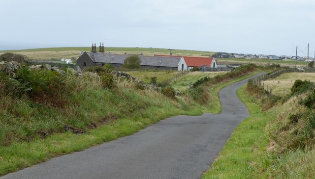
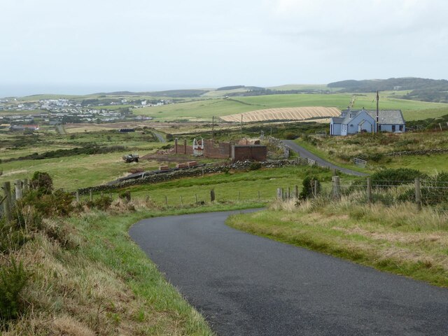
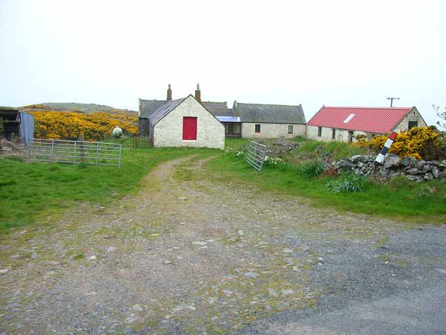
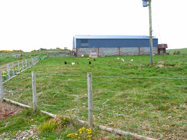
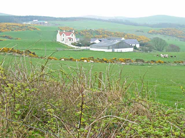
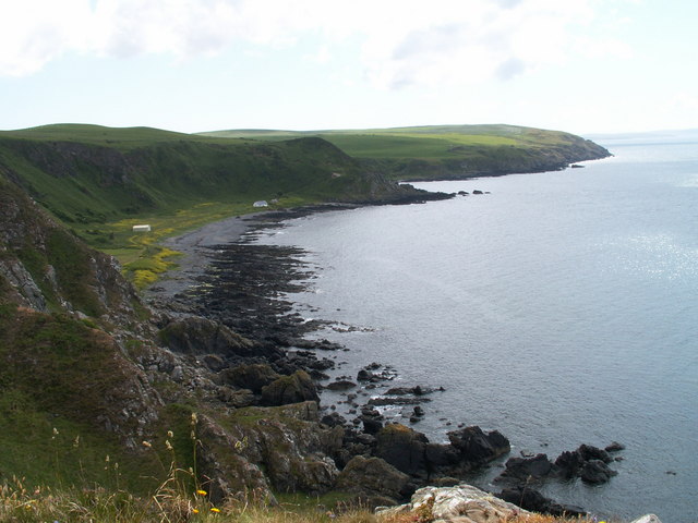
Antonlew Glen, located in the scenic region of Wigtownshire, is a picturesque valley that offers visitors a tranquil and idyllic setting to enjoy the beauty of nature. Situated in the southwestern part of Scotland, this glen is known for its stunning landscapes, wildlife, and historical significance.

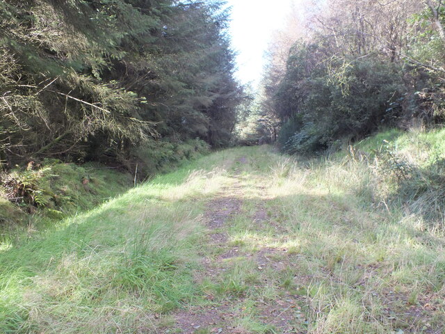
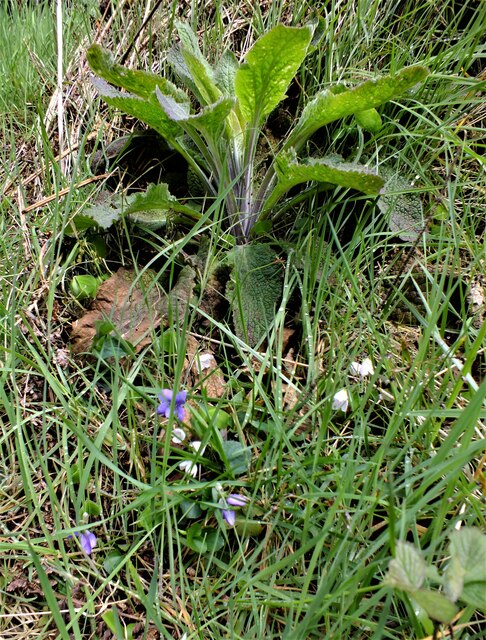
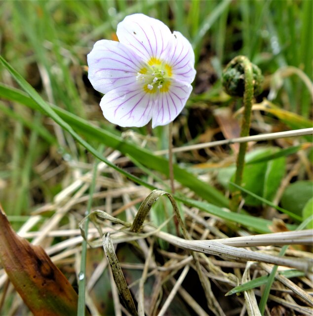
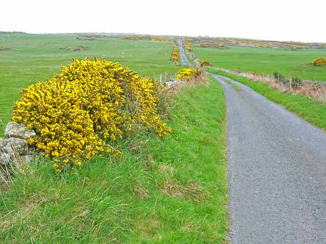
Covering an area of approximately x square kilometers, Antonlew Glen is characterized by rolling hills, lush green meadows, and meandering streams. The glen is home to a diverse range of flora and fauna, including native wildflowers, ferns, and various bird species. Nature enthusiasts can indulge in activities such as hiking, birdwatching, and photography, while enjoying the peaceful ambiance of the glen.

In addition to its natural beauty, Antonlew Glen holds historical significance. The glen was once a hub for various industries, including farming, mining, and forestry. Remnants of these activities can still be seen in the form of old ruins and abandoned structures scattered throughout the glen. History buffs can explore these remnants and learn about the region's past.

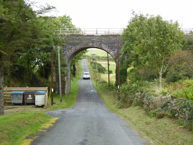
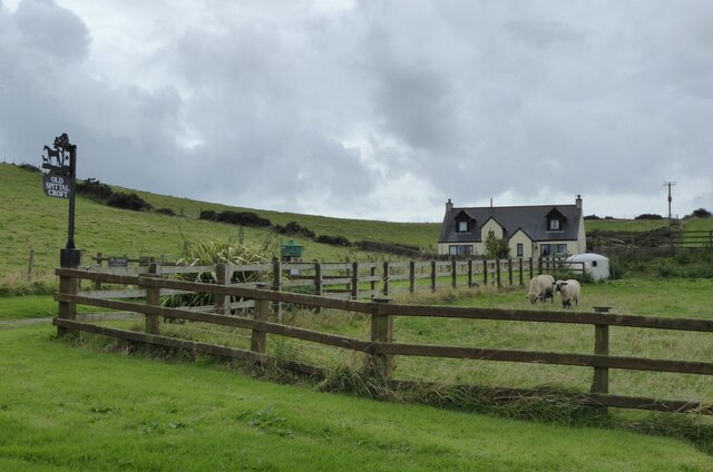
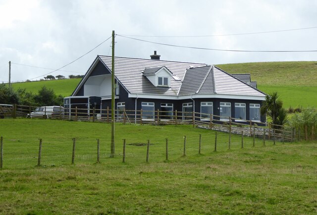
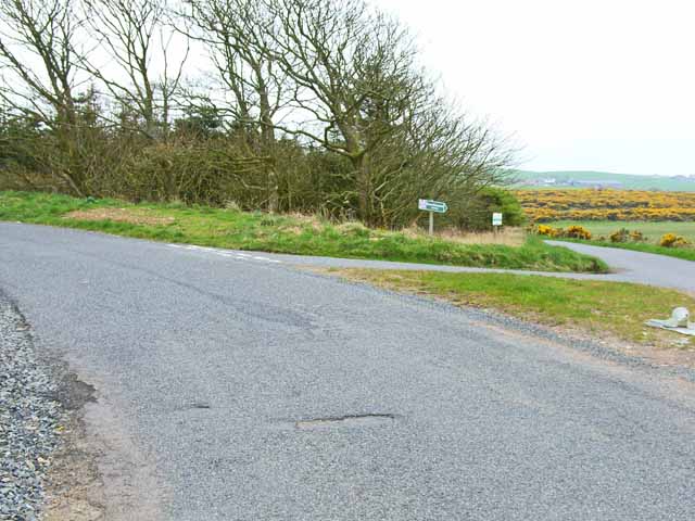
Access to Antonlew Glen is convenient, with well-maintained roads leading to the area. Visitors can find ample parking facilities and designated walking trails that guide them through the glen. Additionally, there are a few local businesses nearby that offer accommodations and refreshments for those looking to spend more time exploring the glen.

Antonlew Glen, with its blend of natural beauty and historical significance, is a must-visit destination for anyone seeking a peaceful and enriching experience in Wigtownshire, Scotland.

If you have any feedback on the listing, please let us know in the comments section below.

Antonlew Glen Images

Images are sourced within 2km of 54.826907/-5.0814607 or Grid Reference NX0252. Thanks to Geograph Open Source API. All images are credited.

Down the track In Knockinaam Wood.
Down the track
In Knockinaam Wood.
Floral Collection Next to the track in Knockinaam Wood. At the top we have a Foxglove (Digitalis purpurea) which is not yet in flower, below this are Dog Violets (Viola riviniana) and the white Wood Sorrel flowers (Oxalis acetosella).
Floral Collection
Next to the track in Knockinaam Wood. At the top we have a Foxglove (Digitalis purpurea) which is not yet in flower, below this are Dog Violets (Viola riviniana) and the white Wood Sorrel flowers (Oxalis acetosella).
Wood Sorrel The pretty white flowers of the Wood Sorrel (Oxalis acetosella) with their five petals, purple veins and distinctive trefoil leaves which close as night falls, reopening in the dappled sun the next morning.
Wood Sorrel
The pretty white flowers of the Wood Sorrel (Oxalis acetosella) with their five petals, purple veins and distinctive trefoil leaves which close as night falls, reopening in the dappled sun the next morning.
Railway bridge of the old Portpatrick Railway The Portpatrick Railway was built to connect with steamers for passengers continuing to Northern Ireland. 
Ferries to Stranraer and now Cairnryan took the trade from Portpatrick.
Railway bridge of the old Portpatrick Railway
The Portpatrick Railway was built to connect with steamers for passengers continuing to Northern Ireland. Ferries to Stranraer and now Cairnryan took the trade from Portpatrick.
Craigoch Park With the Holiday Park beyond on the road to Portpatrick.
Craigoch Park
With the Holiday Park beyond on the road to Portpatrick.
Not a tank on the lawn! But a Husqvarna Automower 435X AWD on the lawn at Knockinaam Lodge.
'Designed for rough terrain and steep hills, the Husqvarna Automower 435X AWD is loaded with features including all-wheel drive, Bluetooth, cellular, and GPS technologies, a pivoting rear end, and an ultra-quiet battery-powered motor.'
<span class="nowrap"><a title="https://uk.pcmag.com/home-security-products/127908/husqvarna-automower-435x-awd" rel="nofollow ugc noopener" href="https://uk.pcmag.com/home-security-products/127908/husqvarna-automower-435x-awd">Link</a><img style="margin-left:2px;" alt="External link" title="External link - shift click to open in new window" src="https://s1.geograph.org.uk/img/external.png" width="10" height="10"/></span>
Not a tank on the lawn!
But a Husqvarna Automower 435X AWD on the lawn at Knockinaam Lodge. 'Designed for rough terrain and steep hills, the Husqvarna Automower 435X AWD is loaded with features including all-wheel drive, Bluetooth, cellular, and GPS technologies, a pivoting rear end, and an ultra-quiet battery-powered motor.' LinkExternal link
Knockinaam Lodge Hotel '19th century country house hotel, fully restored to create a stylish and relaxed ambience for our guests as they enjoy stunning scenery and food served in our 3 AA rosette restaurant.'
<span class="nowrap"><a title="https://www.knockinaamlodge.com/" rel="nofollow ugc noopener" href="https://www.knockinaamlodge.com/">Link</a><img style="margin-left:2px;" alt="External link" title="External link - shift click to open in new window" src="https://s1.geograph.org.uk/img/external.png" width="10" height="10"/></span>
The odd 'box' on the lawn is in fact a mower! 
See <a title="https://www.geograph.org.uk/photo/7284516" href="https://www.geograph.org.uk/photo/7284516">Link</a>
Knockinaam Lodge Hotel
'19th century country house hotel, fully restored to create a stylish and relaxed ambience for our guests as they enjoy stunning scenery and food served in our 3 AA rosette restaurant.' LinkExternal link The odd 'box' on the lawn is in fact a mower! See Link
The winding road  to Eagle View And on to Portpatrick.
The winding road to Eagle View
And on to Portpatrick.
Spittal House Farm South east of the Port of Spittal Burn that flows into Port of Spittal Bay.
The Caledonian Cheese Company is based in Stranraer.
Spittal House Farm
South east of the Port of Spittal Burn that flows into Port of Spittal Bay. The Caledonian Cheese Company is based in Stranraer.
Old Spittal Croft In sheep country!
Old Spittal Croft
In sheep country!
Tobarcnoc North Port o' Spittal Farm, near Portpatrick, Stranraer.
Tobarcnoc
North Port o' Spittal Farm, near Portpatrick, Stranraer.
Croft on Craigoch Park Moor South of Portpatrick. Note the gorse infestation, a major problem in south-west Scotland.
Croft on Craigoch Park Moor
South of Portpatrick. Note the gorse infestation, a major problem in south-west Scotland.
Livestock transportation business, Port of Spittal
Barn on Craigoch Moor
Farm at North Port of Spittal
Road junction on the B7042 Portpatrick to Sandhead road
Road junction on the B7042
Portpatrick to Sandhead road
Morroch Bay
Morroch Bay
Road across Craigoch Park Moor
Show me another place!

Antonlew Glen is located at Grid Ref: NX0252 (Lat: 54.826907, Lng: -5.0814607)

Unitary Authority: Dumfries and Galloway

Police Authority: Dumfries and Galloway

What 3 Words

///outlines.mush.haunt. Near Stranraer, Dumfries & Galloway

Related Wikis

Knockinaam Lodge

Knockinaam Lodge is a hotel and restaurant located about 3.5 miles South of Portpatrick, Dumfries & Galloway, Scotland. As of 2008, the restaurant holds...

Dunskey Castle

Dunskey Castle is a ruined, 12th-century tower house or castle, located 0.5 miles (0.80 km) south of the village of Portpatrick, Rhinns, Wigtownshire,...

Dunskey

Dunskey Estate (also known as Portree Estate) is north of Portpatrick on the west coast of Scotland. The B-listed mansion dates from the start of the twentieth...

Portpatrick railway station

Portpatrick railway station was a railway station serving the village of Portpatrick, Dumfries & Galloway, Scotland. Opened in 1862 the station served...

Colfin railway station

Colfin railway station, located in Wigtownshire, Scotland, between Portpatrick and Stranraer, was a station on the Portpatrick and Wigtownshire Joint Railway...

Portpatrick

Portpatrick is a village and civil parish in the historical county of Wigtownshire, Dumfries and Galloway, Scotland. It is located on the west coast of...

Rhins of Galloway

The Rhins of Galloway, otherwise known as the Rhins of Wigtownshire (or as The Rhins, also spelled The Rhinns; Scottish Gaelic: Na Rannaibh), is a hammer...

MV Craigantlet

MV Craigantlet was a German-owned, Cyprus-registered container ship operated on time-charter by Cawoods Containers Ltd of Belfast. She ran aground on 26...

Nearby Amenities

Located within 500m of 54.826907,-5.0814607
Created By: dmgroom_coastlines
Source: PGS
Lat/Long: 54.828017/-5.088953
Created By: dmgroom_coastlines
Source: PGS
Lat/Long: 54.827893/-5.088725
Created By: dmgroom_coastlines
Source: PGS
Lat/Long: 54.827768/-5.088496
Created By: dmgroom_coastlines
Source: PGS
Lat/Long: 54.827527/-5.087596
Created By: dmgroom_coastlines
Source: PGS
Lat/Long: 54.827404/-5.087369
Created By: dmgroom_coastlines
Source: PGS
Lat/Long: 54.826388/-5.086872
Created By: dmgroom_coastlines
Source: PGS
Lat/Long: 54.826132/-5.086859
Created By: dmgroom_coastlines
Source: PGS
Lat/Long: 54.825868/-5.087289
Created By: dmgroom_coastlines
Source: PGS
Lat/Long: 54.825608/-5.087497
Created By: dmgroom_coastlines
Source: PGS
Lat/Long: 54.825495/-5.086604
Created By: dmgroom_coastlines
Source: PGS
Lat/Long: 54.825372/-5.086376
Created By: dmgroom_coastlines
Source: PGS
Lat/Long: 54.825247/-5.086147
Created By: dmgroom_coastlines
Source: PGS
Lat/Long: 54.825014/-5.084804
Created By: dmgroom_coastlines
Source: PGS
Lat/Long: 54.825021/-5.084361
Created By: dmgroom_coastlines
Source: PGS
Lat/Long: 54.825029/-5.083917
Created By: dmgroom_coastlines
Source: PGS
Lat/Long: 54.824905/-5.08369
Created By: dmgroom_coastlines
Source: PGS
Lat/Long: 54.824781/-5.083461
Created By: dmgroom_coastlines
Source: PGS
Lat/Long: 54.824657/-5.083234
Created By: dmgroom_coastlines
Source: PGS
Lat/Long: 54.823889/-5.083194
Created By: dmgroom_coastlines
Source: PGS
Lat/Long: 54.823377/-5.083168
Created By: dmgroom_coastlines
Source: PGS
Lat/Long: 54.823121/-5.083154
Created By: dmgroom_coastlines
Source: PGS
Lat/Long: 54.822609/-5.083128
Knockinaam Lodge
Addr City: Portpatrick
Addr Housename: Knockinaam Lodge
Addr Postcode: DG9 9AD
Bar: yes
Check Date: 2023-08-06
Contact Facebook: https://www.facebook.com/knockinaamlodgehotel/
Contact Instagram: https://www.instagram.com/knockinaamlodgehotel/
Cuisine: British;Scottish
Diet Dairy Free: yes
Diet Gluten Free: yes
Diet Nut Free: yes
Diet Vegan: yes
Diet Vegetarian: yes
Email: reservations@knockinaamlodge.com
Internet Access: wlan
Payment American Express: yes
Payment Cash: yes
Payment Credit Cards: yes
Payment Debit Cards: yes
Pets: yes
Phone: +44 1776 810471
Reservation: required
Rooms: 10
Source: https://www.telegraph.co.uk/travel/destinations/europe/united-kingdom/scotland/southern-uplands/hotels/knockinaam-lodge-hotel/;https://scotlandstartshere.com/point-of-interest/knockinaam-lodge/
Tourism: hotel
Website: https://www.knockinaamlodge.com/
Wheelchair: limited
Wikidata: Q6422873
Wikipedia: en:Knockinaam Lodge
Lat/Long: 54.8252778/-5.081713
Barrier: stile
Foot: yes
Lat/Long: 54.8273472/-5.0845487
Barrier: kissing_gate
Foot: yes
Lat/Long: 54.8284978/-5.0857265
Barrier: stile
Foot: yes
Lat/Long: 54.8277754/-5.0807795
Barrier: kissing_gate
Foot: yes
Lat/Long: 54.8273899/-5.0846177
Barrier: kissing_gate
Foot: yes
Lat/Long: 54.8295614/-5.0872883
Power: pole
Lat/Long: 54.8308093/-5.0792957
Power: pole
Lat/Long: 54.8304483/-5.0784106
Power: pole
Lat/Long: 54.8300967/-5.0775679
Power: pole
Lat/Long: 54.8297451/-5.0767133
Power: pole
Lat/Long: 54.8294192/-5.0759269
Power: pole
Lat/Long: 54.8296748/-5.0776852
Power: pole
Lat/Long: 54.8288093/-5.0779693
Power: pole
Lat/Long: 54.8279317/-5.078251
Power: pole
Lat/Long: 54.8270906/-5.0785304
Power: pole
Lat/Long: 54.8264739/-5.0790868
Power: pole
Lat/Long: 54.8258369/-5.0797042
Power: pole
Lat/Long: 54.8252906/-5.0804906
Power: pole
Lat/Long: 54.8253609/-5.0812959
Power: pole
Lat/Long: 54.8252676/-5.0802113
Power: pole
Lat/Long: 54.8250411/-5.0798274
Power: pole
Lat/Long: 54.8249024/-5.0795833
Playground: structure
Lat/Long: 54.8253243/-5.0828814
Passing Place
Passing Place: left
Lat/Long: 54.8254929/-5.076918
The data included in this document is from www.openstreetmap.org. The data is made available under ODbL.

Have you been to Antonlew Glen?

Leave your review of Antonlew Glen below (or comments, questions and feedback).