Lacharn

Settlement in Carmarthenshire

Wales

Lacharn

Broadway I wonder what's playing??
Broadway Credit: Dara Jasumani

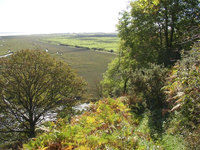
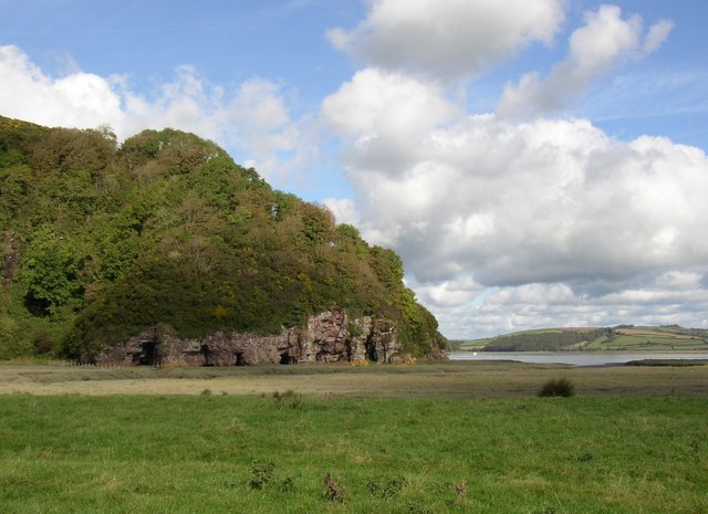
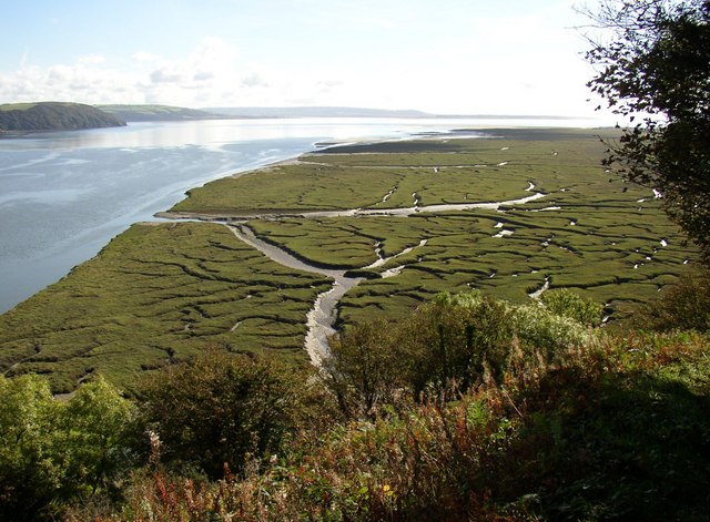
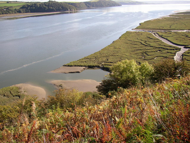
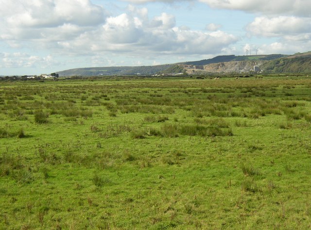
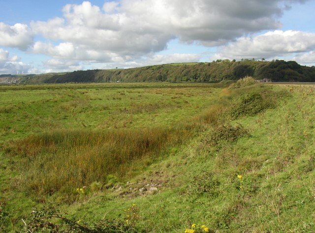
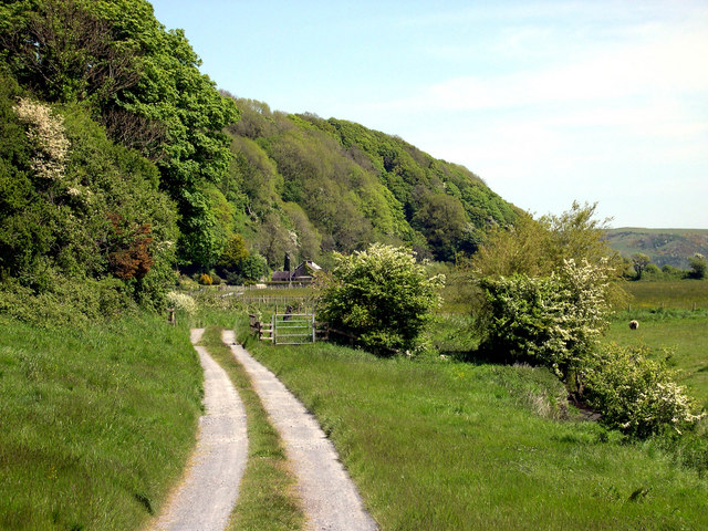
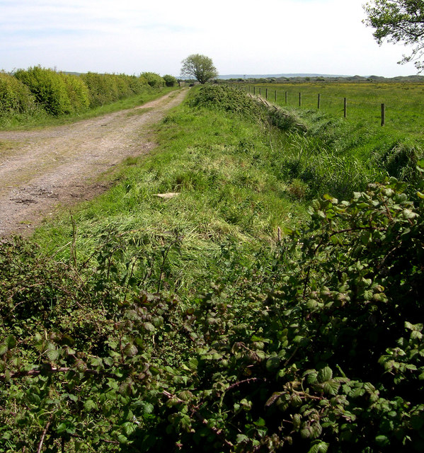
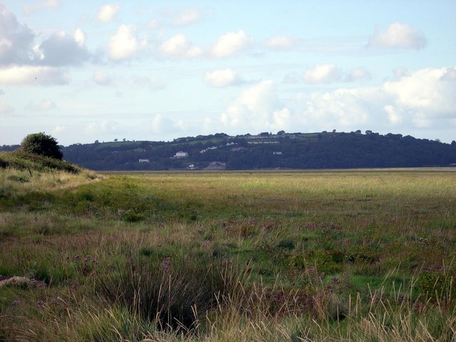
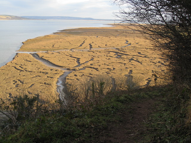
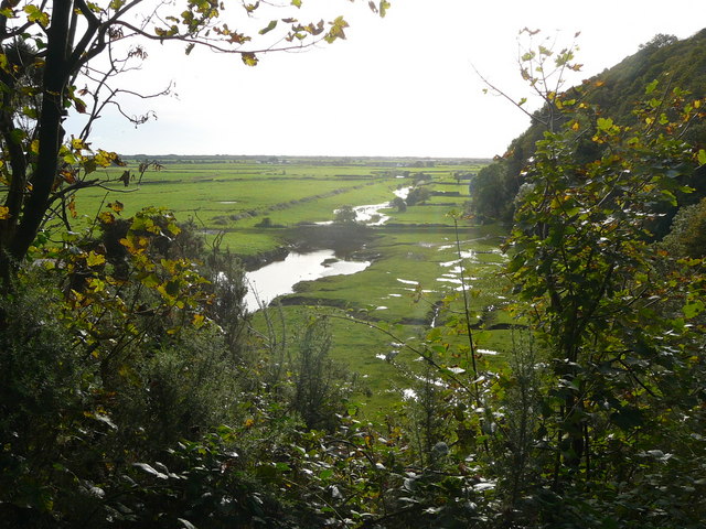
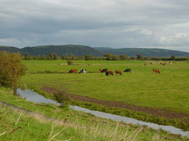
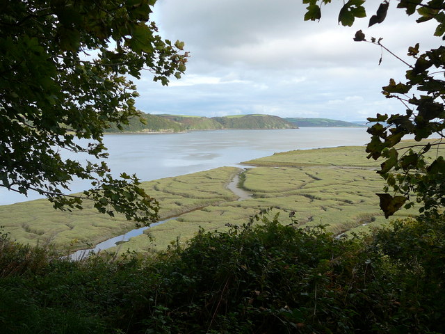
Lacharn is a small village located in the county of Carmarthenshire, Wales. Situated in the western part of the country, it is nestled amidst the picturesque landscape of rolling hills and lush green valleys. The village is situated near the River Towy, which adds to its natural beauty.

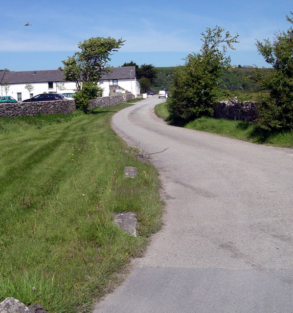
Lacharn is a tight-knit community with a population of approximately 300 residents. The village has a rich history dating back many centuries, with evidence of early human settlements discovered in the surrounding area. The charm of Lacharn lies in its traditional architecture, with many buildings constructed using locally sourced materials such as stone and slate.

Although small in size, Lacharn offers a range of amenities to its residents and visitors. The village boasts a primary school, a community hall, and a local pub, providing essential services and opportunities for social interaction. Additionally, Lacharn benefits from excellent transport links, with regular bus services connecting it to nearby towns and cities.

Surrounded by stunning countryside, Lacharn offers ample opportunities for outdoor activities. The village is a popular starting point for hiking and walking trails that wind through the scenic Carmarthenshire countryside. The nearby River Towy also attracts anglers, who come to fish for salmon and trout.

Lacharn is a tranquil and idyllic village, perfect for those seeking a peaceful retreat in the heart of the Welsh countryside. Its natural beauty, rich history, and community spirit make it an appealing destination for both residents and visitors alike.

If you have any feedback on the listing, please let us know in the comments section below.
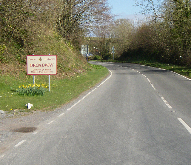
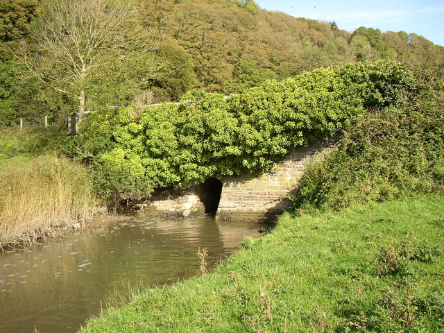
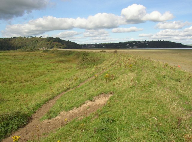
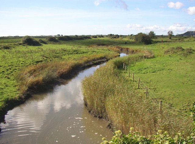
Lacharn Images

Images are sourced within 2km of 51.762806/-4.4648183 or Grid Reference SN3010. Thanks to Geograph Open Source API. All images are credited.

Broadway I wonder what's playing??
Broadway
I wonder what's playing??
Bridge over Railsgate Pill, Laugharne The bridge has a very small waterway, presumably so that it can be blocked to prevent flooding due to very high tides.
Bridge over Railsgate Pill, Laugharne
The bridge has a very small waterway, presumably so that it can be blocked to prevent flooding due to very high tides.
Bend in the sea wall, Laugharne The sea wall is not straight, but has a gradual curve from the northern end and then a sharper bend.  It is an earth bank, protected by stone pitching on the seaward side.
Bend in the sea wall, Laugharne
The sea wall is not straight, but has a gradual curve from the northern end and then a sharper bend. It is an earth bank, protected by stone pitching on the seaward side.
Railsgate Pill, Laugharne This is the name of the watercourse.  The line of bushes on the left side probably marks the line of the tramway that carried limestone from the quarry at Coygan to boats below the bridge (from which this photograph was taken).
Railsgate Pill, Laugharne
This is the name of the watercourse. The line of bushes on the left side probably marks the line of the tramway that carried limestone from the quarry at Coygan to boats below the bridge (from which this photograph was taken).
Path down from Sir John's Hill, Laugharne This leads down to East Marsh.  The boundary between the drained part and the salt marsh, formed by the sea wall, can be clearly seen in the distance.
Path down from Sir John's Hill, Laugharne
This leads down to East Marsh. The boundary between the drained part and the salt marsh, formed by the sea wall, can be clearly seen in the distance.
Headland south of Laugharne Sir John's Hill is cut short by the Taff estuary.
Headland south of Laugharne
Sir John's Hill is cut short by the Taff estuary.
Salt marsh south of Laugharne An intricate pattern of channels.
Salt marsh south of Laugharne
An intricate pattern of channels.
Mouth of Railsgate Pill, Laugharne Although Railsgate Pill is hardly more than a drainage ditch for East Marsh, it has quite a broad mouth into the Taff Estuary.
Mouth of Railsgate Pill, Laugharne
Although Railsgate Pill is hardly more than a drainage ditch for East Marsh, it has quite a broad mouth into the Taff Estuary.
Lower Marsh Laugharne Marshland drained to make pasture.  Seen from the sea wall.  There is another embankment crossing the marsh in the distance, beyond which the land is called East Marsh. The limestone quarry at Coygan can be seen in the distance, and some wind turbines on the hill.
Lower Marsh Laugharne
Marshland drained to make pasture. Seen from the sea wall. There is another embankment crossing the marsh in the distance, beyond which the land is called East Marsh. The limestone quarry at Coygan can be seen in the distance, and some wind turbines on the hill.
Pond at the bend in the sea wall, Lower Marsh, Laugharne A pond on the map, but more a patch of rushes.  Presumably at the lowest point of the field.
Pond at the bend in the sea wall, Lower Marsh, Laugharne
A pond on the map, but more a patch of rushes. Presumably at the lowest point of the field.
Salthouse
Salthouse
Lane to Hurst House on the Marsh & Malthouse
Main Pill at Longridge
Lower Marsh On the Taf estuary near Laugharne.
Lower Marsh
On the Taf estuary near Laugharne.
A winter view - Salt marshes south of Laugharne A popular spot for a photograph of the wonderful meanderings of the creeks across the salt marshes, but the difference in colours from summer to winter are to be appreciated here. The summer view is at <a href="https://www.geograph.org.uk/photo/596335">SN3009 : Salt marsh south of Laugharne</a>
A winter view - Salt marshes south of Laugharne
A popular spot for a photograph of the wonderful meanderings of the creeks across the salt marshes, but the difference in colours from summer to winter are to be appreciated here. The summer view is at SN3009 : Salt marsh south of Laugharne
Salt marshes, Laugharne Township
Cattle grazing on salt marsh, west of Salt House Farm
Salt marshes bordering the western side of the River Taf
Show me another place!

Lacharn is located at Grid Ref: SN3010 (Lat: 51.762806, Lng: -4.4648183)

Unitary Authority: Carmarthenshire

Police Authority: Dyfed Powys

What 3 Words

///enhancement.constrain.tonic. Near Llansteffan, Carmarthenshire

Related Wikis

Laugharne

Laugharne (Welsh: Talacharn) is a town on the south coast of Carmarthenshire, Wales, lying on the estuary of the River Tâf. The ancient borough of Laugharne...

Island House, Laugharne

Island House is a Grade II* listed, partly Tudor, sub-medieval townhouse located in Laugharne, Carmarthenshire, in southwest Wales. It sits below the...

Laugharne Castle

Laugharne Castle (Welsh: Castell Talacharn) is in Laugharne, Carmarthenshire, Wales. The castle, located on the estuary of the River Tâf, was originally...

Castle House, Laugharne

Castle House in Laugharne, Carmarthenshire, Wales, is a Grade II*–listed Georgian mansion. Described by Dylan Thomas as “the best of houses in the best...

Great House, Laugharne

The Great House in Laugharne, Carmarthenshire, Wales, is a Grade II*–listed early eighteenth century gentry residence in the Queen Anne style and is one...

Laugharne Town Hall

Laugharne Town Hall (Welsh: Neuadd y Dref Talacharn) is a municipal building in Market Street in Laugharne, Carmarthenshire, Wales. The structure, which...

Coygan Cave

Coygan Cave was an ossiferous cave near Laugharne in Carmarthenshire, Wales. The cave was about a mile from the sea and located in a limestone hillside...

St Odoceus' Church, Llandawke

St Odoceus' Church, Llandawke, is a redundant church situated in a hollow near the road between Llandawke and Laugharne in Carmarthenshire, Wales. It...

Nearby Amenities

Located within 500m of 51.762806,-4.4648183
Bench
Lat/Long: 51.7662869/-4.4603131
Information: board
Tourism: information
Lat/Long: 51.7663186/-4.4603341
Direction: 170
Generator Method: photovoltaic
Generator Output Electricity: yes
Generator Solar Modules: 16
Generator Source: solar
Generator Type: solar_photovoltaic_panel
Location: roof
Power: generator
Lat/Long: 51.7597456/-4.4661409
Ele: 60.1
Source Ele: gpx
Lat/Long: 51.7596767/-4.4670608
Ele: 60.1
Source Ele: gpx
Lat/Long: 51.7597936/-4.4670319
Ele: 60.1
Source Ele: gpx
Lat/Long: 51.7598631/-4.4669929
Ele: 60.3
Source Ele: gpx
Lat/Long: 51.7599785/-4.4660709
Ele: 60.1
Source Ele: gpx
Lat/Long: 51.7600832/-4.4656963
Ele: 60.1
Source Ele: gpx
Lat/Long: 51.7601513/-4.4654092
Ele: 60.1
Source Ele: gpx
Lat/Long: 51.7601069/-4.4649715
Ele: 96.7
Source Ele: gpx
Lat/Long: 51.7603997/-4.4644541
Ele: 94.4
Source Ele: gpx
Lat/Long: 51.7603333/-4.4639715
Ele: 102.9
Source Ele: gpx
Lat/Long: 51.7601973/-4.4636601
Ele: 99.2
Source Ele: gpx
Lat/Long: 51.7602639/-4.4630898
Ele: 99.7
Source Ele: gpx
Lat/Long: 51.7601833/-4.4625686
Ele: 100.5
Source Ele: gpx
Lat/Long: 51.7602453/-4.461984
Ele: 107
Source Ele: gpx
Lat/Long: 51.7606097/-4.4611686
Ele: 107.2
Source Ele: gpx
Lat/Long: 51.7608844/-4.4603085
Ele: 109.2
Source Ele: gpx
Lat/Long: 51.7611341/-4.4600099
Ele: 110.6
Source Ele: gpx
Lat/Long: 51.7613356/-4.4599247
Ele: 120.8
Source Ele: gpx
Lat/Long: 51.7617288/-4.4594108
Ele: 118.9
Source Ele: gpx
Lat/Long: 51.7619404/-4.4588211
Ele: 117.4
Source Ele: gpx
Lat/Long: 51.762003/-4.4583514
Bus Stop
Bus: yes
Public Transport: platform
Lat/Long: 51.7668085/-4.4681048
Bus Stop
Bus: yes
Public Transport: platform
Lat/Long: 51.7667065/-4.46796
The data included in this document is from www.openstreetmap.org. The data is made available under ODbL.

Have you been to Lacharn?

Leave your review of Lacharn below (or comments, questions and feedback).