Glen Ormidale

Valley in Buteshire

Scotland

Glen Ormidale

Gleann Dubh - Isle of Arran Gleann Dubh
Gleann Dubh - Isle of Arran Credit: Raibeart MacAoidh

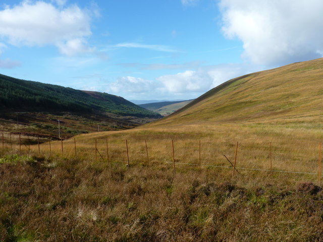
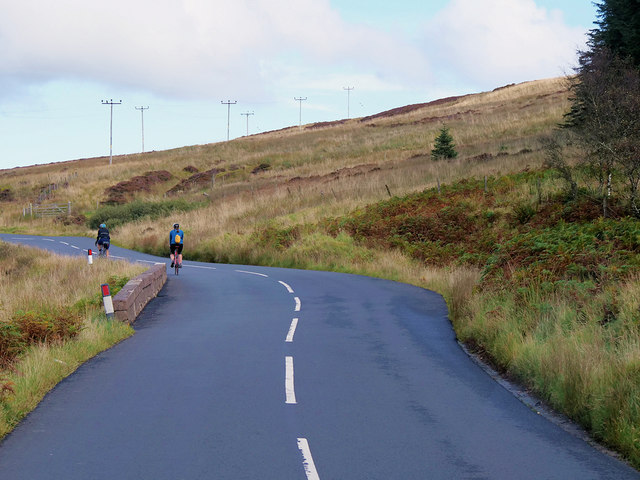
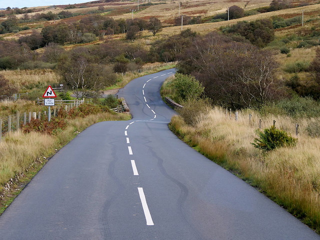
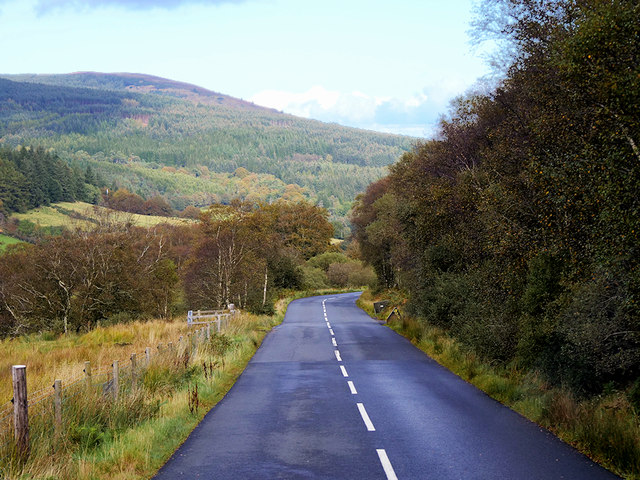
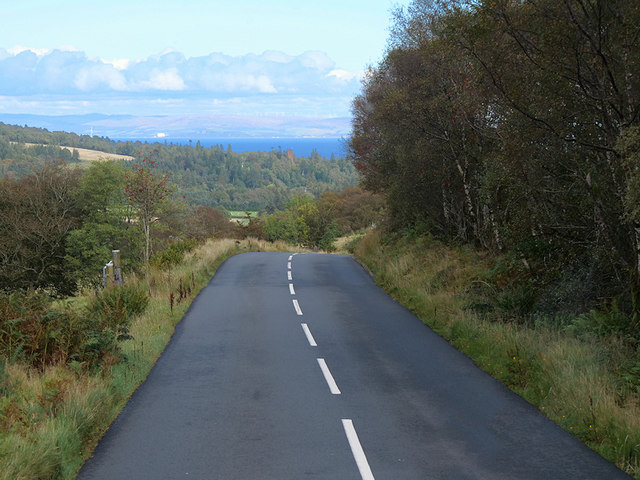
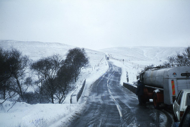
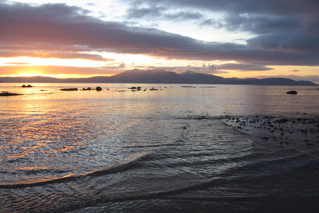
Glen Ormidale is a picturesque valley located in Buteshire, Scotland. It is surrounded by rolling hills and lush greenery, making it a popular destination for nature lovers and outdoor enthusiasts. The valley is home to a variety of wildlife, including red deer, otters, and various species of birds.

Glen Ormidale is known for its stunning views and tranquil atmosphere, making it a perfect place for relaxation and rejuvenation. The valley is also a great spot for hiking and exploring, with numerous trails and paths that wind through the beautiful countryside.

In addition to its natural beauty, Glen Ormidale is also home to a number of historic sites and landmarks, including ancient ruins and stone circles that date back centuries. Visitors to the valley can learn about the area's rich history and cultural heritage while taking in the breathtaking scenery.

Overall, Glen Ormidale is a hidden gem in Buteshire, offering a peaceful retreat from the hustle and bustle of everyday life. Whether you're looking for a quiet escape or an adventure in the great outdoors, this valley has something to offer for everyone.

If you have any feedback on the listing, please let us know in the comments section below.

Glen Ormidale Images

Images are sourced within 2km of 55.563344/-5.1893513 or Grid Reference NR9834. Thanks to Geograph Open Source API. All images are credited.

Gleann Dubh - Isle of Arran Gleann Dubh
Gleann Dubh - Isle of Arran
Gleann Dubh
Gleann Dubh - Isle of Arran Footpath in Gleann Dubh
Gleann Dubh - Isle of Arran
Footpath in Gleann Dubh
Gleann an t-Suidhe and the B880
String Road in the mist Looking towards Brodick.
String Road in the mist
Looking towards Brodick.
String Road with no mist Looking towards Brodick. Compare weather with <a href="https://www.geograph.org.uk/photo/5946635">NR9735 : String Road in the mist</a>.
String Road with no mist
Looking towards Brodick. Compare weather with NR9735 : String Road in the mist.
Old Milestone by the B880, The String, Kilmory Parish Arran by the B880, in parish of Kilmory (Arran District), 20m from small lay-by, standing in burn, top of stone at road level.

Inscription reads:-
3
(To Brodick Old Quay)

Surveyed

Milestone Society National ID: AYN_ARRS03
Old Milestone by the B880, The String, Kilmory Parish
Arran by the B880, in parish of Kilmory (Arran District), 20m from small lay-by, standing in burn, top of stone at road level. Inscription reads:- 3 (To Brodick Old Quay) Surveyed Milestone Society National ID: AYN_ARRS03
Old Milestone by the B880, Glen Shurig, Kilbride parish Arran by the B880, in parish of Kilbride (Arran District), by a little stone bridge over Allt Ailein, on grass verge, Southeast side of road.

Inscription reads:-
2
(To Brodick Old Quay)

Surveyed

Milestone Society National ID: AYN_ARRS02
Old Milestone by the B880, Glen Shurig, Kilbride parish
Arran by the B880, in parish of Kilbride (Arran District), by a little stone bridge over Allt Ailein, on grass verge, Southeast side of road. Inscription reads:- 2 (To Brodick Old Quay) Surveyed Milestone Society National ID: AYN_ARRS02
Heather by "The String" road The top of a car can just be seen centre image;  beyond lie the forested slopes of Cnoc Dubh.
Heather by "The String" road
The top of a car can just be seen centre image; beyond lie the forested slopes of Cnoc Dubh.
The String summit viewpoint A small one-car layby and a (very) small sign give notice of the short path to this lovely viewpoint.  To the right the sea over to the mainland, but ahead, Arran's stunning mountain-scape laid out in all its splendour.
The String summit viewpoint
A small one-car layby and a (very) small sign give notice of the short path to this lovely viewpoint. To the right the sea over to the mainland, but ahead, Arran's stunning mountain-scape laid out in all its splendour.
Cyclists crossing Gleann an t-Suidhe via the String Road The String Road (or The String) is the main cross-island route on Arran. The 10-mile road bisects Arran from the island capital of Brodick on the east coast to Blackwaterfoot on the west coast, rising to 233m (768 feet) as it climbs over Gleann an t-Suidhe. It is now designated as the B880.
Cyclists crossing Gleann an t-Suidhe via the String Road
The String Road (or The String) is the main cross-island route on Arran. The 10-mile road bisects Arran from the island capital of Brodick on the east coast to Blackwaterfoot on the west coast, rising to 233m (768 feet) as it climbs over Gleann an t-Suidhe. It is now designated as the B880.
An Tunna and the String Road, Isle of Arran The String Road (or The String) is the main cross-island route on Arran. The 10-mile road bisects Arran from the island capital of Brodick on the east coast to Blackwaterfoot on the west coast, rising to 233m (768 feet) as it climbs over Gleann an t-Suidhe. It is now designated as the B880.
An Tunna and the String Road, Isle of Arran
The String Road (or The String) is the main cross-island route on Arran. The 10-mile road bisects Arran from the island capital of Brodick on the east coast to Blackwaterfoot on the west coast, rising to 233m (768 feet) as it climbs over Gleann an t-Suidhe. It is now designated as the B880.
Firth of Clyde from the String Road A view looking eastwards, towards Brodick Bay, from close to the summit of the String Road. Beyond the Firth of Clyde is the North Ayrshire Coast.
Firth of Clyde from the String Road
A view looking eastwards, towards Brodick Bay, from close to the summit of the String Road. Beyond the Firth of Clyde is the North Ayrshire Coast.
Isle of Arran, The String Road The String Road (or The String) is the main cross-island route on Arran. The 10-mile road bisects Arran from the island capital of Brodick on the east coast to Blackwaterfoot on the west coast, rising to 233m (768 feet) as it climbs over Gleann an t-Suidhe. It is now designated as the B880.
Isle of Arran, The String Road
The String Road (or The String) is the main cross-island route on Arran. The 10-mile road bisects Arran from the island capital of Brodick on the east coast to Blackwaterfoot on the west coast, rising to 233m (768 feet) as it climbs over Gleann an t-Suidhe. It is now designated as the B880.
B880 String Road near Allt Mor The String Road (or The String) is the main cross-island route on Arran. The 10-mile road bisects Arran from the island capital of Brodick on the east coast to Blackwaterfoot on the west coast, rising to 233m (768 feet) as it climbs over Gleann an t-Suidhe. It is now designated as the B880.
B880 String Road near Allt Mor
The String Road (or The String) is the main cross-island route on Arran. The 10-mile road bisects Arran from the island capital of Brodick on the east coast to Blackwaterfoot on the west coast, rising to 233m (768 feet) as it climbs over Gleann an t-Suidhe. It is now designated as the B880.
Isle of Arran, The String Road near to Brodick, The String Road (or The String) is the main cross-island route on Arran. The 10-mile road bisects Arran from the island capital of Brodick on the east coast to Blackwaterfoot on the west coast, rising to 233m (768 feet) as it climbs over Gleann an t-Suidhe. It is now designated as the B880.
Isle of Arran, The String Road near to Brodick,
The String Road (or The String) is the main cross-island route on Arran. The 10-mile road bisects Arran from the island capital of Brodick on the east coast to Blackwaterfoot on the west coast, rising to 233m (768 feet) as it climbs over Gleann an t-Suidhe. It is now designated as the B880.
The String Road (B880) near Brodick The String Road (or The String) is the main cross-island route on Arran. The 10-mile road bisects Arran from the island capital of Brodick on the east coast to Blackwaterfoot on the west coast, rising to 233m (768 feet) as it climbs over Gleann an t-Suidhe. It is now designated as the B880.
The String Road (B880) near Brodick
The String Road (or The String) is the main cross-island route on Arran. The 10-mile road bisects Arran from the island capital of Brodick on the east coast to Blackwaterfoot on the west coast, rising to 233m (768 feet) as it climbs over Gleann an t-Suidhe. It is now designated as the B880.
Difficult road conditions on the B880 The String , west of Brodick From a week of shorts and tee shirts, this came as quite a shock on the last full day on Arran.
Difficult road conditions on the B880 The String , west of Brodick
From a week of shorts and tee shirts, this came as quite a shock on the last full day on Arran.
Near the summit of the B880, The String, Arran
Show me another place!

Glen Ormidale is located at Grid Ref: NR9834 (Lat: 55.563344, Lng: -5.1893513)

Unitary Authority: North Ayrshire

Police Authority: Ayrshire

What 3 Words

///thorax.supposing.overhear. Near Brodick, North Ayrshire

Nearby Locations

Glen Ormidale Sgiath Bhàn

Related Wikis

Brodick

Brodick ( BROD-ik, Scottish Gaelic: Tràigh a' Chaisteil ("Castle Beach") or Breadhaig) is the main village on the Isle of Arran, in the Firth of Clyde...

Home Farm, Brodick

Home Farm was the estate farm for Brodick Castle. It now houses a series of tourist enterprises including a cheese shop and Arran Aromatics. This was the...

Isle of Arran

The Isle of Arran (; Scottish Gaelic: Eilean Arainn) or simply Arran is an island off the west coast of Scotland. It is the largest island in the Firth...

Strathwhillan

Strathwhillan (Scottish Gaelic: Srath Chuilinn) is a tiny community on the Isle of Arran in the Firth of Clyde, Scotland. It is really a suburb of the...

Have you been to Glen Ormidale?

Leave your review of Glen Ormidale below (or comments, questions and feedback).