Lacasaidh

Settlement in Ross-shire

Scotland

Lacasaidh

Kinloch Parish Kirk Belonging to the Church of Scotland.
Kinloch Parish Kirk Credit: Anne Burgess

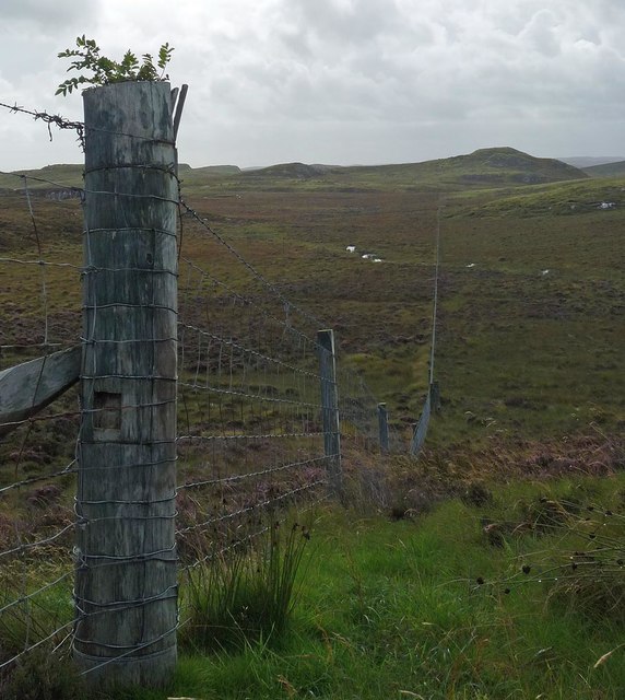
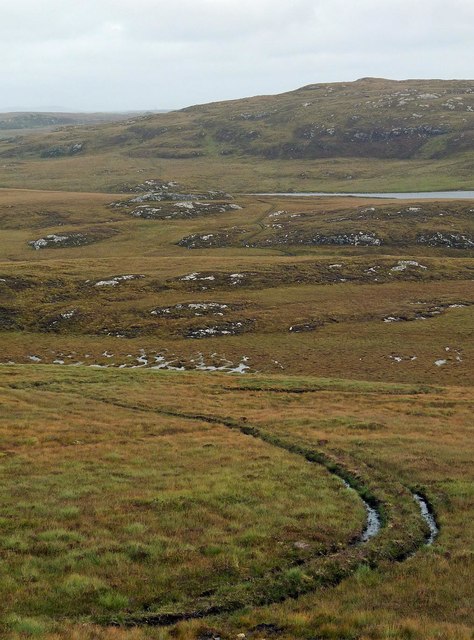
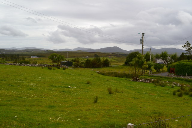
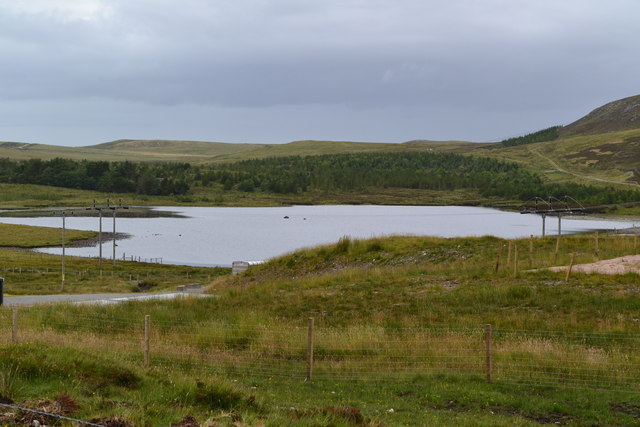
Lacasaidh is a small village located in the county of Ross-shire in the Highlands of Scotland. Situated approximately 15 miles northwest of Inverness, it is nestled amidst the picturesque scenery of the Scottish countryside. The village is surrounded by rolling hills, lush green meadows, and stunning lochs, providing residents and visitors with breathtaking views and ample opportunities for outdoor activities.

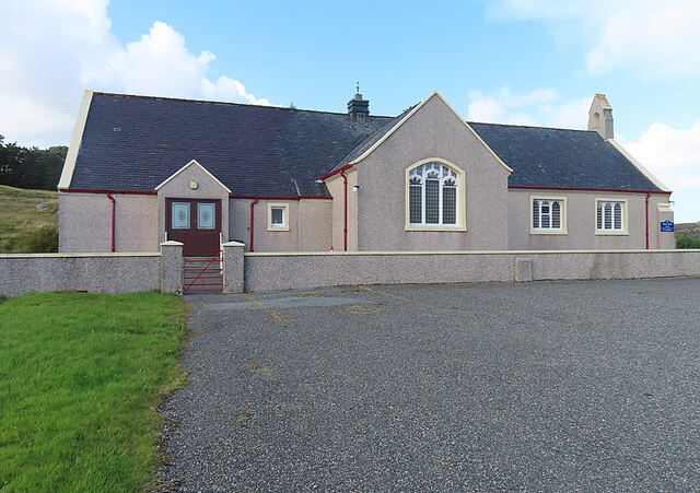
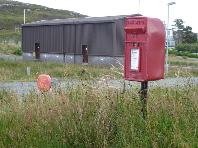
Despite its small size, Lacasaidh offers essential amenities to its residents. These include a local grocery store, a post office, and a primary school, ensuring that the basic needs of the community are met. The village also boasts a friendly and close-knit community, with residents taking pride in maintaining the village's charm and character.

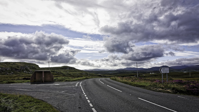
Lacasaidh is well-connected to the larger towns and cities in the region. There are regular bus services to Inverness, providing easy access to additional amenities, shopping centers, and employment opportunities. Inverness Airport is also within reach, offering domestic and international flights for those looking to travel further afield.

The village is popular among nature enthusiasts and outdoor adventurers. The surrounding countryside offers excellent opportunities for hiking, cycling, and fishing. Additionally, Lacasaidh benefits from its proximity to historical sites and landmarks, such as the impressive Beauly Priory and the ancient Clava Cairns.

Overall, Lacasaidh provides a serene and idyllic setting for those seeking a peaceful rural lifestyle, while still being within easy reach of essential services and recreational activities.

If you have any feedback on the listing, please let us know in the comments section below.
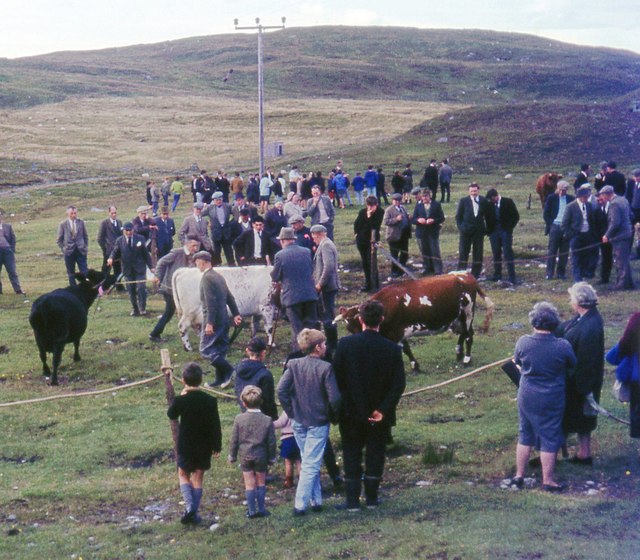
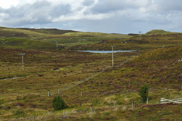
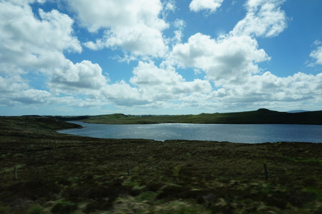
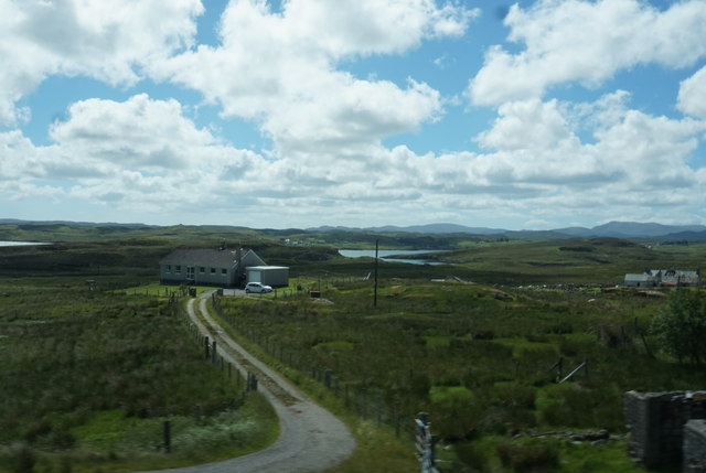
Lacasaidh Images

Images are sourced within 2km of 58.104216/-6.5356592 or Grid Reference NB3221. Thanks to Geograph Open Source API. All images are credited.
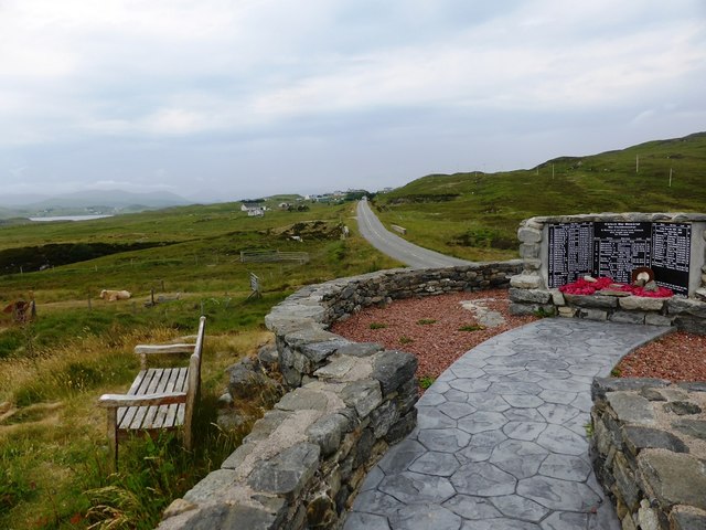
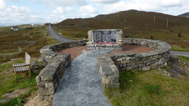
Kinloch Parish Kirk Belonging to the Church of Scotland.
Kinloch Parish Kirk
Belonging to the Church of Scotland.
Bus shelter and signpost at a junction on the A859
Kinloch War Memorial 'In memory of all those from Kinloch who fought and died for Freedom'
A list of 54 men and women, aged from 15 - 46, who were lost in the Boer War [2], WW1 [41] and ww2 [11], and the crofts they came from. 
The hill beyond is Nabhar.
Kinloch War Memorial
'In memory of all those from Kinloch who fought and died for Freedom' A list of 54 men and women, aged from 15 - 46, who were lost in the Boer War [2], WW1 [41] and ww2 [11], and the crofts they came from. The hill beyond is Nabhar.
Fence, Eastaper, Isle of Lewis The fence is seen decscending to cross an unnamed burn which runs between Loch Eastapair and Loch an Eilean Liath.
Fence, Eastaper, Isle of Lewis
The fence is seen decscending to cross an unnamed burn which runs between Loch Eastapair and Loch an Eilean Liath.
Moorland track, Beinn Ceadraiseal, Isle of Lewis Looking towards <a href="https://www.geograph.org.uk/photo/2002634">NB3324 : Dubh Loch Shobhail</a>.
Moorland track, Beinn Ceadraiseal, Isle of Lewis
Looking towards NB3324 : Dubh Loch Shobhail.
Balallan/Laxay Agricultural Show
Loch Nabhar
Loch Nabhar
Loch Bhaltois, taken from the A859
Laxay / Lacasaigh from the A859
Kinloch War Memorial, beside the A859
Kinloch War Memorial Further details are available on Canmore. <span class="nowrap"><a title="https://canmore.org.uk/site/318753/lewis-lacasaidh-kinloch-war-memorial" rel="nofollow ugc noopener" href="https://canmore.org.uk/site/318753/lewis-lacasaidh-kinloch-war-memorial">Link</a><img style="margin-left:2px;" alt="External link" title="External link - shift click to open in new window" src="https://s1.geograph.org.uk/img/external.png" width="10" height="10"/></span>
Kinloch War Memorial
Further details are available on Canmore. LinkExternal link
Abhainn Lacasaidh (Laxay River) The view of the river from the top of Cnoa a' Ghille Ruaidh Bhig. Its name means 'salmon river' and it drains Loch nam Faoileag 'loch of the gulls' into the sea-loch Loch Eireasort via Loch Bhaltois (not to be confused with the other Bhaltos on the west side of the island). The low green hill on the far bank is Druim nan Iadhlann, and the higher brown ridge is Beinn Ceadraiseal.
Abhainn Lacasaidh (Laxay River)
The view of the river from the top of Cnoa a' Ghille Ruaidh Bhig. Its name means 'salmon river' and it drains Loch nam Faoileag 'loch of the gulls' into the sea-loch Loch Eireasort via Loch Bhaltois (not to be confused with the other Bhaltos on the west side of the island). The low green hill on the far bank is Druim nan Iadhlann, and the higher brown ridge is Beinn Ceadraiseal.
Fishing hut on Loch Bhaltois In the foreground is the Abhainn Lacasaidh as it flows into the loch
Fishing hut on Loch Bhaltois
In the foreground is the Abhainn Lacasaidh as it flows into the loch
Lacasaidh Lacasaidh with Loch Èireasort behind
Lacasaidh
Lacasaidh with Loch Èireasort behind
View over lane near Lacasaidh
Loch Ulapuil
Loch Ulapuil
Laxay: postbox № HS2 50 This postbox stands at the end of the driveway to the village's post office, which opens for a few hours on Mondays and Tuesdays. The box is emptied at 11:30 on weekday and Saturday mornings.
Laxay: postbox № HS2 50
This postbox stands at the end of the driveway to the village's post office, which opens for a few hours on Mondays and Tuesdays. The box is emptied at 11:30 on weekday and Saturday mornings.
Church at Kinloch Near Lacasaidh on the A859.
Church at Kinloch
Near Lacasaidh on the A859.
Show me another place!

Lacasaidh is located at Grid Ref: NB3221 (Lat: 58.104216, Lng: -6.5356592)

Unitary Authority: Na h-Eileanan an Iar

Police Authority: Highlands and Islands

Also known as: Laxay

What 3 Words

///relaxed.quoted.twists. Near Leurbost, Na h-Eileanan Siar

Related Wikis

Loch Erisort

Loch Erisort (Scottish Gaelic: Èireasort) is an 8-mile-long narrow sea inlet on the east coast of the Isle of Lewis in the Outer Hebrides off the west...

Cabharstadh

Cabharstadh or Caversta (Scottish Gaelic: Cabharstaigh) is a village on the Isle of Lewis in the Outer Hebrides, Scotland. Caversta is situated in the...

Balallan

Balallan (Scottish Gaelic: Baile Ailein, Bail' Ailein), meaning "Allan's Town", is a crofting township on the Isle of Lewis, in the Outer Hebrides, Scotland...

Eilean Chaluim Chille

Eilean Chaluim Chille (Gaelic: island of Saint Columba, Calum Cille) is an unpopulated island in the Outer Hebrides. It lies off the east coast of Lewis...

Leurbost

Leurbost (Scottish Gaelic: Liùrbost) is a village on the east coast of the Isle of Lewis in the Outer Hebrides of Scotland. It is approximately 6 miles...

North Lochs

North Lochs, (Scottish Gaelic: Ceann a Tuath nan Loch), an area in eastern Lewis, Outer Hebrides, Scotland, is named for the many lochans (small lochs...

Crossbost

Crossbost is a village on the Isle of Lewis in the parish of North Lochs, in the Outer Hebrides, Scotland. It is located approximately ten miles away...

Cromore

Cromore (Scottish Gaelic: Crò Mòr) is a crofting township on the Isle of Lewis in the district of Pairc, in the Outer Hebrides, Scotland. The settlement...

Nearby Amenities

Located within 500m of 58.104216,-6.5356592
Telephone
Booth: KX100
Covered: booth
Mapillary: 1401804363634715
Source: survey
Survey Date: 2022-06-23
Lat/Long: 58.1063674/-6.5337447
Toilets
Source: survey
Lat/Long: 58.1064245/-6.5337339
Power: pole
Lat/Long: 58.1079617/-6.5397367
Power: pole
Lat/Long: 58.1080381/-6.5348451
Power: pole
Lat/Long: 58.1080596/-6.5335796
Turning Circle
Lat/Long: 58.101911/-6.5290272
Barrier: cattle_grid
Lat/Long: 58.1032196/-6.5388691
Barrier: cattle_grid
Lat/Long: 58.1051262/-6.5284866
Post Box
Collection Times: Mo-Fr 11:30; Sa 11:30
Operator: Royal Mail
Post Box Type: lamp
Ref: HS2 50
Royal Cypher: scottish_crown
Source: survey
Lat/Long: 58.1061126/-6.5295546
Power: pole
Lat/Long: 58.1080262/-6.5363549
Power: pole
Lat/Long: 58.1079905/-6.5378769
Power: pole
Lat/Long: 58.1060451/-6.5280657
Power: pole
Lat/Long: 58.1064404/-6.5293996
Power: pole
Lat/Long: 58.106769/-6.5304544
Power: pole
Lat/Long: 58.1070823/-6.531467
Power: pole
Lat/Long: 58.1078267/-6.5314395
Power: pole
Lat/Long: 58.1079325/-6.5328226
Power: pole
Lat/Long: 58.1077426/-6.5340756
Power: pole
Lat/Long: 58.1070467/-6.5346882
Power: pole
Lat/Long: 58.1068708/-6.5377627
Power: pole
Lat/Long: 58.1066266/-6.54141
Power: pole
Lat/Long: 58.1067487/-6.5395863
Power: pole
Lat/Long: 58.1069461/-6.5362236
Power: pole
Lat/Long: 58.1071442/-6.5331691
Power: pole
Lat/Long: 58.1072557/-6.5320233
Power: pole
Lat/Long: 58.1075518/-6.5353717
Power: pole
Lat/Long: 58.1076272/-6.5380636
Power: pole
Lat/Long: 58.1074425/-6.5392339
Power: pole
Lat/Long: 58.107273/-6.5403919
Power: pole
Lat/Long: 58.1070855/-6.5415594
Power: pole
Lat/Long: 58.1075938/-6.5366909
Lacasaigh
Name En: Laxay
Name Gd: Lacasaigh
Place: village
Lat/Long: 58.1057623/-6.532279
Barrier: cattle_grid
Lat/Long: 58.1057391/-6.54032
Barrier: cattle_grid
Lat/Long: 58.104758/-6.536085
Barrier: cattle_grid
Lat/Long: 58.1000838/-6.5340371
Turning Circle
Turning Circle: knuckle
Lat/Long: 58.1013927/-6.5320419
Turning Circle
Lat/Long: 58.1024171/-6.529505
Power: pole
Lat/Long: 58.1004784/-6.5402181
Power: pole
Lat/Long: 58.1009663/-6.5391944
Power: pole
Lat/Long: 58.1013264/-6.5384514
Power: pole
Lat/Long: 58.1017477/-6.5375368
Power: pole
Lat/Long: 58.102243/-6.5364974
Power: pole
Lat/Long: 58.1028432/-6.5351973
Power: pole
Lat/Long: 58.1027496/-6.5319778
Power: pole
Lat/Long: 58.1028575/-6.5321376
Power: pole
Lat/Long: 58.1031243/-6.5325865
Power: pole
Lat/Long: 58.1037009/-6.5335317
Power: pole
Lat/Long: 58.1041934/-6.5342959
Power: pole
Lat/Long: 58.1046317/-6.535063
Power: pole
Lat/Long: 58.1053182/-6.5361627
Power: pole
Lat/Long: 58.1029698/-6.5339673
Power: pole
Lat/Long: 58.1029226/-6.5361815
Power: pole
Lat/Long: 58.1029801/-6.537049
Power: pole
Lat/Long: 58.1030256/-6.5378231
Power: pole
Lat/Long: 58.1030834/-6.5387414
Power: pole
Lat/Long: 58.1003486/-6.5340031
Power: pole
Lat/Long: 58.1009258/-6.5343631
Power: pole
Lat/Long: 58.101357/-6.5346256
Power: pole
Lat/Long: 58.1013271/-6.5337146
Power: pole
Lat/Long: 58.1012917/-6.5324964
Power: pole
Lat/Long: 58.1012726/-6.5319669
Power: pole
Lat/Long: 58.1014839/-6.5312343
Power: pole
Lat/Long: 58.1016301/-6.5306799
Power: pole
Lat/Long: 58.1018968/-6.5297401
Power: pole
Lat/Long: 58.1018815/-6.5290889
Power: pole
Lat/Long: 58.1000242/-6.5383789
Power: pole
Lat/Long: 58.1003477/-6.5374727
Power: pole
Lat/Long: 58.1006525/-6.5366046
Power: pole
Lat/Long: 58.1010249/-6.5355768
Power: pole
Lat/Long: 58.1019711/-6.5347359
Power: pole
Lat/Long: 58.1014336/-6.5329018
Power: pole
Lat/Long: 58.1018874/-6.5327819
Power: pole
Lat/Long: 58.1024333/-6.5323257
Power: pole
Lat/Long: 58.1050897/-6.539541
Power: pole
Lat/Long: 58.1051456/-6.5386166
Power: pole
Lat/Long: 58.1052043/-6.5377045
Power: pole
Lat/Long: 58.1052532/-6.536957
Power: pole
Lat/Long: 58.1057374/-6.5355127
Power: pole
Lat/Long: 58.1060783/-6.534733
Power: pole
Lat/Long: 58.1063326/-6.5340943
Power: pole
Lat/Long: 58.1065612/-6.5335535
Power: pole
Lat/Long: 58.1068522/-6.5326728
Power: pole
Lat/Long: 58.1072846/-6.5316066
Power: pole
Lat/Long: 58.1057737/-6.529583
Power: pole
Lat/Long: 58.1055604/-6.5293764
Power: pole
Lat/Long: 58.1053025/-6.5291377
Power: pole
Lat/Long: 58.1048852/-6.5287117
Power: pole
Lat/Long: 58.1045052/-6.5283028
Power: pole
Lat/Long: 58.1039055/-6.5285035
Power: pole
Lat/Long: 58.1035621/-6.5282766
Barrier: cattle_grid
Lat/Long: 58.1028897/-6.5425328
Barrier: cattle_grid
Lat/Long: 58.1053506/-6.5362872
Hebridean Art Studio
Addr Housenumber: Seilebost Old School
Addr Street: A859
Phone: +44 7521 702455
Tourism: gallery
Website: https://www.hebrideanartstudio.co.uk
Lat/Long: 58.1064319/-6.5338364
Barrier: cattle_grid
Lat/Long: 58.1061231/-6.5296915
Barrier: cattle_grid
Lat/Long: 58.1057571/-6.5353241
Barrier: cattle_grid
Lat/Long: 58.1026343/-6.5334438
Barrier: cattle_grid
Lat/Long: 58.1065329/-6.5334231
Barrier: cattle_grid
Lat/Long: 58.1014366/-6.533275
Power: pole
Lat/Long: 58.1018664/-6.5408133
Power: pole
Lat/Long: 58.1022866/-6.5415523
Power: pole
Lat/Long: 58.1033221/-6.5302528
The data included in this document is from www.openstreetmap.org. The data is made available under ODbL.

Have you been to Lacasaidh?

Leave your review of Lacasaidh below (or comments, questions and feedback).