Attadale
Valley in Ross-shire
Scotland
Attadale

Attadale, located in the county of Ross-shire in the Scottish Highlands, is a picturesque valley nestled amidst stunning natural beauty. Situated approximately 5 miles east of the town of Lochcarron, Attadale enjoys an idyllic setting surrounded by rugged mountains and tranquil lochs.
The valley is renowned for its lush green landscapes, dotted with ancient woodlands and meandering rivers. The River Attadale, which runs through the valley, adds to the area's charm, offering breathtaking views and an ideal spot for fishing enthusiasts.
One of Attadale's notable features is the Attadale Gardens, a magnificent 20-acre garden that attracts visitors from far and wide. These gardens, established in the 19th century, showcase a wide variety of plants, including rhododendrons, azaleas, and camellias. Visitors can explore the garden's pathways, which lead to a beautiful water garden and a Japanese-style garden with a reflection pond.
Attadale is also home to a historic mansion house, which dates back to the 18th century. This grand house, surrounded by well-manicured lawns, offers a glimpse into the area's rich history and architecture.
For those seeking outdoor adventures, Attadale offers ample opportunities for hiking, cycling, and wildlife spotting. The surrounding mountains, including the famous Beinn Alligin and Beinn Eighe, are popular among climbers and hillwalkers. The area is also known for its diverse wildlife, with red deer, golden eagles, and otters frequently spotted in the vicinity.
Overall, Attadale is a hidden gem in Ross-shire, offering visitors a tranquil retreat amidst spectacular natural surroundings, historic landmarks, and a range of outdoor activities.
If you have any feedback on the listing, please let us know in the comments section below.
Attadale Images
Images are sourced within 2km of 57.389818/-5.447161 or Grid Reference NG9238. Thanks to Geograph Open Source API. All images are credited.


Attadale is located at Grid Ref: NG9238 (Lat: 57.389818, Lng: -5.447161)
Unitary Authority: Highland
Police Authority: Highlands and Islands
What 3 Words
///limelight.outdoors.wage. Near Lochcarron, Highland
Nearby Locations
Related Wikis

Attadale, Scotland
Attadale (Gaelic: Attadal ) is a settlement and estate in Wester Ross, in the Highland council area of Scotland. It is on the southern shore of Loch Carron...
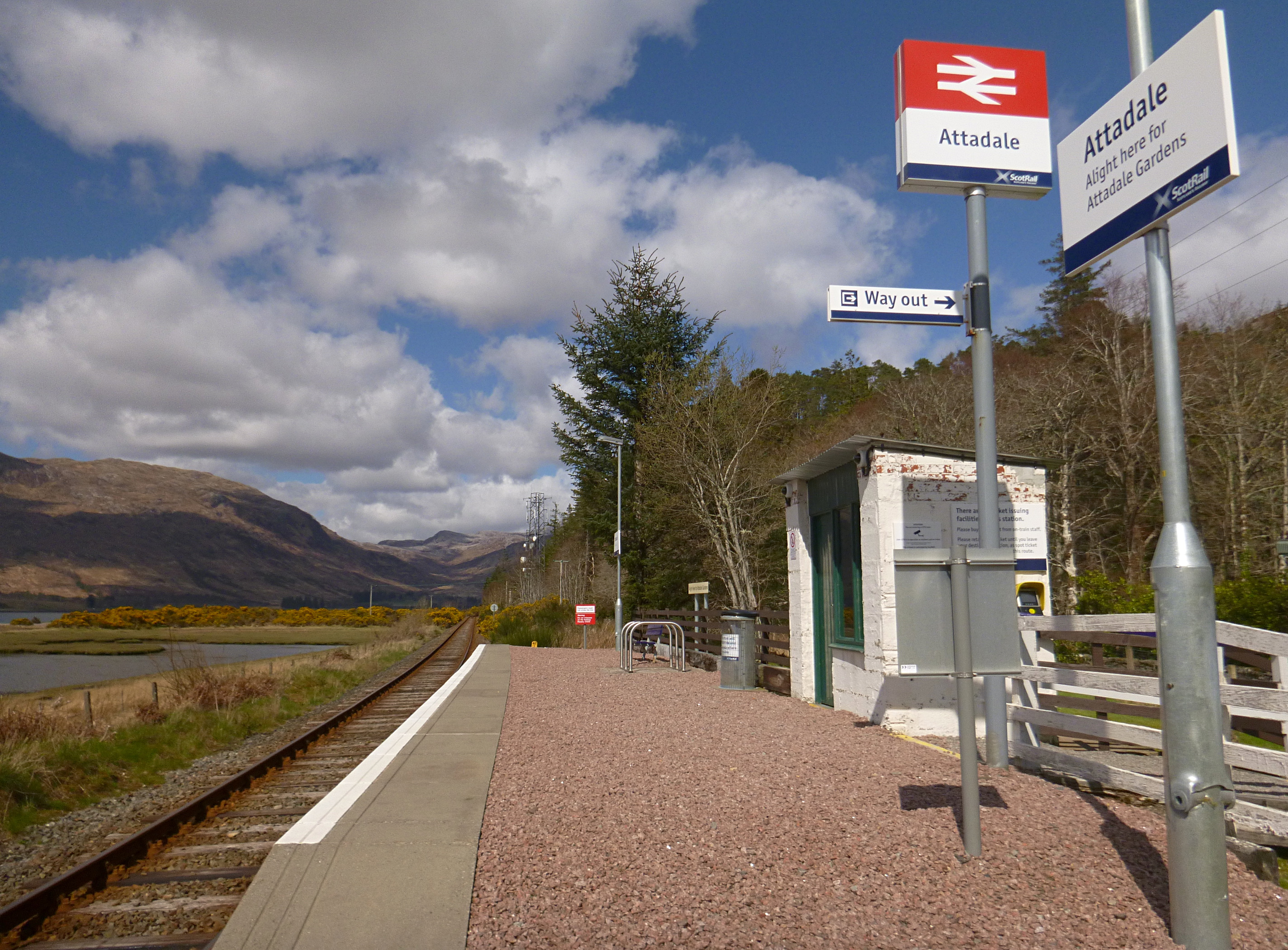
Attadale railway station
Attadale railway station is a remote railway station on the Kyle of Lochalsh Line, serving the village of Attadale on Loch Carron in the Highlands, northern...

Lochcarron
Lochcarron (Scottish Gaelic: Loch Carrann) is a village, community and civil parish in the Wester Ross area of Highland, Scotland. It has a population...

Strathcarron railway station
Strathcarron railway station is a remote railway station on the Kyle of Lochalsh Line, serving the small village of Strathcarron and the larger village...

Strathcarron, Highland
Strathcarron (Scottish Gaelic: Srath Carrann) is a hamlet, in the Highland council area of Scotland. == Geography == It is situated at the head of the...

River Carron, Wester Ross
River Carron (Scottish Gaelic: Carrann, pronounced [ˈkʰaᵲən̴̪]) is a west coast river in Wester Ross, in the Highlands of Scotland. The river rises in...
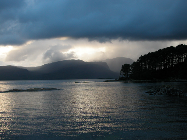
Loch Carron
Loch Carron (Scottish Gaelic: "Loch Carrann") is a sea loch on the west coast of Ross and Cromarty in the Scottish Highlands, which separates the Lochalsh...

An Sgùrr (Lochcarron)
An Sgùrr is a hill in Scotland, occupying the broad peninsula between Loch Carron and Loch Kishorn. It has the appearance of a rough knoll, with small...
Nearby Amenities
Located within 500m of 57.389818,-5.447161Have you been to Attadale?
Leave your review of Attadale below (or comments, questions and feedback).