Knowlton

Settlement in Kent Dover

England

Knowlton

Chillenden Windmill: aerial 2022
Chillenden Windmill: aerial 2022 Credit: Simon Tomson

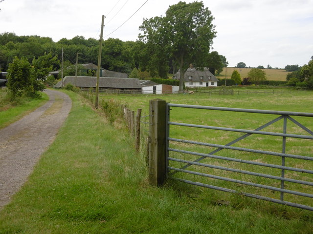
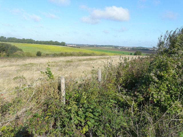
Knowlton is a small village located in the county of Kent, England. Situated in the southeastern part of the country, Knowlton is part of the Ashford district and falls within the civil parish of Woodchurch. The village is surrounded by picturesque countryside, characterized by rolling hills, lush fields, and charming rural landscapes.

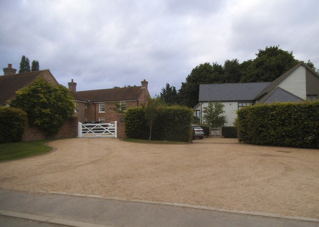
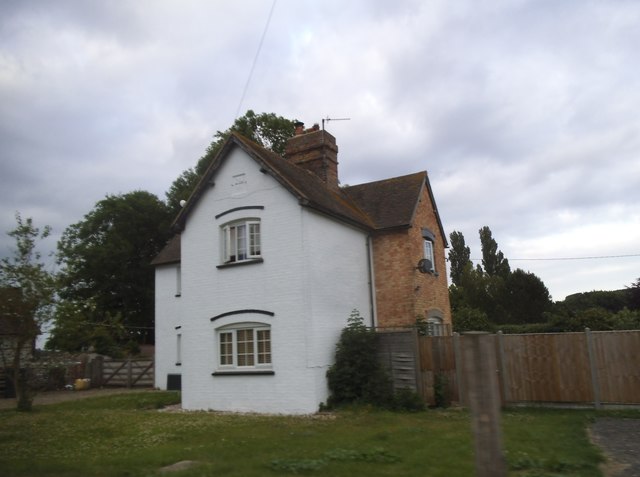
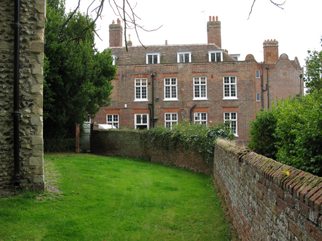
Knowlton is a quiet and peaceful village, offering residents and visitors a tranquil escape from the bustling city life. The village is known for its traditional English charm, with a collection of quaint cottages, historic buildings, and a welcoming community atmosphere.

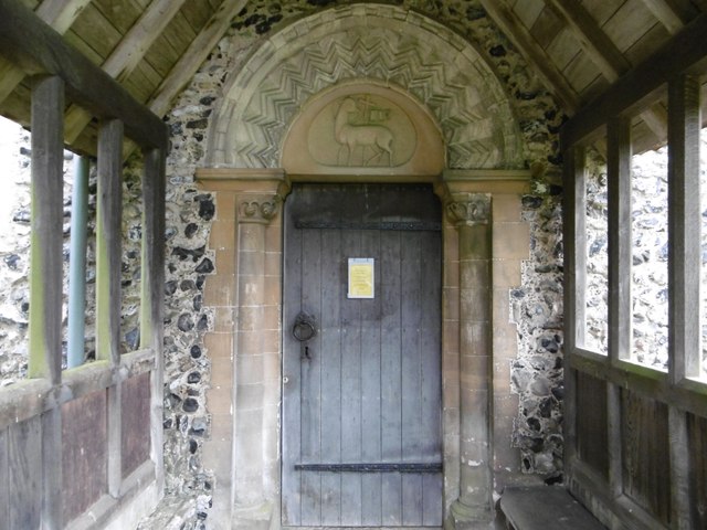
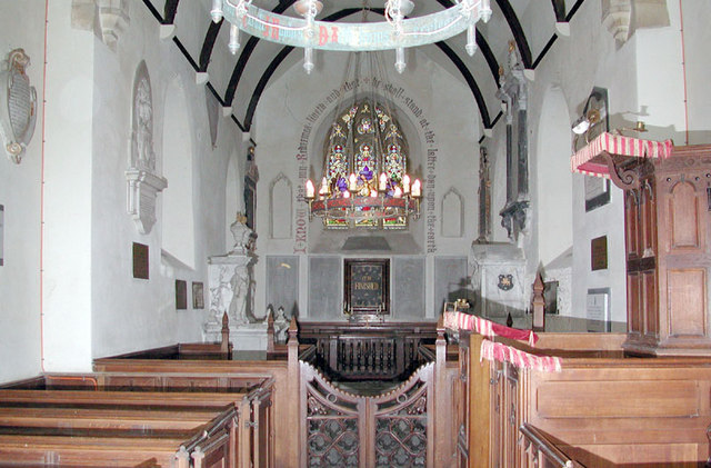
One of the notable landmarks in Knowlton is the St. Clement's Church, a beautiful medieval structure that dates back to the 13th century. The church boasts stunning architectural features, including a Norman doorway and a striking tower. Inside, visitors can admire various historical artifacts, such as ancient brasses and intricate stained glass windows.

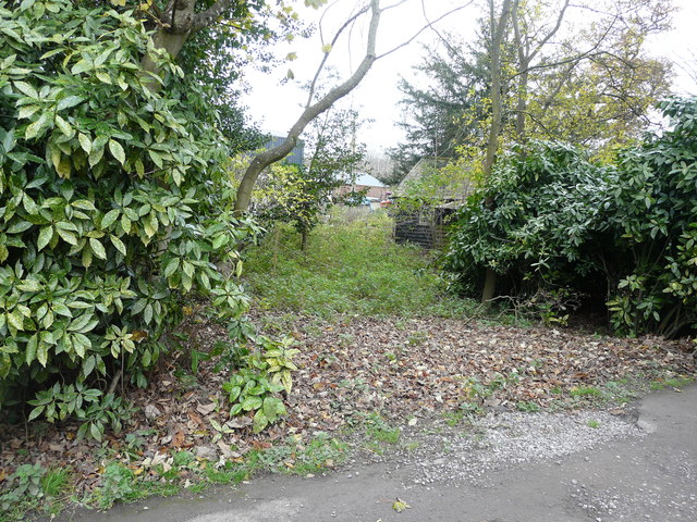
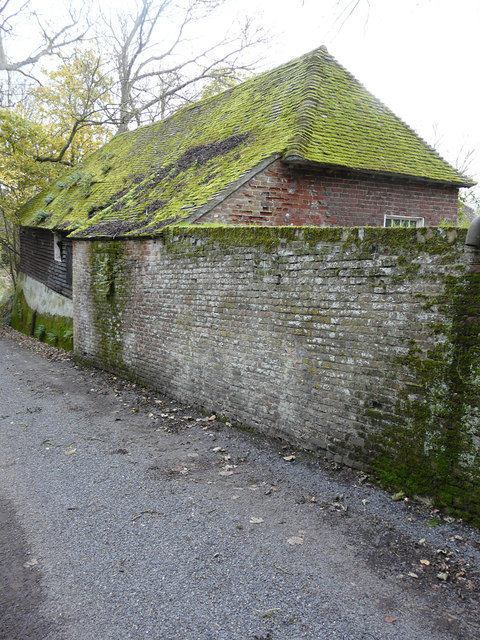
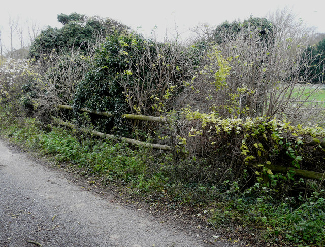
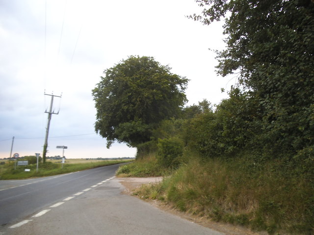
The surrounding area of Knowlton is also renowned for its natural beauty and is a popular destination for outdoor enthusiasts. There are numerous walking and cycling trails, allowing visitors to explore the idyllic countryside and enjoy panoramic views of the Kentish landscape.

Although small in size, Knowlton offers a range of amenities for its residents, including a local pub, a village hall, and a primary school. The village also benefits from its proximity to larger towns and cities, with Ashford and Canterbury just a short drive away, providing additional services, shopping centers, and cultural attractions.

If you have any feedback on the listing, please let us know in the comments section below.

Knowlton Images

Images are sourced within 2km of 51.234423/1.267571 or Grid Reference TR2853. Thanks to Geograph Open Source API. All images are credited.

Chillenden Windmill: aerial 2022
Chillenden Mill A post mill windmill built in 1858 at Chillenden.  The mill is Grade II* listed, see: <span class="nowrap"><a title="https://historicengland.org.uk/listing/the-list/list-entry/1111765?section=official-list-entry" rel="nofollow ugc noopener" href="https://historicengland.org.uk/listing/the-list/list-entry/1111765?section=official-list-entry">Link</a><img style="margin-left:2px;" alt="External link" title="External link - shift click to open in new window" src="https://s1.geograph.org.uk/img/external.png" width="10" height="10"/></span>
Chillenden Mill
A post mill windmill built in 1858 at Chillenden. The mill is Grade II* listed, see: LinkExternal link
Course of Black Lane The slight depression on the left is the course of Black Lane, an old sunken way between Canterbury and Deal. Here, the lane follows the ancient parish boundary between Eastry and Knowlton (now, Goodnestone). At the time of writing, the recorded public footpath west from Thornton Lane terminates just short of the photographer, at the turn in the parish boundary.
Course of Black Lane
The slight depression on the left is the course of Black Lane, an old sunken way between Canterbury and Deal. Here, the lane follows the ancient parish boundary between Eastry and Knowlton (now, Goodnestone). At the time of writing, the recorded public footpath west from Thornton Lane terminates just short of the photographer, at the turn in the parish boundary.
Course of Black Lane The disturbed ground stretching away to the east is the course of Black Lane, an old slightly sunken way between Canterbury and Deal. Here, the lane heads across the field to pick up the parish boundary between Eastry and Knowlton (now, Goodnestone) where it performs a dog-leg on its north-south alignment.  The depression in the field here was filled in some years ago. This part of Black Lane was enclosed until the late nineteenth century.
Course of Black Lane
The disturbed ground stretching away to the east is the course of Black Lane, an old slightly sunken way between Canterbury and Deal. Here, the lane heads across the field to pick up the parish boundary between Eastry and Knowlton (now, Goodnestone) where it performs a dog-leg on its north-south alignment. The depression in the field here was filled in some years ago. This part of Black Lane was enclosed until the late nineteenth century.
Road junction near Rowling
Free-range pigs A bridleway runs in a northeasterly direction to their right, to pass to the right of the pig-arks in the distance.
Free-range pigs
A bridleway runs in a northeasterly direction to their right, to pass to the right of the pig-arks in the distance.
Possibly abandoned access Compared with <a href="https://www.geograph.org.uk/photo/4373162">TR2853 : Creation of an access</a>, it appears that the work got no further, after a hole was made through the bushes.
Possibly abandoned access
Compared with TR2853 : Creation of an access, it appears that the work got no further, after a hole was made through the bushes.
Mossy barn roof, Heronden Farm Ferns are also growing on the roof, at the far end.
Mossy barn roof, Heronden Farm
Ferns are also growing on the roof, at the far end.
Ivy-covered building, Heronden Road Nick Smith’s <a href="https://www.geograph.org.uk/photo/304028">TR2954 : Derelict house in Heronden</a> shows the building as it was almost nine years ago, when one could see a lot more of its structure.
Ivy-covered building, Heronden Road
Nick Smith’s TR2954 : Derelict house in Heronden shows the building as it was almost nine years ago, when one could see a lot more of its structure.
Looking along Cherrygarden Lane towards Gooseberryhall Farm Gooseberryhall Farm belongs to the Bruderhof Community who are based at nearby Beech Grove at Nonington - see <span class="nowrap"><a title="http://www.bruderhof.com/en/where-we-are/united-kingdom/beech-grove" rel="nofollow ugc noopener" href="http://www.bruderhof.com/en/where-we-are/united-kingdom/beech-grove">Link</a><img style="margin-left:2px;" alt="External link" title="External link - shift click to open in new window" src="https://s1.geograph.org.uk/img/external.png" width="10" height="10"/></span>
Looking along Cherrygarden Lane towards Gooseberryhall Farm
Gooseberryhall Farm belongs to the Bruderhof Community who are based at nearby Beech Grove at Nonington - see LinkExternal link
Path across the grounds of Beech Grove Beech Grove at Nonington is the base of the Bruderhof Community - see <span class="nowrap"><a title="http://www.bruderhof.com/en/where-we-are/united-kingdom/beech-grove" rel="nofollow ugc noopener" href="http://www.bruderhof.com/en/where-we-are/united-kingdom/beech-grove">Link</a><img style="margin-left:2px;" alt="External link" title="External link - shift click to open in new window" src="https://s1.geograph.org.uk/img/external.png" width="10" height="10"/></span>  This is the view from Cherrygarden Lane.
Path across the grounds of Beech Grove
Beech Grove at Nonington is the base of the Bruderhof Community - see LinkExternal link This is the view from Cherrygarden Lane.
The Norman doorway at All Saints, Chillenden The church of All Saints is no bigger than it was in Norman times. It has Norman north and south doorways - this is the north doorway.
The Norman doorway at All Saints, Chillenden
The church of All Saints is no bigger than it was in Norman times. It has Norman north and south doorways - this is the north doorway.
Looking northwest from Thornton Lane The hedge, on the other side of the meadow, follows the route of the former East Kent Light Railway. To the right of the hedge at the top of the next field, the pale patch marks the redevelopment of Hammill brickworks in <a href="https://www.geograph.org.uk/gridref/TR2955">TR2955</a> and beyond that the tower and spire of Wingham church is visible in <a href="https://www.geograph.org.uk/gridref/TR2457">TR2457</a>. Just over six years ago, I took a view from this location <a href="https://www.geograph.org.uk/photo/1514584">TR2954 : Looking southwest from Thornton Lane</a>.
Looking northwest from Thornton Lane
The hedge, on the other side of the meadow, follows the route of the former East Kent Light Railway. To the right of the hedge at the top of the next field, the pale patch marks the redevelopment of Hammill brickworks in TR2955 and beyond that the tower and spire of Wingham church is visible in TR2457. Just over six years ago, I took a view from this location TR2954 : Looking southwest from Thornton Lane.
Chillenden Windmill For more information see <a title="https://www.geograph.org.uk/photo/4458381" href="https://www.geograph.org.uk/photo/4458381">Link</a>
Chillenden Windmill
For more information see Link
Track to Chillenden Windmill
Cuckolds Corner, Chillenden
Houses in Chillenden
House in Chillenden
House in Chillenden
Show me another place!

Knowlton is located at Grid Ref: TR2853 (Lat: 51.234423, Lng: 1.267571)

Administrative County: Kent

District: Dover

Police Authority: Kent

What 3 Words

///highways.tissue.urban. Near Eastry, Kent

Related Wikis

St Clement's Church, Knowlton

St Clement's Church is a redundant Anglican church in the village of Knowlton, Kent, England. It is recorded in the National Heritage List for England...

John Narborough

Admiral Sir John Narborough (or Narbrough, c. 1640–1688) was an English naval commander. He served with distinction in the Anglo-Dutch Wars and against...

Knowlton Court

Knowlton Court is a Grade I listed manor house near Goodnestone, Kent, England that dates back to the Elizabethan period. The present front façade in the...

Knowlton, Kent

Knowlton was an eccesiastical and civil parish; the former was abolished in 1940 [1], the latter on 1 April 1935 [2], and the village is now part of Goodnestone...

Chillenden

Chillenden is a village and former civil parish, now in the parish of Goodnestone, in the Dover district, in east Kent, England. It is between Canterbury...

Knowlton railway station

Knowlton was a halt on the East Kent Light Railway. It opened on 16 October 1916 as Tilmanstone Village but was renamed the following year. It closed to...
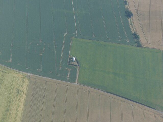
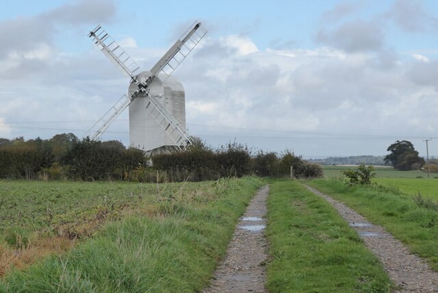
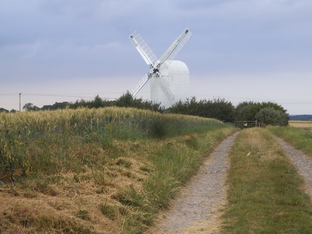
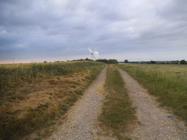
Chillenden Windmill

Chillenden windmill is a grade II* listed open-trestle post mill north of Chillenden, Kent, England. It is the last post mill built in Kent. == History... ==

Eastry South railway station

Eastry South railway station was a railway station on the East Kent Light Railway. It opened on 13 April 1925 and closed to passenger traffic after the...

Nearby Amenities

Located within 500m of 51.234423,1.267571
Knowlton
Is In: Kent, England, UK
Is In County: Kent
Is In District: Dover
Place: hamlet
Source: survey
Lat/Long: 51.2335573/1.2667541
Post Box
Brand: Royal Mail
Brand Wikidata: Q638098
Collection Times: Mo-Fr 09:00; Sa 07:00
Operator: Royal Mail
Operator Wikidata: Q638098
Post Box Mounting: wall
Post Box Type: wall
Ref: CT3 131
Royal Cypher: VR
Royal Cypher Wikidata: Q33102356
Source: survey
Lat/Long: 51.2340615/1.2667757
Power: pole
Lat/Long: 51.2341571/1.2668878
Power: pole
Lat/Long: 51.2348919/1.266928
Power: pole
Lat/Long: 51.2358332/1.2646669
Power: pole
Lat/Long: 51.2354402/1.2660214
Power: pole
Lat/Long: 51.2362127/1.2633311
Power: pole
Lat/Long: 51.2365956/1.2619874
The data included in this document is from www.openstreetmap.org. The data is made available under ODbL.

Have you been to Knowlton?

Leave your review of Knowlton below (or comments, questions and feedback).