Glen Orinsay

Valley in Ross-shire

Scotland

Glen Orinsay

Looking towards Loch Mor Stiomrabhaigh
Looking towards Loch Mor Stiomrabhaigh Credit: Mike Dunn

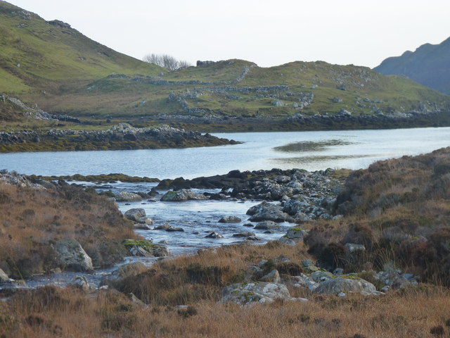
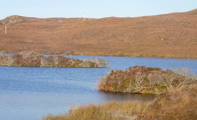
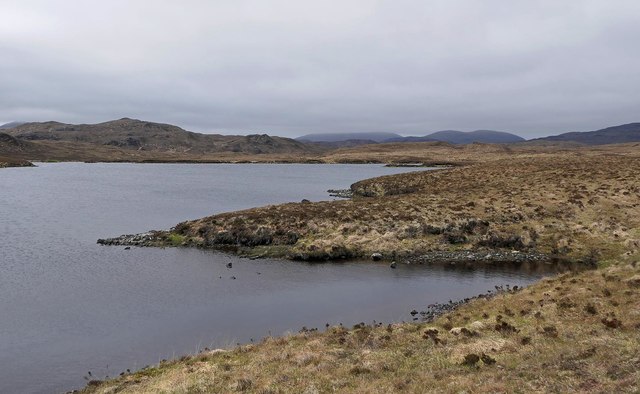
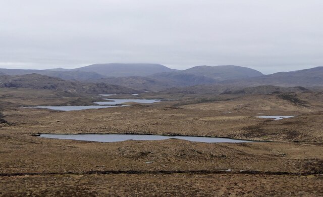
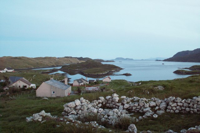
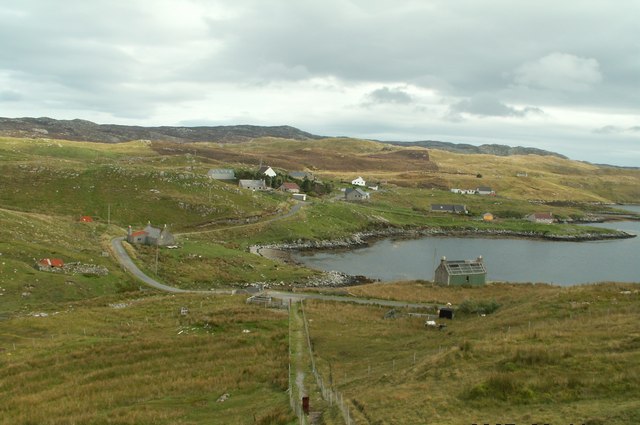
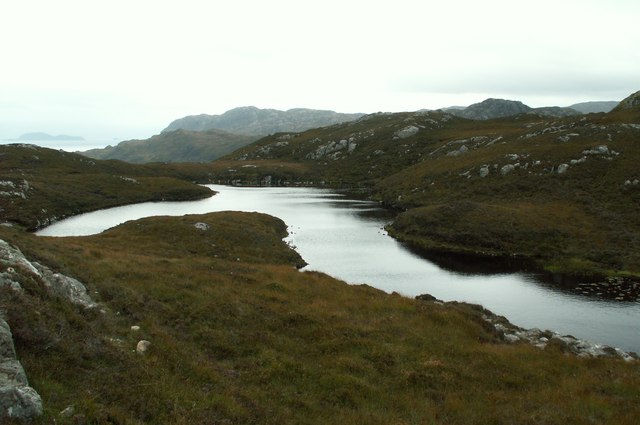
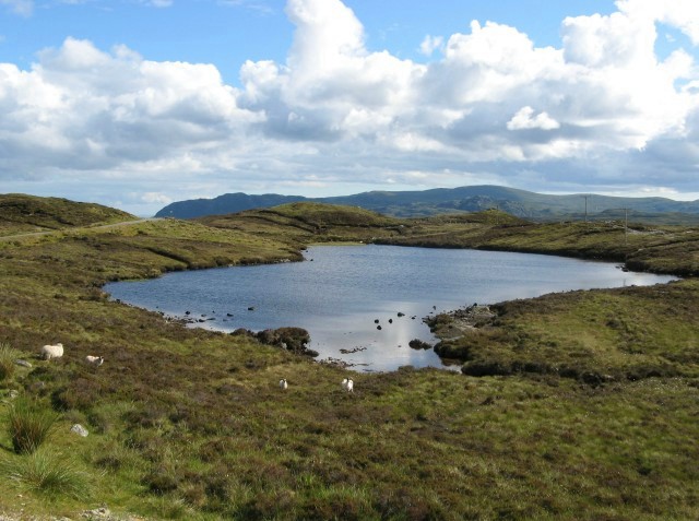
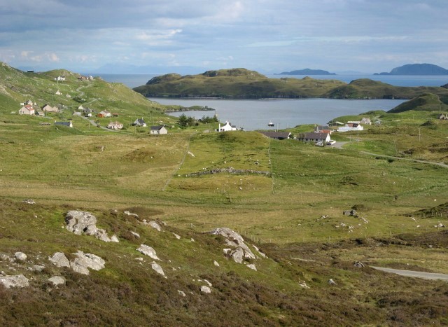
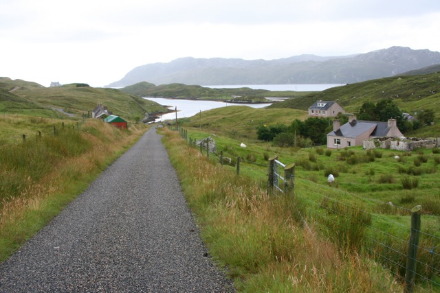
Glen Orinsay is a picturesque valley located in the county of Ross-shire, in the Scottish Highlands. Situated in the northern part of the country, the valley is known for its stunning natural beauty and rugged landscapes.

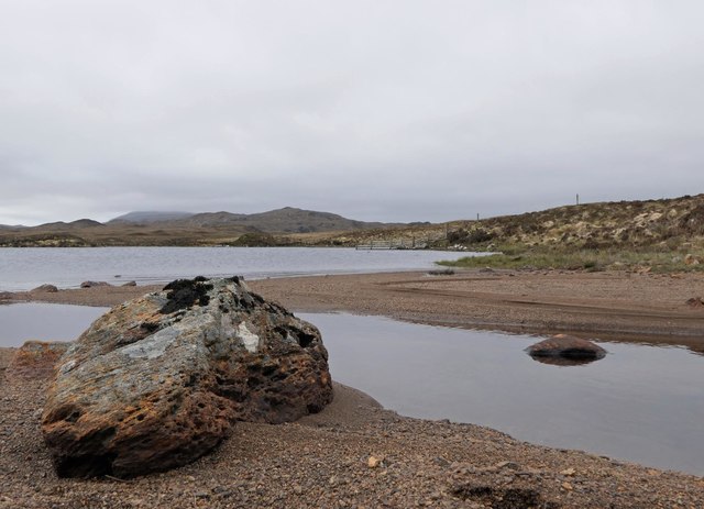
The valley is surrounded by towering mountains, including the famous Ben Wyvis, which provides a stunning backdrop to the area. The River Orrin runs through the glen, adding to its charm and providing a serene and peaceful atmosphere.

The region is rich in wildlife, and visitors to Glen Orinsay have the opportunity to spot a variety of species in their natural habitat. Red deer, golden eagles, and red squirrels are just a few of the creatures that can be seen in the area.

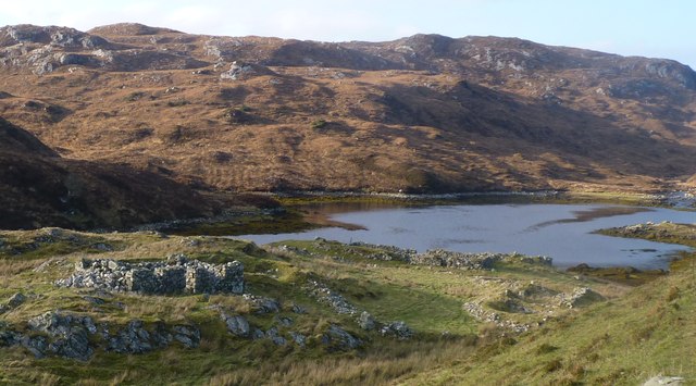
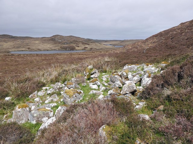
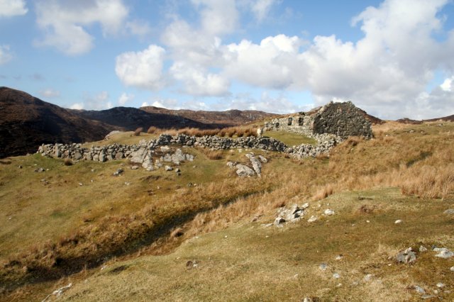
Glen Orinsay is also home to several archaeological sites, including stone circles and burial mounds, which offer a glimpse into the area's ancient history. These sites are of great interest to historians and archaeologists, and provide valuable insight into the lives of the people who once inhabited the valley.

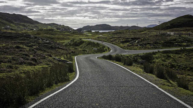
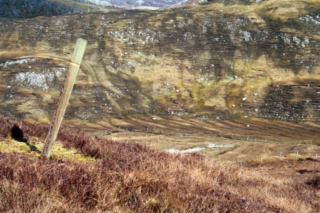
Outdoor enthusiasts will find plenty to do in Glen Orinsay, with opportunities for hiking, mountain biking, and fishing. The valley's rugged terrain and scenic trails make it a popular destination for those seeking adventure and a chance to immerse themselves in nature.

Overall, Glen Orinsay is a beautiful and diverse valley in the Scottish Highlands, offering visitors a chance to explore its natural wonders, learn about its rich history, and experience the tranquility of the countryside.

If you have any feedback on the listing, please let us know in the comments section below.

Glen Orinsay Images

Images are sourced within 2km of 58.021219/-6.4742435 or Grid Reference NB3512. Thanks to Geograph Open Source API. All images are credited.

Looking towards Loch Mor Stiomrabhaigh
The abandoned township of Stiomrabhaigh
Islands on Loch Shaghachain
The township of Stiomrabhaigh looking North West
B8060 nearing Leumrabhagh
Loch Shanndabhat, Isle of Lewis The OS Name Book of 1848-1852 describes Loch Shanndabhat as, "a large fresh water loch into which flows Allt Feithe Luachraich.  It is deep and very narrow about its centre".
Loch Shanndabhat, Isle of Lewis
The OS Name Book of 1848-1852 describes Loch Shanndabhat as, "a large fresh water loch into which flows Allt Feithe Luachraich. It is deep and very narrow about its centre".
Inflow to Loch Shanndabhat, Isle of Lewis This unnamed burn rises below Sidhean Shanndabhat and flows for approximately 500m before discharging into the loch.
Inflow to Loch Shanndabhat, Isle of Lewis
This unnamed burn rises below Sidhean Shanndabhat and flows for approximately 500m before discharging into the loch.
Shieling hut below Sidhean Shanndabhat, Isle of Lewis This is one in a row of about ten huts.
Shieling hut below Sidhean Shanndabhat, Isle of Lewis
This is one in a row of about ten huts.
Loch na Cuilee, Isle of Lewis Approximately half of the loch lies within the grid square.  Its name means Bulrush Loch.
Loch na Cuilee, Isle of Lewis
Approximately half of the loch lies within the grid square. Its name means Bulrush Loch.
Dyke below Sidhean Loch na Cuilee, Isle of Lewis The dyke appears on the 2nd edition OS six inch map, surveyed in 1895, but not on the 1st edition, surveyed 1850-1853, and so, presumably, was originally built between some time between 1850 and 1895.
Dyke below Sidhean Loch na Cuilee, Isle of Lewis
The dyke appears on the 2nd edition OS six inch map, surveyed in 1895, but not on the 1st edition, surveyed 1850-1853, and so, presumably, was originally built between some time between 1850 and 1895.
Orasaigh with view of Shiant Islands
Orasaigh from top of footpath steps
Loch near Giearol
Loch near Giearol
Roadside lochan Loch a' Bhùiridh, near the road leading to Leumrabhagh.
Roadside lochan
Loch a' Bhùiridh, near the road leading to Leumrabhagh.
Near Leumrabhagh Looking towards the village of Leumrabhagh from a vantage point to the north of the village.
Near Leumrabhagh
Looking towards the village of Leumrabhagh from a vantage point to the north of the village.
Ruined blackhouse at Stiomrabhaig The census of 1851 shows that the village consisted of 16 dwellings and supported a population of 81. By 1858 there were none. Clearances had been well underway in the area during the first half of the 19th century; many of them brutal and uncaring. The residents of Stiomrabhaigh were better placed of than most, having leases directly with the land owner. But when these expired, they accepted an offer of crofts in Leumrabhagh. Lewis was relatively prosperous right up until World War I, which put an end to the herring trade with Russia and Eastern Europe and in spite of the clearances, the increasing population put pressure on land. There were numerous requests to resettle Stiomrabhaigh, all of which were resisted by the landowners and it was not until 1921 when Lord Leverhulme abandoned his ambitious plan for Lewis that crofters returned to the township. Even the resettlement was marked with tragedy as two young men were drowned while transporting household goods from Calbost. These settlers were never officially recognized as crofters by the government;  they received no help and no road was built to the township. Given the difficulties of living without facilities, over the next twenty years, a number of the families drifted back to Leumrabhagh. At the start of World War II only two families remained and by the end of the 1940’s, Stiomrabhaigh was once again deserted. Today there is much of the township to be seen; its ruined buildings, lazybeds and field walls standing in splendid isolation between the moor and the sea.
Ruined blackhouse at Stiomrabhaig
The census of 1851 shows that the village consisted of 16 dwellings and supported a population of 81. By 1858 there were none. Clearances had been well underway in the area during the first half of the 19th century; many of them brutal and uncaring. The residents of Stiomrabhaigh were better placed of than most, having leases directly with the land owner. But when these expired, they accepted an offer of crofts in Leumrabhagh. Lewis was relatively prosperous right up until World War I, which put an end to the herring trade with Russia and Eastern Europe and in spite of the clearances, the increasing population put pressure on land. There were numerous requests to resettle Stiomrabhaigh, all of which were resisted by the landowners and it was not until 1921 when Lord Leverhulme abandoned his ambitious plan for Lewis that crofters returned to the township. Even the resettlement was marked with tragedy as two young men were drowned while transporting household goods from Calbost. These settlers were never officially recognized as crofters by the government; they received no help and no road was built to the township. Given the difficulties of living without facilities, over the next twenty years, a number of the families drifted back to Leumrabhagh. At the start of World War II only two families remained and by the end of the 1940’s, Stiomrabhaigh was once again deserted. Today there is much of the township to be seen; its ruined buildings, lazybeds and field walls standing in splendid isolation between the moor and the sea.
Glen Orinsay A marker post on the footpath to the deserted village of Stiomrabhaigh in front of the greens and browns of Glen Orinsay.
Glen Orinsay
A marker post on the footpath to the deserted village of Stiomrabhaigh in front of the greens and browns of Glen Orinsay.
The road to Orasaigh Looking towards Orinsay Island
The road to Orasaigh
Looking towards Orinsay Island
Show me another place!

Glen Orinsay is located at Grid Ref: NB3512 (Lat: 58.021219, Lng: -6.4742435)

Unitary Authority: Na h-Eileanan an Iar

Police Authority: Highlands and Islands

What 3 Words

///lighter.reap.hourglass. Near Leurbost, Na h-Eileanan Siar

Related Wikis

Orinsay

Orinsay (Scottish Gaelic: Orasaigh) is a crofting village on the Isle of Lewis in the district of Pairc, in the Outer Hebrides, Scotland. The settlement...

Stiomrabhaig

Stiomrabhaig is an abandoned crofter's village on the Isle of Lewis in the Outer Hebrides. == History == The United Kingdom Census 1851 shows that the...

Eilean Liubhaird

Eilean Liubhaird or Eilean Iubhard is an island in the Outer Hebrides, to the east of Lewis. == Geography and geology == The rock is "gneiss bedrock with...

Gravir

Gravir (Scottish Gaelic: Grabhair), is a village on the shore of Loch Odhairn (a sea loch) in the Park district of the Isle of Lewis. Gravir is within...

Nearby Amenities

Located within 500m of 58.021219,-6.4742435
Passing Place
Lat/Long: 58.0175608/-6.4694655
Barrier: cattle_grid
Lat/Long: 58.0186023/-6.4694247
Power: pole
Lat/Long: 58.0182746/-6.4691065
Power: pole
Lat/Long: 58.0188582/-6.4690407
Power: pole
Lat/Long: 58.0191592/-6.4682391
Power: pole
Lat/Long: 58.0190125/-6.4674605
Power: pole
Lat/Long: 58.0189349/-6.467035
Power: pole
Lat/Long: 58.0177611/-6.4691457
The data included in this document is from www.openstreetmap.org. The data is made available under ODbL.

Have you been to Glen Orinsay?

Leave your review of Glen Orinsay below (or comments, questions and feedback).