Gleann Haladail
Valley in Inverness-shire
Scotland
Gleann Haladail

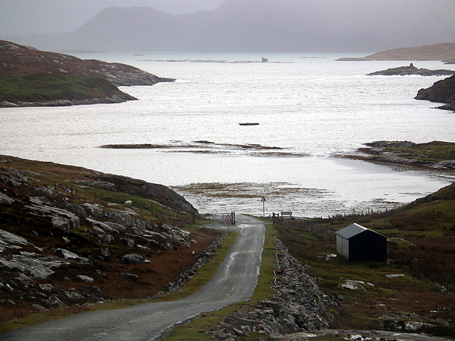
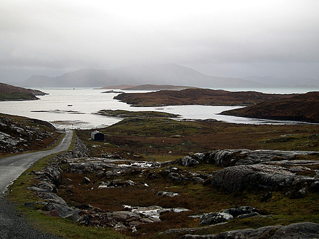
Gleann Haladail is a stunning valley located in the remote region of Inverness-shire, in the Scottish Highlands. Nestled between towering mountains and surrounded by pristine wilderness, this valley is a true haven for nature enthusiasts and outdoor adventurers.
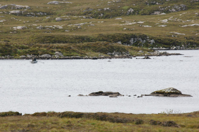
Stretching for approximately 10 miles, Gleann Haladail offers breathtaking panoramic views of rugged landscapes, lush green forests, and crystal-clear streams. The valley is characterized by its dramatic scenery, with steep slopes covered in heather and scattered with rocky outcrops. It is home to a diverse range of flora and fauna, including rare species of birds, mammals, and plants.
The valley's remote location and unspoiled environment make it an ideal destination for hiking, mountain biking, and wildlife spotting. There are numerous trails and paths that wind through the valley, offering a variety of difficulty levels to cater to different skill levels. One of the most popular routes is the Gleann Haladail Circuit, which takes adventurers on a circular journey through the valley, showcasing its most picturesque spots.
Gleann Haladail also holds historical significance, with traces of ancient settlements and burial sites dating back to the Bronze Age. Archaeological enthusiasts can explore these remnants and gain insight into the valley's rich cultural heritage.
Visitors to Gleann Haladail can enjoy the tranquility and serenity of the surroundings, as well as the opportunity to disconnect from the modern world and immerse themselves in the raw beauty of the Scottish Highlands.
If you have any feedback on the listing, please let us know in the comments section below.
Gleann Haladail Images
Images are sourced within 2km of 57.97999/-7.0235949 or Grid Reference NB0310. Thanks to Geograph Open Source API. All images are credited.


![Leosaval [Leosabhal] First subMarilyn of 3 today with Alan Holmes, George Morl, Iain Brown, Martin Richardson, Jim Bloomer and Michael Earnshaw in mixed weather. A lovely viewpoint for Taransay.
Name: Leosaval [Leosabhal]
Hill number: 1598
Height: 412m / 1352ft
Area: 24B: Harris and Nearby Islands
Class: Hu,4,sMa
Grid ref: NB038098 (est)
Drop: 143m
Col: 269m NB034107](https://s1.geograph.org.uk/geophotos/03/69/51/3695153_86f4216f.jpg)
![Leosaval [Leosabhal] Boulder And Rainbow Name: Leosaval [Leosabhal]
Hill number: 1598
Height: 412m / 1352ft
Area: 24B: Harris and Nearby Islands
Class: Hu,4,sMa
Grid ref: NB038098 (est)
Drop: 143m
Col: 269m NB034107](https://s0.geograph.org.uk/geophotos/03/69/51/3695164_94071cad.jpg)
Gleann Haladail is located at Grid Ref: NB0310 (Lat: 57.97999, Lng: -7.0235949)
Unitary Authority: Na h-Eileanan an Iar
Police Authority: Highlands and Islands
What 3 Words
///workflow.portfolio.operating. Near Tarbert, Na h-Eileanan Siar
Nearby Locations
Related Wikis

Amhuinnsuidhe
Amhuinnsuidhe (Scottish Gaelic: Abhainn Suidhe) is a settlement on Harris, in the Outer Hebrides, Scotland. The settlement is also within the parish of...

Tiorga Mor
Tiorga Mor (679 m) is a mountain in Harris, in the Outer Hebrides of Scotland. The most westerly peak of the high mountains of Harris, it is a very rugged...

Amhuinnsuidhe Castle
Amhuinnsuidhe Castle is a large 19th-century private country house on Harris, one of the Western Isles of Scotland. It was designated as a Category A listed...

Chliostair Hydro-Electric Scheme
Chliostair Hydro-Electric Scheme is a small scheme promoted by the North of Scotland Hydro-Electric Board on Harris, Outer Hebrides. It consists of a single...
Have you been to Gleann Haladail?
Leave your review of Gleann Haladail below (or comments, questions and feedback).