Crubisdale

Valley in Inverness-shire

Scotland

Crubisdale

New hotel at Bàgh Halaman Sheltered from an easterly gale.
New hotel at Bàgh Halaman Credit: Alan Reid

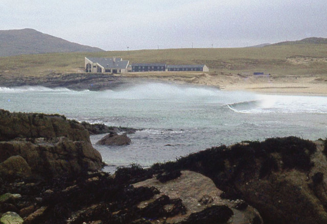
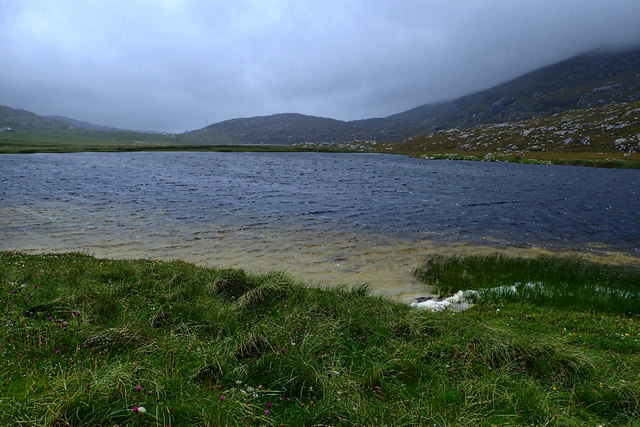
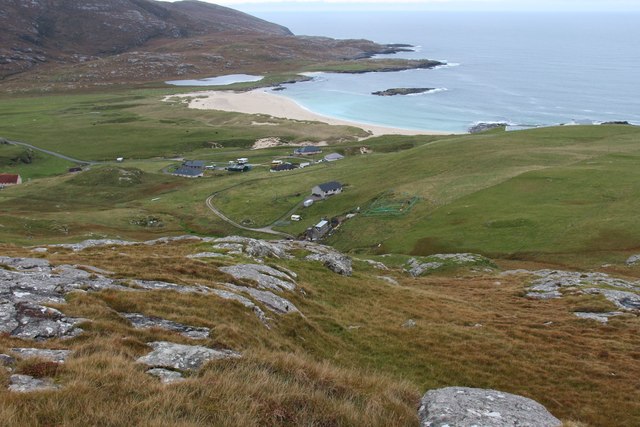
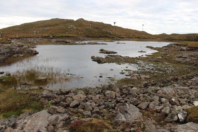
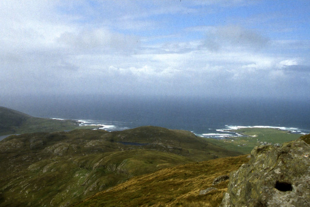
Crubisdale is a picturesque valley located in Inverness-shire, Scotland. Nestled between rolling hills and surrounded by lush greenery, Crubisdale is a tranquil and scenic area known for its natural beauty.

The valley is home to a variety of wildlife, including deer, birds, and other native species. Visitors to Crubisdale can enjoy hiking trails that wind through the valley, offering stunning views of the surrounding landscape. The area is also popular for birdwatching, with a diverse range of bird species making their home in the valley.

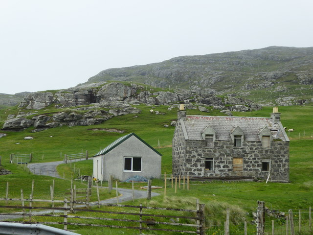
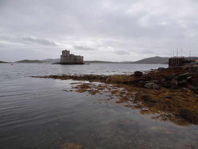
In addition to its natural attractions, Crubisdale is also known for its charming villages and historic sites. The valley is dotted with traditional Scottish cottages and farmhouses, adding to its rustic charm. Visitors can explore local shops and cafes, as well as visit nearby historic landmarks such as castles and ruins.

Overall, Crubisdale is a peaceful and idyllic destination for nature lovers and history enthusiasts alike. Whether you're looking to immerse yourself in the great outdoors or simply relax and enjoy the stunning scenery, Crubisdale offers something for everyone.

If you have any feedback on the listing, please let us know in the comments section below.

Crubisdale Images

Images are sourced within 2km of 56.958867/-7.5148221 or Grid Reference NL6498. Thanks to Geograph Open Source API. All images are credited.

New hotel at Bàgh Halaman Sheltered from an easterly gale.
New hotel at Bàgh Halaman
Sheltered from an easterly gale.
Bagh Halaman The bay is viewed here from the Beach Hotel's garden.
Bagh Halaman
The bay is viewed here from the Beach Hotel's garden.
Loch na Doirlinn
Loch na Doirlinn
Sheep at Tangasdail
Sheep at Tangasdail
Derelict house at Tangasdal
Stream through the machair at Tangasdal
Our hotel view A lovely view of the beach from near our hotel.
Our hotel view
A lovely view of the beach from near our hotel.
Tangasdal from Beinn na Mòine A crofting community on the west coast of Barra.
Tangasdal from Beinn na Mòine
A crofting community on the west coast of Barra.
Loch Uisge, Barra
Loch Uisge, Barra
View towards Cadha Mor from Heabhal
Castle in the bay View of Caisteal Chiosmuil from Castlebay.
Castle in the bay
View of Caisteal Chiosmuil from Castlebay.
MV Claymore at Castlebay The Caledonian MacBrayne car ferry arrives at Castlebay pier on a still misty Wednesday evening at the end of her 5-hour passage from Oban.  In the 1980s she maintained the triangular route between Lochboisdale, Barra and the mainland, but Uist, being the larger and more populous island, enjoyed many more direct sailings.  The next return sailing on this route will not be until Saturday.

Claymore perpetuated the name of the last of the classic MacBrayne steamers built in 1955 - see <a href="https://www.geograph.org.uk/photo/2341322">NM6797 : SS Claymore at Mallaig bound for Stornoway</a>.  After withdrawal from the CalMac fleet Claymore, in a new livery and by then looking rather dated with her awkward side-loading ramps, saw service on the short-lived Kintyre-Antrim route <a href="https://www.geograph.org.uk/photo/2177551">D1241 : The Campbeltown ferry, Ballycastle</a> and later on the short Pentland Firth crossing from John o' Groats to St Margaret's Hope <a href="https://www.geograph.org.uk/photo/488872">ND4093 : The Bu, Hoxa Head</a>.  She was finally sold to the Danes who renamed her Sia and use her as a cable-laying and supply ship.
MV Claymore at Castlebay
The Caledonian MacBrayne car ferry arrives at Castlebay pier on a still misty Wednesday evening at the end of her 5-hour passage from Oban. In the 1980s she maintained the triangular route between Lochboisdale, Barra and the mainland, but Uist, being the larger and more populous island, enjoyed many more direct sailings. The next return sailing on this route will not be until Saturday. Claymore perpetuated the name of the last of the classic MacBrayne steamers built in 1955 - see NM6797 : SS Claymore at Mallaig bound for Stornoway. After withdrawal from the CalMac fleet Claymore, in a new livery and by then looking rather dated with her awkward side-loading ramps, saw service on the short-lived Kintyre-Antrim route D1241 : The Campbeltown ferry, Ballycastle and later on the short Pentland Firth crossing from John o' Groats to St Margaret's Hope ND4093 : The Bu, Hoxa Head. She was finally sold to the Danes who renamed her Sia and use her as a cable-laying and supply ship.
Bagh a' Chaisteil, Barra
The 'Claymore' berthed at Castlebay, Barra
'Claymore' at Castlebay, Barra
The road to Vatersay The road descends steeply after the war memorial as it heads towards the causeway to Vatersay.
The road to Vatersay
The road descends steeply after the war memorial as it heads towards the causeway to Vatersay.
Castlebay harbour on Barra The Caledonian Macbrayne ferry and the lifeboat berthed in Castlebay harbour on the island of Barra, Western Isles.
Castlebay harbour on Barra
The Caledonian Macbrayne ferry and the lifeboat berthed in Castlebay harbour on the island of Barra, Western Isles.
War memorial outside Castlebay This is illuminated at night - the lights can be seen on the pillars at rear, although I do not know if they are currently in use.
War memorial outside Castlebay
This is illuminated at night - the lights can be seen on the pillars at rear, although I do not know if they are currently in use.
Show me another place!

Crubisdale is located at Grid Ref: NL6498 (Lat: 56.958867, Lng: -7.5148221)

Unitary Authority: Na h-Eileanan an Iar

Police Authority: Highlands and Islands

What 3 Words

///pilots.tailwind.bookshelf. Near CastleBay, Na h-Eileanan Siar

Nearby Locations

Crubisdale

Related Wikis

Castlebay Community School

Castlebay Community School is a bilingual Gaelic/English school for ages 3–18 on the Scottish island of Barra.In September 2007, it hosted a major tribute...

Barrathon

The Barrathon is an annual half marathon which takes place on the Isle of Barra, which is the southernmost inhabited isle of the Outer Hebrides in Scotland...

St Brendan's Hospital, Castlebay

St Brendan's Hospital is a hospital in Castlebay on the island of Barra, Eileanan Siar. It is managed by NHS Western Isles. == History == The current facility...
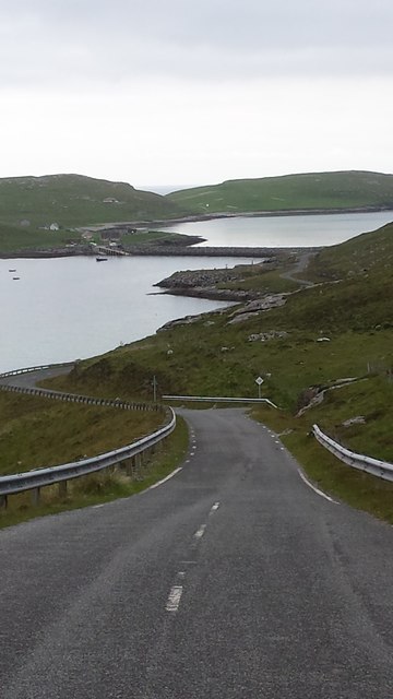
Vatersay Causeway

The Vatersay Causeway (Scottish Gaelic: Rathad Bhàgh Bhatarsaigh) is a 250-metre-long causeway that links the Scottish Hebridean Islands of Vatersay and...

Nearby Amenities

Located within 500m of 56.958867,-7.5148221
Man Made: antenna
Lat/Long: 56.9558082/-7.5138008
The data included in this document is from www.openstreetmap.org. The data is made available under ODbL.

Have you been to Crubisdale?

Leave your review of Crubisdale below (or comments, questions and feedback).