Corndon Down

Hill, Mountain in Devon Teignbridge

England

Corndon Down

Dartmoor looking towards Sharp Tor, Yartor Down This view is from near Rowbrook Hill car park on the road between Dartmeet and Ponsworthy.
Dartmoor looking towards Sharp Tor, Yartor Down Credit: Richard Rogerson

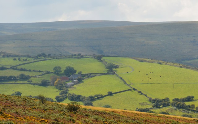
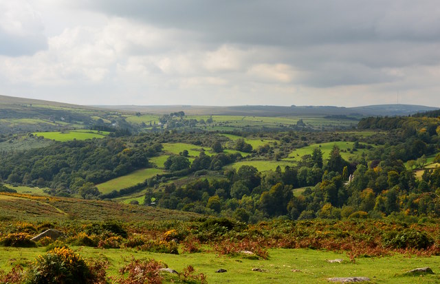
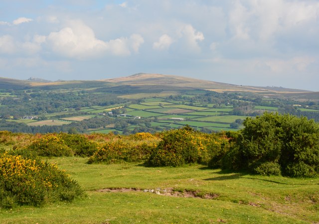
Corndon Down is a prominent hill located in the county of Devon, England. Situated in the southwestern part of the county, it forms part of the Dartmoor National Park, a vast moorland known for its rugged beauty and rich natural heritage.

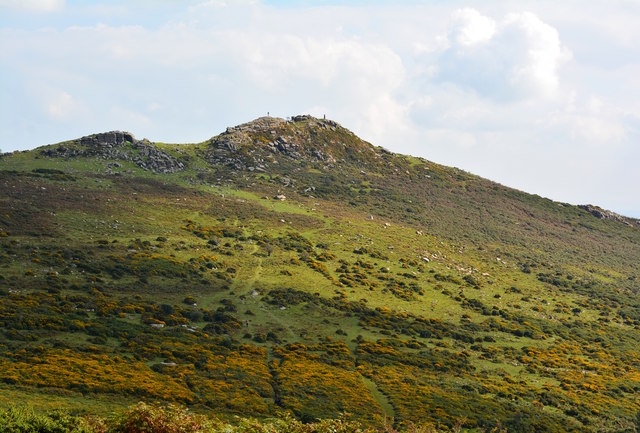
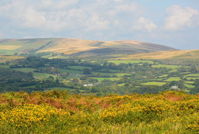
Standing at an elevation of approximately 400 meters (1,312 feet), Corndon Down offers breathtaking panoramic views of the surrounding landscape. Its distinctive shape and prominent position make it a popular destination for hikers, nature enthusiasts, and photographers.

The hill is characterized by its diverse and unique flora and fauna. Its slopes are covered in heather and gorse, which provide a vibrant display of colors throughout the year. The hill is also home to a variety of wildlife, including Dartmoor ponies, sheep, and numerous bird species such as skylarks and stonechats.

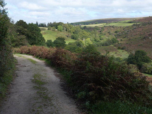
Corndon Down is crisscrossed by a network of footpaths and trails, making it easily accessible for visitors. These paths offer opportunities for leisurely walks, challenging hikes, and even mountain biking.

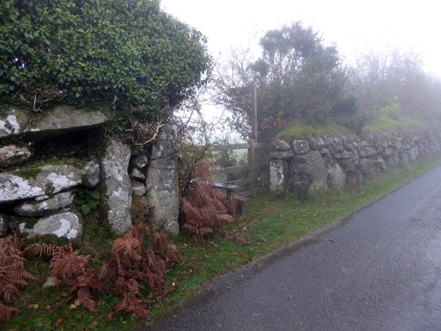
The hill's rich history is evident in the presence of ancient monuments and archaeological sites. The remains of prehistoric settlements, stone circles, and burial mounds can be found scattered across its slopes, providing a glimpse into the area's past.

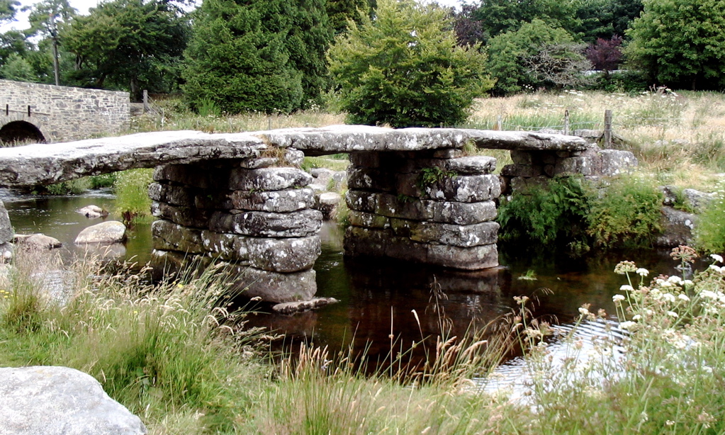
Overall, Corndon Down is a captivating natural landmark that combines stunning scenery, diverse wildlife, and a rich cultural heritage. Whether exploring its trails, admiring its panoramic views, or delving into its history, visitors are sure to be captivated by the beauty and allure of this Devonshire hill.

If you have any feedback on the listing, please let us know in the comments section below.

Corndon Down Images

Images are sourced within 2km of 50.552309/-3.8562226 or Grid Reference SX6874. Thanks to Geograph Open Source API. All images are credited.

Dartmoor looking towards Sharp Tor, Yartor Down This view is from near Rowbrook Hill car park on the road between Dartmeet and Ponsworthy.
Dartmoor looking towards Sharp Tor, Yartor Down
This view is from near Rowbrook Hill car park on the road between Dartmeet and Ponsworthy.
Remains of a clapper bridge At Dartmeet in the Dartmoor National Park. A very popular beauty spot.
Remains of a clapper bridge
At Dartmeet in the Dartmoor National Park. A very popular beauty spot.
Badger's Holt - restaurant and gift shop At Dartmeet in the Dartmoor National Park.
Badger's Holt - restaurant and gift shop
At Dartmeet in the Dartmoor National Park.
Dartmeet Bridge Two arch masonry bridge at Dartmeet in the Dartmoor National Park.
Dartmeet Bridge
Two arch masonry bridge at Dartmeet in the Dartmoor National Park.
Badger's Holt - chicken coops and predator One of the interesting things about cats is that they are obligate carnivores. Your dog can survive on a vegetarian diet but a pure vegetarian diet will kill your cat (not so sure about curiosity!). Cats need at least some meat protein in their diet.
Badger's Holt - chicken coops and predator
One of the interesting things about cats is that they are obligate carnivores. Your dog can survive on a vegetarian diet but a pure vegetarian diet will kill your cat (not so sure about curiosity!). Cats need at least some meat protein in their diet.
Cairn, Corndon Down
Cairn, Corndon Down
Cairn, Yar Tor
Cairn, Yar Tor
Dartmeet Bridge
Dartmeet Bridge
Dartmeet Clapper Bridge A clapper bridge is an ancient form of bridge found on the moors. This one has partially collapsed.
Dartmeet Clapper Bridge
A clapper bridge is an ancient form of bridge found on the moors. This one has partially collapsed.
Dartmeet: Bridges Two bridges can be seen; in the foreground is the old clapper bridge (partially collapsed) and behind the road bridge, constructed in 1792, which spans the East Dart River.
Dartmeet: Bridges
Two bridges can be seen; in the foreground is the old clapper bridge (partially collapsed) and behind the road bridge, constructed in 1792, which spans the East Dart River.
Autumn colours, Dartmeet, Devon
Sharp Tor, near Dartmeet, Devon There are four tors called Sharp Tor, this is the one between Dartmeet and Poundsgate.

Atop the granite peak of the tor is a couple (at the right) and a single walker. Another walker can be spotted walking up the hill just above the gorse.

The Dartmoor tors and clitter slopes have been formed through the weathering of the granite over at least the last ten million years.
Sharp Tor, near Dartmeet, Devon
There are four tors called Sharp Tor, this is the one between Dartmeet and Poundsgate. Atop the granite peak of the tor is a couple (at the right) and a single walker. Another walker can be spotted walking up the hill just above the gorse. The Dartmoor tors and clitter slopes have been formed through the weathering of the granite over at least the last ten million years.
Misty Dartmoor near Dartmeet, Devon In the foreground the typical moorland scrub - heather, gorse, rough grass and bracken, with a mixed moorland farm in the middle distance and bleaker, darker hills behind.
Misty Dartmoor near Dartmeet, Devon
In the foreground the typical moorland scrub - heather, gorse, rough grass and bracken, with a mixed moorland farm in the middle distance and bleaker, darker hills behind.
Dartmoor above Dartmeet, Devon
Moorland in autumn, Ponsworthy, Devon
Sherbeton Common, Dartmoor, Devon
Path from Brimpts Farm to Babeny With the valley of East Dart River on the right.
Path from Brimpts Farm to Babeny
With the valley of East Dart River on the right.
Stile and gate at the start of a footpath to Ponsworthy From one of the minor roads on Bel Tor; the walls are granite
Stile and gate at the start of a footpath to Ponsworthy
From one of the minor roads on Bel Tor; the walls are granite
Show me another place!

Corndon Down is located at Grid Ref: SX6874 (Lat: 50.552309, Lng: -3.8562226)

Administrative County: Devon

District: Teignbridge

Police Authority: Devon and Cornwall

Also known as: Corndon Tor

What 3 Words

///pass.spilling.golden. Near Ashburton, Devon

Related Wikis

Ponsworthy

Ponsworthy is a hamlet on the eastern side of Dartmoor, Devon, England. It lies in the steep valley of the West Webburn River about 3.5 km (2.2 mi) southwest...

East Dart River

The East Dart River is one of the two main tributaries of the River Dart in Devon, England. Its source is to the west of Whitehorse Hill and slightly south...

Babeny

Babeny is a village in Devon, England. == External links == Media related to Babeny at Wikimedia Commons == References ==

Dartmeet

Dartmeet is a popular tourist spot in the centre of Dartmoor, Devon, England at grid reference SX672731. It lies at the end of the B3357 road, about 4...

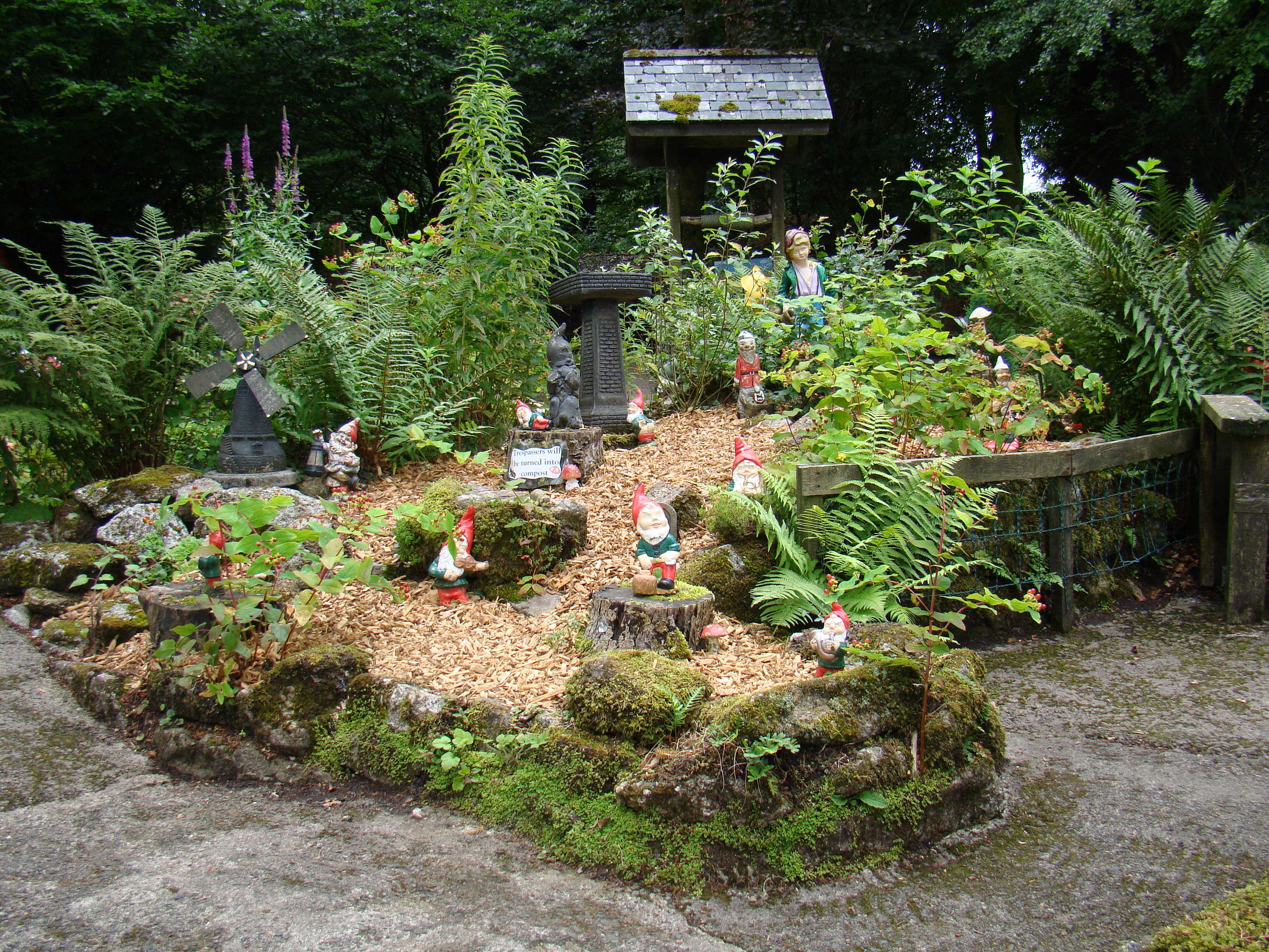
Pixieland (Dartmoor)

Pixieland is in Dartmoor National Park, Devon and is a visitor attraction, garden gnome manufacturer and retailer. It was founded by Ken Ruth in 1947....

Leusdon

Leusdon is a parish in the southern part of Dartmoor in the county of Devon, UK. It is near Poundsgate and Ponsworthy. The village church is St John the...

Dr Blackall's Drive

Dr Blackall's Drive is a track built along the hill above the River Dart, near the hamlet of Poundsgate, in the parish of Widecombe-in-the-Moor, Devon...

East Webburn River

The East Webburn is a stream in the Dartmoor moors in Devon in south-west England. It rises on the western side of the moors flowing off the west side...

Nearby Amenities

Located within 500m of 50.552309,-3.8562226
Corndon Tor
Natural: peak
Lat/Long: 50.5525974/-3.8562471
War Memorial
Historic: memorial
Source: GPS
Lat/Long: 50.5499071/-3.8601007
Corndon Down
Place: locality
Source: Bing
Lat/Long: 50.554729/-3.8562441
Corndon Tor
Place: locality
Source: Bing
Lat/Long: 50.5528196/-3.8551418
The data included in this document is from www.openstreetmap.org. The data is made available under ODbL.

Have you been to Corndon Down?

Leave your review of Corndon Down below (or comments, questions and feedback).