Carn Hyddgen

Hill, Mountain in Montgomeryshire

Wales

Carn Hyddgen

The Hyddgen Valley viewed from Plynlimon With Cadair Idris on the horizon.
The Hyddgen Valley viewed from Plynlimon Credit: John Lucas

The requested URL returned error: 429 Too Many Requests

If you have any feedback on the listing, please let us know in the comments section below.
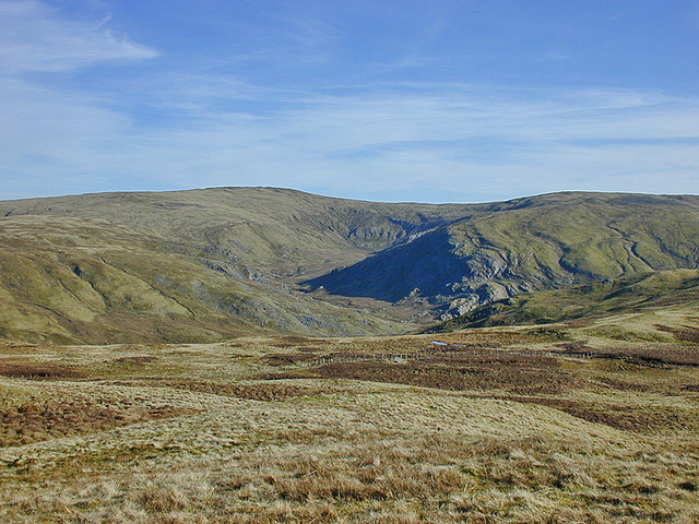
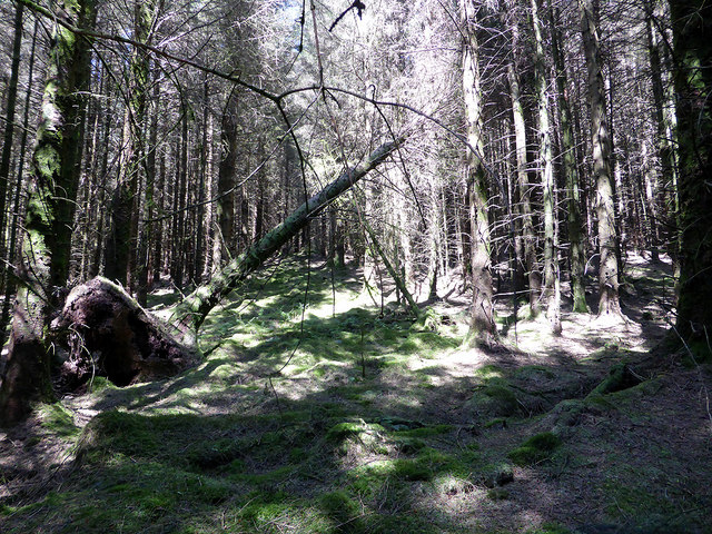
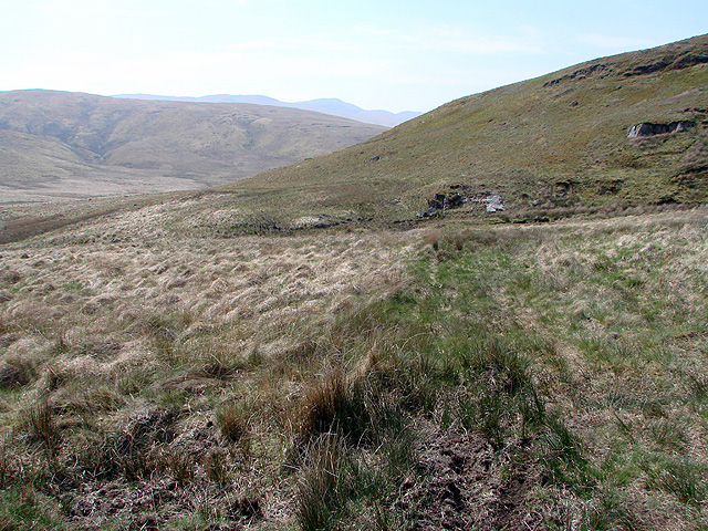
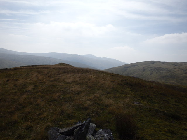
Carn Hyddgen Images

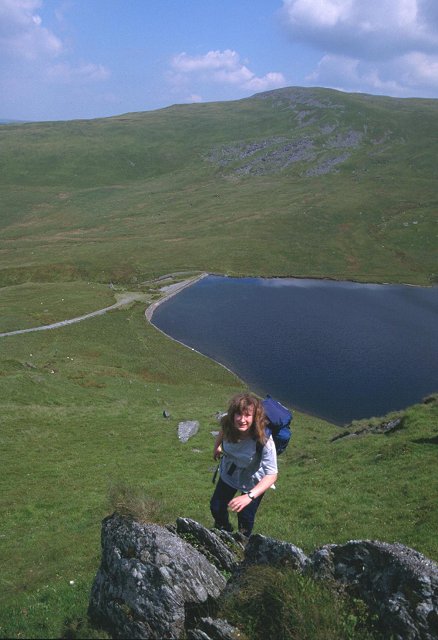
Images are sourced within 2km of 52.501938/-3.7805148 or Grid Reference SN7990. Thanks to Geograph Open Source API. All images are credited.

The Hyddgen Valley viewed from Plynlimon With Cadair Idris on the horizon.
The Hyddgen Valley viewed from Plynlimon
With Cadair Idris on the horizon.
Banc Llechwedd-mawr and the Hyddgen Valley Viewed from Plynlimon.
Banc Llechwedd-mawr and the Hyddgen Valley
Viewed from Plynlimon.
Carn Gwilym from the south west The pair of relatively modern cairns were built from the remains of the original ancient cairn. They are instantly recognisable from points afar, and are useful navigation aids in this remote and fairly featureless country.
Carn Gwilym from the south west
The pair of relatively modern cairns were built from the remains of the original ancient cairn. They are instantly recognisable from points afar, and are useful navigation aids in this remote and fairly featureless country.
Sunlight on Carn Hyddgen On a cold mixed autumnal day, a sunlit patch appears on the hill.
Sunlight on Carn Hyddgen
On a cold mixed autumnal day, a sunlit patch appears on the hill.
The summit of Carn Hyddgen Dominated by the twin cairns known as Cairn Gwilym. Rebuilt from ancient burial cairns, they are visible from miles around and thus aid navigation, which is probably their purpose. An old route from the upper Wye valley to Machynlleth crosses Pumlumon and passes to the west.

Cadair Idris stands out in the distance.
The summit of Carn Hyddgen
Dominated by the twin cairns known as Cairn Gwilym. Rebuilt from ancient burial cairns, they are visible from miles around and thus aid navigation, which is probably their purpose. An old route from the upper Wye valley to Machynlleth crosses Pumlumon and passes to the west. Cadair Idris stands out in the distance.
Looking south along Carn Hyddgen's ridge Looking along the broad ridge, with Pumlumon in the distance. Most approach routes from the south cross the fence on the left of the picture, having first traversed the crest of the ridge pointing towards Pumlumon Fawr.
Looking south along Carn Hyddgen's ridge
Looking along the broad ridge, with Pumlumon in the distance. Most approach routes from the south cross the fence on the left of the picture, having first traversed the crest of the ridge pointing towards Pumlumon Fawr.
Pumlumon Arwystli from Carn Hyddgen With remote Cwm Gwerin below it.
Pumlumon Arwystli from Carn Hyddgen
With remote Cwm Gwerin below it.
Cwm Gwerin from Carn Hyddgen
Hyddgen [Farm] At shearing time.
Hyddgen [Farm]
At shearing time.
Gate on the road south through Cwm Hyddgen
Ford across Llygnant Llygnant has a confluence with Nant Goch just by Hyddgen farm at <a href="https://www.geograph.org.uk/gridref/SN7804891085">SN7804891085</a> to form Afon Hyddgen which itself runs south for just a couple of kilometres before joining Afon Hengwm.
Ford across Llygnant
Llygnant has a confluence with Nant Goch just by Hyddgen farm at SN7804891085 to form Afon Hyddgen which itself runs south for just a couple of kilometres before joining Afon Hengwm.
Rough ground on Mynydd Bychan Supposedly following a right of way through the forestry but the path disappeared and I had to fight my way through the undergrowth. Wish I had my machete with me!
Rough ground on Mynydd Bychan
Supposedly following a right of way through the forestry but the path disappeared and I had to fight my way through the undergrowth. Wish I had my machete with me!
Hyddgen Farm buildings This was once a full farmstead with a farmhouse. It is now just a few corrugated iron sheds which are mostly used at shearing time. The house is thought to have been occupied from the 16th c. until very early in the 20th c. but is now just a flattened ruin.
Hyddgen Farm buildings
This was once a full farmstead with a farmhouse. It is now just a few corrugated iron sheds which are mostly used at shearing time. The house is thought to have been occupied from the 16th c. until very early in the 20th c. but is now just a flattened ruin.
Track through Cwm Hyddgen Viewed from beside the forestry on Mynydd Bychan.
Track through Cwm Hyddgen
Viewed from beside the forestry on Mynydd Bychan.
Improvised stile beside Afon Hengwm A wooden stump has been thoughtfully placed to help get your leg over and avoid damaging the crown jewels!
Improvised stile beside Afon Hengwm
A wooden stump has been thoughtfully placed to help get your leg over and avoid damaging the crown jewels!
Looking towards Foel Uchaf The footpath here (such as it is) is well above the valley floor because of the boggy ground that is found beside the river. Even at this height, wet feet and 'that sinking feeling' are a hazard for the unwary!
Looking towards Foel Uchaf
The footpath here (such as it is) is well above the valley floor because of the boggy ground that is found beside the river. Even at this height, wet feet and 'that sinking feeling' are a hazard for the unwary!
Afon Hengwm Pumlumon Fawr in the far distance.
Afon Hengwm
Pumlumon Fawr in the far distance.
On Foel Isaf Small cairn on this pathless top
On Foel Isaf
Small cairn on this pathless top
Show me another place!

Carn Hyddgen is located at Grid Ref: SN7990 (Lat: 52.501938, Lng: -3.7805148)

Unitary Authority: Powys

Police Authority: Dyfed Powys

Also known as: Carn Gwilym

What 3 Words

///hunter.vitals.snoozing. Near Staylittle, Powys

Nearby Locations

Carn Gwilym Carn Hyddgen

Related Wikis

Battle of Mynydd Hyddgen

The Battle of Mynydd Hyddgen was a battle between the Welsh and English in June 1401. It was part of the Welsh Revolt of 1400-1415 led by Owain Glyndŵr...

Clipyn Du

Clipyn Du is a mountain in northern Powys in Wales. Also known as Tarren Bwlch-Gwyn or Siambwr Trawsfynydd, it is one of the higher summits of the area...

Siambr Trawsfynydd

Siambr Trawsfynydd is a mountain in Ceredigion, Wales, located to the north of Pumlumon. It is 582 m (1,910 ft) above sea level and one of the higher summits...

Pumlumon Fach

Pumlumon Fach is a top of Pen Pumlumon Fawr on the Plynlimon massif, a part of the Cambrian Mountains in the county of Ceredigion, Wales. It lies on small...

Nearby Amenities

Located within 500m of 52.501938,-3.7805148
Carn Hyddgen
Created By: POI Editor
Ele: 564
Natural: peak
Source: npe
Lat/Long: 52.5018535/-3.7797919
Landmark: cairn
Man Made: cairn
Source: Bing
Lat/Long: 52.5019494/-3.7806241
Landmark: cairn
Man Made: cairn
Source: Bing
Lat/Long: 52.5021233/-3.7805361
The data included in this document is from www.openstreetmap.org. The data is made available under ODbL.

Have you been to Carn Hyddgen?

Leave your review of Carn Hyddgen below (or comments, questions and feedback).