Beacon Hill

Hill, Mountain in Kent Dover

England

Beacon Hill

White Cliffs Country Trail The White Cliffs Trails were created in 1987 by Dover District Council to link the towns of Dover, Deal and Sandwich, going along the famous 'white cliffs' to the east of Dover to Deal with an inland return through the beautiful Kent countryside. A link from Deal to Northbourne via Sholden and a loop from Sandwich to Northbourne via Eastry provide a range of options.
The routes are marked on OS mapping but have no apparent current publications.
White Cliffs Country Trail Credit: N Chadwick

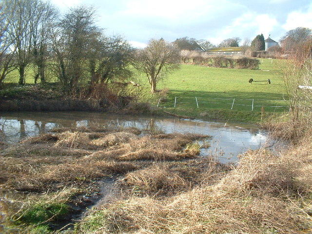
Beacon Hill, located in Kent, England, is a prominent hill and a part of the North Downs range. Standing at an impressive height of 261 meters (856 feet), it offers breathtaking panoramic views of the surrounding landscape. The hill is situated near the village of Chatham, within the Medway unitary authority.

Beacon Hill is known for its historical significance, dating back to ancient times when it served as a beacon site. During the Roman era, this hill was used as a signaling point to warn of invasions or other imminent dangers. It continued to play this role throughout the medieval period, with a beacon fire being lit on its summit to communicate messages across long distances.

In addition to its historical importance, Beacon Hill is cherished for its natural beauty. It is covered in lush greenery, with a mixture of woodland and open grassland. This diverse landscape provides a habitat for a variety of flora and fauna, making it a popular destination for nature enthusiasts and hikers.

The hill is also a designated Site of Special Scientific Interest (SSSI), highlighting its ecological significance. It supports a range of rare plant species, including orchids and wildflowers, as well as various bird species. Visitors to Beacon Hill can enjoy peaceful walks along its well-maintained footpaths and take in the breathtaking views of the surrounding countryside.

Overall, Beacon Hill in Kent offers a unique blend of historical, cultural, and natural attractions, making it a must-visit destination for those seeking to explore the region's rich heritage and stunning landscapes.

If you have any feedback on the listing, please let us know in the comments section below.

Beacon Hill Images

Images are sourced within 2km of 51.206151/1.3473689 or Grid Reference TR3350. Thanks to Geograph Open Source API. All images are credited.

White Cliffs Country Trail The White Cliffs Trails were created in 1987 by Dover District Council to link the towns of Dover, Deal and Sandwich, going along the famous 'white cliffs' to the east of Dover to Deal with an inland return through the beautiful Kent countryside. A link from Deal to Northbourne via Sholden and a loop from Sandwich to Northbourne via Eastry provide a range of options.
The routes are marked on OS mapping but have no apparent current publications.
White Cliffs Country Trail
The White Cliffs Trails were created in 1987 by Dover District Council to link the towns of Dover, Deal and Sandwich, going along the famous 'white cliffs' to the east of Dover to Deal with an inland return through the beautiful Kent countryside. A link from Deal to Northbourne via Sholden and a loop from Sandwich to Northbourne via Eastry provide a range of options. The routes are marked on OS mapping but have no apparent current publications.
Pumping Station
Pumping Station
Winkland Oaks Cottages
Gate, White Cliffs Country Trail The White Cliffs Trails were created in 1987 by Dover District Council to link the towns of Dover, Deal and Sandwich, going along the famous 'white cliffs' to the east of Dover to Deal with an inland return through the beautiful Kent countryside. A link from Deal to Northbourne via Sholden and a loop from Sandwich to Northbourne via Eastry provide a range of options.
The routes are marked on OS mapping but have no apparent current publications.
Gate, White Cliffs Country Trail
The White Cliffs Trails were created in 1987 by Dover District Council to link the towns of Dover, Deal and Sandwich, going along the famous 'white cliffs' to the east of Dover to Deal with an inland return through the beautiful Kent countryside. A link from Deal to Northbourne via Sholden and a loop from Sandwich to Northbourne via Eastry provide a range of options. The routes are marked on OS mapping but have no apparent current publications.
Houses on Forge Lane
Farmland near Sutton
White Cliffs Country Trail approaching Sutton The White Cliffs Trails were created in 1987 by Dover District Council to link the towns of Dover, Deal and Sandwich, going along the famous 'white cliffs' to the east of Dover to Deal with an inland return through the beautiful Kent countryside. A link from Deal to Northbourne via Sholden and a loop from Sandwich to Northbourne via Eastry provide a range of options.
The routes are marked on OS mapping but have no apparent current publications.
White Cliffs Country Trail approaching Sutton
The White Cliffs Trails were created in 1987 by Dover District Council to link the towns of Dover, Deal and Sandwich, going along the famous 'white cliffs' to the east of Dover to Deal with an inland return through the beautiful Kent countryside. A link from Deal to Northbourne via Sholden and a loop from Sandwich to Northbourne via Eastry provide a range of options. The routes are marked on OS mapping but have no apparent current publications.
Approaching Sutton Court Farm The White Cliffs Trails were created in 1987 by Dover District Council to link the towns of Dover, Deal and Sandwich, going along the famous 'white cliffs' to the east of Dover to Deal with an inland return through the beautiful Kent countryside. A link from Deal to Northbourne via Sholden and a loop from Sandwich to Northbourne via Eastry provide a range of options.
The routes are marked on OS mapping but have no apparent current publications.
Approaching Sutton Court Farm
The White Cliffs Trails were created in 1987 by Dover District Council to link the towns of Dover, Deal and Sandwich, going along the famous 'white cliffs' to the east of Dover to Deal with an inland return through the beautiful Kent countryside. A link from Deal to Northbourne via Sholden and a loop from Sandwich to Northbourne via Eastry provide a range of options. The routes are marked on OS mapping but have no apparent current publications.
Sutton Court Farm
Sutton Court Farm
Silos, Sutton Court Farm
Barn, Sutton Court Farm
Church of St Peter & St Paul A C12 church.
Grade II* listed. <span class="nowrap"><a title="https://historicengland.org.uk/listing/the-list/list-entry/1247673" rel="nofollow ugc noopener" href="https://historicengland.org.uk/listing/the-list/list-entry/1247673">Link</a><img style="margin-left:2px;" alt="External link" title="External link - shift click to open in new window" src="https://s1.geograph.org.uk/img/external.png" width="10" height="10"/></span>
Church of St Peter & St Paul
A C12 church. Grade II* listed. LinkExternal link
The Granary, Sutton Court Farm
The Cabin
The Cabin
The Boot Grade II listed.
The Boot
Grade II listed.
Church of St Peter & St Paul A C12 church.
Grade II* listed. <span class="nowrap"><a title="https://historicengland.org.uk/listing/the-list/list-entry/1247673" rel="nofollow ugc noopener" href="https://historicengland.org.uk/listing/the-list/list-entry/1247673">Link</a><img style="margin-left:2px;" alt="External link" title="External link - shift click to open in new window" src="https://s1.geograph.org.uk/img/external.png" width="10" height="10"/></span>
Church of St Peter & St Paul
A C12 church. Grade II* listed. LinkExternal link
Show me another place!

Beacon Hill is located at Grid Ref: TR3350 (Lat: 51.206151, Lng: 1.3473689)

Administrative County: Kent

District: Dover

Police Authority: Kent

What 3 Words

///fence.homeward.lions. Near Deal, Kent

Related Wikis

Great Mongeham

Great Mongeham is a village and civil parish in the Dover District of east Kent, England, on the outskirts of Deal. Its name is derived from Mundelingham...

Ripple, Kent

Ripple, also known as 'Ripple Vale', is a village and civil parish in the Dover District of Kent, England. Ripple parish church is dedicated to St Mary...

Sutton, Kent

Sutton is a village and civil parish near Dover in Kent, England. In 1935 this village became a parish when the small settlements of Studdal, Sutton, Ashley...

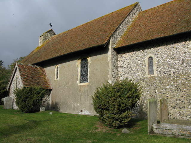
St Peter's and St Paul's Church, Sutton By Dover

All Saints is a parish church in Sutton, Kent. It was begun in the 12th century and is a Grade II listed building.The south porch and vestry was added...

Northbourne, Kent

Northbourne is a village and civil parish near Deal in Kent, England. It has a public house, The Hare and Hounds, a primary school and is the home of the...

New Mill, Northbourne

New Mill is a Grade II listed smock mill in Northbourne, Kent, England that was built in 1848 and which has been converted to residential accommodation...

East Studdal

East Studdal is a village near Dover in Kent, England. The population of the village is included in the civil parish of Sutton. == References == ��2�...

Mill Hill Anglo-Saxon cemetery

Mill Hill Anglo-Saxon cemetery is a place of burial located close to the town of Deal in Kent, South-East England. Belonging to the Middle Anglo-Saxon...

Nearby Amenities

Located within 500m of 51.206151,1.3473689
The data included in this document is from www.openstreetmap.org. The data is made available under ODbL.

Have you been to Beacon Hill?

Leave your review of Beacon Hill below (or comments, questions and feedback).