Beacon Hill

Hill, Mountain in Norfolk South Norfolk

England

Beacon Hill

View down Mendham Lane
View down Mendham Lane Credit: Helen Steed

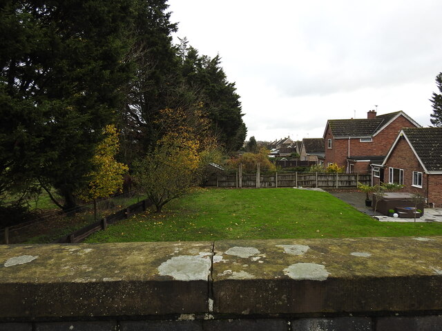
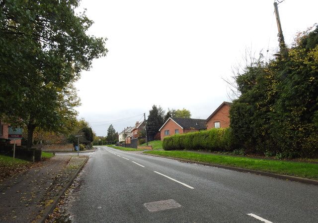
Beacon Hill, located in Norfolk, is a prominent hill that stands at an elevation of 103 meters (338 feet) above sea level. It is situated near the village of West Runton in the eastern part of England. This hill is part of the North Norfolk Coast Area of Outstanding Natural Beauty, which is known for its scenic landscapes and diverse wildlife.

Beacon Hill gets its name from the historical function it served as a beacon site. In the past, it was used as a lookout point where beacons were lit to warn of impending invasions or other emergencies. Today, visitors can still see the remnants of an old beacon tower at the summit.

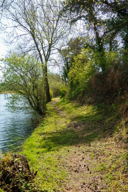
The hill offers breathtaking panoramic views of the surrounding countryside, including the nearby coastal area. On clear days, one can see as far as the North Sea and the distant cliffs of Sheringham and Cromer. The area around Beacon Hill is also home to a variety of flora and fauna, making it a popular destination for nature enthusiasts.

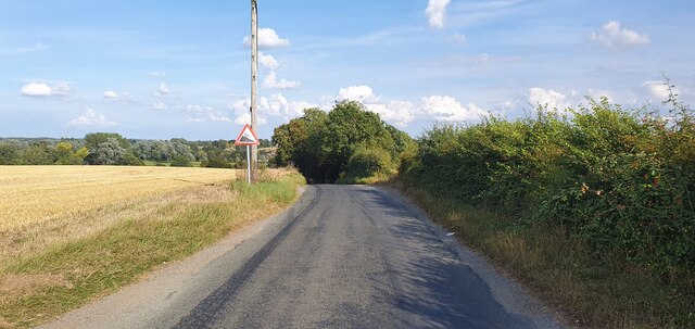
There are several walking trails that lead up to the hill, providing an opportunity for visitors to explore the beautiful countryside. The paths are well-maintained and offer a range of difficulty levels, accommodating both casual walkers and more experienced hikers.

Overall, Beacon Hill in Norfolk is a picturesque location that offers both historical significance and natural beauty. With its stunning views and tranquil atmosphere, it is a must-visit destination for those seeking a peaceful retreat or an adventurous outdoor experience.

If you have any feedback on the listing, please let us know in the comments section below.

Beacon Hill Images

Images are sourced within 2km of 52.396123/1.2989604 or Grid Reference TM2482. Thanks to Geograph Open Source API. All images are credited.

View down Mendham Lane
Path along Ocean Pit, Weybread This old pit is now a fishing and leisure lake.
Path along Ocean Pit, Weybread
This old pit is now a fishing and leisure lake.
Path to ruins of old priory, Mendham
A143 east approaching Harmans Lane West junction, Needham
A143 east at island for Harleston and Needham
A143 east at turning for Harleston Industrial Estate
A143 east at the end of the Harleston by-pass
Former bicycle shop, Redenhall Road, Harleston The roundel on the first floor is that of the Cyclists' Touring Club.  In the late 19th and early 20th century the CTC used these to indicate premises that were welcoming to "wheelmen": in general these were pubs and hotels, but in this case there is a small curved bar around the top of the standard logo in which the text "Repairer to" indicates that this housed a cycle workshop.
Former bicycle shop, Redenhall Road, Harleston
The roundel on the first floor is that of the Cyclists' Touring Club. In the late 19th and early 20th century the CTC used these to indicate premises that were welcoming to "wheelmen": in general these were pubs and hotels, but in this case there is a small curved bar around the top of the standard logo in which the text "Repairer to" indicates that this housed a cycle workshop.
Remembrance display in butcher's window, Thoroughfare, Harleston I've seen wreaths on display before, but never a model Cenotaph.
Remembrance display in butcher's window, Thoroughfare, Harleston
I've seen wreaths on display before, but never a model Cenotaph.
Former butcher's shop, Redenhall Road, Harleston This former butcher's shop is now a pizza takeaway. Tiles below the window give its former telephone number, Harleston 38.
Former butcher's shop, Redenhall Road, Harleston
This former butcher's shop is now a pizza takeaway. Tiles below the window give its former telephone number, Harleston 38.
Harleston Station, on the former Waveney Valley Railway Harleston Station was the largest station on the line, if Tivetshall and Beccles are discounted. It was 6¼ miles down line from Tivetshall and about 14 miles from Beccles. Everything except the station building has been demolished, cleared or built over. The owners of the building are a company called Zero Retain so it isn't surprising.
The station was approached from an embankment and a girder bridge, diagonally spanning Redenhall Road
The Tivetshall to Harleston was the first stage to be completed and trains began running on 1st December 1855, with stations at Pulham Market Pulham St Mary and Starston. Work was already underway to extend the line to Bungay and finally to Beccles.
The station was well equipped with a 70 Yard long platform, Goods shed with various sidings with a total length of 3500 feet serving a coal yard, maltings, cattle pens, the corn mill and five private sidings. The station signal box which stood at the eastern end of the Up platform. After a Down platform was installed a covered passenger footbridge, the only one on the line was also added.
Harleston Station, on the former Waveney Valley Railway
Harleston Station was the largest station on the line, if Tivetshall and Beccles are discounted. It was 6¼ miles down line from Tivetshall and about 14 miles from Beccles. Everything except the station building has been demolished, cleared or built over. The owners of the building are a company called Zero Retain so it isn't surprising. The station was approached from an embankment and a girder bridge, diagonally spanning Redenhall Road The Tivetshall to Harleston was the first stage to be completed and trains began running on 1st December 1855, with stations at Pulham Market Pulham St Mary and Starston. Work was already underway to extend the line to Bungay and finally to Beccles. The station was well equipped with a 70 Yard long platform, Goods shed with various sidings with a total length of 3500 feet serving a coal yard, maltings, cattle pens, the corn mill and five private sidings. The station signal box which stood at the eastern end of the Up platform. After a Down platform was installed a covered passenger footbridge, the only one on the line was also added.
Harleston Railway Station from the west Standing where the level crossing was once located west of the station.
More about the station here <a href="https://www.geograph.org.uk/photo/7353067">TM2483 : Harleston Station, on the former Waveney Valley Railway</a>
The goods yard was north of the station. 
The different colour brickwork is an extension built on the platform.
Harleston Railway Station from the west
Standing where the level crossing was once located west of the station. More about the station here TM2483 : Harleston Station, on the former Waveney Valley Railway The goods yard was north of the station. The different colour brickwork is an extension built on the platform.
The site of the former level crossing #34 The station on the right with the malthouse and the corn mill on the left of the picture, where houses on what is now Millers Green have been built. West of the crossing was a siding of over 300 yards which ran as far as the bridge number TIB 1177, on the B1134 (The Street).
The site of the former level crossing #34
The station on the right with the malthouse and the corn mill on the left of the picture, where houses on what is now Millers Green have been built. West of the crossing was a siding of over 300 yards which ran as far as the bridge number TIB 1177, on the B1134 (The Street).
Part of the former Harleston goods yard The line of cars are standing on where the old track-bed of the Up and Down railway tracks. The signal box was on the back of the platform behind the station building. The Goods Shed, which had a line running through the building, stood beyond the wooden shed on the left. A covered passenger footbridge used to span the two platforms close to the centre of the picture with the coal yards a little to the left of centre. Behind the camera were the malthouse and corn mill with a short siding for a few wagons.
Part of the former Harleston goods yard
The line of cars are standing on where the old track-bed of the Up and Down railway tracks. The signal box was on the back of the platform behind the station building. The Goods Shed, which had a line running through the building, stood beyond the wooden shed on the left. A covered passenger footbridge used to span the two platforms close to the centre of the picture with the coal yards a little to the left of centre. Behind the camera were the malthouse and corn mill with a short siding for a few wagons.
Former railway bridge (TIB 1177) The bridge is a single arch constructed with engineering bricks, capped with coping stone on the parapets.
Former railway bridge (TIB 1177)
The bridge is a single arch constructed with engineering bricks, capped with coping stone on the parapets.
View from the former railway bridge The bridge, Tivetshall- Beccles #1177, is on the B 1134 road to Starston.
Houses have been built over the former Waveney Valley Railway line on the Harleston side while the Starston side of the track has been returned to agriculture.
View from the former railway bridge
The bridge, Tivetshall- Beccles #1177, is on the B 1134 road to Starston. Houses have been built over the former Waveney Valley Railway line on the Harleston side while the Starston side of the track has been returned to agriculture.
Overlooking the former railway bridge The field shows no sign of the former railway track which crossed it heading towards the trees in the centre of the picture.
Overlooking the former railway bridge
The field shows no sign of the former railway track which crossed it heading towards the trees in the centre of the picture.
Site of the former Redenhall Road girder bridge at Harleston The bridge, just a few yards from Harleston Station, (designated  No.1179) was a girder bridge on brick abutments, crossed the road diagonally where a house has since been erected on one side of the road and two bungalows on the other.
Site of the former Redenhall Road girder bridge at Harleston
The bridge, just a few yards from Harleston Station, (designated No.1179) was a girder bridge on brick abutments, crossed the road diagonally where a house has since been erected on one side of the road and two bungalows on the other.
Show me another place!

Beacon Hill is located at Grid Ref: TM2482 (Lat: 52.396123, Lng: 1.2989604)

Administrative County: Norfolk

District: South Norfolk

Police Authority: Norfolk

What 3 Words

///bracing.baseline.grad. Near Harleston, Norfolk

Nearby Locations

Beacon Hill The Dell

Related Wikis

Redenhall with Harleston

Redenhall with Harleston is a civil parish in the South Norfolk district of the English county of Norfolk, comprising the town of Harleston and the neighbouring...

Harleston Sancroft Academy

The Harleston Sancroft Academy is a Church of England all-through school located in Harleston, Norfolk, England. It was formed on 1 September 2022 from...

Corn Exchange, Harleston

The Corn Exchange is a commercial building in Exchange Street in Harleston, Norfolk, England. The structure, which used as a vintage and antiques emporium...

Harleston, Norfolk

Harleston is a town 16 miles (26 km) from Norwich, in the civil parish of Redenhall with Harleston, in the South Norfolk district, in the county of Norfolk...

Harleston Town F.C.

Harleston Town Football Club is a football club based in Harleston, Norfolk, England. They are currently members of the Eastern Counties League Premier...

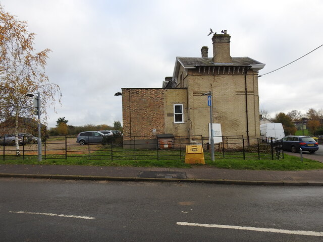
Harleston railway station

Harleston was a railway station in Harleston, Norfolk, on the Waveney Valley Line. It was an early post-war closure; passenger services on this line were...

Starston railway station

Starston was a railway station on the Waveney Valley Line in Norfolk, England. It was open for just ten years before low traffic usage caused its closure...

Mendham Priory

Mendham Priory was a priory in Suffolk, England. == References ==

Nearby Amenities

Located within 500m of 52.396123,1.2989604
Bus Stop
high school, adj
Bus: yes
Naptan AtcoCode: 2900R2415
Naptan Bearing: N
Naptan CommonName: high school
Naptan Indicator: adj
Naptan Landmark: high school
Naptan Locality: Harleston
Naptan NaptanCode: nfodptpg
Naptan ShortCommonName: high school
Naptan Street: Wilderness Lane
Naptan Verified: no
Public Transport: platform
Source: naptan_import
Lat/Long: 52.3991911/1.2948578
Bus Stop
Love Lane, opp
Bus: yes
Naptan AtcoCode: 2900R2417
Naptan Bearing: NE
Naptan CommonName: Love Lane
Naptan Indicator: opp
Naptan Landmark: Love Lane
Naptan Locality: Harleston
Naptan NaptanCode: nfodptpm
Naptan ShortCommonName: Love Lane
Naptan Street: London Road
Naptan Verified: no
Public Transport: platform
Source: naptan_import
Lat/Long: 52.4003007/1.2969541
Bus Stop
Malthouse Court, opp
Bus: yes
Naptan AtcoCode: 2900R2418
Naptan Bearing: SW
Naptan BusStopType: CUS
Naptan CommonName: Malthouse Court
Naptan Indicator: opp
Naptan Landmark: Malthouse Court
Naptan Locality: Harleston
Naptan NaptanCode: nfodptpt
Naptan ShortCommonName: Malthouse Court
Naptan Street: London Road
Naptan Verified: no
Public Transport: platform
Source: naptan_import
Lat/Long: 52.4001183/1.2970434
Bus Stop
Malthouse Court, adj
Naptan AtcoCode: 2900R2419
Naptan Bearing: NE
Naptan BusStopType: CUS
Naptan CommonName: Malthouse Court
Naptan Indicator: adj
Naptan Landmark: Shotford Road
Naptan Locality: Harleston
Naptan NaptanCode: nfodptpw
Naptan Street: Needham Road
Naptan Verified: no
Source: naptan_import
Lat/Long: 52.3974063/1.294959
Bus Stop
Dove Close, adj
Naptan AtcoCode: 2900R2424
Naptan Bearing: SW
Naptan CommonName: Dove Close
Naptan Indicator: adj
Naptan Landmark: Dove Close
Naptan Locality: Harleston
Naptan NaptanCode: nfogmwmj
Naptan Street: Needham Road
Naptan Verified: no
Source: naptan_import
Lat/Long: 52.3965438/1.2941713
Parking
Fee: no
Parking: layby
Lat/Long: 52.3931344/1.3000959
Recycling
Lat/Long: 52.3988956/1.2949712
Entrance: yes
Lat/Long: 52.3989655/1.2934812
Entrance: main
Lat/Long: 52.3992708/1.2946093
Entrance: main
Lat/Long: 52.3996393/1.2946029
Entrance: main
Lat/Long: 52.3989208/1.2940476
Entrance: main
Lat/Long: 52.399606/1.2944937
Entrance: yes
Lat/Long: 52.3990582/1.2939938
Entrance: yes
Lat/Long: 52.3990983/1.2942099
Entrance: yes
Lat/Long: 52.3989209/1.2938627
Love Lane, adj
Naptan AtcoCode: 2900R2421
Naptan Bearing: SW
Naptan BusStopType: CUS
Naptan CommonName: Love Lane
Naptan Indicator: adj
Naptan Landmark: Pemberton Road
Naptan Locality: Harleston
Naptan NaptanCode: nfodptwa
Naptan ShortCommonName: Love Lane
Naptan Street: London Road
Naptan Verified: no
Source: naptan_import
Lat/Long: 52.3978387/1.2955794
Bus Stop
high school, opp
Bus: yes
Naptan AtcoCode: 2900R2416
Naptan Bearing: S
Naptan BusStopType: CUS
Naptan CommonName: high school
Naptan Indicator: opp
Naptan Landmark: high school
Naptan Locality: Harleston
Naptan NaptanCode: nfodptpj
Naptan ShortCommonName: high school
Naptan Street: Wilderness Lane
Naptan Verified: no
Public Transport: platform
Source: naptan_import
Lat/Long: 52.3995998/1.2948103
Entrance: emergency
Lat/Long: 52.3987989/1.293407
Entrance: main
Lat/Long: 52.3989506/1.2941059
Entrance: yes
Lat/Long: 52.3989816/1.293673
Entrance: exit
Lat/Long: 52.3990951/1.2941002
Post Box
Collection Times: Mo-Fr 09:00; Sa 07:00
Label Date: 2016-08-23
Operator: Royal Mail
Post Box Mounting: pier
Post Box Type: lamp
Ref: IP20 7046D
Royal Cypher: EIIR
Royal Cypher Wikidata: Q33102113
Lat/Long: 52.399369/1.3038265
Post Box
Collection Times: Mo-Fr 09:00; Sa 07:00
Operator: Royal Mail
Post Box Mounting: pier
Post Box Type: lamp
Ref: IP20 7012D
Royal Cypher: EIIR
Royal Cypher Wikidata: Q33102113
Lat/Long: 52.3987374/1.295861
Restaurant
Momiji
Addr Postcode: IP20 9BZ
Addr Street: London Road
Cuisine: japanese
Old Name: The Cherry Tree
Website: https://www.momijijapanese.co.uk/
Lat/Long: 52.3979132/1.295338
Post Box
Collection Times: Mo-Fr 09:00; Sa 07:00
Operator: Royal Mail
Post Box Mounting: pier
Post Box Type: lamp
Ref: IP20 7157
Royal Cypher: EIIR
Royal Cypher Wikidata: Q33102113
Lat/Long: 52.3958724/1.293026
Lemken UK Ltd
Addr Housenumber: 46
Addr Street: Fuller Road
Phone: +44 1379 855449
Website: https://lemken.com/
Lat/Long: 52.3972461/1.3026618
Coatings Direct
Addr Housenumber: 42-44
Addr Street: Fuller Road
Phone: +44 1379 852121
Lat/Long: 52.3969646/1.3026327
Hamiltons Removals
Website: https://www.hamiltonsremovals.co.uk/
Lat/Long: 52.3966421/1.3029744
Stonemanor International
Industrial: warehouse
Lat/Long: 52.3958125/1.3021526
Onward Enterprises
Lat/Long: 52.3958539/1.3019277
Anglian Salt
Industrial: warehouse
Website: https://www.facebook.com/angliansalt
Lat/Long: 52.3959249/1.3015632
Jayar Car Parts
Website: www.jayar.co.uk
Lat/Long: 52.3959871/1.3011608
A14 Training Services
Website: www.a14trainingservices.co.uk
Lat/Long: 52.3965927/1.3019762
Riflecraft
Shop: weapons
Lat/Long: 52.3965407/1.3043188
St Elizabeth Hospice
Brand Wikidata: Q112666885
Shop: charity
Lat/Long: 52.39672/1.3045174
Cornerstone
Industrial: warehouse
Phone: +44 1379 853613
Lat/Long: 52.3967157/1.3042767
Rix Engineering
Addr Housenumber: Unit 8
Addr Street: Mayflower Way
Lat/Long: 52.396536/1.3051238
Unit 7 [empty]
Lat/Long: 52.396685/1.3051346
Finn Pathologists
Lat/Long: 52.3970318/1.3051553
Harleston Tyre Services Ltd
Url: http://www.harlestontyreservices.co.uk/
Lat/Long: 52.3974694/1.3054403
Jenelec
Addr Postcode: IP20 9EA
Addr Street: Fuller Road
Phone: +44 1379 853666
Website: jenelec.com
Lat/Long: 52.3969811/1.3048924
Zone Power
Addr Housenumber: 48
Addr Postcode: IP20 9EA
Addr Street: Fuller Road
Description: Manufacturers of offshore wireline equipment
Man Made: works
Operator: Zone Power
Website: http://www.zonepower.com
Lat/Long: 52.3969343/1.3015932
Post Box
Note: Collection plate mising 2017-06
Post Box Design: type_b
Post Box Type: pillar
Ref: IP20 7924
Royal Cypher: EIIR
Royal Cypher Wikidata: Q33102113
Lat/Long: 52.3973801/1.305804
Harleston Joinery Ltd
Lat/Long: 52.3977255/1.3054687
Fixme: incomplete
Lat/Long: 52.3937384/1.2993051
Pipeline: manhole
Lat/Long: 52.3938563/1.2993212
Pipeline: manhole
Lat/Long: 52.3947434/1.2993749
Fixme: incomplete
Lat/Long: 52.3960757/1.2993446
Pipeline: manhole
Lat/Long: 52.3956436/1.2993534
Fixme: Does pavement continue further N?
Lat/Long: 52.3934177/1.2966516
Give Way
Lat/Long: 52.3965712/1.3062434
Give Way
Lat/Long: 52.3962613/1.306323
Give Way
Lat/Long: 52.39629/1.3060239
Fuel
Shell
Addr City: Harleston
Addr Street: London Road
Brand: Shell
Brand Wikidata: Q110716465
Website: https://find.shell.com/gb/fuel/12965460-harleston-service-station
Lat/Long: 52.3992071/1.2958835
Generator Method: photovoltaic
Generator Output Electricity: yes
Generator Solar Modules: 16
Generator Source: solar
Generator Type: solar_photovoltaic_panel
Location: roof
Power: generator
Lat/Long: 52.398411/1.299706
Generator Method: photovoltaic
Generator Output Electricity: yes
Generator Solar Modules: 9
Generator Source: solar
Generator Type: solar_photovoltaic_panel
Location: roof
Power: generator
Lat/Long: 52.3986074/1.2950161
Generator Method: photovoltaic
Generator Output Electricity: yes
Generator Solar Modules: 10
Generator Source: solar
Generator Type: solar_photovoltaic_panel
Location: roof
Power: generator
Lat/Long: 52.3985125/1.2943992
Generator Method: photovoltaic
Generator Output Electricity: yes
Generator Solar Modules: 32
Generator Source: solar
Generator Type: solar_photovoltaic_panel
Location: roof
Power: generator
Lat/Long: 52.3983644/1.2932096
Generator Method: photovoltaic
Generator Output Electricity: yes
Generator Solar Modules: 14
Generator Source: solar
Generator Type: solar_photovoltaic_panel
Location: roof
Power: generator
Lat/Long: 52.3963865/1.2922052
Generator Method: photovoltaic
Generator Output Electricity: yes
Generator Solar Modules: 4
Generator Source: solar
Generator Type: solar_photovoltaic_panel
Location: roof
Power: generator
Lat/Long: 52.3986189/1.2974261
Generator Method: photovoltaic
Generator Output Electricity: yes
Generator Solar Modules: 12
Generator Source: solar
Generator Type: solar_photovoltaic_panel
Location: roof
Power: generator
Lat/Long: 52.3986107/1.2974918
Generator Method: photovoltaic
Generator Output Electricity: yes
Generator Solar Modules: 16
Generator Source: solar
Generator Type: solar_photovoltaic_panel
Location: roof
Power: generator
Lat/Long: 52.3992686/1.2969647
Generator Method: photovoltaic
Generator Output Electricity: yes
Generator Solar Modules: 6
Generator Source: solar
Generator Type: solar_photovoltaic_panel
Location: roof
Power: generator
Lat/Long: 52.3992121/1.297866
Generator Method: photovoltaic
Generator Output Electricity: yes
Generator Solar Modules: 10
Generator Source: solar
Generator Type: solar_photovoltaic_panel
Location: roof
Power: generator
Lat/Long: 52.3992056/1.2979183
Generator Method: photovoltaic
Generator Output Electricity: yes
Generator Solar Modules: 16
Generator Source: solar
Generator Type: solar_photovoltaic_panel
Location: roof
Power: generator
Lat/Long: 52.399492/1.298039
Generator Method: photovoltaic
Generator Output Electricity: yes
Generator Solar Modules: 16
Generator Source: solar
Generator Type: solar_photovoltaic_panel
Location: roof
Power: generator
Lat/Long: 52.399834/1.2987725
Generator Method: photovoltaic
Generator Output Electricity: yes
Generator Source: solar
Generator Type: solar_photovoltaic_panel
Location: roof
Power: generator
Lat/Long: 52.3990182/1.3037239
Generator Method: photovoltaic
Generator Output Electricity: yes
Generator Solar Modules: 10
Generator Source: solar
Generator Type: solar_photovoltaic_panel
Location: roof
Power: generator
Lat/Long: 52.3990141/1.3035871
Generator Method: photovoltaic
Generator Output Electricity: yes
Generator Solar Modules: 16
Generator Source: solar
Generator Type: solar_photovoltaic_panel
Location: roof
Power: generator
Lat/Long: 52.400046/1.3007949
Generator Method: photovoltaic
Generator Output Electricity: yes
Generator Solar Modules: 16
Generator Source: solar
Generator Type: solar_photovoltaic_panel
Location: roof
Power: generator
Lat/Long: 52.4000893/1.3000976
Generator Method: photovoltaic
Generator Output Electricity: yes
Generator Solar Modules: 16
Generator Source: solar
Generator Type: solar_photovoltaic_panel
Location: roof
Power: generator
Lat/Long: 52.3996544/1.3004831
Generator Method: photovoltaic
Generator Output Electricity: yes
Generator Solar Modules: 16
Generator Source: solar
Generator Type: solar_photovoltaic_panel
Location: roof
Power: generator
Lat/Long: 52.3996066/1.3005683
Generator Method: photovoltaic
Generator Output Electricity: yes
Generator Solar Modules: 18
Generator Source: solar
Generator Type: solar_photovoltaic_panel
Location: roof
Power: generator
Lat/Long: 52.3995583/1.3006575
Generator Method: photovoltaic
Generator Output Electricity: yes
Generator Solar Modules: 16
Generator Source: solar
Generator Type: solar_photovoltaic_panel
Location: roof
Power: generator
Lat/Long: 52.3996467/1.3012019
Generator Method: photovoltaic
Generator Output Electricity: yes
Generator Solar Modules: 16
Generator Source: solar
Generator Type: solar_photovoltaic_panel
Location: roof
Power: generator
Lat/Long: 52.3998348/1.3013595
Generator Method: photovoltaic
Generator Output Electricity: yes
Generator Solar Modules: 16
Generator Source: solar
Generator Type: solar_photovoltaic_panel
Location: roof
Power: generator
Lat/Long: 52.400003/1.3012006
Crossing
Crossing: unmarked
Tactile Paving: yes
Lat/Long: 52.3993762/1.3013046
Crossing
Crossing: unmarked
Kerb: flush
Tactile Paving: yes
Lat/Long: 52.3992405/1.3021983
Crossing
Crossing: unmarked
Kerb: flush
Tactile Paving: yes
Lat/Long: 52.3992391/1.3031015
Crossing
Crossing: unmarked
Kerb: flush
Tactile Paving: yes
Lat/Long: 52.3993809/1.302213
Crossing
Crossing: unmarked
Kerb: flush
Tactile Paving: yes
Lat/Long: 52.3999598/1.3000933
Generator Method: photovoltaic
Generator Output Electricity: yes
Generator Source: solar
Generator Type: solar_photovoltaic_panel
Location: roof
Power: generator
Lat/Long: 52.3955624/1.292877
Generator Method: photovoltaic
Generator Output Electricity: yes
Generator Source: solar
Generator Type: solar_photovoltaic_panel
Location: roof
Power: generator
Lat/Long: 52.3955363/1.292818
Power: pole
Lat/Long: 52.3947613/1.2922186
Power: pole
Lat/Long: 52.3947154/1.2922749
Power: pole
Lat/Long: 52.3948382/1.2923849
Power: pole
Lat/Long: 52.3937187/1.2932512
Power: pole
Lat/Long: 52.3929322/1.2938641
Power: pole
Lat/Long: 52.3932424/1.2937635
Power: pole
Lat/Long: 52.3940968/1.2930728
Power: pole
Lat/Long: 52.394979/1.2923889
Give Way
Lat/Long: 52.3973251/1.2955271
Give Way
Lat/Long: 52.3973464/1.2951194
Addr City: Harleston
Addr Housenumber: 68
Addr Street: London Road
Lat/Long: 52.3983448/1.2955391
Addr City: Harleston
Addr Housenumber: 1
Addr Street: Wilderness Close
Lat/Long: 52.3983938/1.2955499
Barrier: cycle_barrier
Bicycle: no
Lat/Long: 52.3983177/1.2936495
Give Way
Lat/Long: 52.3973639/1.2934236
The Angles Way
Information: guidepost
Inscription: Town centre
Material: wood
Tourism: information
Lat/Long: 52.4001646/1.2997086
Generator Method: photovoltaic
Generator Output Electricity: yes
Generator Solar Modules: 16
Generator Source: solar
Generator Type: solar_photovoltaic_panel
Location: roof
Power: generator
Lat/Long: 52.400352/1.3004677
Grit Bin
Colour: yellow
Lat/Long: 52.3999465/1.3002726
Give Way
Lat/Long: 52.399619/1.3001595
Crossing
Crossing: unmarked
Kerb: flush
Tactile Paving: yes
Lat/Long: 52.3997065/1.3001096
Generator Method: photovoltaic
Generator Output Electricity: yes
Generator Solar Modules: 16
Generator Source: solar
Generator Type: solar_photovoltaic_panel
Location: roof
Power: generator
Lat/Long: 52.4000018/1.301326
Generator Method: photovoltaic
Generator Output Electricity: yes
Generator Solar Modules: 16
Generator Source: solar
Generator Type: solar_photovoltaic_panel
Location: roof
Power: generator
Lat/Long: 52.3996303/1.3013153
Colour: green
Man Made: cabinet
Material: metal
Operator: Openreach
Ref: 6
Utility: telecom
Lat/Long: 52.3993885/1.3020576
Give Way
Lat/Long: 52.3992792/1.3021985
Give Way
Lat/Long: 52.3993353/1.3022104
Generator Method: photovoltaic
Generator Output Electricity: yes
Generator Solar Modules: 10
Generator Source: solar
Generator Type: solar_photovoltaic_panel
Location: roof
Power: generator
Lat/Long: 52.399064/1.3020784
Generator Method: photovoltaic
Generator Output Electricity: yes
Generator Solar Modules: 10
Generator Source: solar
Generator Type: solar_photovoltaic_panel
Location: roof
Power: generator
Lat/Long: 52.399141/1.302081
Grit Bin
Colour: yellow
Lat/Long: 52.3993832/1.3031204
Give Way
Lat/Long: 52.3992735/1.3031012
Give Way
Lat/Long: 52.3993235/1.3040728
Generator Method: thermal
Generator Output Hot Water: yes
Generator Source: solar
Generator Thermal Modules: 1
Generator Type: solar_photovoltaic_panel
Power: generator
Lat/Long: 52.3990342/1.3023644
Generator Method: thermal
Generator Output Hot Water: yes
Generator Source: solar
Generator Thermal Modules: 1
Generator Type: solar_photovoltaic_panel
Power: generator
Lat/Long: 52.3990333/1.3023825
Generator Method: thermal
Generator Output Hot Water: yes
Generator Source: solar
Generator Thermal Modules: 1
Generator Type: solar_photovoltaic_panel
Power: generator
Lat/Long: 52.3990243/1.3025226
Generator Method: thermal
Generator Output Hot Water: yes
Generator Source: solar
Generator Thermal Modules: 1
Generator Type: solar_photovoltaic_panel
Power: generator
Lat/Long: 52.3990235/1.3025407
Generator Method: thermal
Generator Output Hot Water: yes
Generator Source: solar
Generator Thermal Modules: 1
Generator Type: solar_photovoltaic_panel
Power: generator
Lat/Long: 52.3990972/1.302713
Generator Method: thermal
Generator Output Hot Water: yes
Generator Source: solar
Generator Thermal Modules: 1
Generator Type: solar_photovoltaic_panel
Power: generator
Lat/Long: 52.3990964/1.3027311
Generator Method: thermal
Generator Output Hot Water: yes
Generator Source: solar
Generator Thermal Modules: 1
Generator Type: solar_photovoltaic_panel
Power: generator
Lat/Long: 52.3990988/1.3029062
Generator Method: thermal
Generator Output Hot Water: yes
Generator Source: solar
Generator Thermal Modules: 1
Generator Type: solar_photovoltaic_panel
Power: generator
Lat/Long: 52.399098/1.3029243
Generator Method: thermal
Generator Output Hot Water: yes
Generator Source: solar
Generator Thermal Modules: 1
Generator Type: solar_photovoltaic_panel
Power: generator
Lat/Long: 52.3990947/1.3033058
Generator Method: thermal
Generator Output Hot Water: yes
Generator Source: solar
Generator Thermal Modules: 1
Generator Type: solar_photovoltaic_panel
Power: generator
Lat/Long: 52.3990939/1.3033239
Generator Method: thermal
Generator Output Hot Water: yes
Generator Source: solar
Generator Thermal Modules: 1
Generator Type: solar_photovoltaic_panel
Power: generator
Lat/Long: 52.3990939/1.3034895
Generator Method: thermal
Generator Output Hot Water: yes
Generator Source: solar
Generator Thermal Modules: 1
Generator Type: solar_photovoltaic_panel
Power: generator
Lat/Long: 52.3990931/1.3035076
Generator Method: thermal
Generator Output Hot Water: yes
Generator Source: solar
Generator Thermal Modules: 1
Generator Type: solar_photovoltaic_panel
Power: generator
Lat/Long: 52.3990231/1.3039103
Generator Method: thermal
Generator Output Hot Water: yes
Generator Source: solar
Generator Thermal Modules: 1
Generator Type: solar_photovoltaic_panel
Power: generator
Lat/Long: 52.3990239/1.3038922
Generator Method: thermal
Generator Output Hot Water: yes
Generator Source: solar
Generator Thermal Modules: 1
Generator Type: solar_photovoltaic_panel
Power: generator
Lat/Long: 52.3987948/1.3041249
Generator Method: thermal
Generator Output Hot Water: yes
Generator Source: solar
Generator Thermal Modules: 1
Generator Type: solar_photovoltaic_panel
Power: generator
Lat/Long: 52.3987948/1.3041557
Generator Method: thermal
Generator Output Hot Water: yes
Generator Source: solar
Generator Thermal Modules: 1
Generator Type: solar_photovoltaic_panel
Power: generator
Lat/Long: 52.3987793/1.3043663
Generator Method: thermal
Generator Output Hot Water: yes
Generator Source: solar
Generator Thermal Modules: 1
Generator Type: solar_photovoltaic_panel
Power: generator
Lat/Long: 52.3987899/1.3045192
Generator Method: thermal
Generator Output Hot Water: yes
Generator Source: solar
Generator Thermal Modules: 1
Generator Type: solar_photovoltaic_panel
Power: generator
Lat/Long: 52.3990149/1.3045272
Generator Method: thermal
Generator Output Hot Water: yes
Generator Source: solar
Generator Thermal Modules: 1
Generator Type: solar_photovoltaic_panel
Power: generator
Lat/Long: 52.3990256/1.3043649
Generator Method: thermal
Generator Output Hot Water: yes
Generator Source: solar
Generator Thermal Modules: 1
Generator Type: solar_photovoltaic_panel
Power: generator
Lat/Long: 52.3990239/1.3041772
Communication Mobile Phone: yes
Layer: 1
Man Made: mast
Material: metal
Operator: O2-UK;Vodafone UK;Three UK;EE
Tower Construction: guyed_tube
Tower Type: communication
Lat/Long: 52.3948777/1.3012244
Defibrillator
Defibrillator Location: On outside wall of Sancroft Academy school building at the side of Wildemess Lane, just south of the vehicle exit from the site.
Emergency: defibrillator
Ref GB The Circuit: 6B720CB8-290A-47DA-A2B0-B0B600EA8A01
Lat/Long: 52.3995578/1.2946387
The data included in this document is from www.openstreetmap.org. The data is made available under ODbL.

Have you been to Beacon Hill?

Leave your review of Beacon Hill below (or comments, questions and feedback).