Kislingbury
Settlement in Northamptonshire
England
Kislingbury

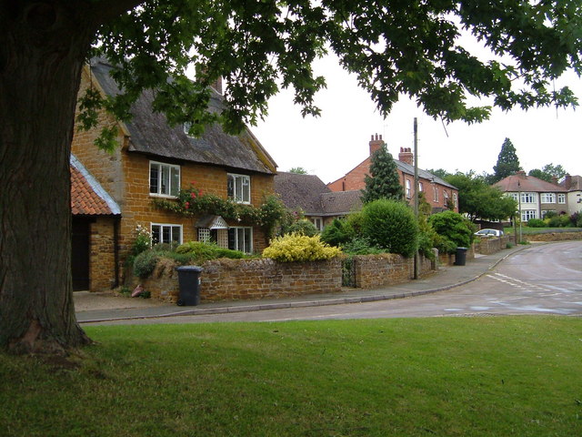
Kislingbury is a picturesque village located in the county of Northamptonshire, England. Situated approximately 4 miles west of the town of Northampton, it is nestled along the banks of the River Nene. With a population of around 1,500 residents, Kislingbury offers a tranquil and rural setting, making it an attractive place to live for those seeking a peaceful lifestyle.
The village boasts a rich history, with records dating back to the Domesday Book of 1086. It is characterized by its charming thatched cottages, historic buildings, and a traditional village green, which serves as a focal point for community gatherings and events. The All Saints' Church, a Grade I listed building with origins dating back to the 12th century, stands proudly in the heart of the village.
Despite its small size, Kislingbury offers a range of amenities to cater to the needs of its residents. These include a primary school, village hall, convenience store, post office, and a couple of local pubs. The village is also well-connected to nearby towns and cities, with regular bus services running to Northampton and other surrounding areas.
The surrounding countryside provides ample opportunities for outdoor activities, such as walking, cycling, and fishing. The nearby Grand Union Canal also offers scenic walks and opportunities for boating enthusiasts. Additionally, Kislingbury benefits from its proximity to the beautiful Althorp Estate, home to the Spencer family and renowned for its stunning gardens and historical significance.
Overall, Kislingbury is a charming village that combines its rich history, natural beauty, and close-knit community to create an idyllic place to live in Northamptonshire.
If you have any feedback on the listing, please let us know in the comments section below.
Kislingbury Images
Images are sourced within 2km of 52.230066/-0.979275 or Grid Reference SP6959. Thanks to Geograph Open Source API. All images are credited.


Kislingbury is located at Grid Ref: SP6959 (Lat: 52.230066, Lng: -0.979275)
Unitary Authority: West Northamptonshire
Police Authority: Northamptonshire
What 3 Words
///copy.valley.mass. Near Kislingbury, Northamptonshire
Nearby Locations
Related Wikis

Kislingbury
Kislingbury is a village in Northamptonshire, England, about 4 miles (6 km) west of Northampton town centre, and close to junctions 15A and 16 of the M1...
Harpole Treasure
The Harpole Treasure is a collection of Anglo-Saxon artefacts excavated at a bed burial discovered in spring 2022 in Harpole, Northamptonshire, England...
Harpole
Harpole is a village 4 miles (6.4 km) west of Northampton, England, along the A4500 road (formerly the A45) about 1 mile (1.6 km) east of the M1 Motorway...
Upton, Northamptonshire
Upton is a civil parish north-east of Kislingbury and south-west of Dallington, in Northamptonshire, England about 3.5 miles (6 km) west of Northampton...

St Michael's Church, Upton
St Michael's Church is a redundant Anglican church in Upton, Northamptonshire, England (grid reference SP717602). This was formerly a separate hamlet...
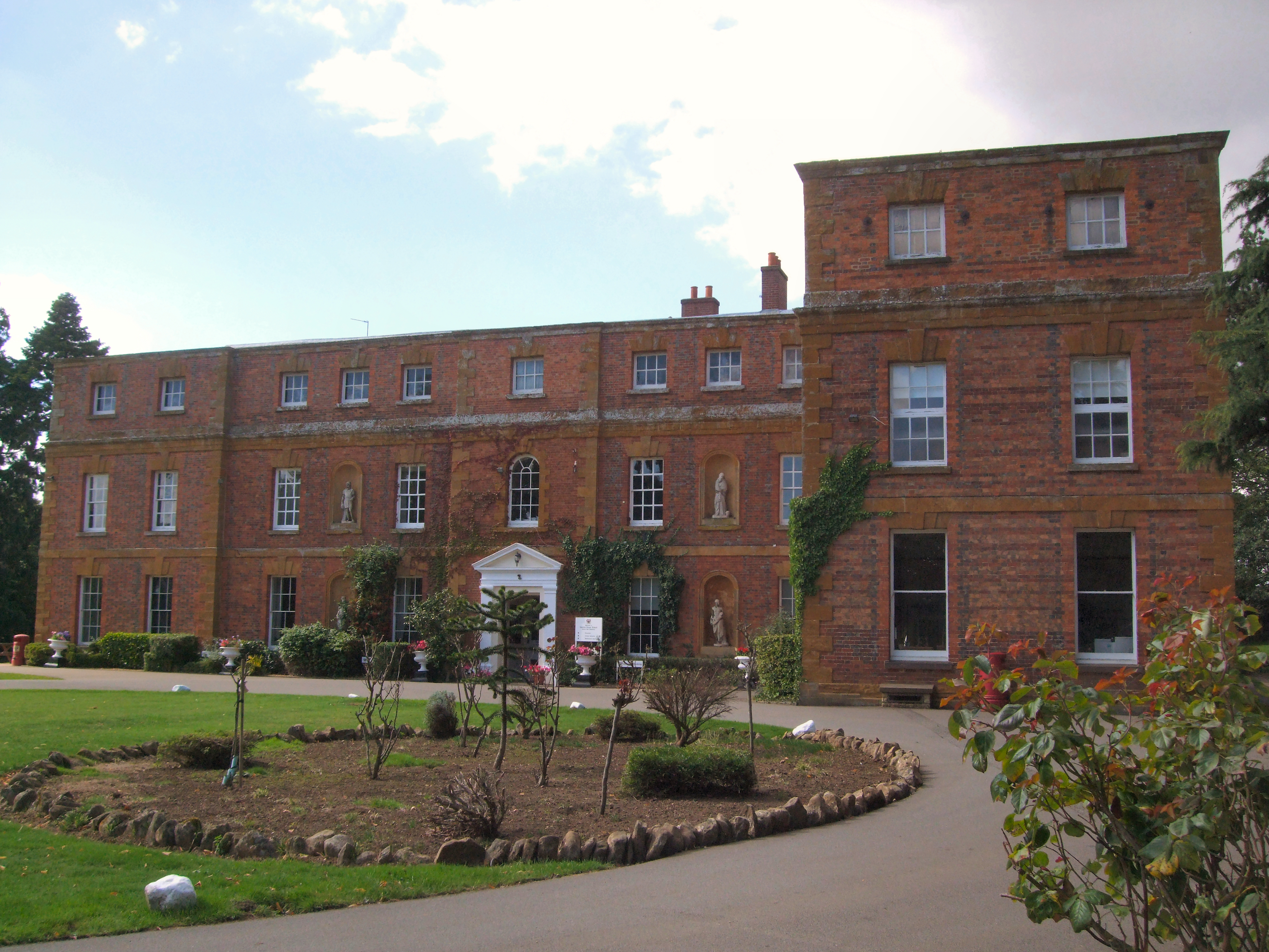
Quinton House School
Quinton House School is a co-educational private school for children aged 2 to 18 years located in Upton, Northampton, England. The school is owned and...
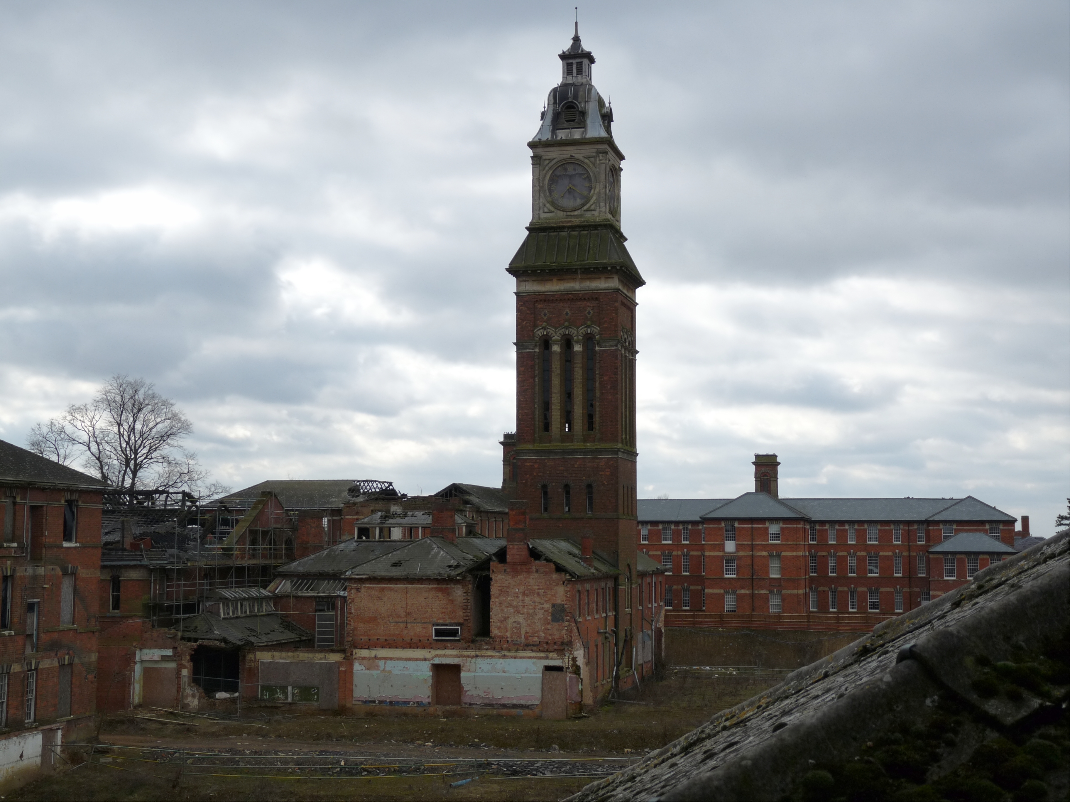
St Crispin's Hospital
St Crispin's Hospital was a large psychiatric facility on the outskirts of Duston village in Northampton, Northamptonshire, England. It was established...
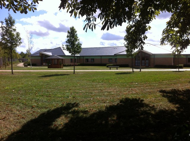
Berrywood Hospital
Berrywood Hospital is a modern psychiatric hospital on the outskirts of Duston, Northampton. It is managed by Northamptonshire Healthcare NHS Foundation...
Nearby Amenities
Located within 500m of 52.230066,-0.979275Have you been to Kislingbury?
Leave your review of Kislingbury below (or comments, questions and feedback).