Beacon Hill
Hill, Mountain in Norfolk Breckland
England
Beacon Hill

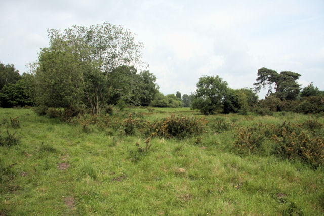
Beacon Hill is a prominent geographic feature located in Norfolk, England. Standing at an impressive height of 103 meters, it is classified as a hill within the region. Nestled in the Norfolk Broads, the hill offers breathtaking panoramic views of the surrounding landscape, making it a popular attraction for locals and tourists alike.
The hill's name originates from its historical significance as a beacon site during the medieval period, where a fire would be lit to warn of impending attacks or danger. Today, the remnants of the beacon can still be seen at the summit, adding to the hill's allure.
Covered in lush greenery, Beacon Hill boasts a diverse range of flora and fauna. The area is known for its rich biodiversity, with various species of plants and animals thriving in the hill's unique microclimate. The hill's slopes are dotted with ancient trees, providing a peaceful and serene environment for visitors to explore.
In addition to its natural beauty, Beacon Hill offers recreational activities for outdoor enthusiasts. Hiking trails crisscross the hill, providing opportunities for leisurely walks or more challenging hikes. The hill is also a popular spot for birdwatchers, as it attracts a wide variety of avian species throughout the year.
Beacon Hill's location in the Norfolk Broads ensures that it is easily accessible to visitors. Whether it's exploring the historical significance, enjoying the stunning views, or immersing oneself in nature, Beacon Hill is a must-visit destination for those seeking an unforgettable experience in Norfolk.
If you have any feedback on the listing, please let us know in the comments section below.
Beacon Hill Images
Images are sourced within 2km of 52.471766/0.95510308 or Grid Reference TM0090. Thanks to Geograph Open Source API. All images are credited.


Beacon Hill is located at Grid Ref: TM0090 (Lat: 52.471766, Lng: 0.95510308)
Administrative County: Norfolk
District: Breckland
Police Authority: Norfolk
What 3 Words
///seaside.onlookers.entire. Near East Harling, Norfolk
Nearby Locations
Related Wikis

Snetterton Circuit
Snetterton Circuit is a motor racing course in Norfolk, England, originally opened in 1953. Owned by Jonathan Palmer's MotorSport Vision organisation,...
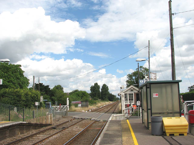
Eccles Road railway station
Eccles Road railway station is on the Breckland line in the east of England, serving the villages of Eccles, Quidenham and Wilby in Norfolk. The line runs...

Snetterton
Snetterton is a village and civil parish in Norfolk, England. The village is about 9 miles (14 km) east-northeast of Thetford and 19 miles (31 km) southwest...

Kenninghall Road Mill, East Harling
Kenninghall Road Mill is a Grade II listed tower mill at East Harling, Norfolk, England which has been converted to residential accommodation. == History... ==
East Harling Common
East Harling Common is a 15.1-hectare (37-acre) biological Site of Special Scientific Interest east of Thetford in Norfolk.The importance of this site...

Wilby, Norfolk
Wilby is a village and former civil parish, 17 miles (27 km) south west of Norwich, now in the parish of Quidenham, in the Breckland district, in the county...

Larling
Larling is a village and former civil parish, now in the parish of Roudham and Larling, in the Breckland district, in the county of Norfolk, England. The...

Quidenham
Quidenham is a small rural village and civil parish in the English county of Norfolk. It covers an area of 22.51 km2 (8.69 sq mi) and had a population...
Related Videos
Did he REALLY.. just Shoot Himself in the LEG?! #shorts
Did he REALLY.. just Shoot Himself in the LEG?! #shorts RIF: Wolverine MTW Filming: @GoPro & @runcamscope2643 Check out ...

He Almost Shot Me in the 🍆😱 #shorts
He Almost Shot Me in the #shorts @HYDEairsoft thanks bro RIF: Wolverine MTW Filming: @GoPro & @runcamscope2643 ...

UNBELIEVABLE Airsoft Shot Can I do it again? #shorts
UNBELIEVABLE Airsoft Shot Can I do it again? #shorts RIF: @WolverineAirsoft Filming: @GoPro & @runcamscope2643 Check ...

Airsoft Human Shield.. why not?! #shorts
Airsoft Human Shield.. why not?! #shorts RIF: MTW Wolverine Filming: @GoPro & @runcamscope2643 Check out other videos on ...
Nearby Amenities
Located within 500m of 52.471766,0.95510308Have you been to Beacon Hill?
Leave your review of Beacon Hill below (or comments, questions and feedback).