Bunker's Hill
Hill, Mountain in Norfolk King's Lynn and West Norfolk
England
Bunker's Hill

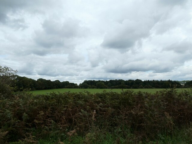
Bunker's Hill, located in Norfolk, is a prominent hill that stands approximately 103 meters (338 feet) above sea level. Situated in the eastern part of the city, it is considered one of the highest points in Norfolk, offering breathtaking panoramic views of the surrounding area. The hill is named after the American Revolutionary War's Battle of Bunker Hill.
Bunker's Hill is covered with lush greenery and is a popular spot for outdoor activities such as hiking and picnicking. The hill's terrain is relatively steep, which provides an added challenge for those who enjoy outdoor adventures. Many visitors also come to Bunker's Hill to witness stunning sunrises and sunsets, as the elevated position allows for unobstructed views.
The hill is well-connected to the rest of Norfolk, with several roads and pathways leading to its summit. There are also designated parking areas for visitors who prefer to drive. Additionally, Bunker's Hill is equipped with basic amenities such as benches and trash bins to ensure a comfortable and clean environment for all visitors.
Apart from its recreational value, Bunker's Hill also holds historical significance. It serves as a reminder of the Battle of Bunker Hill, a decisive moment in the American Revolution. The hill's name pays tribute to the brave soldiers who fought on these grounds.
Overall, Bunker's Hill in Norfolk is a cherished natural landmark that offers both recreational opportunities and a connection to the nation's history. Its elevated position and stunning views make it a must-visit destination for nature enthusiasts and history buffs alike.
If you have any feedback on the listing, please let us know in the comments section below.
Bunker's Hill Images
Images are sourced within 2km of 52.792179/0.60910997 or Grid Reference TF7624. Thanks to Geograph Open Source API. All images are credited.


Bunker's Hill is located at Grid Ref: TF7624 (Lat: 52.792179, Lng: 0.60910997)
Administrative County: Norfolk
District: King's Lynn and West Norfolk
Police Authority: Norfolk
What 3 Words
///minds.takeovers.nobody. Near Grimston, Norfolk
Nearby Locations
Related Wikis
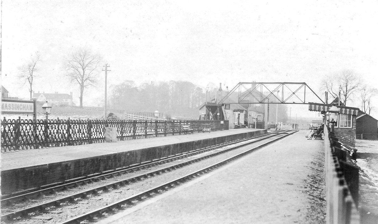
Massingham railway station
Massingham railway station is a now closed railway station in North Norfolk. It was situated at Little Massingham and was on the line between South Lynn...

KL.FM 96.7
KL.FM 96.7 (King's Lynn FM) was an Independent Local Radio station located in King's Lynn, Norfolk, England. It broadcast from a former bank building at...
Little Massingham
Little Massingham is a small village and civil parish in the English county of Norfolk. It is located on the northern boundary of Great Massingham. It...

Harpley, Norfolk
Harpley is a village and civil parish in the English county of Norfolk. It covers an area of 9.29 km2 (3.59 sq mi) and had a population of 353 in 157 households...

Flitcham, Norfolk
Flitcham is a village and civil parish in the English county of Norfolk. The village is located 7.1 miles (11.4 km) north-east of King's Lynn and 33 miles...

Hillington railway station
Hillington railway station was a station in Hillington, Norfolk on the now closed Midland and Great Northern Joint Railway line between South Lynn and...

Great Massingham
Great Massingham is a village and civil parish in the English county of Norfolk. It has a primary school (including a pre-school in the grounds), a village...

Hillington, Norfolk
Hillington is a village and civil parish in the English county of Norfolk. It covers an area of 10.27 km2 (3.97 sq mi) and had a population of 287 in 123...
Have you been to Bunker's Hill?
Leave your review of Bunker's Hill below (or comments, questions and feedback).