Portway Hill

Hill, Mountain in Suffolk West Suffolk

England

Portway Hill

Patterned ground, Lakenheath Road, Mildenhall: aerial 2022 (1)
Patterned ground, Lakenheath Road, Mildenhall: aerial 2022 (1) Credit: Chris

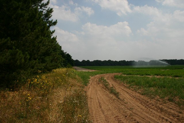
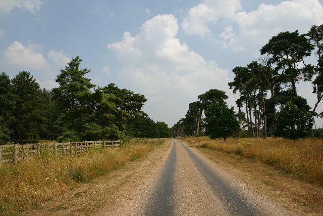
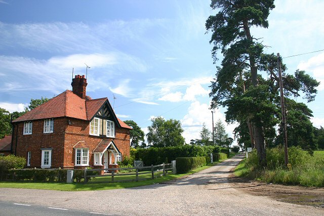
Portway Hill is a prominent hill located in Suffolk, England. Situated in the eastern region of the county, it forms part of the larger Suffolk Hills, which are known for their scenic beauty and rolling landscapes. Despite its name, Portway Hill does not reach the height of a mountain but offers an elevated vantage point that provides sweeping views of the surrounding countryside.

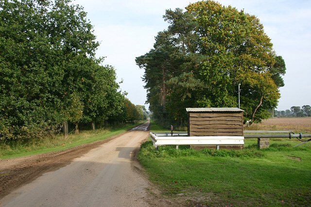
This hill is a popular destination for outdoor enthusiasts and nature lovers, as it offers a range of activities and opportunities to explore the great outdoors. Its well-maintained trails and paths make it easily accessible for hikers and walkers of all abilities. The diverse flora and fauna found in the area further enhance the natural beauty of Portway Hill.

Visitors can expect to encounter a mix of woodland, grassland, and heathland ecosystems while exploring the hill. This variety of habitats supports a wide array of plant and animal species, making it an ideal location for nature enthusiasts to observe and appreciate the local wildlife.

In addition to its natural attractions, Portway Hill also holds historical significance. It is believed to have been used as a trading route during medieval times, serving as a connection between nearby towns and villages. The remnants of ancient footpaths can still be found on the hill, adding a sense of historical charm to the area.

Overall, Portway Hill in Suffolk offers a diverse and picturesque landscape, making it a must-visit destination for those seeking to immerse themselves in nature and experience the beauty of the Suffolk Hills.

If you have any feedback on the listing, please let us know in the comments section below.

Portway Hill Images

Images are sourced within 2km of 52.373999/0.54505113 or Grid Reference TL7378. Thanks to Geograph Open Source API. All images are credited.

Patterned ground, Lakenheath Road, Mildenhall: aerial 2022 (1)
Patterned ground, Lakenheath Road, Mildenhall: aerial 2022 (2)
B1112 by Foxhole Heath
Field entrance near Chamberlain's Buildings Farm Looking east from the B1112.
Field entrance near Chamberlain's Buildings Farm
Looking east from the B1112.
B1112 at Foxhole Heath The road snakes across typical Breckland country.
B1112 at Foxhole Heath
The road snakes across typical Breckland country.
Private track to Rakeheath Farm This track leads eastwards across open heathland towards Rakeheath and Rakebottom Farms.
Private track to Rakeheath Farm
This track leads eastwards across open heathland towards Rakeheath and Rakebottom Farms.
Eriswell Church Unusual cone-shaped yews line the churchyard at the rear of St Lawrence Church.
Eriswell Church
Unusual cone-shaped yews line the churchyard at the rear of St Lawrence Church.
Footpath to Eriswell The village of Eriswell is just over the crest of this rise.
Footpath to Eriswell
The village of Eriswell is just over the crest of this rise.
Cut-off Channel The old maps call this Eriswell Lode, which is more evocative than 'Cut-off Channel' as shown on modern maps.  Looking south from the bridge carrying the road from RAF Lakenheath to Holywell Row.
Cut-off Channel
The old maps call this Eriswell Lode, which is more evocative than 'Cut-off Channel' as shown on modern maps. Looking south from the bridge carrying the road from RAF Lakenheath to Holywell Row.
Cut-off Channel The former Eriswell Lode, looking north from the bridge carrying the road from RAF Lakenheath to Holywell Row.
Cut-off Channel
The former Eriswell Lode, looking north from the bridge carrying the road from RAF Lakenheath to Holywell Row.
Track to Codson Hill This track leads eastwards from the A1065, north of Mildenhall.
Track to Codson Hill
This track leads eastwards from the A1065, north of Mildenhall.
Uncultivated field near Mildenhall This field lies to the west of the A1065, two kilometres north of Mildenhall.
Uncultivated field near Mildenhall
This field lies to the west of the A1065, two kilometres north of Mildenhall.
Track to High Lodge This private track leads eastwards from the A1065 to High Lodge on the Elveden Estate.
Track to High Lodge
This private track leads eastwards from the A1065 to High Lodge on the Elveden Estate.
Water towers, RAF Lakenheath These waters towers are just inside the eastern perimeter fence of RAF Lakenheath, the US Air Force base in North Suffolk.
Water towers, RAF Lakenheath
These waters towers are just inside the eastern perimeter fence of RAF Lakenheath, the US Air Force base in North Suffolk.
Blocked road, RAF Lakenheath Although the 30 MPH sign still exists, access to the US Air Force base along this public road is denied.
Blocked road, RAF Lakenheath
Although the 30 MPH sign still exists, access to the US Air Force base along this public road is denied.
Sand and gravel dump This track leads to an area where sand and gravel is stored, close to the US Air Force base at RAF Lakenheath.
Sand and gravel dump
This track leads to an area where sand and gravel is stored, close to the US Air Force base at RAF Lakenheath.
Track to Cranhouse Farm Part of the Elveden Estate, this private track leads to several farms. The role of the hut is unknown, but it may be a weather station.
Track to Cranhouse Farm
Part of the Elveden Estate, this private track leads to several farms. The role of the hut is unknown, but it may be a weather station.
Field near Cranhouse Farm This field is part of the huge Elveden Estate, one of England's largest farming estates.
Field near Cranhouse Farm
This field is part of the huge Elveden Estate, one of England's largest farming estates.
Show me another place!

Portway Hill is located at Grid Ref: TL7378 (Lat: 52.373999, Lng: 0.54505113)

Administrative County: Suffolk

District: West Suffolk

Police Authority: Suffolk

What 3 Words

///violin.thing.unclaimed. Near Mildenhall, Suffolk

Nearby Locations

Portway Hill

Related Wikis

Foxhole Heath

Foxhole Heath is an 85.2-hectare (211-acre) biological Site of Special Scientific Interest east of Eriswell in Suffolk. It is a Nature Conservation Review...

Eriswell

Eriswell is a village and civil parish of West Suffolk in the English county of Suffolk. About forty scattered archaeological finds have been made here...

Eriswell Low Warren

Eriswell Low Warren is a 7.4-hectare (18-acre) biological Site of Special Scientific Interest north-east of Eriswell in Suffolk. It is a Nature Conservation...

Lordswell Field

Lordswell Field or Lord's Well Field is a 3.2-hectare (7.9-acre) biological Site of Special Scientific Interest in Eriswell in Suffolk. It is a Nature...

Nearby Amenities

Located within 500m of 52.373999,0.54505113
Power: pole
Lat/Long: 52.3716054/0.5388476
Power: pole
Lat/Long: 52.3700122/0.5417736
Power: pole
Lat/Long: 52.3708506/0.540229
Power: pole
Lat/Long: 52.3761739/0.5437103
Power: pole
Lat/Long: 52.3747774/0.5387802
Power: pole
Lat/Long: 52.3752652/0.5410416
Power: pole
Lat/Long: 52.3757368/0.5421466
Power: pole
Lat/Long: 52.3752915/0.540588
Power: pole
Lat/Long: 52.3775576/0.5488012
The data included in this document is from www.openstreetmap.org. The data is made available under ODbL.

Have you been to Portway Hill?

Leave your review of Portway Hill below (or comments, questions and feedback).