Harts Hill

Hill, Mountain in Kent Gravesham

England

Harts Hill

Byway through woods near Ashenbank Pond
Byway through woods near Ashenbank Pond Credit: David Martin

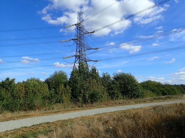
Harts Hill is a prominent hill located in the county of Kent, England. Situated near the village of Hartley, it stands at an impressive height of approximately 201 meters (660 feet) above sea level. The hill is part of the North Downs, a range of chalk hills that stretches across southern England.

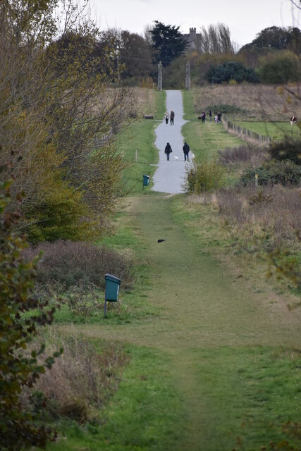
Harts Hill offers breathtaking panoramic views of the surrounding countryside, making it a popular destination for hikers, nature enthusiasts, and photographers. On a clear day, visitors can enjoy vistas that extend as far as the Thames Estuary and the Isle of Sheppey.

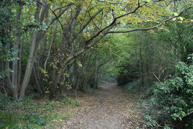
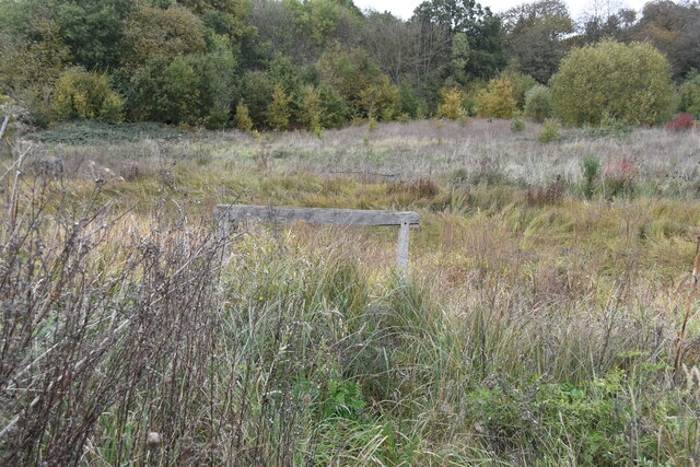
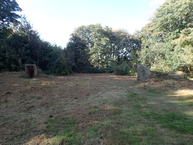
The hill is covered in a diverse range of flora and fauna, with its slopes adorned with wildflowers, including bluebells and primroses, during the spring months. It also provides a habitat for various bird species, such as skylarks and kestrels, which can often be spotted soaring above.

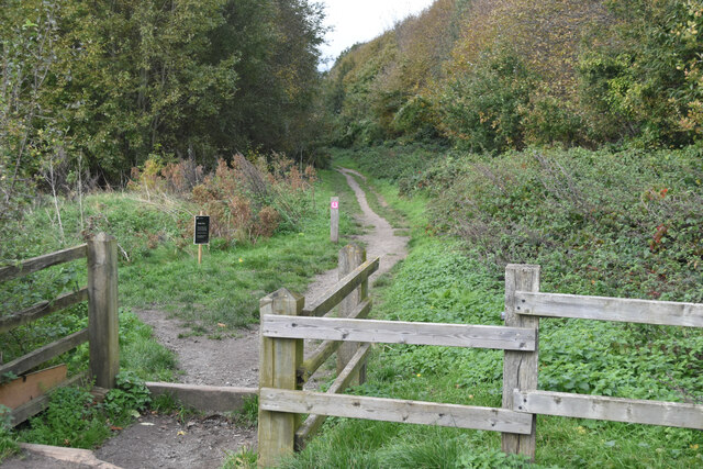
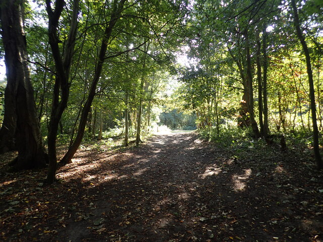
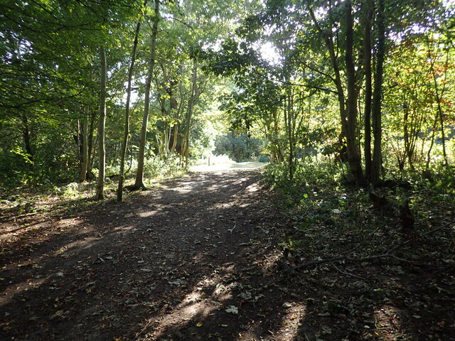
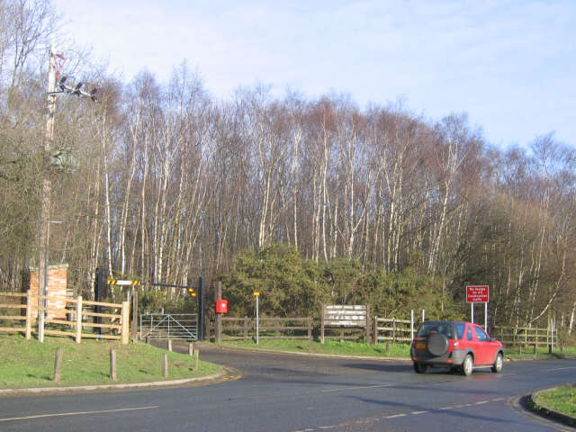
There are several footpaths and trails that lead up to Harts Hill, allowing visitors to explore its natural beauty. The hill is easily accessible and is a favorite spot for locals and tourists alike, seeking a peaceful escape from the hustle and bustle of daily life.

Overall, Harts Hill stands as a notable landmark in Kent, offering stunning views, rich biodiversity, and a tranquil atmosphere for those who venture to its summit.

If you have any feedback on the listing, please let us know in the comments section below.
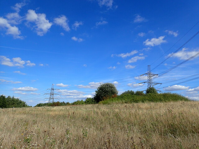
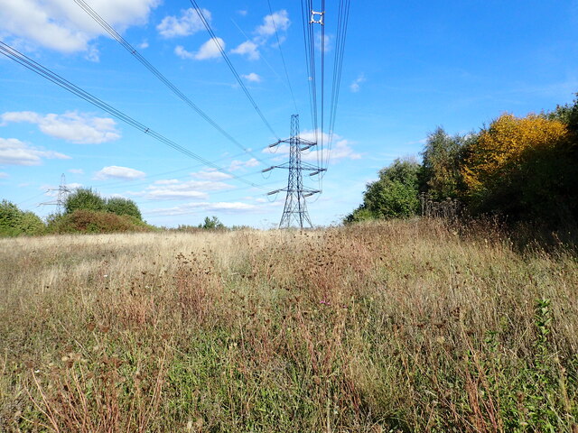
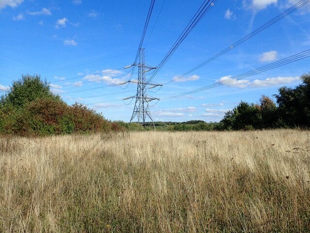
Harts Hill Images

Images are sourced within 2km of 51.411362/0.41081124 or Grid Reference TQ6770. Thanks to Geograph Open Source API. All images are credited.

Byway through woods near Ashenbank Pond
Overgrown Ashenbank Pond The wooden rail marks the end of a small jetty.  No water was visible from outside the fenced enclosure.
Overgrown Ashenbank Pond
The wooden rail marks the end of a small jetty. No water was visible from outside the fenced enclosure.
Long straight path in Jeskyns Community Woodland The tower of Cobham Church can be seen on the horizon.
Long straight path in Jeskyns Community Woodland
The tower of Cobham Church can be seen on the horizon.
Horse Trail in Jeskyns Community Woodland
Car park at Jeskyns Community Woodland
Grassland in Jeskyns Community Woodland Jeskyns is a brand new country park created by the Forestry Commission as part of the Thames Gateway from 2006 onwards. It lies between the Channel Tunnel Rail Link and Cobham, and consists of 360 acres of grassland, 130,000 trees, wildflower meadows and orchards, as well as ponds. It partly replaced two large chalk pits of dumped rubbish. There are also a number of attractions for children, dog exercise areas and a cafe.

See <span class="nowrap"><a title="www.forestryengland.uk/jeskyns" rel="nofollow ugc noopener" href="http://www.forestryengland.uk/jeskyns">Link</a><img style="margin-left:2px;" alt="External link" title="External link - shift click to open in new window" src="https://s1.geograph.org.uk/img/external.png" width="10" height="10"/></span> for more information.
Grassland in Jeskyns Community Woodland
Jeskyns is a brand new country park created by the Forestry Commission as part of the Thames Gateway from 2006 onwards. It lies between the Channel Tunnel Rail Link and Cobham, and consists of 360 acres of grassland, 130,000 trees, wildflower meadows and orchards, as well as ponds. It partly replaced two large chalk pits of dumped rubbish. There are also a number of attractions for children, dog exercise areas and a cafe. See LinkExternal link for more information.
Path in Jeskyns Community Woodland Jeskyns is a brand new country park created by the Forestry Commission as part of the Thames Gateway from 2006 onwards. It lies between the Channel Tunnel Rail Link and Cobham, and consists of 360 acres of grassland, 130,000 trees, wildflower meadows and orchards, as well as ponds. It partly replaced two large chalk pits of dumped rubbish. There are also a number of attractions for children, dog exercise areas and a cafe.

See <span class="nowrap"><a title="www.forestryengland.uk/jeskyns" rel="nofollow ugc noopener" href="http://www.forestryengland.uk/jeskyns">Link</a><img style="margin-left:2px;" alt="External link" title="External link - shift click to open in new window" src="https://s1.geograph.org.uk/img/external.png" width="10" height="10"/></span> for more information.
Path in Jeskyns Community Woodland
Jeskyns is a brand new country park created by the Forestry Commission as part of the Thames Gateway from 2006 onwards. It lies between the Channel Tunnel Rail Link and Cobham, and consists of 360 acres of grassland, 130,000 trees, wildflower meadows and orchards, as well as ponds. It partly replaced two large chalk pits of dumped rubbish. There are also a number of attractions for children, dog exercise areas and a cafe. See LinkExternal link for more information.
Grassland in Jeskyns Community Woodland Jeskyns is a brand new country park created by the Forestry Commission as part of the Thames Gateway from 2006 onwards. It lies between the Channel Tunnel Rail Link and Cobham, and consists of 360 acres of grassland, 130,000 trees, wildflower meadows and orchards, as well as ponds. It partly replaced two large chalk pits of dumped rubbish. There are also a number of attractions for children, dog exercise areas and a cafe.

See <span class="nowrap"><a title="www.forestryengland.uk/jeskyns" rel="nofollow ugc noopener" href="http://www.forestryengland.uk/jeskyns">Link</a><img style="margin-left:2px;" alt="External link" title="External link - shift click to open in new window" src="https://s1.geograph.org.uk/img/external.png" width="10" height="10"/></span> for more information.
Grassland in Jeskyns Community Woodland
Jeskyns is a brand new country park created by the Forestry Commission as part of the Thames Gateway from 2006 onwards. It lies between the Channel Tunnel Rail Link and Cobham, and consists of 360 acres of grassland, 130,000 trees, wildflower meadows and orchards, as well as ponds. It partly replaced two large chalk pits of dumped rubbish. There are also a number of attractions for children, dog exercise areas and a cafe. See LinkExternal link for more information.
Pylon in Jeskyns Community Woodland Jeskyns is a brand new country park created by the Forestry Commission as part of the Thames Gateway from 2006 onwards. It lies between the Channel Tunnel Rail Link and Cobham, and consists of 360 acres of grassland, 130,000 trees, wildflower meadows and orchards, as well as ponds. It partly replaced two large chalk pits of dumped rubbish. There are also a number of attractions for children, dog exercise areas and a cafe.

See <span class="nowrap"><a title="www.forestryengland.uk/jeskyns" rel="nofollow ugc noopener" href="http://www.forestryengland.uk/jeskyns">Link</a><img style="margin-left:2px;" alt="External link" title="External link - shift click to open in new window" src="https://s1.geograph.org.uk/img/external.png" width="10" height="10"/></span> for more information.
Pylon in Jeskyns Community Woodland
Jeskyns is a brand new country park created by the Forestry Commission as part of the Thames Gateway from 2006 onwards. It lies between the Channel Tunnel Rail Link and Cobham, and consists of 360 acres of grassland, 130,000 trees, wildflower meadows and orchards, as well as ponds. It partly replaced two large chalk pits of dumped rubbish. There are also a number of attractions for children, dog exercise areas and a cafe. See LinkExternal link for more information.
Path in Ashenbank Wood The northern part of Ashenbank Wood here is owned by the Woodland Trust whilst the southern part is in private ownership. A small part of Ashenbank Wood was lost when the Channel Tunnel Rail Link was built to the north. The striking features of Ashenbank Wood are the numerous veteran trees and pollards. Ashenbank Wood is also well known for its prolific shows of bluebell and wood anemone throughout the site in the spring.
Path in Ashenbank Wood
The northern part of Ashenbank Wood here is owned by the Woodland Trust whilst the southern part is in private ownership. A small part of Ashenbank Wood was lost when the Channel Tunnel Rail Link was built to the north. The striking features of Ashenbank Wood are the numerous veteran trees and pollards. Ashenbank Wood is also well known for its prolific shows of bluebell and wood anemone throughout the site in the spring.
Entrances to underground air raid shelters in Ashenbank Wood The northern part of Ashenbank Wood here is owned by the Woodland Trust whilst the southern part is in private ownership. A small part of Ashenbank Wood was lost when the Channel Tunnel Rail Link was built to the north. The striking features of Ashenbank Wood are the numerous veteran trees and pollards. Ashenbank Wood is also well known for its prolific shows of bluebell and wood anemone throughout the site in the spring.

Three RAF camps known as Camps 1, 4 and 5 were constructed in Ashenbank Wood following the outbreak of the Second World War when Gravesend Airport was requisitioned by the Air Ministry to become a satellite station for Biggin Hill. There were 76 structures within the camps including three officers' barracks, but the remains of Camps 1 and 4 were lost to the Channel Tunnel Rail Link. However, there are still four underground air raid shelters on the site and the entrance to two of them can be seen here. There is also an information board - see <a title="www.geograph.org.uk/photo/7603082" href="https://www.geograph.org.uk/photo/7603082">Link</a>
Entrances to underground air raid shelters in Ashenbank Wood
The northern part of Ashenbank Wood here is owned by the Woodland Trust whilst the southern part is in private ownership. A small part of Ashenbank Wood was lost when the Channel Tunnel Rail Link was built to the north. The striking features of Ashenbank Wood are the numerous veteran trees and pollards. Ashenbank Wood is also well known for its prolific shows of bluebell and wood anemone throughout the site in the spring. Three RAF camps known as Camps 1, 4 and 5 were constructed in Ashenbank Wood following the outbreak of the Second World War when Gravesend Airport was requisitioned by the Air Ministry to become a satellite station for Biggin Hill. There were 76 structures within the camps including three officers' barracks, but the remains of Camps 1 and 4 were lost to the Channel Tunnel Rail Link. However, there are still four underground air raid shelters on the site and the entrance to two of them can be seen here. There is also an information board - see Link
Information board in Ashenbank Wood The northern part of Ashenbank Wood here is owned by the Woodland Trust whilst the southern part is in private ownership. A small part of Ashenbank Wood was lost when the Channel Tunnel Rail Link was built to the north. The striking features of Ashenbank Wood are the numerous veteran trees and pollards. Ashenbank Wood is also well known for its prolific shows of bluebell and wood anemone throughout the site in the spring.

The entrance to two of the air raid shelters can be seen at <a title="www.geograph.org.uk/photo/7603079" href="https://www.geograph.org.uk/photo/7603079">Link</a>
Information board in Ashenbank Wood
The northern part of Ashenbank Wood here is owned by the Woodland Trust whilst the southern part is in private ownership. A small part of Ashenbank Wood was lost when the Channel Tunnel Rail Link was built to the north. The striking features of Ashenbank Wood are the numerous veteran trees and pollards. Ashenbank Wood is also well known for its prolific shows of bluebell and wood anemone throughout the site in the spring. The entrance to two of the air raid shelters can be seen at Link
Entrance to underground air raid shelter in Ashenbank Wood The northern part of Ashenbank Wood here is owned by the Woodland Trust whilst the southern part is in private ownership. A small part of Ashenbank Wood was lost when the Channel Tunnel Rail Link was built to the north. The striking features of Ashenbank Wood are the numerous veteran trees and pollards. Ashenbank Wood is also well known for its prolific shows of bluebell and wood anemone throughout the site in the spring.

Three RAF camps known as Camps 1, 4 and 5 were constructed in Ashenbank Wood following the outbreak of the Second World War when Gravesend Airport was requisitioned by the Air Ministry to become a satellite station for Biggin Hill. There were 76 structures within the camps including three officers' barracks, but the remains of Camps 1 and 4 were lost to the Channel Tunnel Rail Link. However, there are still four underground air raid shelters on the site and the entrance to one of them can be seen here. There is also an information board - see <a title="www.geograph.org.uk/photo/7603082" href="https://www.geograph.org.uk/photo/7603082">Link</a>
Entrance to underground air raid shelter in Ashenbank Wood
The northern part of Ashenbank Wood here is owned by the Woodland Trust whilst the southern part is in private ownership. A small part of Ashenbank Wood was lost when the Channel Tunnel Rail Link was built to the north. The striking features of Ashenbank Wood are the numerous veteran trees and pollards. Ashenbank Wood is also well known for its prolific shows of bluebell and wood anemone throughout the site in the spring. Three RAF camps known as Camps 1, 4 and 5 were constructed in Ashenbank Wood following the outbreak of the Second World War when Gravesend Airport was requisitioned by the Air Ministry to become a satellite station for Biggin Hill. There were 76 structures within the camps including three officers' barracks, but the remains of Camps 1 and 4 were lost to the Channel Tunnel Rail Link. However, there are still four underground air raid shelters on the site and the entrance to one of them can be seen here. There is also an information board - see Link
CTRL and A2 at Shorne The CTRL (Channel Tunnel Rail Link) running parallel to the A2 at the (road) junction for Shorne and Cobham.
CTRL and A2 at Shorne
The CTRL (Channel Tunnel Rail Link) running parallel to the A2 at the (road) junction for Shorne and Cobham.
Entrance to Shorne Wood Country Park
Show me another place!

Harts Hill is located at Grid Ref: TQ6770 (Lat: 51.411362, Lng: 0.41081124)

Administrative County: Kent

District: Gravesham

Police Authority: Kent

What 3 Words

///from.jaws.tile. Near Gravesend, Kent

Related Wikis

Thong, Kent

Thong is a hamlet southeast of Gravesend in Kent, England. The population of the hamlet is included in the civil parish of Shorne. It has frequently been...

Gravesham

Gravesham ( GRAYV-shəm) is a local government district with borough status in north-west Kent, England. The council is based in its largest town of Gravesend...

Shorne and Ashenbank Woods

Shorne and Ashenbank Woods is a 197.4-hectare (488-acre) biological Site of Special Scientific Interest between Rochester and Gravesend in Kent. Part of...

Shorne Wood Country Park

Shorne Wood Country Park is located between Strood and Gravesend, in the English county of Kent. It was once part of a large estate, later passed to the...

Gravesend Airport

Gravesend Airport, located 2.5 miles (4.0 km) south-east of Gravesend town centre, Kent and 7.0 miles (11.3 km) west of Rochester. It was operated from...

Shorne

Shorne is a village and civil parish in the borough of Gravesham in Kent, England. The parish lies 3 miles (4.8 km) east of Gravesend. Most of the land...

Thamesview School

Thamesview School is a coeducational foundation high school and sixth form, located in Gravesend in the English county of Kent.It is administered by Kent...

Jeskyns

Jeskyns is a park near Cobham, in Kent, England. A former farm, it was reopened as a large open-space recreational area in 2007, with areas being developed...

Nearby Amenities

Located within 500m of 51.411362,0.41081124
Thong
Is In: Shorne
Place: hamlet
Wikidata: Q3308342
Lat/Long: 51.4092234/0.4047326
Bench
Ele: 96
Lat/Long: 51.4082914/0.4111887
Artwork Type: sculpture
Note: Statue of Hand Holding A Flint
Tourism: artwork
Lat/Long: 51.4086369/0.4114968
Barrier: kissing_gate
Lat/Long: 51.40763/0.4099827
Ele: 87
Lat/Long: 51.4076651/0.4100515
Ele: 93
Lat/Long: 51.408195/0.4110213
Ele: 98
Lat/Long: 51.40828/0.4112167
Barrier: kissing_gate
Lat/Long: 51.409411/0.4113298
Harts Hill
Source: OS_OpenData_StreetView
Lat/Long: 51.4139475/0.4106557
Barrier: kissing_gate
Lat/Long: 51.4118009/0.4169845
Post Box
Operator: Royal Mail
Post Box Type: lamp
Ref: DA12 86D
Lat/Long: 51.4096073/0.4042169
Colour: red and white
Marker: aerial
Material: plastic
Utility: gas
Lat/Long: 51.4130369/0.4061713
The data included in this document is from www.openstreetmap.org. The data is made available under ODbL.

Have you been to Harts Hill?

Leave your review of Harts Hill below (or comments, questions and feedback).