Buckland Hill

Hill, Mountain in Sussex Wealden

England

Buckland Hill

Sussex Border Path Sussex border path and public footpath between Bewl Water and approaching Cousley Wood Road, near to the Vine pub.
Sussex Border Path Credit: Oast House Archive

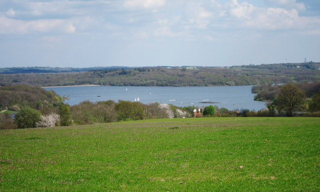
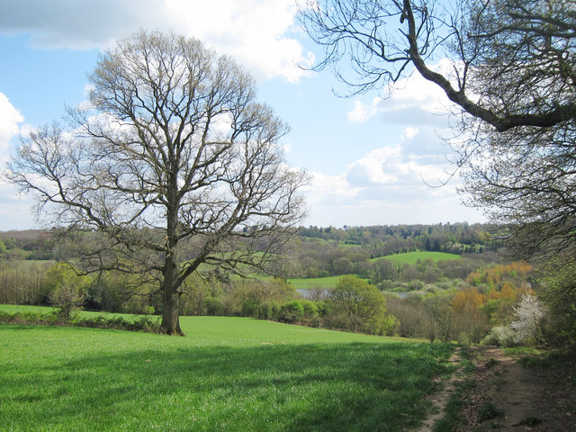
Buckland Hill, also known as Buckland Beacon, is a prominent hill located in the county of Sussex, England. Situated in the South Downs National Park, it rises to an elevation of approximately 242 meters (794 feet) and offers breathtaking panoramic views of the surrounding countryside.

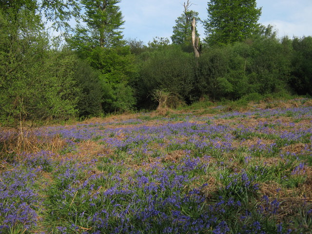
The hill is part of a range of chalk hills that stretches across the southern coast of England, known as the South Downs. Buckland Hill is notable for its distinctive shape, with a rounded summit and sloping sides covered in lush grass and patches of woodland.

At the top of Buckland Hill stands Buckland Beacon, a historic landmark that has been a site of importance for centuries. The beacon was originally built as a communication signal during the Napoleonic Wars in the early 19th century. It served as a way to quickly transmit messages across long distances, alerting nearby towns and villages of potential threats or news.

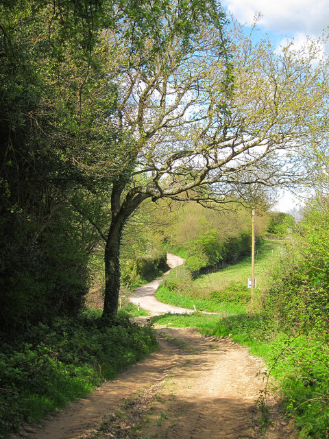
Today, Buckland Beacon is a popular destination for hikers, walkers, and nature enthusiasts. The hill offers a variety of footpaths and trails that lead visitors through the picturesque landscape, allowing them to explore the area's natural beauty and enjoy the stunning views from the summit.

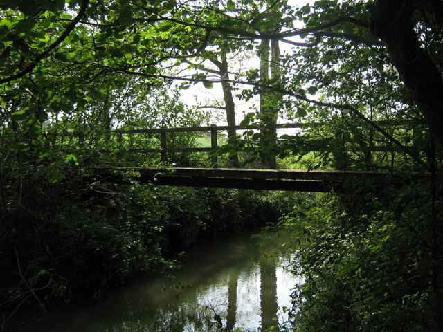
In addition to its natural and historical significance, Buckland Hill is also home to a diverse range of wildlife. The surrounding area provides habitats for various species of birds, butterflies, and wildflowers, making it a haven for nature lovers.

Overall, Buckland Hill in Sussex is a captivating destination that combines natural beauty, historical interest, and recreational opportunities, making it a must-visit location for both locals and tourists alike.

If you have any feedback on the listing, please let us know in the comments section below.

Buckland Hill Images

Images are sourced within 2km of 51.081243/0.35172742 or Grid Reference TQ6433. Thanks to Geograph Open Source API. All images are credited.

Sussex Border Path Sussex border path and public footpath between Bewl Water and approaching Cousley Wood Road, near to the Vine pub.
Sussex Border Path
Sussex border path and public footpath between Bewl Water and approaching Cousley Wood Road, near to the Vine pub.
Butts Lane Dead end lane to Little Butts Farm.
Butts Lane
Dead end lane to Little Butts Farm.
View to Bewl Water Reservoir Looking from the Sussex Border Path towards the reservoir. Little Butts Farm at the end of the field. The dam of the reservoir just seen to the left.
View to Bewl Water Reservoir
Looking from the Sussex Border Path towards the reservoir. Little Butts Farm at the end of the field. The dam of the reservoir just seen to the left.
Countryside around Bewl Water View from the Sussex Border Path, from Cousley Wood Road towards Bewl Water, which is just seen beyond the trees.
Countryside around Bewl Water
View from the Sussex Border Path, from Cousley Wood Road towards Bewl Water, which is just seen beyond the trees.
Sussex Border Path From Cousley Wood Road down to Bewl Water
Sussex Border Path
From Cousley Wood Road down to Bewl Water
Tree by the Sussex Border Path The Sussex Border Path is a footpath route nearly 150 miles long around the inland boundary of the county of Sussex. The county owes its origins to the kingdom of the South Saxons and can claim to have one of the longest inland county boundaries from Emsworth to Rye. The route was devised in 1983 and is well signed along most of the route. Website <span class="nowrap"><a title="http://www.sussexborderpath.co.uk/" rel="nofollow ugc noopener" href="http://www.sussexborderpath.co.uk/">Link</a><img style="margin-left:2px;" alt="External link" title="External link - shift click to open in new window" src="https://s1.geograph.org.uk/img/external.png" width="10" height="10"/></span> 
Map: <a title="https://www.geograph.org.uk/search.php?i=40140109&page=1&displayclass=map#i=40140109&page=1&displayclass=map&zoom=2&lat=51.03263&lon=-0.05427&layers=FTTB00000000000T" href="https://www.geograph.org.uk/search.php?i=40140109&page=1&displayclass=map#i=40140109&page=1&displayclass=map&zoom=2&lat=51.03263&lon=-0.05427&layers=FTTB00000000000T">Link</a>
Tree by the Sussex Border Path
The Sussex Border Path is a footpath route nearly 150 miles long around the inland boundary of the county of Sussex. The county owes its origins to the kingdom of the South Saxons and can claim to have one of the longest inland county boundaries from Emsworth to Rye. The route was devised in 1983 and is well signed along most of the route. Website LinkExternal link Map: Link
Damselfly near Hook Green Beside a footpath near B2169 Bayham Road, on a private hedge.
A female Beautiful Demoiselle, (Calopteryx virgo).

See <span class="nowrap"><a title="http://en.wikipedia.org/wiki/Beautiful_Demoiselle" rel="nofollow ugc noopener" href="http://en.wikipedia.org/wiki/Beautiful_Demoiselle">Link</a><img style="margin-left:2px;" alt="External link" title="External link - shift click to open in new window" src="https://s1.geograph.org.uk/img/external.png" width="10" height="10"/></span> for more details.
My first of the year!
Damselfly near Hook Green
Beside a footpath near B2169 Bayham Road, on a private hedge. A female Beautiful Demoiselle, (Calopteryx virgo). See LinkExternal link for more details. My first of the year!
Sluice Wood Stream This stream leads from Puxty Wood near Wadhurst, past Brick Kiln Wood, then it leads through Sluice Wood via two streams, before leading towards Bayham Abbey.
Sluice Wood Stream
This stream leads from Puxty Wood near Wadhurst, past Brick Kiln Wood, then it leads through Sluice Wood via two streams, before leading towards Bayham Abbey.
Footbridge in Sluice Wood This bridge is used by a footpath heading right towards the A2169 Bayham Road, or left towards Wickhurst Farm.
Footbridge in Sluice Wood
This bridge is used by a footpath heading right towards the A2169 Bayham Road, or left towards Wickhurst Farm.
Footbridge in Sluice Wood (2) This bridge is used by a footpath heading right towards the A2169 Bayham Road, or left towards Wickhurst Farm. It heads over a stream in the wood.
Footbridge in Sluice Wood (2)
This bridge is used by a footpath heading right towards the A2169 Bayham Road, or left towards Wickhurst Farm. It heads over a stream in the wood.
Footpath towards Wickhurst Farm A path leads from the B2169 Bayham Road, past Sluice Wood and towards the farm before heading towards Buss's Green.
Footpath towards Wickhurst Farm
A path leads from the B2169 Bayham Road, past Sluice Wood and towards the farm before heading towards Buss's Green.
Footpath past Gage's Wood A path leads from the A2169 Bayham Road, past Wickhurst Farm and then onwards along this track towards Buss's Green.
Gage's Wood is on the left, Wickhurst Wood is on the right.
Footpath past Gage's Wood
A path leads from the A2169 Bayham Road, past Wickhurst Farm and then onwards along this track towards Buss's Green. Gage's Wood is on the left, Wickhurst Wood is on the right.
Tank Cottages On Bartley Mill Road.
Tank Cottages
On Bartley Mill Road.
Footpath near Brick Kiln Wood A path leads from Bartley Mill Road, along a farm track and then it heads right into the wood, heading towards Great Shoesmith Farm.
Footpath near Brick Kiln Wood
A path leads from Bartley Mill Road, along a farm track and then it heads right into the wood, heading towards Great Shoesmith Farm.
Footpath in Brick Kiln Wood A path leads from Great Shoesmith Farm, through the wood, heading towards Bartley Mill Road .

This section of the path was very muddy, even though it has been dry for the last week.
Footpath in Brick Kiln Wood
A path leads from Great Shoesmith Farm, through the wood, heading towards Bartley Mill Road . This section of the path was very muddy, even though it has been dry for the last week.
Bluebells in Sluice Wood As seen from a footpath passing through the wood towards Bartley Mill Road.
Bluebells in Sluice Wood
As seen from a footpath passing through the wood towards Bartley Mill Road.
Footpath junction in Brick Kiln Wood A footpath from Great Shoesmith Farm, leads right through the wood towards Bartley Mill Road. The permissive path leads left along a woodland stream, before rejoining the footpath.
Footpath junction in Brick Kiln Wood
A footpath from Great Shoesmith Farm, leads right through the wood towards Bartley Mill Road. The permissive path leads left along a woodland stream, before rejoining the footpath.
Footbridge near Brick Kiln Wood A footpath leads from Bartley Mill Road, through Brick Kiln wood and then over a stream towards a field near Great Shoesmith Farm.
Footbridge near Brick Kiln Wood
A footpath leads from Bartley Mill Road, through Brick Kiln wood and then over a stream towards a field near Great Shoesmith Farm.
Show me another place!

Buckland Hill is located at Grid Ref: TQ6433 (Lat: 51.081243, Lng: 0.35172742)

Administrative County: East Sussex

District: Wealden

Police Authority: Sussex

What 3 Words

///rail.midfield.anchors. Near Wadhurst, East Sussex

Related Wikis

Rehoboth Chapel, Pell Green

Rehoboth Chapel is a former Strict Baptist place of worship in the hamlet of Pell Green in East Sussex, England. Pell Green is in the parish of Wadhurst...

Wadhurst

Wadhurst is a market town in East Sussex, England. It is the centre of the civil parish of Wadhurst, which also includes the hamlets of Cousley Wood and...
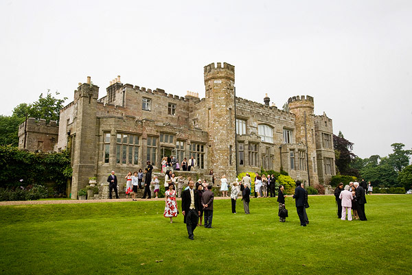
Wadhurst Castle

Wadhurst Castle is a 19th-century castellated mansion just to the west of the town of Wadhurst, East Sussex, England, in an elevated position overlooking...

Bewl Bridge Rowing Club

Bewl Bridge Rowing Club is a rowing club on the Bewl Water, based at Bewlbridge Lane, Lamberhurst, Wadhurst, Tunbridge Wells. Rowers aged 12 and upwards...

Uplands Academy

Uplands Academy (formerly Uplands Community College) is a coeducational secondary school and sixth form located in Wadhurst, East Sussex, England. ��2...

Bayham Old Abbey

Bayham Old Abbey is an English Heritage property, located near Lamberhurst, Kent, England. Founded c. 1208 through a combination of the failing Premonstratensian...

Wadhurst railway station

Wadhurst railway station is on the Hastings line in the south of England and serves the town of Wadhurst, East Sussex. It is 39 miles 23 chains (63.2 km...

Bewl Water

Bewl Water is a reservoir in the valley of the River Bewl, straddling the boundary between Kent and East Sussex in England. It is about 2 miles (3.2 km...

Nearby Amenities

Located within 500m of 51.081243,0.35172742
The data included in this document is from www.openstreetmap.org. The data is made available under ODbL.

Have you been to Buckland Hill?

Leave your review of Buckland Hill below (or comments, questions and feedback).