Brick Hill

Hill, Mountain in Cambridgeshire East Cambridgeshire

England

Brick Hill

Chettisham Garage Viewed from Lynn Road on the edge of Chettisham village.
Chettisham Garage Credit: Mary and Angus Hogg

Brick Hill is a small hill located in the county of Cambridgeshire, England. Situated in the eastern part of the county, it is part of the picturesque landscape that characterizes the region. Although referred to as a hill, it is more accurately described as a gentle slope, offering a modest elevation compared to the surrounding flat terrain.

The hill is known for its scenic beauty, attracting both locals and tourists alike. Its lush greenery and panoramic views make it a popular spot for outdoor activities such as hiking, picnicking, and photography. The hill is covered in a variety of vegetation, including grasses, wildflowers, and scattered trees, adding to its natural charm.

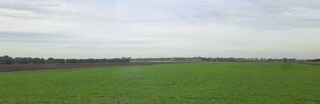
Rising to a modest height, Brick Hill does not pose a significant challenge for hikers and is suitable for all ages and fitness levels. The well-maintained footpaths and trails make it easily accessible, allowing visitors to explore its slopes and enjoy the peaceful surroundings. On clear days, the hill offers stunning views of the surrounding countryside, with its patchwork fields and distant villages.

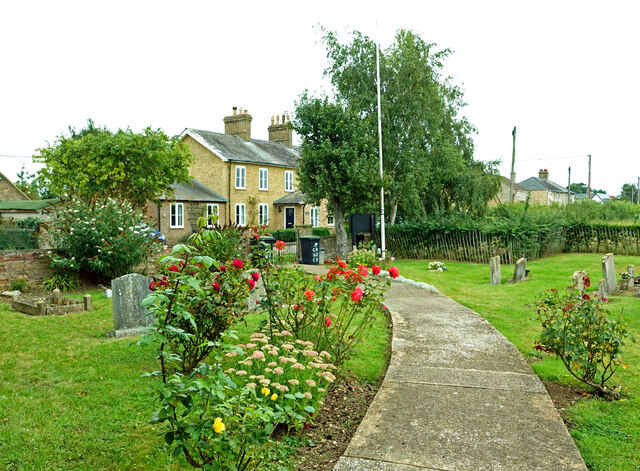
Brick Hill is also home to a small community, with a few houses scattered along its base. The residents enjoy the tranquility and natural beauty of the area, as well as the recreational opportunities it offers. Local events and gatherings are occasionally held on the hill, further fostering a sense of community spirit.

Overall, Brick Hill is a delightful destination for nature lovers and those seeking a break from the hustle and bustle of city life. Its simplicity and natural allure make it a hidden gem in the Cambridgeshire countryside.

If you have any feedback on the listing, please let us know in the comments section below.

Brick Hill Images

Images are sourced within 2km of 52.43118/0.29890231 or Grid Reference TL5683. Thanks to Geograph Open Source API. All images are credited.

Chettisham Garage Viewed from Lynn Road on the edge of Chettisham village.
Chettisham Garage
Viewed from Lynn Road on the edge of Chettisham village.
At Chettisham Church The access path for the Church of St Michael and All Angels goes through the surrounding graveyard.
At Chettisham Church
The access path for the Church of St Michael and All Angels goes through the surrounding graveyard.
Level crossing near Chettisham The traffic was waiting to go south towards Ely.
Level crossing near Chettisham
The traffic was waiting to go south towards Ely.
Looking across Waterden Fen, from the Ely-Manea railway line In the distance, the railway line from Ely north to Kings Lynn, beyond which runs the River Great Ouse; the single tree just to the right of the centre of the picture lies on the far bank of the river.
Looking across Waterden Fen, from the Ely-Manea railway line
In the distance, the railway line from Ely north to Kings Lynn, beyond which runs the River Great Ouse; the single tree just to the right of the centre of the picture lies on the far bank of the river.
Fields west of Redmoor Plantation, from the railway Redmoor Plantation is on the right of the picture.
Fields west of Redmoor Plantation, from the railway
Redmoor Plantation is on the right of the picture.
Wood Fen, from the railway line
St. Michael and All Angels, Chettisham Chettisham is a small village on the old A10 Ely to Littleport road. The new A10 road now bypasses Ely and Littleport to the west. The church is near the end of a road leading west off the old A10.
St. Michael and All Angels, Chettisham
Chettisham is a small village on the old A10 Ely to Littleport road. The new A10 road now bypasses Ely and Littleport to the west. The church is near the end of a road leading west off the old A10.
Great Ouse and Lark Rivers Confluence of Great Ouse and Lark Rivers taken from Branch Bank
Great Ouse and Lark Rivers
Confluence of Great Ouse and Lark Rivers taken from Branch Bank
Branch Bank and Second Drove Junction View along Branch Bank towards Queen Adelaide from Second Drove Junction
Branch Bank and Second Drove Junction
View along Branch Bank towards Queen Adelaide from Second Drove Junction
Pill Box Pill Box by the side of Branch Bank road between Queen Adelaide and Littleport
Pill Box
Pill Box by the side of Branch Bank road between Queen Adelaide and Littleport
Powerlines over River Lark
Littleport water tower A most imposing water tower in Grange Lane on the south side of Littleport. The low-lying nature of the Fens means that a head of water for the whole village must be provided by this massive tower.
Littleport water tower
A most imposing water tower in Grange Lane on the south side of Littleport. The low-lying nature of the Fens means that a head of water for the whole village must be provided by this massive tower.
A road called The Lynn, just north of Ely This is actually in the small village of Chettisham.
A road called The Lynn, just north of Ely
This is actually in the small village of Chettisham.
Part of Church Farm, by Chettisham church
Level Crossing on Lynn Road This was once the original A.10 road but now it is unclassified.
Level Crossing on Lynn Road
This was once the original A.10 road but now it is unclassified.
A view of Pyper's Hill Farm as seen from Ely Road
Part of Daisy Hill Farm
Farm track that leads to Padnal Fen The O/S map shows Clayway Farm as being the nearest farm, which is just south of this building.
Farm track that leads to Padnal Fen
The O/S map shows Clayway Farm as being the nearest farm, which is just south of this building.
Show me another place!

Brick Hill is located at Grid Ref: TL5683 (Lat: 52.43118, Lng: 0.29890231)

Division: Isle of Ely

Administrative County: Cambridgeshire

District: East Cambridgeshire

Police Authority: Cambridgeshire

What 3 Words

///defeated.grills.agreeable. Near Littleport, Cambridgeshire

Nearby Locations

Brick Hill

Related Wikis

River Lark

The River Lark crosses the border between Suffolk and Cambridgeshire in England. It is a tributary of the River Great Ouse, and was extended when that...

Chettisham railway station

Chettisham railway station is a former railway station in Chettisham, Cambridgeshire. It was on the Great Eastern Railway route between Ely and March....

Chettisham

Chettisham is a pretty hamlet in East Cambridgeshire between Ely and Littleport. The main claim to fame is the attractive St. Michael church. There are...

Queen Adelaide, Cambridgeshire

Queen Adelaide is a hamlet on the River Great Ouse in the Fens about 1+1⁄2 miles (2.4 km) northeast of Ely, Cambridgeshire, England. The hamlet is named...

The Boat Race 2021

The Boat Race 2021 was an event comprising two side-by-side rowing races that took place on 4 April 2021. The Boat Race is contested annually between crews...

Chettisham Meadow

Chettisham Meadow is a 0.7-hectare (1.7-acre) biological Site of Special Scientific Interest west of Chettisham, 3 km (2 mi) north of Ely in Cambridgeshire...

Princess of Wales Hospital, Ely

The Princess of Wales Hospital is a healthcare facility in Ely, Cambridgeshire. It is managed by the Cambridgeshire and Peterborough NHS Foundation Trust...

RAF Hospital Ely

RAF Hospital Ely (also known as RAF Ely and RAFH Ely), was a Royal Air Force staffed military hospital in Ely, Cambridgeshire, England. The hospital opened...

Nearby Amenities

Located within 500m of 52.43118,0.29890231
Whitebridge Farm
Note Retag: CS #48756035
Place: farm
Lat/Long: 52.43203/0.2996543
Power: pole
Lat/Long: 52.4318701/0.2989939
Material: wood
Power: pole
Lat/Long: 52.4307302/0.3003269
Material: wood
Power: pole
Lat/Long: 52.4298124/0.2980414
Material: wood
Power: pole
Lat/Long: 52.4302517/0.2991038
Power: pole
Lat/Long: 52.4312655/0.3016521
Power: pole
Lat/Long: 52.4319727/0.3033126
Power: pole
Lat/Long: 52.4298151/0.2938078
Power: pole
Lat/Long: 52.4296426/0.2952441
Power: pole
Lat/Long: 52.4299885/0.2923876
Material: wood
Power: pole
Lat/Long: 52.4294374/0.297009
Power: pole
Lat/Long: 52.4326083/0.3036408
Building: yes
Lat/Long: 52.4306882/0.3015344
Place: farm
Lat/Long: 52.4332067/0.3036801
The data included in this document is from www.openstreetmap.org. The data is made available under ODbL.

Have you been to Brick Hill?

Leave your review of Brick Hill below (or comments, questions and feedback).