Haw's Hill

Hill, Mountain in Essex Uttlesford

England

Haw's Hill

Hadstock The village green. Looking east from the northeast corner of the grid square.
Hadstock Credit: Alan Simkins

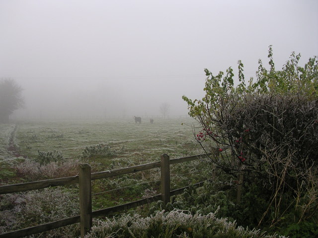
Haw's Hill is a prominent geographical feature located in Essex, England. Situated in the northeastern part of the county, it is a designated hill with an elevation of approximately 151 meters (495 feet) above sea level. While not traditionally classified as a mountain due to its height, it still offers stunning views of the surrounding landscape.

Covered in lush greenery and dotted with patches of dense woodland, Haw's Hill is a popular destination for outdoor enthusiasts and nature lovers. Its diverse flora and fauna make it an ideal location for hiking, birdwatching, and photography. The hill's slopes are relatively gentle, making it accessible to individuals of all fitness levels.

At the summit of Haw's Hill, visitors are rewarded with breathtaking panoramic views of the Essex countryside. On a clear day, the skyline stretches for miles, showcasing the patchwork of fields, meadows, and quaint villages that define the region. The hill's strategic positioning also provides an excellent vantage point to observe the nearby River Stour and the surrounding valleys.

Haw's Hill has historical significance as well. It is believed to have been an ancient settlement site, with remnants of Iron Age fortifications discovered in the area. These archaeological findings add an additional layer of intrigue to the natural beauty of the hill.

Overall, Haw's Hill is a picturesque and culturally significant location in Essex. Its combination of natural splendor, recreational opportunities, and historical interest make it a must-visit destination for both locals and tourists alike.

If you have any feedback on the listing, please let us know in the comments section below.
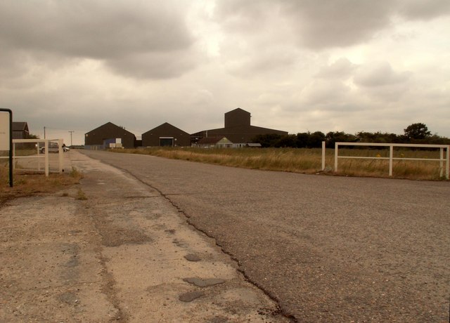
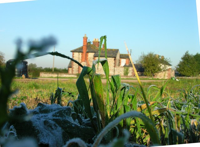
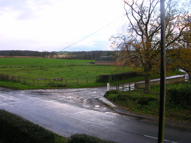
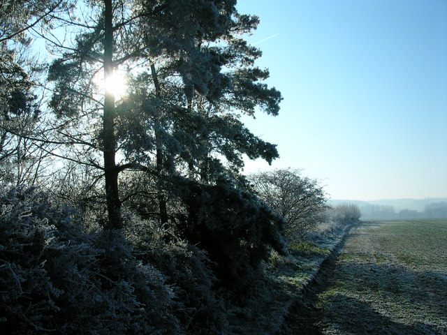
Haw's Hill Images

Images are sourced within 2km of 52.085432/0.27952541 or Grid Reference TL5645. Thanks to Geograph Open Source API. All images are credited.

Hadstock The village green. Looking east from the northeast corner of the grid square.
Hadstock
The village green. Looking east from the northeast corner of the grid square.
Linton, St Mary the Virgin <span class="nowrap"><a title="http://www.druidic.org/camchurch/churches/linton.htm" rel="nofollow ugc noopener" href="http://www.druidic.org/camchurch/churches/linton.htm">Link</a><img style="margin-left:2px;" alt="External link" title="External link - shift click to open in new window" src="https://s1.geograph.org.uk/img/external.png" width="10" height="10"/></span>
Linton, St Mary the Virgin
Icknield way path leading to Linton Linton water tower on the horizon at about 110m.
Icknield way path leading to Linton
Linton water tower on the horizon at about 110m.
FDL, Hadstock Common, Essex These buildings belong to a company called Fuerst Day Lawson.
FDL, Hadstock Common, Essex
These buildings belong to a company called Fuerst Day Lawson.
St. Botolph's church, Hadstock, Essex This is a very interesting church, which contains rare evidence of an 11th century building. It has remains of Saxon transepts, which are a rarity. Other parts are 14th century. The church stands on high ground at the centre of the village.
St. Botolph's church, Hadstock, Essex
This is a very interesting church, which contains rare evidence of an 11th century building. It has remains of Saxon transepts, which are a rarity. Other parts are 14th century. The church stands on high ground at the centre of the village.
Cottages at Linton, Cambridgeshire
Iknield Way Trig This Triangulation Pillar is just off the Iknield Way long distance footpath. At this point it follows the Essex Cambridgeshire border. The pillar is a few metres into Cambridgeshire.
Iknield Way Trig
This Triangulation Pillar is just off the Iknield Way long distance footpath. At this point it follows the Essex Cambridgeshire border. The pillar is a few metres into Cambridgeshire.
Esxbridgshire This is the Icknield Way long-distance footpath. At this point it follows the Essex/Cambridgeshire border. Cambridgeshire is to the left and Essex is to the right.
Esxbridgshire
This is the Icknield Way long-distance footpath. At this point it follows the Essex/Cambridgeshire border. Cambridgeshire is to the left and Essex is to the right.
Harrison Sayer Reserve This is one of two surviving fuel tanks of <a href="https://www.geograph.org.uk/photo/221842">TL5543 : RAF Little Walden</a> they are located on the Harrison Sayer nature reserve this is run by Essex Wildlife Trust see <span class="nowrap"><a title="http://www.essexwt.org.uk/" rel="nofollow ugc noopener" href="http://www.essexwt.org.uk/">Link</a><img style="margin-left:2px;" alt="External link" title="External link - shift click to open in new window" src="https://s1.geograph.org.uk/img/external.png" width="10" height="10"/></span> for more info. The building in the background is <a href="https://www.geograph.org.uk/photo/200416">TL5543 : FDL, Hadstock Common, Essex</a> Continue on a virtual tour of Wildlife Trust Reserves in Essex by visiting <a href="https://www.geograph.org.uk/photo/1319878">TQ5099 : Hawksmere Springs</a>
Harrison Sayer Reserve
This is one of two surviving fuel tanks of TL5543 : RAF Little Walden they are located on the Harrison Sayer nature reserve this is run by Essex Wildlife Trust see LinkExternal link for more info. The building in the background is TL5543 : FDL, Hadstock Common, Essex Continue on a virtual tour of Wildlife Trust Reserves in Essex by visiting TQ5099 : Hawksmere Springs
Frosty November 3rd Numbers 4, 3, 2 and 1 Barham Hall Cottages looking toward Linton and Bartlow Road.  Path to Horseheath Lodge goes Northeast from here.
Frosty November 3rd
Numbers 4, 3, 2 and 1 Barham Hall Cottages looking toward Linton and Bartlow Road. Path to Horseheath Lodge goes Northeast from here.
Zoom 4 pheasants Barham Hall had 30 pheasants this day. Only a few came out on this shot.
Zoom 4 pheasants
Barham Hall had 30 pheasants this day. Only a few came out on this shot.
More fowl than you can shake a stick at. The halfway point between the Reformed Church and the Anglican Church.
More fowl than you can shake a stick at.
The halfway point between the Reformed Church and the Anglican Church.
Ploughed earth above Barham Hall Cottages The edge of the grid with the dirt in the foreground barely within the grid.
Ploughed earth above Barham Hall Cottages
The edge of the grid with the dirt in the foreground barely within the grid.
The sun is not so high when the day is so short. The third shortest day of the year at 53 degrees north.
The sun is not so high when the day is so short.
The third shortest day of the year at 53 degrees north.
Barham Hall Horse (name unknown) and Pony (Paris). They have jackets.
Barham Hall Horse (name unknown) and Pony (Paris).
They have jackets.
View from a cottage loo. Barham Hall Cottages look toward Bartlow
View from a cottage loo.
Barham Hall Cottages look toward Bartlow
Pheasants at sunset. Sorry about the grittiness.  Digital optical zoom has poor resolution.
Pheasants at sunset.
Sorry about the grittiness. Digital optical zoom has poor resolution.
Water tank at New Farm Cottages The wood in the distance is Thirty Three Acre Covert.
Water tank at New Farm Cottages
The wood in the distance is Thirty Three Acre Covert.
Show me another place!

Haw's Hill is located at Grid Ref: TL5645 (Lat: 52.085432, Lng: 0.27952541)

Administrative County: Essex

District: Uttlesford

Police Authority: Essex

What 3 Words

///girder.functions.rank. Near Linton, Cambridgeshire

Nearby Locations

Haw's Hill

Related Wikis

Hadstock

Hadstock is a village in Essex, England, about 6 miles (10 km) from Saffron Walden. It is on the county boundary with Cambridgeshire and about 9 miles...

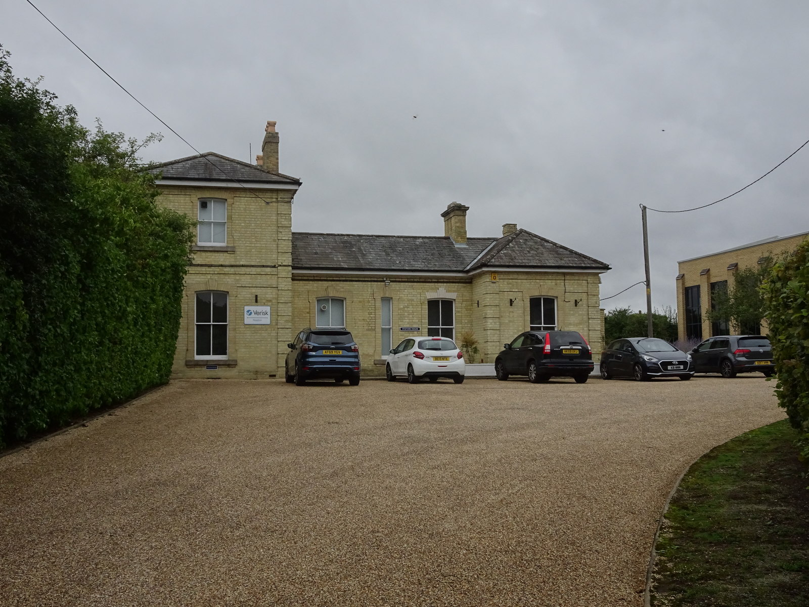
Linton railway station (Cambridgeshire)

Linton railway station was a railway station in Linton, Cambridgeshire on the Stour Valley Railway. It closed in 1967. The station house is H-shaped and...

Barham Friary

Barham Friary was a Crutched Friars friary in Linton, Cambridgeshire, England. It was established around 1272 and was dissolved in 1538. == References ==

Linton, Cambridgeshire

Linton is a village and civil parish in Cambridgeshire, England, on the border with Essex. The village is approximately 8 miles (13 km) southeast from...

Linton Village College

Linton Village College is a secondary school in Linton, South Cambridgeshire, England. Established in 1937 as a village college, the school now has academy...

Caxton and Arrington Rural District

Caxton and Arrington was a rural district in Cambridgeshire, England, from 1894 to 1934. It was formed in 1894 under the Local Government Act 1894, covering...

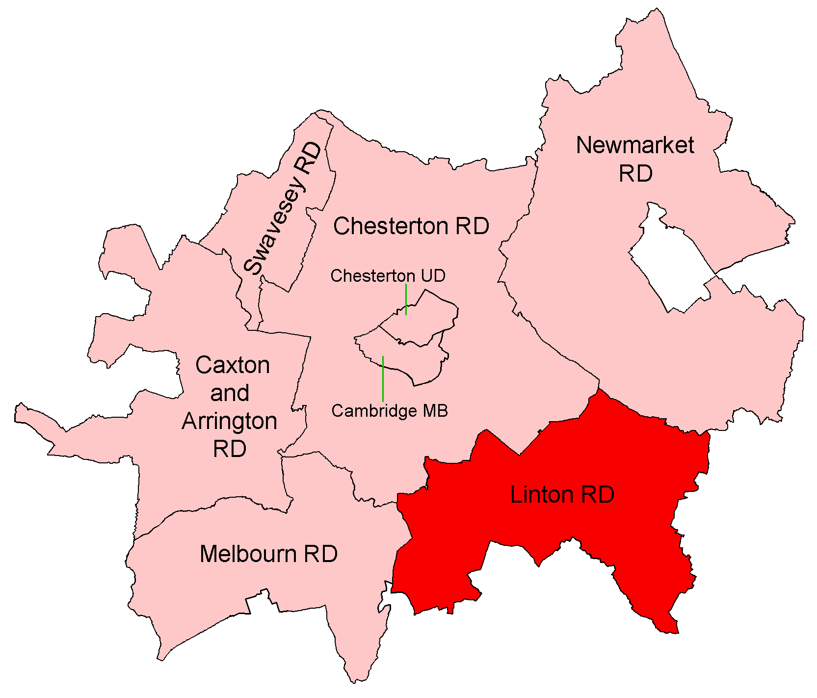
Linton Rural District

Linton was a rural district in Cambridgeshire, England, from 1894 to 1934. It was formed in 1894 under the Local Government Act 1894, covering the area...

RAF Little Walden

Royal Air Force Little Walden or more simply RAF Little Walden is a former Royal Air Force station primarily used by the United States Army Air Forces...

Nearby Amenities

Located within 500m of 52.085432,0.27952541
Source: npe
Lat/Long: 52.0866888/0.2738698
Source: npe
Lat/Long: 52.0844755/0.2742836
Source: npe
Lat/Long: 52.0838954/0.2738169
Leisure: playground
Lat/Long: 52.0819176/0.2778191
The data included in this document is from www.openstreetmap.org. The data is made available under ODbL.

Have you been to Haw's Hill?

Leave your review of Haw's Hill below (or comments, questions and feedback).