Newbarn Hill

Hill, Mountain in Sussex Wealden

England

Newbarn Hill

Cuckmere River: North of Cuckmere Haven This section of the river is near the east side of the grid square.
Cuckmere River: North of Cuckmere Haven Credit: Pam Brophy

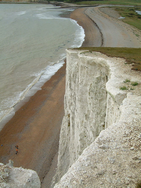
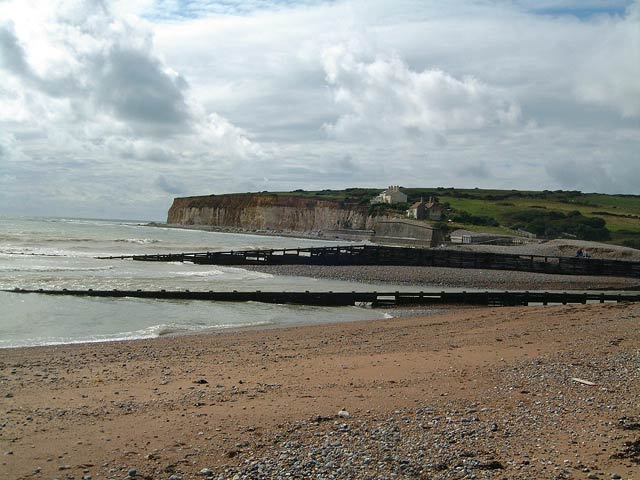
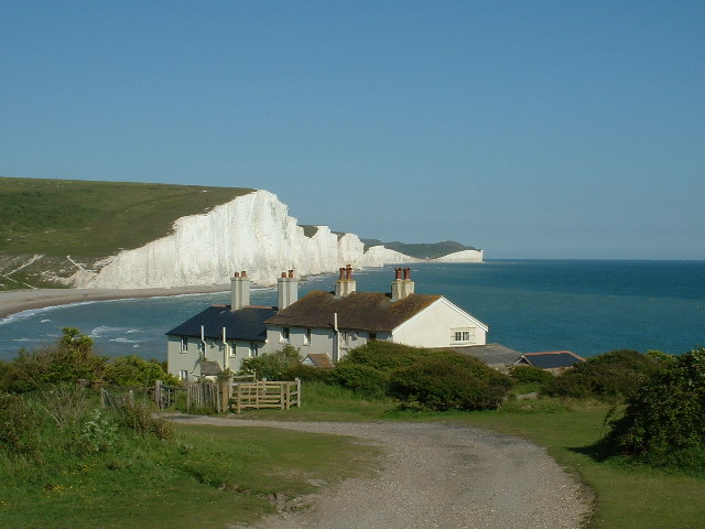
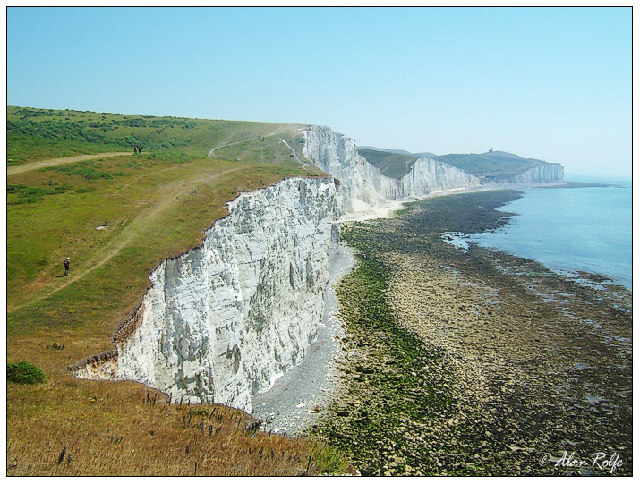
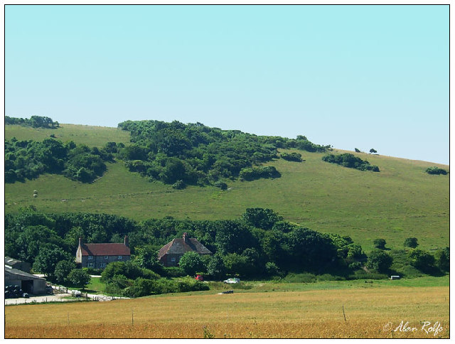
Newbarn Hill is a prominent landmark located in Sussex, England. Although often referred to as a hill, it is more accurately described as a gentle rise in the landscape rather than a true mountain. Situated in the South Downs National Park, Newbarn Hill offers stunning panoramic views of the surrounding countryside.

Standing at an elevation of approximately 215 meters (705 feet), Newbarn Hill is a popular destination for hikers, nature enthusiasts, and those seeking a peaceful retreat. The hill is covered in lush greenery, with a diverse range of flora and fauna that adds to its natural beauty. It is home to an array of wildlife, including birds, butterflies, and small mammals.

Accessible via well-maintained footpaths, Newbarn Hill offers a variety of walking routes for visitors to explore. From the summit, on clear days, it is possible to see as far as the English Channel, providing a breathtaking vista that captures the essence of the picturesque Sussex countryside.

In addition to its natural beauty, Newbarn Hill also has historical significance. It is believed to have been inhabited by humans since the Neolithic period, with evidence of ancient settlements and burial mounds found in the vicinity. The hill has been a cherished part of the local community for generations, and its historical and natural importance is recognized and protected by the South Downs National Park Authority.

Overall, Newbarn Hill is a captivating location that offers a blend of natural splendor, recreational opportunities, and a glimpse into the region's rich history. Whether one seeks an invigorating hike or a peaceful escape, Newbarn Hill is a must-visit destination in Sussex.

If you have any feedback on the listing, please let us know in the comments section below.

Newbarn Hill Images

Images are sourced within 2km of 50.761421/0.1698423 or Grid Reference TV5398. Thanks to Geograph Open Source API. All images are credited.

Cuckmere River: North of Cuckmere Haven This section of the river is near the east side of the grid square.
Cuckmere River: North of Cuckmere Haven
This section of the river is near the east side of the grid square.
Meanders Meanders on the River Cuckmere at Seven Sisters Country Park - note the river no longer flows through these meanders - The river was straightened in the 1860's
Meanders
Meanders on the River Cuckmere at Seven Sisters Country Park - note the river no longer flows through these meanders - The river was straightened in the 1860's
Cliffs above Cuckmere Haven Looking down from the first of the Seven Sisters, above the mouth of the river Cuckmere
Cliffs above Cuckmere Haven
Looking down from the first of the Seven Sisters, above the mouth of the river Cuckmere
Cuckmere Haven The mouth of the Cuckmere
Cuckmere Haven
The mouth of the Cuckmere
All Saints Church, West Dean West Dean church is the oldest in the Cuckmere Valley. It shows Saxon influences and the spire has been likened to a monk's cowl, with the small windows in the tower giving the appearance of a face.
All Saints Church, West Dean
West Dean church is the oldest in the Cuckmere Valley. It shows Saxon influences and the spire has been likened to a monk's cowl, with the small windows in the tower giving the appearance of a face.
Coastguard Cottages Coastguard cottages with The Seven Sisters beyond. What an idyllic location for retirement?
Coastguard Cottages
Coastguard cottages with The Seven Sisters beyond. What an idyllic location for retirement?
All Saints, West Dean
Converted Barn in the middle of Friston Forest
Straightened River Cuckmere Although the River Cuckmere is famous for its meanders, this is the true river. It was straightened for navigation and to reclaim pasture land.
Straightened River Cuckmere
Although the River Cuckmere is famous for its meanders, this is the true river. It was straightened for navigation and to reclaim pasture land.
On the Seven Sisters looking east The old lighthouse of Belle Tout can be seen right on the distant cliff. This was moved some 16 metres or so back from the cliff edge in 1999 and may have to be moved again within the next 50 years.
On the Seven Sisters looking east
The old lighthouse of Belle Tout can be seen right on the distant cliff. This was moved some 16 metres or so back from the cliff edge in 1999 and may have to be moved again within the next 50 years.
Farm at Foxhole Close to the Seven Sisters Country Park.
Farm at Foxhole
Close to the Seven Sisters Country Park.
Meanders near the mouth of the Cuckmere The view looks to the mouth of the river from a location just east of the grid box.
Meanders near the mouth of the Cuckmere
The view looks to the mouth of the river from a location just east of the grid box.
Cliff End, E side of Cuckmere Haven Cuckmere Haven lies on the coast at the point where the South Downs meet the sea. Cliff End marks the western end of the famous Seven Sisters chalk cliffs.
Cliff End, E side of Cuckmere Haven
Cuckmere Haven lies on the coast at the point where the South Downs meet the sea. Cliff End marks the western end of the famous Seven Sisters chalk cliffs.
Cuckmere River
Cuckmere River
Visitor Centre at Exceat Tourism is an important industry for this area.
Visitor Centre at Exceat
Tourism is an important industry for this area.
Old cottages in Westdean Looks like Tudor style to me.
Old cottages in Westdean
Looks like Tudor style to me.
Bridleway through Friston Forest Popular with walkers and cyclists - probably horse-riders too.
Bridleway through Friston Forest
Popular with walkers and cyclists - probably horse-riders too.
The Seven Sisters View of the Seven Sisters from the cliff path.  Could not get any closer on this occasion because of the foot and mouth restrictions.
The Seven Sisters
View of the Seven Sisters from the cliff path. Could not get any closer on this occasion because of the foot and mouth restrictions.
Show me another place!

Newbarn Hill is located at Grid Ref: TV5398 (Lat: 50.761421, Lng: 0.1698423)

Administrative County: East Sussex

District: Wealden

Police Authority: Sussex

What 3 Words

///performed.encloses.notch. Near Friston, East Sussex

Nearby Locations

Newbarn Hill

Related Wikis

RAF Friston

Royal Air Force Friston or more simply RAF Friston is a former Royal Air Force satellite station and Emergency Landing Ground located in East Sussex, England...

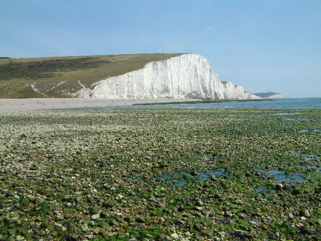
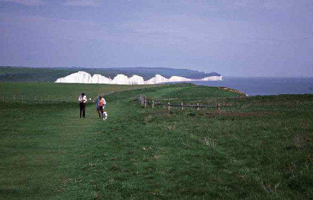
Seven Sisters, East Sussex

The Seven Sisters are a series of chalk sea cliffs on the English Channel coast, and are a stretch of the sea-eroded section of the South Downs range of...

Seaford to Beachy Head

Seaford to Beachy Head is a 1,108.7-hectare (2,740-acre) biological and geological Site of Special Scientific Interest which stretches from Seaford to...
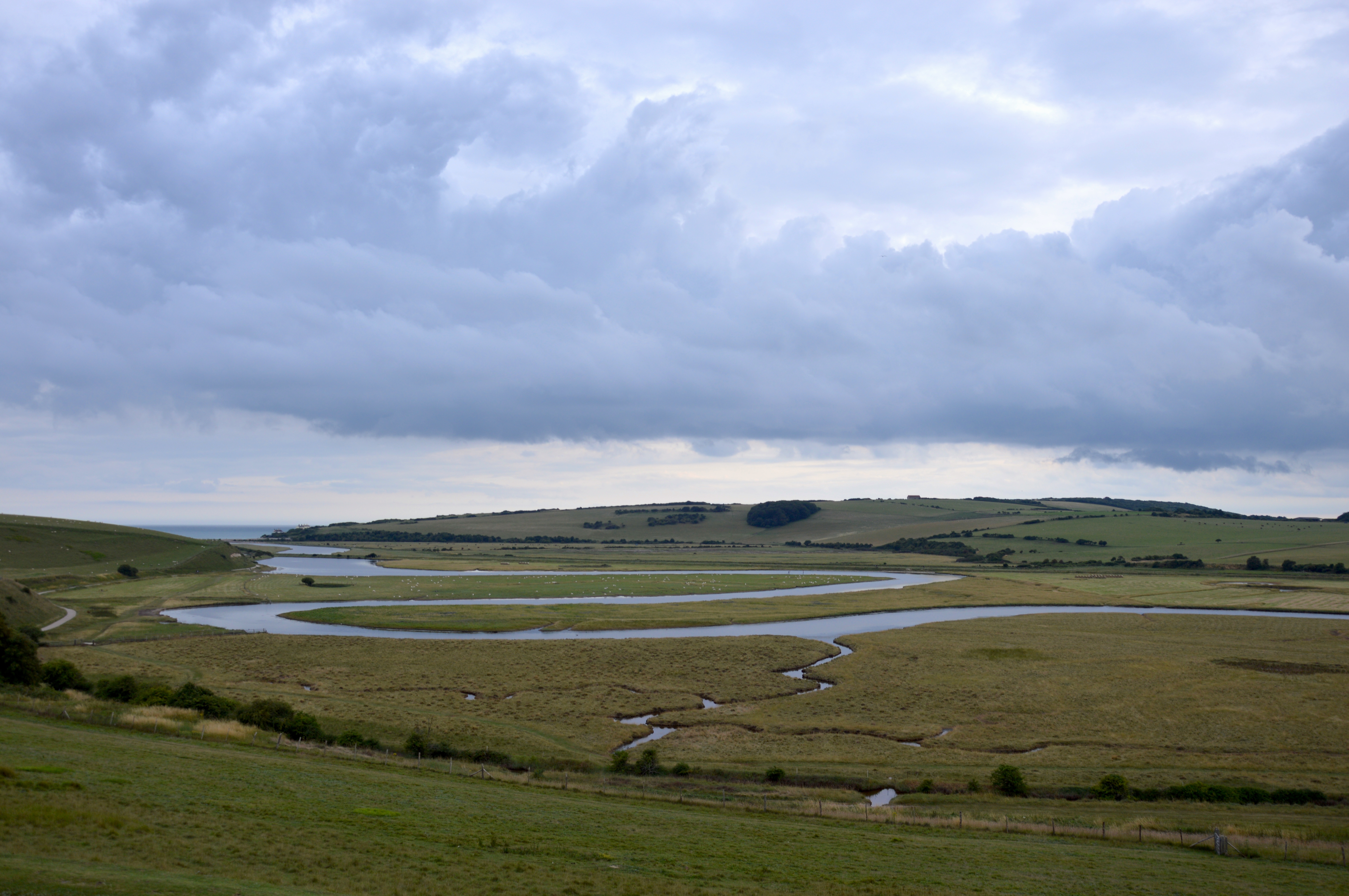
River Cuckmere

The River Cuckmere rises near Heathfield in East Sussex, England on the southern slopes of the Weald. The name of the river probably comes from an Old...

Cuckmere Haven

Cuckmere Haven (also known as the Cuckmere estuary) is an area of flood plains in Sussex, England, where the river Cuckmere meets the English Channel between...

East Dean and Friston

East Dean and Friston is a civil parish in the Wealden District of East Sussex, England.The two villages in the parish are in a dry valley on the South...

Seaford Head

Seaford Head is a 150.2-hectare (371-acre) Local Nature Reserve east of Seaford in East Sussex. It is part of Seaford to Beachy Head Site of Special Scientific...

Friston Forest

Friston Forest is a forest, located between Seaford and Eastbourne in East Sussex. It is part of the South Downs National Park area. The forest is managed...

Nearby Amenities

Located within 500m of 50.761421,0.1698423
Friston Airfield Memorial Stone
Commemorates Wikidata: Q28970478
Height: 1
Historic: monument
Material: stone
Website: https://www.abct.org.uk/airfields/airfield-finder/friston/
Lat/Long: 50.7626774/0.1745708
Barrier: entrance
Lat/Long: 50.7635841/0.1751364
The data included in this document is from www.openstreetmap.org. The data is made available under ODbL.

Have you been to Newbarn Hill?

Leave your review of Newbarn Hill below (or comments, questions and feedback).