Blackcap Hill

Hill, Mountain in Sussex Lewes

England

Blackcap Hill

View NE over Stump Bottom
View NE over Stump Bottom Credit: Robin Webster

Blackcap Hill, located in Sussex, England, is a prominent hill rising to a height of 218 meters (715 feet) above sea level. This hill is a part of the South Downs National Park, renowned for its scenic beauty and diverse wildlife. The name "Blackcap" is derived from the black cap worn by the male blackcap warbler, a small migratory bird that frequents the hill during its breeding season.

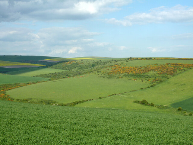
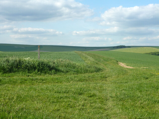
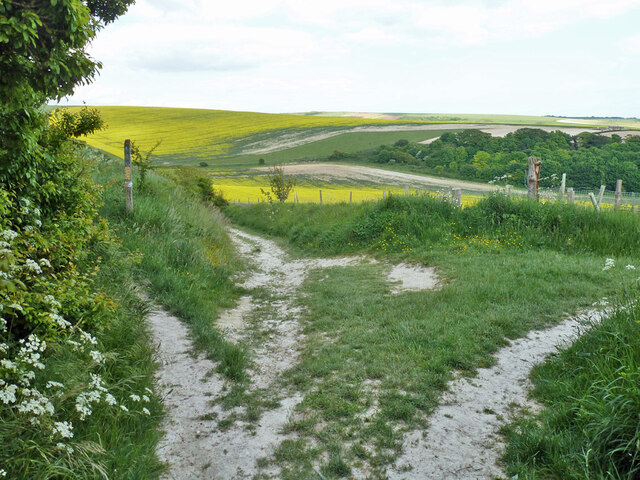
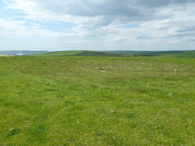
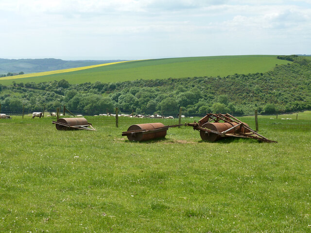
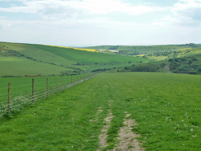
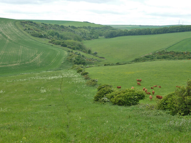
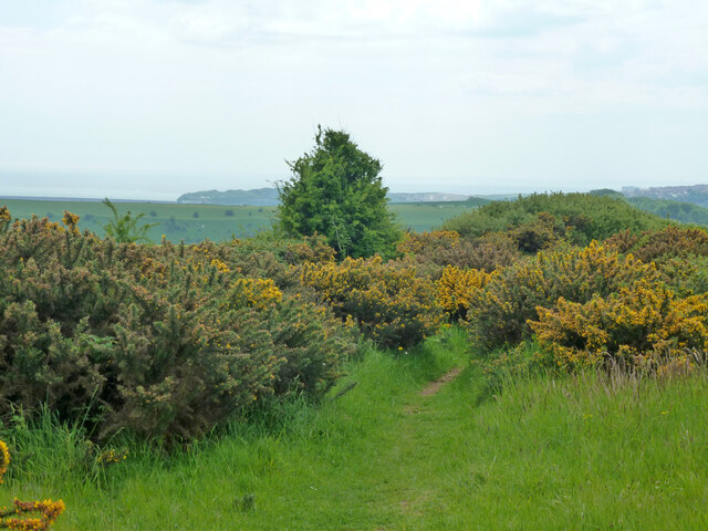
The hill is characterized by its gentle slopes and rolling grasslands, covered with a mix of wildflowers and heather. It offers breathtaking panoramic views of the surrounding countryside, including the nearby towns of Lewes and Brighton, as well as the English Channel. On a clear day, it is even possible to catch a glimpse of the white cliffs of Beachy Head in the distance.

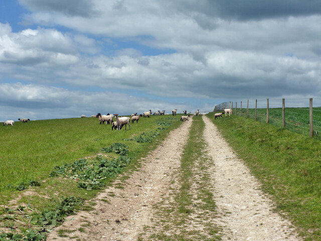
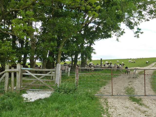
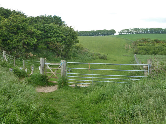
Blackcap Hill is a popular destination for nature enthusiasts and walkers, offering various footpaths and trails that wind through its lush green landscape. The hill is home to a rich variety of flora and fauna, including rare butterflies, orchids, and bird species such as skylarks and kestrels. Visitors can also explore the remains of an Iron Age hill fort, which sits atop the hill, adding an element of historical interest to the area.

Overall, Blackcap Hill provides an idyllic setting for those seeking tranquility and natural beauty. Its accessibility, combined with its stunning views and abundant wildlife, make it a cherished location among locals and tourists alike.

If you have any feedback on the listing, please let us know in the comments section below.

Blackcap Hill Images

Images are sourced within 2km of 50.82532/0.080606482 or Grid Reference TQ4604. Thanks to Geograph Open Source API. All images are credited.

View NE over Stump Bottom
Bridleway South Heighton 5 Towards the South Downs Way (along the skyline), Beddingham and Firle.
Bridleway South Heighton 5
Towards the South Downs Way (along the skyline), Beddingham and Firle.
Bridleway junction, South Heighton Looking from bridleway South Heighton 6a from the housing of Denton. 6b goes left at a lower level, 5 left at a higher level, 11 comes in from the right.
Bridleway junction, South Heighton
Looking from bridleway South Heighton 6a from the housing of Denton. 6b goes left at a lower level, 5 left at a higher level, 11 comes in from the right.
Dew pond, Blackcap Hill Large, but not very obvious and not very wet.
Dew pond, Blackcap Hill
Large, but not very obvious and not very wet.
Rollers on Blackcap Hill
Sheep, Blackcap Hill The track is bridleway Beddingham 5.
Sheep, Blackcap Hill
The track is bridleway Beddingham 5.
Gate on bridleway at parish boundary Bridleway South Heighton 7 becomes Beddingham 5 on the other side.
Gate on bridleway at parish boundary
Bridleway South Heighton 7 becomes Beddingham 5 on the other side.
Bridleway descending into Home Bottom Bridleway South Heighton 7 from Blackcap Hill.
Bridleway descending into Home Bottom
Bridleway South Heighton 7 from Blackcap Hill.
Bridleway gate, Home Bottom Bridleway South Heighton 7 up to Blackcap Hill.
Bridleway gate, Home Bottom
Bridleway South Heighton 7 up to Blackcap Hill.
Looking down to Home Bottom The trail down the hill is where I came up. There is no public route, I think I planned to come up on the other side of the hedge, which is CRoW access downland, but couldn't find a way into the field.
Looking down to Home Bottom
The trail down the hill is where I came up. There is no public route, I think I planned to come up on the other side of the hedge, which is CRoW access downland, but couldn't find a way into the field.
Bridleway on Gardener's Hill There is some danger of the gorse overwhelming bridleway South Heighton 6c.
Bridleway on Gardener's Hill
There is some danger of the gorse overwhelming bridleway South Heighton 6c.
Sheep taking shade, Gardener's Hill
Bridleway up Heighton Hill Bridleway South Heighton 6c.
Bridleway up Heighton Hill
Bridleway South Heighton 6c.
View NNW from Heighton Hill
Depression on Heighton Hill This might be a dew pond, but it is not very convincing. Lidar highlights several of what appear to be circular depressions dotted around here, too close to all be ponds. There are also several randomly arranged linear features. Flint digging?
Depression on Heighton Hill
This might be a dew pond, but it is not very convincing. Lidar highlights several of what appear to be circular depressions dotted around here, too close to all be ponds. There are also several randomly arranged linear features. Flint digging?
Depression on Heighton Hill There are several of these up here, also several randomly arranged linear features. There is no sign of raised tumuli and they cannot all be dew ponds. Flint digging?
Depression on Heighton Hill
There are several of these up here, also several randomly arranged linear features. There is no sign of raised tumuli and they cannot all be dew ponds. Flint digging?
Grassland, Heighton Hill A fair number of cowslips.
Grassland, Heighton Hill
A fair number of cowslips.
Bridleway on Heighton Hill Bridleway South Heighton 6c towards Bopeep Bostal.
Bridleway on Heighton Hill
Bridleway South Heighton 6c towards Bopeep Bostal.
Show me another place!

Blackcap Hill is located at Grid Ref: TQ4604 (Lat: 50.82532, Lng: 0.080606482)

Administrative County: East Sussex

District: Lewes

Police Authority: Sussex

What 3 Words

///showering.pure.hatter. Near Newhaven, East Sussex

Nearby Locations

Blackcap Hill Home Bottom

Related Wikis

Firle Escarpment

Firle Escarpment is a 302.1-hectare (747-acre) biological Site of Special Scientific Interest north of Seaford in East Sussex.This is a long stretch of...

Firle Beacon

Firle Beacon is a hill in the South Downs of southern England. It is 217 metres high and is a Marilyn. It commands a far-reaching view. When the prevailing...

Tarring Neville

Tarring Neville is a village and civil parish in the Lewes District of East Sussex, England. The village is located five miles (8 km) south of Lewes, on...

Firle Place

Firle Place is a manor house in Firle, East Sussex, United Kingdom. The Gage family have owned the land at Firle since acquiring it from the Levett family...

Nearby Amenities

Located within 500m of 50.82532,0.080606482
Blackcap Farm
Created By: Potlatch 0.10f
Place: farm
Source: NPE
Lat/Long: 50.82781/0.0805426
Blackcap Hill
Created By: Potlatch 0.10f
Place: locality
Lat/Long: 50.8245299/0.0811434
The data included in this document is from www.openstreetmap.org. The data is made available under ODbL.

Have you been to Blackcap Hill?

Leave your review of Blackcap Hill below (or comments, questions and feedback).