Great Chishill

Hill, Mountain in Essex South Cambridgeshire

England

Great Chishill

Great Chishill, St Swithuns <span class="nowrap"><a title="http://www.druidic.org/camchurch/churches/gtchishill.htm" rel="nofollow ugc noopener" href="http://www.druidic.org/camchurch/churches/gtchishill.htm">Link</a><img style="margin-left:2px;" alt="External link" title="External link - shift click to open in new window" src="https://s1.geograph.org.uk/img/external.png" width="10" height="10"/></span>
Great Chishill, St Swithuns Credit: mym

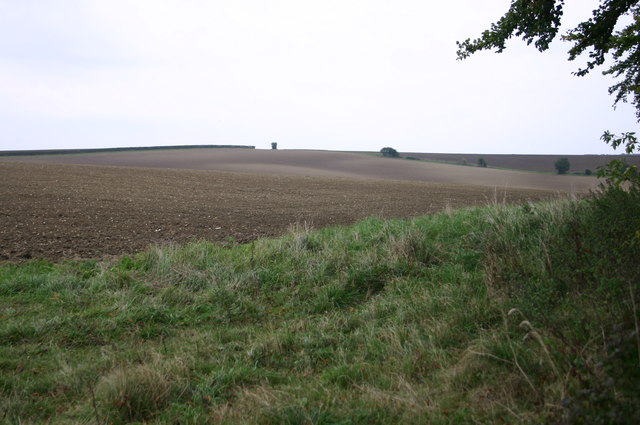
Great Chishill is a village located in the county of Essex, England. It is situated on top of a hill, which gives it the distinction of being the highest village in the county, with an elevation of approximately 146 meters (479 feet) above sea level. The village is part of the civil parish of Great Chishill and is surrounded by picturesque countryside, offering breathtaking views of the surrounding area.

The village itself is small, with a population of around 300 residents. It is characterized by its charming and quaint atmosphere, with a mix of traditional English cottages and more modern houses. The village is known for its tight-knit community spirit and friendly residents.

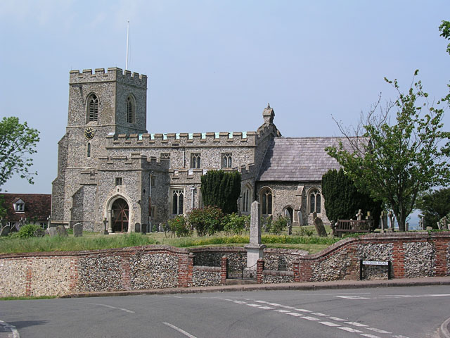
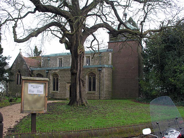
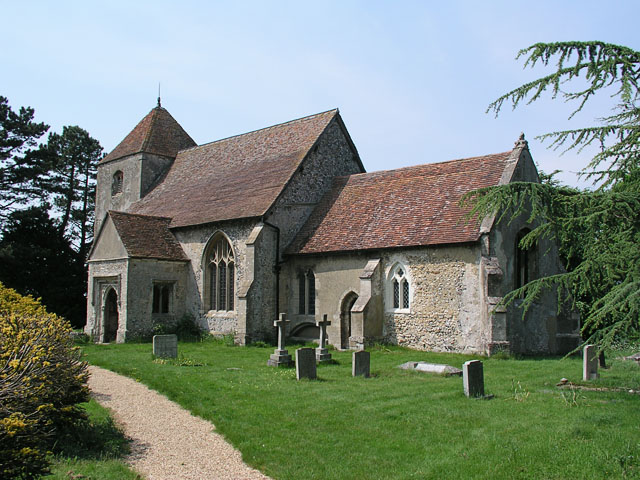
Great Chishill is home to the Holy Trinity Church, a Grade II listed building that dates back to the 13th century. The church features beautiful stained glass windows and a striking tower, making it a prominent landmark in the village. The church holds regular Sunday services and is also used for community events and gatherings.

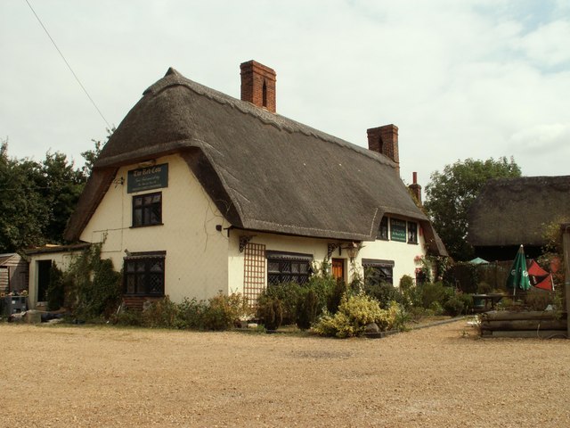
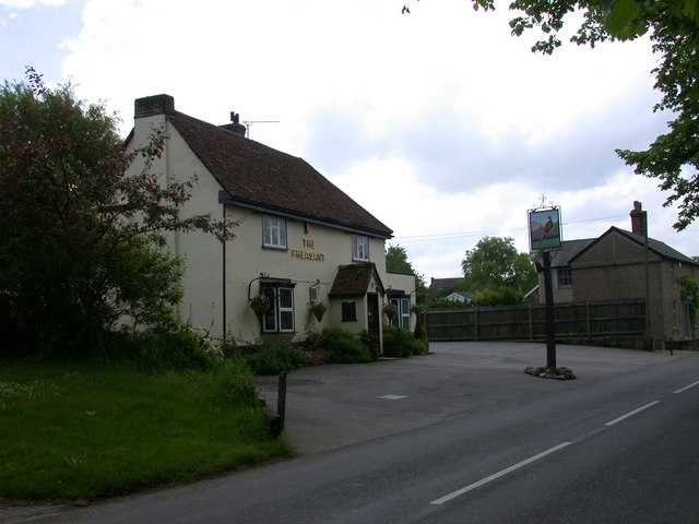
The village has limited amenities, with a small local pub called The Pheasant, which serves as a popular meeting point for residents and visitors alike. The surrounding area offers plenty of opportunities for outdoor activities, including hiking, cycling, and horse riding, thanks to its scenic location.

Overall, Great Chishill is a charming village with stunning views, a close-knit community, and a rich historical heritage. It is a perfect destination for those seeking a peaceful and idyllic setting in the heart of the Essex countryside.

If you have any feedback on the listing, please let us know in the comments section below.

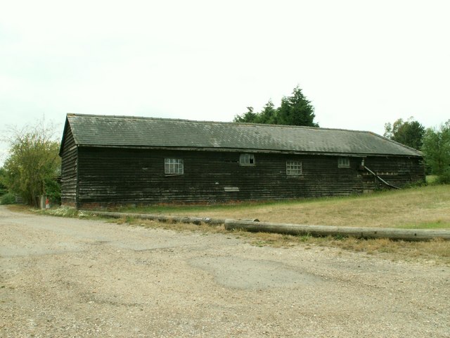
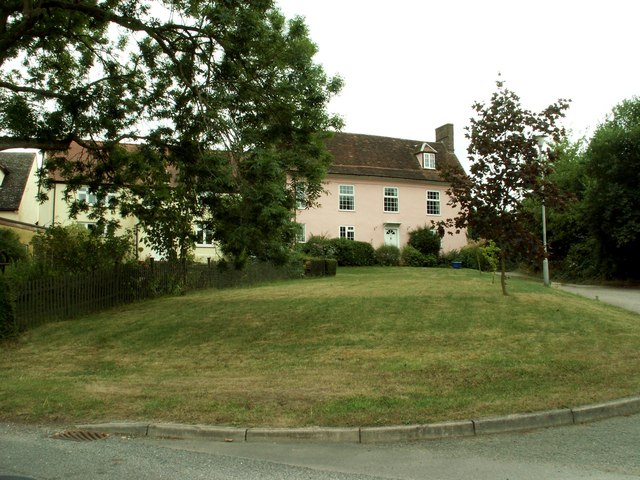
Great Chishill Images

Images are sourced within 2km of 52.026977/0.079099937 or Grid Reference TL4238. Thanks to Geograph Open Source API. All images are credited.

Great Chishill, St Swithuns <span class="nowrap"><a title="http://www.druidic.org/camchurch/churches/gtchishill.htm" rel="nofollow ugc noopener" href="http://www.druidic.org/camchurch/churches/gtchishill.htm">Link</a><img style="margin-left:2px;" alt="External link" title="External link - shift click to open in new window" src="https://s1.geograph.org.uk/img/external.png" width="10" height="10"/></span>
Great Chishill, St Swithuns
Little Chishill, St Nicholas <span class="nowrap"><a title="http://www.druidic.org/camchurch/churches/ltchishill.htm" rel="nofollow ugc noopener" href="http://www.druidic.org/camchurch/churches/ltchishill.htm">Link</a><img style="margin-left:2px;" alt="External link" title="External link - shift click to open in new window" src="https://s1.geograph.org.uk/img/external.png" width="10" height="10"/></span>
Little Chishill, St Nicholas
Heydon, Holy Trinity <span class="nowrap"><a title="http://www.druidic.org/camchurch/churches/heydon.htm" rel="nofollow ugc noopener" href="http://www.druidic.org/camchurch/churches/heydon.htm">Link</a><img style="margin-left:2px;" alt="External link" title="External link - shift click to open in new window" src="https://s1.geograph.org.uk/img/external.png" width="10" height="10"/></span>
Heydon, Holy Trinity
Heydon, Holy Trinity 1940
Chishill Windmill This post mill is an interesting example of rural engineering, built in 1819 using timbers from an earlier mill of 1726 it was last restored in 1951.
Chishill Windmill
This post mill is an interesting example of rural engineering, built in 1819 using timbers from an earlier mill of 1726 it was last restored in 1951.
Patterns in the Fields Way past harvest time but some interesting patterns here in the fields.
Patterns in the Fields
Way past harvest time but some interesting patterns here in the fields.
'The Red Cow' inn, Chrishall, Essex
Barn at Parsonage Farm, Chrishall, Essex
Old house at Great Chishill, Cambs.
Footpath bridge by Barnard's Wood Bridge over the stream on the footpath between the B1039 and Chrishall, nearby Barnard's Wood.
Footpath bridge by Barnard's Wood
Bridge over the stream on the footpath between the B1039 and Chrishall, nearby Barnard's Wood.
Bridleway at Building End Bridleway leading from Building End to Great Chishill
Bridleway at Building End
Bridleway leading from Building End to Great Chishill
Chishill windmill The windmill at Chishill is preserved by the Cambridgeshire County Council
Chishill windmill
The windmill at Chishill is preserved by the Cambridgeshire County Council
Little Chishill Game Reserve Entrance to Little Chishill Game Reserve. A big notice warns 'no dogs allowed'!
Little Chishill Game Reserve
Entrance to Little Chishill Game Reserve. A big notice warns 'no dogs allowed'!
Autumn colours frame the climb up to Chrishall village View north on Hollow Rd, Chrishall at the entrance to New Farm. (The highest point in Essex is within the parish boundary).
Autumn colours frame the climb up to Chrishall village
View north on Hollow Rd, Chrishall at the entrance to New Farm. (The highest point in Essex is within the parish boundary).
By the Copse above Little Chishill Just off the bridleway by the copse above Little Chishill looking over the fields
By the Copse above Little Chishill
Just off the bridleway by the copse above Little Chishill looking over the fields
Bridleway heading down to Little Chishill Bridleway from Great Chishill heading down to Little Chishill
Bridleway heading down to Little Chishill
Bridleway from Great Chishill heading down to Little Chishill
The Pheasant, Great Chishill
The sign of The Pheasant
Show me another place!

Great Chishill is located at Grid Ref: TL4238 (Lat: 52.026977, Lng: 0.079099937)

Administrative County: Cambridgeshire

District: South Cambridgeshire

Police Authority: Cambridgeshire

What 3 Words

///grapes.stickler.snapping. Near Fowlmere, Cambridgeshire

Related Wikis

Great Chishill

Great Chishill is a village and former civil parish, now in the parish of Great and Little Chishill, in the South Cambridgeshire district, in the county...

Heydon, Cambridgeshire

Heydon is a village and civil parish in Cambridgeshire, England. The parish of Heydon was transferred from Essex to Cambridgeshire in 1894. The area of...

Little Chishill

Little Chishill is a village and former civil parish, now in the parish of Great and Little Chishill, in the South Cambridgeshire district, in the county...

Chrishall

Chrishall (pronounced Chris hall) is a small village in the English county of Essex. It is located 12 miles (20 km) south of Cambridge and lies equidistant...

Nearby Amenities

Located within 500m of 52.026977,0.079099937
Great Chishill
Is In: Cambridgeshire, England, UK
Note: population includes Little Chishill
Place: village
Population: 590
Source Population: http://www.scambs.gov.uk/CommunityandLiving/VillageServicesAndAmenities/
Wikidata: Q1879294
Wikipedia: en:Great Chishill
Lat/Long: 52.0297899/0.0746135
Post Box
Post Box Type: lamp
Ref: SG8 305
Lat/Long: 52.0276586/0.0768732
Bus Stop
Hall Farm
Bus: yes
Naptan AtcoCode: 0500SGALC003
Naptan Bearing: NW
Naptan BusStopType: CUS
Naptan CommonName: Hall Farm
Naptan Indicator: near
Naptan Landmark: Hall Farm
Naptan NaptanCode: cmbdwjad
Naptan Street: Hall Lane
Naptan Verified: no
Public Transport: platform
Source: naptan_import
Lat/Long: 52.0262593/0.0806536
Bus Stop
Hall Farm
Bus: yes
Naptan AtcoCode: 0500SGALC005
Naptan Bearing: SE
Naptan BusStopType: CUS
Naptan CommonName: Hall Farm
Naptan Indicator: opp
Naptan Landmark: Hall Farm
Naptan NaptanCode: cmbdwjaj
Naptan Street: Hall Lane
Naptan Verified: no
Public Transport: platform
Source: naptan_import
Lat/Long: 52.0263035/0.0806994
Ele: 146
Maxspeed: 30 mph
Traffic Sign: maxspeed
Traffic Sign Direction: forward
Lat/Long: 52.0263888/0.080429
Hall Farm
Addr Country: GB
Addr Housenumber: 110
Addr Postcode: SG8 8SH
Addr Street: Hall Lane
Fhrs Id: 596426
Guest House: bed_and_breakfast
Survey Date: 2018-03-19
Tourism: guest_house
Lat/Long: 52.0258373/0.0800067
Power: pole
Lat/Long: 52.0293361/0.08032
Power: pole
Lat/Long: 52.0287652/0.0790503
Power: pole
Lat/Long: 52.0280662/0.079329
Power: pole
Lat/Long: 52.0302528/0.0814989
Leisure: picnic_table
Source: GPS, observation
Lat/Long: 52.0277192/0.0777814
Bench
Backrest: yes
Source: GPS, observation
Lat/Long: 52.0277146/0.0772523
Bus Stop
Plaistow Way
Bus: yes
Naptan AtcoCode: 0500SGALC007
Naptan BusStopType: CUS
Naptan NaptanCode: CMBGMJTG
Naptan Verified: no
Public Transport: platform
Source: naptan
Lat/Long: 52.0288954/0.073387
Bus Stop
Plaistow Way
Bus: yes
Naptan AtcoCode: 0500SGALC008
Naptan BusStopType: CUS
Naptan NaptanCode: CMBGMJTJ
Naptan Verified: no
Public Transport: platform
Source: naptan
Lat/Long: 52.0291403/0.0727569
Cambridgeshire County Top
Description: The highest point of the current administrative county of Cambridgeshire, 146 m (479 ft) above sea level, is about 1⁄2 mile (800 m) east of St Swithun's parish church.
Ele: 146
Natural: peak
Note: Needs survey for exact location.
Source: https://en.wikipedia.org/wiki/Great_Chishill
Wikidata: Q1879294
Wikipedia: en:Great Chishill
Lat/Long: 52.0299206/0.0753848
Entrance: main
Lat/Long: 52.0281545/0.0789034
Barrier: sliding_gate
Lat/Long: 52.0259899/0.0810762
The data included in this document is from www.openstreetmap.org. The data is made available under ODbL.

Have you been to Great Chishill?

Leave your review of Great Chishill below (or comments, questions and feedback).