Kirkstall

Settlement in Yorkshire

England

Kirkstall

Wyther Parade A row of shops on the north side of Stanningley Road, occupying an eclectic set of buildings, so clearly not planned as a shopping parade.  As of 2021 it comprises Cuccina (takeaway), UB Studio (hairdresser, formerly EGAS <a href="https://www.geograph.org.uk/photo/1765111">SE2534 : Everall Gas Appliance Spares - Stanningley Road</a>), Stanningley Wines (convenience store), We Are Vapes (formerly Daniels Cafe <a href="https://www.geograph.org.uk/photo/2373787">SE2534 : Daniels Cafe & Take Away - Stanningley Road</a>), Pure Raw Feeds, Burgerama, FibreMold, Mother India (another takeaway) and Menz (sic) Hair Studio.
Wyther Parade Credit: Stephen Craven

Kirkstall is a historic suburb located in the city of Leeds, in the county of Yorkshire, England. Situated on the banks of the River Aire, it is known for its rich history and picturesque surroundings.

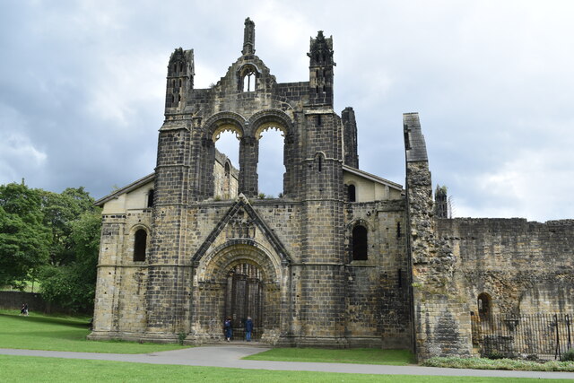
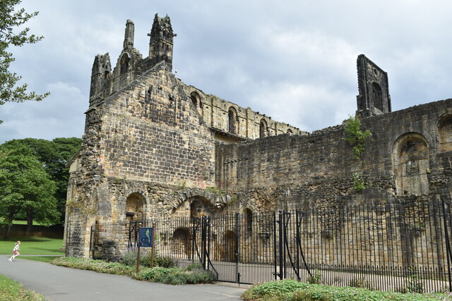
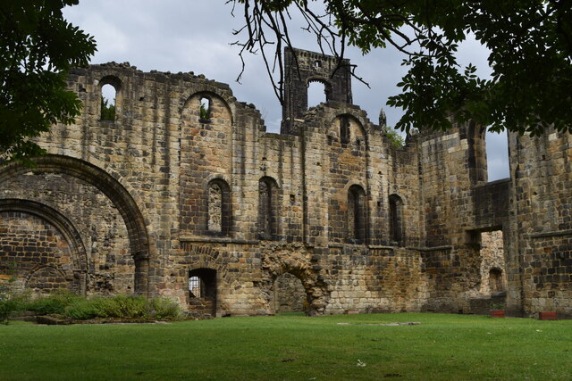
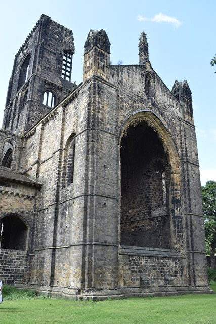
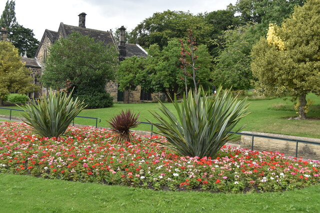
The centerpiece of Kirkstall is Kirkstall Abbey, a Cistercian monastery founded in the 12th century. The abbey, now in ruins, attracts visitors from near and far, offering a glimpse into medieval monastic life. Surrounding the abbey is Kirkstall Abbey Park, a vast green space perfect for picnics, walks, and family outings.

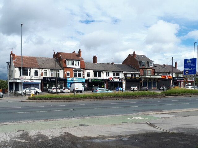
The suburb is also home to Kirkstall Bridge Shopping Park, a modern retail center that provides a diverse range of shops, restaurants, and leisure facilities. Here, visitors can shop for both everyday essentials and luxury items, while also enjoying a variety of dining options.

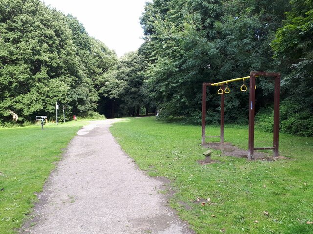
Kirkstall has a vibrant community with a range of amenities, including schools, churches, and sports facilities. The suburb is well-connected to the rest of Leeds via public transport, with regular bus services and a nearby train station.

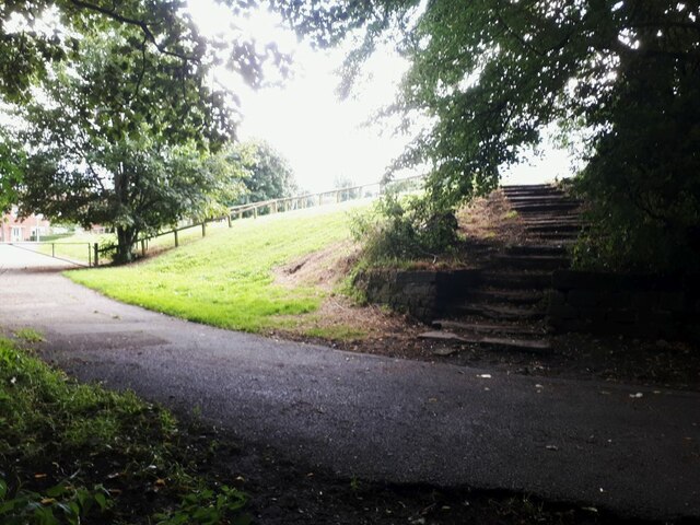
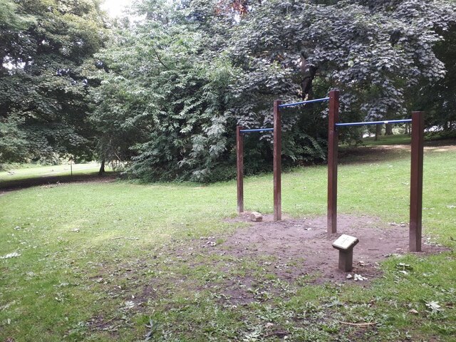
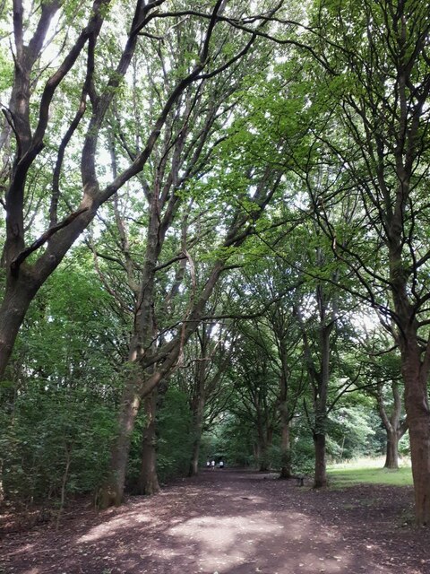
Nature lovers can explore the nearby Kirkstall Valley Nature Reserve, a haven for wildlife and a popular spot for birdwatching and walking. The tranquil canal towpath also offers a serene escape from the hustle and bustle of the city.

Overall, Kirkstall is a charming suburb that seamlessly blends its rich historical past with modern amenities, making it an attractive destination for both residents and visitors alike.

If you have any feedback on the listing, please let us know in the comments section below.
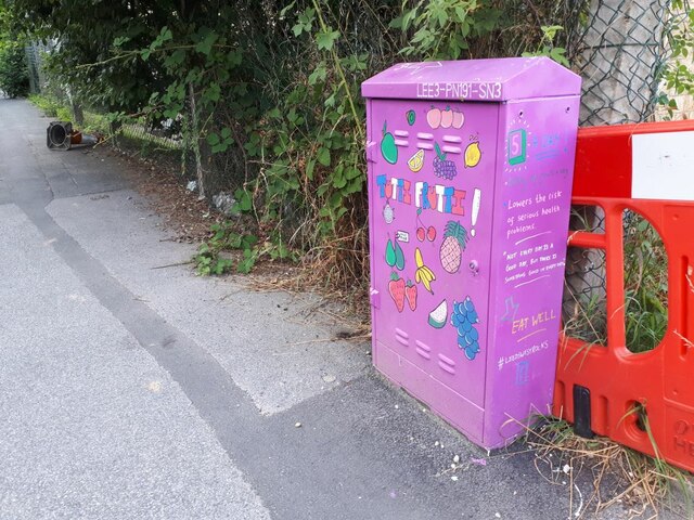
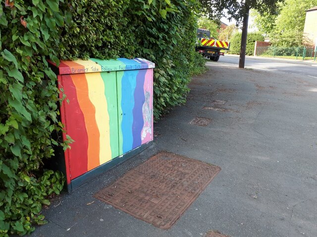
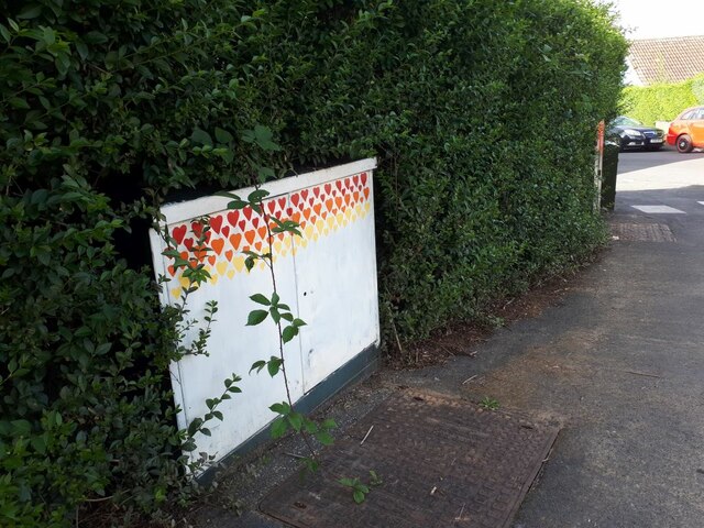
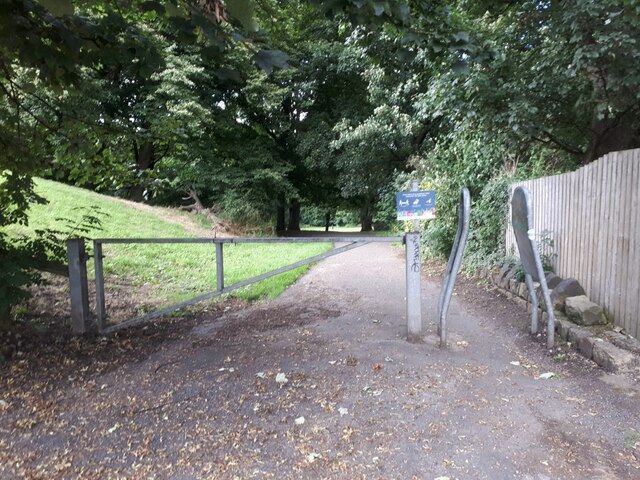
Kirkstall Images

Images are sourced within 2km of 53.817821/-1.603526 or Grid Reference SE2635. Thanks to Geograph Open Source API. All images are credited.

Wyther Parade A row of shops on the north side of Stanningley Road, occupying an eclectic set of buildings, so clearly not planned as a shopping parade.  As of 2021 it comprises Cuccina (takeaway), UB Studio (hairdresser, formerly EGAS <a href="https://www.geograph.org.uk/photo/1765111">SE2534 : Everall Gas Appliance Spares - Stanningley Road</a>), Stanningley Wines (convenience store), We Are Vapes (formerly Daniels Cafe <a href="https://www.geograph.org.uk/photo/2373787">SE2534 : Daniels Cafe & Take Away - Stanningley Road</a>), Pure Raw Feeds, Burgerama, FibreMold, Mother India (another takeaway) and Menz (sic) Hair Studio.
Wyther Parade
A row of shops on the north side of Stanningley Road, occupying an eclectic set of buildings, so clearly not planned as a shopping parade. As of 2021 it comprises Cuccina (takeaway), UB Studio (hairdresser, formerly EGAS SE2534 : Everall Gas Appliance Spares - Stanningley Road), Stanningley Wines (convenience store), We Are Vapes (formerly Daniels Cafe SE2534 : Daniels Cafe & Take Away - Stanningley Road), Pure Raw Feeds, Burgerama, FibreMold, Mother India (another takeaway) and Menz (sic) Hair Studio.
Trevor's memorial box A recent work by the Bramley Tate group, maybe commissioned specially for the family of someone called Trevor in whose loving memory it is dedicated. This is on the corner of Trescoe Avenue.
Trevor's memorial box
A recent work by the Bramley Tate group, maybe commissioned specially for the family of someone called Trevor in whose loving memory it is dedicated. This is on the corner of Trescoe Avenue.
Brick effect box, Landseer Road A recent addition to the Bramley Tate outdoor gallery.
Brick effect box, Landseer Road
A recent addition to the Bramley Tate outdoor gallery.
Sold: one garage The householder on Waterloo Lane is having an extension built, and there was a sign on the fence saying "Garage for sale". Obviously they found a buyer, as only the garage door and concrete floor slab panels remained, stacked against the side fence.

To the left is a path cutting through to Wellington Gardens <a href="https://www.geograph.org.uk/photo/4775123">SE2435 : Footpath from Waterloo Lane to Wellington Gardens</a>.
Sold: one garage
The householder on Waterloo Lane is having an extension built, and there was a sign on the fence saying "Garage for sale". Obviously they found a buyer, as only the garage door and concrete floor slab panels remained, stacked against the side fence. To the left is a path cutting through to Wellington Gardens SE2435 : Footpath from Waterloo Lane to Wellington Gardens.
Tutti Frutti A recent addition, I think, to the painted boxes in this area.  I've included it in the shared description for Bramley Tate but this one is credited to "Leeds West Rocks" which may be a different group of people. The artwork is to encourage healthy eating.
Tutti Frutti
A recent addition, I think, to the painted boxes in this area. I've included it in the shared description for Bramley Tate but this one is credited to "Leeds West Rocks" which may be a different group of people. The artwork is to encourage healthy eating.
Rainbow box A recent addition, I think, to the painted boxes in this area by Bramley Tate. This one is on the corner of Ganners Hill and Wellington Grove.
Rainbow box
A recent addition, I think, to the painted boxes in this area by Bramley Tate. This one is on the corner of Ganners Hill and Wellington Grove.
Box with coloured hearts A recent addition, I think, to the painted boxes in this area by Bramley Tate. This one is on the corner of Ganners Hill and Ganners Road.
Box with coloured hearts
A recent addition, I think, to the painted boxes in this area by Bramley Tate. This one is on the corner of Ganners Hill and Ganners Road.
Entrance to Bramley Fall woods  This entrance is off Leeds and Bradford Road, just east of the football pitches.
Entrance to Bramley Fall woods
This entrance is off Leeds and Bradford Road, just east of the football pitches.
Steps out of Bramley Fall woods  There was a deep contrast between the sunlit playing fields to the left, and the shade of the woods.  The steps are also seen in <a href="https://www.geograph.org.uk/photo/3477659">SE2436 : Steps - Bramley Fall Park</a>.
Steps out of Bramley Fall woods
There was a deep contrast between the sunlit playing fields to the left, and the shade of the woods. The steps are also seen in SE2436 : Steps - Bramley Fall Park.
Bramley Fall exercise trail: horizontal bars  One of several fitness stations around a trail through the wood. I presume these are for swinging by the arms.
Bramley Fall exercise trail: horizontal bars
One of several fitness stations around a trail through the wood. I presume these are for swinging by the arms.
Bramley Fall exercise trail: strap hangers One of several fitness stations around a trail through the wood. These look like essential training equipment for would-be London commuters.
Bramley Fall exercise trail: strap hangers
One of several fitness stations around a trail through the wood. These look like essential training equipment for would-be London commuters.
Bramley Fall : avenue of trees Part of the main bridleway circuit of the woods.
Bramley Fall : avenue of trees
Part of the main bridleway circuit of the woods.
Kirkstall Abbey, west front
Kirkstall Abbey, west side
Kirkstall Abbey, southwest corner
Kirkstall Abbey, east window
Flower bed, Kirkstall Abbey Park
Kirkstall Abbey ruins
Show me another place!

Kirkstall is located at Grid Ref: SE2635 (Lat: 53.817821, Lng: -1.603526)

Division: West Riding

Unitary Authority: Leeds

Police Authority: West Yorkshire

What 3 Words

///bids.drank.tasty. Near Horsforth, West Yorkshire

Nearby Locations

Kirkstall

Related Wikis

Abbey Light Railway

The Abbey Light Railway was a 2 ft (610 mm) narrow gauge railway in Kirkstall, Leeds, West Yorkshire, England. Built by enthusiasts, the Railway ran from...

Kirkstall

Kirkstall is a north-western suburb of Leeds, West Yorkshire, England, on the eastern side of the River Aire. The area sits in the Kirkstall ward of Leeds...

Kirkstall Bridge

Kirkstall Bridge is a Grade II listed road bridge in Kirkstall, City of Leeds, West Yorkshire, leading the B6157 road across the River Aire and the railway...

St Stephen's Church, Kirkstall

St. Stephen's Church is a Church of England church in Kirkstall, Leeds. The church has been Grade II listed since 5 August 1976. == Location == The church...

Nearby Amenities

Located within 500m of 53.817821,-1.603526
Traffic Signals
Lat/Long: 53.8151956/-1.6041355
Mini Roundabout
Lat/Long: 53.814515/-1.6042239
Traffic Signals
Lat/Long: 53.8165258/-1.5987708
Crossing
Button Operated: yes
Crossing: traffic_signals
Crossing Ref: pelican
Kerb: lowered
Tactile Paving: yes
Traffic Signals Vibration: yes
Lat/Long: 53.8216853/-1.6072023
Waterway: sluice_gate
Lat/Long: 53.8193512/-1.6046179
Kirkstall
Is In: Leeds, West Yorkshire, England, UK
Place: suburb
Wikidata: Q3815605
Lat/Long: 53.8155554/-1.6001911
Parking
Access: private
Note: service area
Lat/Long: 53.8167425/-1.6015541
Fuel
Morrisons
Addr City: Leeds
Addr Postcode: LS5 3RP
Addr Street: Savins Mill Way
Brand: Morrisons
Brand Wikidata: Q922344
Brand Wikipedia: en:Morrisons
Fuel Autogas: yes
Fuel Diesel: yes
Fuel Unleaded: yes
Opening Hours: Mo-Sa 06:30-22:00; Su 08:00-18:00
Website: https://my.morrisons.com/storefinder/89/leeds-kirkstall
Lat/Long: 53.8147639/-1.6037838
Noexit: yes
Lat/Long: 53.8178433/-1.6009236
Noexit: yes
Lat/Long: 53.8177387/-1.6011687
Noexit: yes
Lat/Long: 53.8176384/-1.6014089
Noexit: yes
Lat/Long: 53.817527/-1.6016628
Turning Circle
Lat/Long: 53.8220789/-1.6034828
Traffic Signals
Lat/Long: 53.8159495/-1.6043644
Line Management: termination
Location Transition: yes
Power: tower
Lat/Long: 53.8141925/-1.6012179
Atm
Notemachine
Currency GBP: yes
Drive Through: no
Operator: Notemachine
Lat/Long: 53.8135182/-1.6020819
University
Kirkstall Brewery Residences
Addr City: Leeds
Addr Postcode: LS5 3EE
Addr Street: Broad Lane
Fhrs Id: 729600
Lat/Long: 53.8150011/-1.6092865
Crossing
Crossing: marked
Crossing Markings: zebra
Tactile Paving: yes
Traffic Calming: table
Lat/Long: 53.8163564/-1.6037909
Traffic Signals
Traffic Signals Direction: both
Lat/Long: 53.8159431/-1.6056872
Car Wash
Bruce's Drive-Through Hand Car Wash
Automated: no
Self Service: no
Lat/Long: 53.8139346/-1.6003857
TCV Hollybush
Office: charity
Lat/Long: 53.8155611/-1.6080526
Bus Stop
Bridge Road Savins Mill Way
Bench: yes
Bus: yes
Local Ref: 45024146
Naptan AtcoCode: 450024146
Naptan Bearing: E
Naptan CommonName: Bridge Road Savins Mill Way
Naptan Crossing: Savins Mill Way
Naptan Indicator: Stop 45024146
Naptan PlusbusZoneRef: LEEDS
Naptan ShortCommonName: Savins Mill Way
Naptan Street: Bridge Road
Public Transport: platform
Shelter: yes
Source: naptan_import
Lat/Long: 53.8160163/-1.6049387
Bus Stop
Bridge Road Leeds & Bradford Road
Local Ref: 45012533
Naptan AtcoCode: 450012533
Naptan Bearing: W
Naptan CommonName: Bridge Road Leeds & Bradford Road
Naptan Crossing: Leeds and Bradford Road
Naptan Indicator: Stop 45012533
Naptan Landmark: Old Bridge Inn
Naptan PlusbusZoneRef: LEEDS
Naptan ShortCommonName: Leeds & Bradford Rd
Naptan Street: Bridge Road
Shelter: no
Source: naptan_import
Lat/Long: 53.8158318/-1.6063699
Traffic Signals
Lat/Long: 53.8157644/-1.6073477
Noexit: yes
Source: survey
Lat/Long: 53.8179139/-1.6005494
Bus Stop
Kirkstall Lane Kirkstall Hill
Bus: yes
Local Ref: 45010963
Naptan AtcoCode: 450010963
Naptan Bearing: W
Naptan CommonName: Kirkstall Lane Kirkstall Hill
Naptan Crossing: Kirkstall Hill
Naptan Indicator: Stop 45010963
Naptan Notes: Shelter in RTA - Removed to be replaced in approx 3 mts 20/07/09
Naptan PlusbusZoneRef: LEEDS
Naptan ShortCommonName: Kirkstall Hill
Naptan Street: Kirkstall Lane
Naptan Verified: no
Public Transport: platform
Shelter: yes
Source: naptan_import
Lat/Long: 53.8162768/-1.5996066
Bus Stop
Kirkstall Lane Kirkstall Road
Bench: yes
Bin: yes
Bus: yes
Lit: yes
Local Ref: 45010964
Naptan AtcoCode: 450010964
Naptan Bearing: E
Naptan CommonName: Kirkstall Lane Kirkstall Road
Naptan Crossing: Kirkstall Road
Naptan Indicator: Stop 45010964
Naptan Landmark: Kirkstall Leisure centre
Naptan Notes: New TF shelter and 3P tt case installed
Naptan PlusbusZoneRef: LEEDS
Naptan ShortCommonName: Leisure Centre
Naptan Street: Kirkstall Lane
Naptan Verified: no
Public Transport: platform
Shelter: yes
Source: naptan_import
Tactile Paving: no
Lat/Long: 53.8161342/-1.6014043
Bus Stop
Kirkstall Hill Kirkstall Lane
Bench: yes
Bin: yes
Bus: yes
Departures Board: realtime
Local Ref: 45011444
Naptan AtcoCode: 450011444
Naptan Bearing: SE
Naptan CommonName: Kirkstall Hill Kirkstall Lane
Naptan Crossing: Kirkstall Lane
Naptan Indicator: Stop 45011444
Naptan PlusbusZoneRef: LEEDS
Naptan ShortCommonName: Kirkstall Lane
Naptan Street: Kirkstall Hill
Naptan Verified: no
Public Transport: platform
Shelter: no
Source: naptan_import
Lat/Long: 53.816351/-1.5985193
Traffic Signals
Lat/Long: 53.8154382/-1.6018321
Traffic Signals
Lat/Long: 53.8153896/-1.6022048
Traffic Signals
Lat/Long: 53.8152896/-1.6019703
Traffic Signals
Lat/Long: 53.8153312/-1.6019007
Traffic Signals
Lat/Long: 53.8154937/-1.6019356
Traffic Signals
Crossing: traffic_signals
Crossing Ref: pelican
Kerb: flush
Tactile Paving: yes
Lat/Long: 53.8156899/-1.6022543
Traffic Signals
Crossing: traffic_signals
Crossing Ref: pelican
Kerb: flush
Tactile Paving: yes
Lat/Long: 53.8158197/-1.6019058
Traffic Signals
Lat/Long: 53.8159988/-1.6021931
Traffic Signals
Lat/Long: 53.8151215/-1.6037752
Crossing
Lat/Long: 53.8152426/-1.6042625
Traffic Signals
Lat/Long: 53.8152625/-1.6040645
Traffic Signals
Lat/Long: 53.8157665/-1.6044633
Waste Basket
Collection Times: Mo; Fr
Condition: GOOD
Operator: Leeds City Council
Ref UK Leedscc Bin: 5837
Waste: trash
Waste Basket Model: METAL SQUARE
Lat/Long: 53.8201241/-1.5977019
Fixme: stub; needs another survey to get idea of route in updated allotments
Lat/Long: 53.8202466/-1.598184
Leisure: pitch
Sport: soccer
Lat/Long: 53.8196592/-1.5972446
Post Box
Collection Times: Mo-Fr 09:00; Sa 07:00
Operator: Royal Mail
Post Box Type: pillar
Ref: LS5 124
Royal Cypher: EIIR
Royal Cypher Wikidata: Q33102113
Lat/Long: 53.8172505/-1.5990452
J. News
Addr City: Leeds
Addr Housenumber: 1-3
Addr Postcode: LS5 3JT
Addr Street: Morris Lane
Fhrs Id: 319980
Shop: convenience
Lat/Long: 53.8166829/-1.5990148
MOG's
Addr City: Leeds
Addr Housenumber: 55
Addr Postcode: LS5 3BE
Addr Street: Kirkstall Lane
Contact Email: mogscafeltd@gmail.com
Contact Facebook: https://www.facebook.com/mogsleeds
Contact Instagram: https://www.instagram.com/mogsleeds
Contact Phone: +44 7763 552044
Disused Amenity: fast_food
Disused Shop: fast_food
Fhrs Id: 1131655
Lat/Long: 53.8165861/-1.5992088
Atm
Notemachine
Currency GBP: yes
Drive Through: no
Operator: Notemachine
Lat/Long: 53.8135015/-1.602132
The Bookshop
Shop: books
Lat/Long: 53.8155436/-1.6023376
Post Box
Collection Times: Mo-Fr 09:00, Sa 07:00
Fixme: Has disappeared during building work nearby, see if reinstated. 2023-08-15
Operator: Royal Mail
Operator Wikidata: Q638098
Post Box Type: pillar
Ref: LS5 489
Royal Cypher: EVIIR
Royal Cypher Wikidata: Q33102324
Lat/Long: 53.8160021/-1.6009885
Kirkstall War Memorial
Historic: memorial
Inscription: To Our Glorious Dead 1914-1918 1939-1945
Memorial: war_memorial
Wikidata: Q26547410
Lat/Long: 53.8160209/-1.6032505
Bus Stop
Commercial Road Kirkstall
Bus: yes
Layby: yes
Local Ref: 45010925
Naptan AtcoCode: 450010925
Naptan Bearing: SE
Naptan CommonName: Commercial Road Kirkstall
Naptan Crossing: Beecroft Street
Naptan Indicator: Stop 45010925
Naptan Landmark: Kirkstall Lights PH
Naptan PlusbusZoneRef: LEEDS
Naptan ShortCommonName: Kirkstall Lights
Naptan Street: Commercial Road
Public Transport: platform
Shelter: yes
Source: naptan_import
Towards: Leeds
Lat/Long: 53.8151262/-1.6013753
Bus Stop
Kirkstall Lane Church View
Bench: no
Bin: no
Bus: yes
Lit: yes
Local Ref: 45010954
Naptan AtcoCode: 450010954
Naptan Bearing: E
Naptan CommonName: Kirkstall Lane Church View
Naptan Crossing: Church View
Naptan Indicator: Stop 45010954
Naptan PlusbusZoneRef: LEEDS
Naptan ShortCommonName: Church View
Naptan Street: Kirkstall Lane
Naptan Verified: no
Public Transport: platform
Shelter: yes
Source: naptan_import
Tactile Paving: no
Lat/Long: 53.8168096/-1.5976573
Bus Stop
Kirkstall Lane Glebe Avenue
Bench: yes
Bin: no
Bus: yes
Departures Board: timetable
Local Ref: 45010955
Naptan AtcoCode: 450010955
Naptan Bearing: N
Naptan CommonName: Kirkstall Lane Glebe Avenue
Naptan Crossing: Glebe Avenue
Naptan Indicator: Stop 45010955
Naptan Landmark: Church
Naptan Notes: New TF shelter and 3P tt case installed
Naptan PlusbusZoneRef: LEEDS
Naptan ShortCommonName: Glebe Avenue
Naptan Street: Morris lane
Naptan Verified: no
Public Transport: platform
Shelter: yes
Source: naptan_import
Tactile Paving: no
Lat/Long: 53.8172103/-1.599218
Bus Stop
Morris Lane Norman Mount
Bus: yes
Local Ref: 45010956
Naptan AtcoCode: 450010956
Naptan Bearing: SE
Naptan CommonName: Morris Lane Norman Mount
Naptan Crossing: Norman Mount
Naptan Indicator: Stop 45010956
Naptan PlusbusZoneRef: LEEDS
Naptan ShortCommonName: Norman Mount
Naptan Street: Morris Lane
Naptan Verified: no
Public Transport: platform
Shelter: yes
Source: naptan_import
Lat/Long: 53.8194838/-1.6017634
Bus Stop
Morris Lane Norman Mount
Bench: no
Bus: yes
Local Ref: 45011456
Naptan AtcoCode: 450011456
Naptan Bearing: NW
Naptan CommonName: Morris Lane Norman Mount
Naptan Crossing: Norman Mount
Naptan Indicator: Stop 45011456
Naptan PlusbusZoneRef: LEEDS
Naptan ShortCommonName: Norman Mount
Naptan Street: Morris Lane
Naptan Verified: no
Public Transport: platform
Shelter: no
Source: naptan_import
Lat/Long: 53.8195296/-1.602006
Bus Stop
Morris Lane Kirkstall Lane
Bench: no
Bin: yes
Bus: yes
Departures Board: realtime
Local Ref: 45011458
Naptan AtcoCode: 450011458
Naptan Bearing: S
Naptan CommonName: Morris Lane Kirkstall Lane
Naptan Crossing: Kirkstall Lane
Naptan Indicator: Stop 45011458
Naptan PlusbusZoneRef: LEEDS
Naptan ShortCommonName: Kirkstall Lane
Naptan Street: Morris Lane
Naptan Verified: no
Public Transport: platform
Shelter: no
Source: naptan_import;survey
Tactile Paving: no
Lat/Long: 53.8169307/-1.5989169
Bus Stop
Abbey Road Abbey Walk
Bench: no
Bin: no
Bus: yes
Kerb: raised
Local Ref: 45011553
Naptan AtcoCode: 450011553
Naptan Bearing: W
Naptan CommonName: Abbey Road Abbey Walk
Naptan Crossing: Abbey Walk
Naptan Indicator: Stop 45011553
Naptan Landmark: Abbey House Museum
Naptan PlusbusZoneRef: LEEDS
Naptan ShortCommonName: Kirkstall Abbey
Naptan Street: Abbey Road
Public Transport: platform
Shelter: yes
Source: naptan_import
Tactile Paving: no
Towards: Leeds
Lat/Long: 53.8216706/-1.6065761
Bus Stop
Abbey Road Norman Mount
Bus: yes
Kerb: raised
Local Ref: 45011555
Naptan AtcoCode: 450011555
Naptan Bearing: SE
Naptan CommonName: Abbey Road Norman Mount
Naptan Crossing: Norman Mount
Naptan Indicator: Stop 45011555
Naptan PlusbusZoneRef: LEEDS
Naptan ShortCommonName: Norman Mount
Naptan Street: Abbey Road
Public Transport: platform
Shelter: yes
Source: naptan_import
Towards: Leeds
Lat/Long: 53.8189428/-1.603156
Bus Stop
Abbey Road Norman Mount
Bench: no
Bin: no
Bus: yes
Lit: yes
Local Ref: 45011557
Naptan AtcoCode: 450011557
Naptan Bearing: NW
Naptan CommonName: Abbey Road Norman Mount
Naptan Crossing: Norman Mount
Naptan Indicator: Stop 45011557
Naptan PlusbusZoneRef: LEEDS
Naptan ShortCommonName: Norman Mount
Naptan Street: Abbey Road
Naptan Verified: no
Public Transport: platform
Shelter: no
Source: naptan_import
Tactile Paving: no
Lat/Long: 53.8188146/-1.603228
Bus Stop
Kirkstall Bridge Road
Bench: yes
Bin: no
Bus: yes
Departures Board: realtime
Kerb: raised
Lit: no
Local Ref: 45011558
Naptan AtcoCode: 450011558
Naptan Bearing: N
Naptan CommonName: Kirkstall Bridge Road
Naptan Crossing: Bridge Road
Naptan Indicator: Stop 45011558
Naptan Landmark: Leisure Centre
Naptan PlusbusZoneRef: LEEDS
Naptan ShortCommonName: Bridge Road
Naptan Street: Kirkstall Bridge Road
Naptan Verified: yes
Public Transport: platform
Shelter: yes
Source: naptan_import
Tactile Paving: no
Lat/Long: 53.8164388/-1.6023695
Bus Stop
Wyther Lane Wyther Drive
Local Ref: 45012531
Naptan AtcoCode: 450012531
Naptan Bearing: S
Naptan CommonName: Wyther Lane Wyther Drive
Naptan Crossing: Wyther Drive
Naptan Indicator: Stop 45012531
Naptan PlusbusZoneRef: LEEDS
Naptan ShortCommonName: Wyther Drive
Naptan Street: Wyther Lane
Naptan Verified: no
Source: naptan_import
Lat/Long: 53.8141803/-1.6070688
Bus Stop
Kirkstall Morrisons Bridge Road
Bench: yes
Bin: yes
Bus: yes
Local Ref: 45024147
Naptan AtcoCode: 450024147
Naptan Bearing: S
Naptan CommonName: Kirkstall Morrisons Bridge Road
Naptan Crossing: Bridge Road
Naptan Indicator: Stop 45024147
Naptan Landmark: Morrisons
Naptan PlusbusZoneRef: LEEDS
Naptan ShortCommonName: Bridge Road
Naptan Street: Savins Mill Way
Naptan Verified: no
Public Transport: platform
Shelter: yes
Source: naptan_import
Lat/Long: 53.8155732/-1.6042459
Bus Stop
Savins Mill Way Commercial Road
Bench: yes
Bin: yes
Bus: yes
Local Ref: 45024148
Naptan AtcoCode: 450024148
Naptan Bearing: W
Naptan CommonName: Savins Mill Way Commercial Road
Naptan Crossing: Commercial Road
Naptan Indicator: Stop 45024148
Naptan Landmark: Morrisons
Naptan PlusbusZoneRef: LEEDS
Naptan ShortCommonName: Savins Mill Way
Naptan Street: Savins Mill Way
Naptan Verified: no
Public Transport: platform
Shelter: yes
Source: naptan_import
Tactile Paving: no
Lat/Long: 53.8149946/-1.6032337
Traffic Signals
Button Operated: yes
Crossing: traffic_signals
Crossing Ref: pelican
Kerb: flush
Tactile Paving: yes
Traffic Signals Sound: no
Lat/Long: 53.8156753/-1.6023616
Crossing
Button Operated: yes
Crossing: traffic_signals
Crossing Ref: pelican
Kerb: flush
Tactile Paving: yes
Traffic Signals Sound: no
Traffic Signals Vibration: yes
Lat/Long: 53.8159765/-1.6023742
Noexit: yes
Source: survey
Lat/Long: 53.8176123/-1.6009715
Traffic Signals
Lat/Long: 53.8204412/-1.6046797
Crossing
Button Operated: yes
Crossing: traffic_signals
Crossing Ref: pelican
Kerb: lowered
Tactile Paving: yes
Traffic Signals Vibration: yes
Lat/Long: 53.8217547/-1.6070119
Traffic Signals
Button Operated: yes
Crossing: traffic_signals
Crossing Ref: pelican
Kerb: flush
Tactile Paving: no
Traffic Signals Sound: no
Lat/Long: 53.8159203/-1.6020166
Traffic Signals
Crossing: traffic_signals
Crossing Ref: pelican
Kerb: flush
Tactile Paving: yes
Lat/Long: 53.816014/-1.6020199
Traffic Signals
Crossing: traffic_signals
Crossing Ref: pelican
Kerb: flush
Tactile Paving: yes
Lat/Long: 53.8152147/-1.6016719
Parking
Access: yes
Parking: surface
Lat/Long: 53.8147449/-1.6078
Recycling
Check Date Recycling: 2021-10-22
Recycling Glass Bottles: yes
Recycling Type: container
Lat/Long: 53.8188184/-1.5976171
Entrance: main
Lat/Long: 53.8139689/-1.6023821
Entrance: main
Lat/Long: 53.8142302/-1.6026293
Entrance: main
Lat/Long: 53.8144406/-1.6028338
Crossing
Crossing: traffic_signals
Crossing Island: yes
Crossing Ref: pelican
Lat/Long: 53.8161017/-1.6010255
Fast Food
Dinner Box
Addr City: Leeds
Addr Housenumber: 57
Addr Postcode: LS5 3BE
Addr Street: Kirkstall Lane
Addr Suburb: Kirkstall
Cuisine: chinese
Fhrs Id: 726337
Opening Hours: We-Mo 17:15-23:59
Lat/Long: 53.8166328/-1.5990781
Atm
Notemachine
Currency GBP: yes
Drive Through: no
Operator: Notemachine
Lat/Long: 53.8134854/-1.6021803
Abbey Beer & Wine
Addr City: Leeds
Addr Housenumber: 8
Addr Postcode: LS5 3AQ
Addr Street: Commercial Road
Addr Suburb: Kirkstall
Fhrs Id: 466944
Opening Hours: We 10:00-16:00; Th 10:00-14:00; Fr 10:00-14:00; Sa 10:00-16:00
Shop: brewing
Lat/Long: 53.8155699/-1.6023661
Entrance: main
Lat/Long: 53.8163509/-1.6002782
Fast Food
Kirkstall Fisheries
Addr City: Leeds
Addr Housename: Kirkstall Fisheries
Addr Housenumber: 6
Addr Postcode: LS5 3JT
Addr Street: Morris Lane
Addr Suburb: Kirkstall
Cuisine: fish_and_chips
Fhrs Id: 1081215
Opening Hours: Mo-Fr 11:30-19:30
Smoking: no
Wheelchair: no
Lat/Long: 53.8169302/-1.5988143
Abbey Wedding Warehouse
Addr City: Leeds
Addr Housenumber: 2B
Addr Postcode: LS5 3AQ
Addr Street: Commercial Road
Clothes: wedding
Contact Phone: +44 7711 768471
Contact Website: https://www.abbeyweddingwarehouse.co.uk/
Shop: clothes
Source: Bing;local_knowledge
Lat/Long: 53.8157179/-1.6025998
Restaurant
Gallery Forty One
Addr City: Leeds
Addr Housenumber: 41-43
Addr Postcode: LS5 3AW
Addr Street: Commercial Road
Addr Suburb: Kirkstall
Cuisine: italian
Fhrs Id: 323313
Website: https://www.gallery-fortyone.com/
Lat/Long: 53.8149252/-1.6010619
Note: changes to part with handrail somewhere here
Lat/Long: 53.816287/-1.5968029
Crossing
Crossing: uncontrolled
Lat/Long: 53.8165661/-1.5985491
Fixme: wall does not go all around; morris lane to somewhere near here is 'open'
Lat/Long: 53.8179927/-1.5995504
Fixme: approx position; could be more accurate; not sure footway is straight?
Lat/Long: 53.8181151/-1.5992204
Barrier: kissing_gate
Material: wood
Lat/Long: 53.8149332/-1.6019756
Entrance: yes
Lat/Long: 53.8172672/-1.5997646
Entrance: main
Lat/Long: 53.8172801/-1.5994668
Bench
Backrest: yes
Source: gps;survey
Lat/Long: 53.8187019/-1.6036041
Bench
Source: gps;survey
Lat/Long: 53.8197241/-1.6060519
Bench
Backrest: yes
Source: gps;survey
Lat/Long: 53.8197584/-1.6070673
Bench
Backrest: yes
Source: gps;survey
Lat/Long: 53.8197813/-1.6044706
Bench
Backrest: yes
Source: gps;survey
Lat/Long: 53.8199222/-1.6053335
Bench
Backrest: yes
Source: gps;survey
Lat/Long: 53.8200159/-1.6057417
Bench
Source: gps;survey
Lat/Long: 53.8202146/-1.6069735
Bench
Backrest: yes
Source: gps;survey
Lat/Long: 53.8202788/-1.6055543
Bench
Backrest: yes
Source: gps;survey
Lat/Long: 53.8207797/-1.6058133
Bench
Source: gps;survey
Lat/Long: 53.8208107/-1.6082745
Information: board
Source: gps;survey
Lat/Long: 53.8209536/-1.6072056
Bench
Backrest: yes
Source: gps;survey
Lat/Long: 53.8213328/-1.6071155
Bench
Backrest: yes
Material: metal
Source: gps;survey
Lat/Long: 53.821485/-1.6070594
Information: board
Source: gps;survey
Lat/Long: 53.8215266/-1.6074091
Waste Basket
Check Date: 2022-11-13
Source: gps;survey
Lat/Long: 53.8215489/-1.6072219
Bench
Backrest: yes
Source: gps;survey
Lat/Long: 53.8215907/-1.6075297
Bench
Source: gps;survey
Lat/Long: 53.8218078/-1.6065461
Kirkstall
Historic Railway: station
Railway: site
Wikidata: Q42377555
Wikipedia: en:Kirkstall railway station
Lat/Long: 53.8161133/-1.6077618
Cafe
The Hollybush Cafe
Addr City: Leeds
Addr Postcode: LS5 3BP
Addr Street: Broad Lane
Addr Suburb: Bramley
Fhrs Id: 559039
Opening Hours Covid19: off
Operator: TCV Hollybush
Lat/Long: 53.8156349/-1.6079434
Bicycle Parking
Lat/Long: 53.8162368/-1.6094652
Bloom Beauty Lounge & Day Spa
Shop: beauty
Lat/Long: 53.8155964/-1.6024044
Repair Lab
Craft: electronics_repair
Shop: electronics
Lat/Long: 53.8154878/-1.6022609
Pub
The New George
Addr City: Leeds
Addr Housenumber: 2-4
Addr Postcode: LS5 3AQ
Addr Street: Commercial Road
Fhrs Id: 871567
Lat/Long: 53.8156516/-1.6024823
Compressed Air
Lat/Long: 53.8147527/-1.6033751
Man Made: surveillance
Surveillance Type: camera
Lat/Long: 53.8160609/-1.6054064
Information: board
Note: Old Kirkstall Valley Park map and info
Tourism: information
Lat/Long: 53.8160685/-1.6019409
Bicycle Parking
Bicycle Parking: stands
Capacity: 12
Covered: no
Lat/Long: 53.8160827/-1.6052902
Bicycle Parking
Bicycle Parking: stands
Capacity: 4
Covered: no
Lat/Long: 53.8161382/-1.6048759
Bench
Lat/Long: 53.8163393/-1.6048773
Information: board
Tourism: information
Lat/Long: 53.8163574/-1.6048179
Clock
Lat/Long: 53.8163785/-1.6048855
Bicycle Parking
Access: yes
Bicycle Parking: stands
Capacity: 10
Covered: yes
Fee: no
Lat/Long: 53.8163692/-1.6038958
Crossing
Crossing: marked
Crossing Island: no
Tactile Paving: no
Lat/Long: 53.8175282/-1.6046786
Barrier: lift_gate
Lat/Long: 53.8183296/-1.6011107
Bicycle Parking
Bicycle Parking: stands
Capacity: 16
Covered: no
Lat/Long: 53.821517/-1.6071515
Fast Food
Pizza Connection And Balti House
Addr City: Leeds
Addr Housenumber: 45
Addr Postcode: LS5 3AW
Addr Street: Commercial Road
Addr Suburb: Kirkstall
Cuisine: indian;pizza
Fhrs Id: 1355738
Takeaway: yes
Lat/Long: 53.8148737/-1.6009811
Fast Food
Venice Pizza
Addr City: Leeds
Addr Housenumber: 44
Addr Postcode: LS5 3AQ
Addr Street: Commercial Road
Addr Suburb: Kirkstall
Cuisine: pizza
Fhrs Id: 849468
Takeaway: yes
Lat/Long: 53.8148436/-1.6014317
Arcade Club
Addr City: Leeds
Addr Place: Abbey Retail Park
Addr Postcode: LS5 3RP
Addr Street: Savins Mill Way
Fhrs Id: 1101689
Leisure: amusement_arcade
Virtual Reality: yes
Website: https://www.arcadeclub.co.uk/leeds/
Lat/Long: 53.8156591/-1.6031429
Charging Station
Capacity: 2
Operator: Pod Point
Operator Wikidata: Q42888154
Parking Fee: no
Ref: Bryn-Axel
Socket Type2: 2
Socket Type2 Output: 7000
Lat/Long: 53.8153883/-1.6037786
Cafe
Starbucks
Addr City: Leeds
Addr Place: Abbey Retail Park
Addr Street: Savins Mill Way
Addr Suburb: Kirkstall
Addr Unit: 2
Brand: Starbucks
Brand Wikidata: Q37158
Brand Wikipedia: en:Starbucks
Cuisine: coffee_shop
Fhrs Id: 1077552
Official Name: Starbucks Coffee
Takeaway: yes
Website: https://www.starbucks.com/store-locator/store/1021636/leeds-abbey-retail-park-savins-mill-way-leeds-eng-ls-5-3-rp-gb
Lat/Long: 53.8157817/-1.60359
Waste Basket
Collection Times: Mo; Fr
Condition: GOOD
Ref UK Leedscc Bin: 5820
Waste Basket Model: METAL SQUARE
Lat/Long: 53.820422/-1.603086
Waste Basket
Collection Times: Mo; Fr
Condition: GOOD
Ref UK Leedscc Bin: 2205
Waste Basket Model: METAL SQUARE
Lat/Long: 53.81847/-1.600759
Waste Basket
Collection Times: Mo-Fr
Condition: FAIR
Ref UK Leedscc Bin: 5850
Waste Basket Model: METAL TWIN
Lat/Long: 53.81611/-1.604031
Waste Basket
Collection Times: Mo-Fr
Condition: GOOD
Ref UK Leedscc Bin: 12
Waste Basket Model: METAL SQUARE
Lat/Long: 53.816349/-1.602492
Waste Basket
Collection Times: Mo-Fr
Condition: GOOD
Ref UK Leedscc Bin: 8281
Waste Basket Model: METAL SQUARE
Lat/Long: 53.816228/-1.601962
Waste Basket
Collection Times: Mo-Fr
Condition: POOR
Ref UK Leedscc Bin: 8275
Waste Basket Model: METAL TWIN
Lat/Long: 53.8173858/-1.5993685
Waste Basket
Collection Times: Mo; Fr
Condition: GOOD
Ref UK Leedscc Bin: 8276
Waste Basket Model: METAL SQUARE
Lat/Long: 53.818858/-1.597577
Waste Basket
Collection Times: Mo-Fr
Condition: POOR
Ref UK Leedscc Bin: 1660
Waste Basket Model: METAL TWIN
Lat/Long: 53.816231/-1.601186
Waste Basket
Collection Times: Mo-Fr
Condition: GOOD
Ref UK Leedscc Bin: 5819
Waste Basket Model: METAL SQUARE
Lat/Long: 53.816967/-1.599224
Waste Basket
Collection Times: Mo-Fr
Condition: GOOD
Ref UK Leedscc Bin: 5853
Waste Basket Model: METAL SQUARE
Lat/Long: 53.81639/-1.600148
Waste Basket
Collection Times: Mo-Fr
Condition: POOR
Ref UK Leedscc Bin: 1658
Waste Basket Model: METAL TWIN
Lat/Long: 53.815994/-1.600952
Waste Basket
Collection Times: Mo-Fr
Condition: FAIR
Ref UK Leedscc Bin: 5818
Waste Basket Model: METAL TWIN
Lat/Long: 53.816763/-1.599101
Waste Basket
Collection Times: Mo-Fr
Condition: FAIR
Ref UK Leedscc Bin: 2811
Waste Basket Model: METAL TWIN
Lat/Long: 53.815003/-1.603381
Waste Basket
Collection Times: Mo-Fr
Condition: FAIR
Ref UK Leedscc Bin: 5854
Waste Basket Model: METAL TWIN
Lat/Long: 53.816271/-1.599517
Waste Basket
Collection Times: Mo-Fr
Condition: FAIR
Ref UK Leedscc Bin: 5817
Waste Basket Model: METAL TWIN
Lat/Long: 53.816761/-1.598631
Waste Basket
Collection Times: Mo-Fr
Condition: POOR
Ref UK Leedscc Bin: 5851
Waste Basket Model: METAL TWIN
Lat/Long: 53.814704/-1.604462
Waste Basket
Collection Times: Mo-Fr
Condition: GOOD
Ref UK Leedscc Bin: 2810
Waste Basket Model: METAL SQUARE
Lat/Long: 53.815161/-1.602108
Waste Basket
Collection Times: Mo-Fr
Condition: FAIR
Ref UK Leedscc Bin: 5852
Waste Basket Model: METAL TWIN
Lat/Long: 53.816402/-1.5985367
Waste Basket
Collection Times: Mo-Fr
Condition: GOOD
Ref UK Leedscc Bin: 747
Waste Basket Model: METAL SQUARE
Lat/Long: 53.814957/-1.601453
Waste Basket
Collection Times: We; Su
Condition: GOOD
Ref UK Leedscc Bin: 2799
Waste Basket Model: METAL SQUARE
Lat/Long: 53.814491/-1.59855
Defibrillator
Emergency: defibrillator
Indoor: no
Ref: AHA624
Lat/Long: 53.8206865/-1.6078475
Waste Basket
Waste: trash
Lat/Long: 53.8203024/-1.6072178
Waste Basket
Waste: trash
Lat/Long: 53.8200163/-1.6058653
Charging Station
PodPoint
Capacity: 2
Lat/Long: 53.8175449/-1.605041
Cafe
Morrisons Cafe
Addr City: Leeds
Addr Housenumber: 1
Addr Postcode: LS5 3RP
Addr Street: Savins Mill Way
Brand Wikidata: Q922344
Brand Wikipedia: en:Morrisons
Opening Hours: Mo-Sa 08:00-18:00; Su 09:30-16:00
Website: https://my.morrisons.com/storefinder/89/leeds-kirkstall
Lat/Long: 53.8134231/-1.602269
Crossing
Lat/Long: 53.8178133/-1.6045788
Crossing
Lat/Long: 53.8176854/-1.6046187
Man Made: tower
Tower Type: lighting
Lat/Long: 53.8138222/-1.6052267
Man Made: tower
Tower Type: lighting
Lat/Long: 53.814131/-1.6043744
Man Made: tower
Tower Type: lighting
Lat/Long: 53.8136761/-1.6039377
Parking
Parking: surface
Lat/Long: 53.8166836/-1.6063684
Fixme: Needs continuing
Lat/Long: 53.8151152/-1.5974896
Barrier: bollard
Bollard: fixed
Material: concrete
Lat/Long: 53.8153128/-1.5972159
Speed Camera
Lat/Long: 53.8153396/-1.5972368
Bench
Backrest: no
Direction: 280
Fixme: Location approximate
Material: wood
Seats: 2
Lat/Long: 53.8162172/-1.5973173
Bench
Lat/Long: 53.8164332/-1.5984711
Bench
Lat/Long: 53.8163285/-1.5984804
Abbey Road Abbey Walk
Bus: yes
Public Transport: stop_position
Lat/Long: 53.8216343/-1.606608
Crossing
Crossing: unmarked
Crossing Island: yes
Crossing Markings: no
Kerb: lowered
Tactile Paving: yes
Lat/Long: 53.8198266/-1.6041374
Abbey Road Norman Mount
Bus: yes
Public Transport: stop_position
Lat/Long: 53.8189227/-1.6032325
Abbey Road Norman Mount
Bus: yes
Public Transport: stop_position
Lat/Long: 53.8188466/-1.60316
Kirkstall Bridge Road
Bus: yes
Public Transport: stop_position
Lat/Long: 53.8164351/-1.6022927
Kirkstall Lane Kirkstall Road
Bus: yes
Public Transport: stop_position
Lat/Long: 53.8160344/-1.601336
Commercial Road Kirkstall
Bus: yes
Public Transport: stop_position
Lat/Long: 53.8150909/-1.6015061
Canoe: put_in
Leisure: pitch
Sport: canoe
Lat/Long: 53.8142399/-1.6056955
Barrier: kissing_gate
Material: metal
Lat/Long: 53.8140716/-1.605413
Bench
Backrest: no
Material: wood
Lat/Long: 53.8156655/-1.6064123
Bench
Backrest: yes
Material: wood
Lat/Long: 53.8148758/-1.60599
Bench
Lat/Long: 53.8161753/-1.6096093
Bench
Lat/Long: 53.8161321/-1.6095877
Information: board
Tourism: information
Lat/Long: 53.814505/-1.6010457
Access: no
Barrier: cycle_barrier
Bicycle: dismount
Cycle Barrier: double
Foot: yes
Motor Vehicle: no
Start Date: 2020
Wheelchair: limited
Lat/Long: 53.8201955/-1.5978602
Access: no
Barrier: cycle_barrier
Bicycle: dismount
Cycle Barrier: double
Foot: yes
Motor Vehicle: no
Start Date: 2020
Wheelchair: limited
Lat/Long: 53.8204071/-1.5983077
Recycling
Recycling Clothes: yes
Recycling Shoes: yes
Recycling Type: container
Lat/Long: 53.8143858/-1.6039516
Crossing
Button Operated: yes
Crossing: traffic_signals
Lat/Long: 53.8158667/-1.6023879
Crossing
Button Operated: yes
Crossing: traffic_signals
Kerb: flush
Tactile Paving: yes
Traffic Signals Sound: no
Traffic Signals Vibration: yes
Lat/Long: 53.81599/-1.6024431
Crossing
Lat/Long: 53.8159798/-1.6056916
Traffic Signals
Traffic Signals: signal
Traffic Signals Direction: forward
Lat/Long: 53.8160659/-1.6057179
Crossing
Crossing: traffic_signals
Lat/Long: 53.815976/-1.6057631
Traffic Signals
Traffic Signals: signal
Traffic Signals Direction: forward
Lat/Long: 53.8160728/-1.6056748
Crossing
Crossing: traffic_signals
Lat/Long: 53.8159878/-1.6055285
Bicycle Parking
Bicycle Parking: stands
Capacity: 3
Lat/Long: 53.8179785/-1.6040755
The Groom Room
Addr City: Leeds
Addr Housename: Kirkstall Bridge Shopping Park
Addr Postcode: LS5 3BL
Addr Street: Bridge Road
Addr Suburb: Kirkstall
Addr Unit: 2
Shop: pet_grooming
Lat/Long: 53.8179884/-1.6042315
Veterinary
Vets4Pets
Addr City: Leeds
Addr Housename: Kirkstall Bridge Shopping Park
Addr Postcode: LS5 3BL
Addr Street: Bridge Road
Addr Suburb: Kirkstall
Addr Unit: 2
Brand: Vets4Pets
Brand Wikidata: Q16960196
Lat/Long: 53.8179912/-1.6041772
Crossing
Lat/Long: 53.8160505/-1.6056405
Crossing
Lat/Long: 53.8160459/-1.6057252
Crossing
Lat/Long: 53.8159771/-1.6060419
Bicycle Parking
Access: yes
Bicycle Parking: stands
Capacity: 6
Covered: no
Fee: no
Operator: Leeds City Council
Operator Type: local_authority
Lat/Long: 53.8161887/-1.6017744
Bench
Backrest: yes
Material: wood
Lat/Long: 53.816106/-1.6017571
Bench
Backrest: no
Material: wood
Operator: Leeds City Council
Seats: 2
Lat/Long: 53.8161266/-1.601843
Bench
Backrest: no
Operator: Leeds City council
Seats: 2
Lat/Long: 53.8162208/-1.6018242
Public Bookcase
Public Bookcase Type: wooden_cabinet
Lat/Long: 53.8170454/-1.600586
Artwork Type: sculpture
Colour: yellow
Material: steel
Tourism: artwork
Lat/Long: 53.8161809/-1.6019219
Fountain
Drink and Be Grateful
Material: sandstone
Lat/Long: 53.8159908/-1.6026191
Bench
Access: yes
Access Disabled: yes
Backrest: no
Material: wood
Lat/Long: 53.8161847/-1.6025668
Bench
Access: yes
Access Disabled: no
Backrest: yes
Lat/Long: 53.8161145/-1.6026248
Bench
Backrest: no
Lat/Long: 53.8160201/-1.6026211
Bench
Backrest: yes
Material: wood
Lat/Long: 53.8194141/-1.6049063
Waste Basket
Operator: Leeds City Council
Waste: trash
Lat/Long: 53.8191519/-1.5974503
Bench
Backrest: yes
Colour: black
Direction: 110
Material: steel
Seats: 2
Lat/Long: 53.8195631/-1.5976207
Freewheel Bicycle Repairs and Servicing
Addr City: Leeds
Addr Housenumber: 9
Addr Postcode: LS5 3JT
Addr Street: Morris Lane
Opening Hours: Mo-Sa 10:00-18:00
Operator: Freewheel Bicycle Repairs and Servicing
Phone: +44 7898 639851
Service Bicycle Repair: yes
Shop: bicycle
Website: https://freewheelrepairs.co.uk/
Lat/Long: 53.8169155/-1.5992456
Beecroft Street Community Orchard
Garden Type: community
Leisure: garden
Lat/Long: 53.8152314/-1.5978099
Kirkstall Abbey Community Orchard
Garden Type: community
Leisure: garden
Lat/Long: 53.8219512/-1.604953
Hollybush community orchard
Garden Type: community
Leisure: garden
Lat/Long: 53.8160098/-1.6087364
St Stephen's well community orchard
Garden Type: community
Leisure: garden
Lat/Long: 53.8176025/-1.5976109
Leeds Bike Repairs
Addr City: Leeds
Addr Housenumber: 20
Addr Street: Vicarage Avenue
Contact Facebook: https://www.facebook.com/LeedsBikeRepairs
Phone: +44 7544 687365
Service Bicycle Repair: yes
Shop: bicycle
Lat/Long: 53.8183165/-1.5967603
Crossing
Crossing: uncontrolled
Lat/Long: 53.8166386/-1.5988454
Crossing
Crossing: uncontrolled
Lat/Long: 53.8164907/-1.5989616
Crossing
Crossing: uncontrolled
Lat/Long: 53.8163957/-1.5986417
Traffic Signals
Traffic Signals: signal
Traffic Signals Direction: forward
Lat/Long: 53.8216714/-1.6071511
Traffic Signals
Traffic Signals: signal
Traffic Signals Direction: forward
Lat/Long: 53.8217678/-1.6070731
Information: route_marker
Tourism: information
Lat/Long: 53.8167513/-1.610013
Information: guidepost
Tourism: information
Lat/Long: 53.8165998/-1.6099343
Direction East: Leeds 3.25
Direction West: Liverpool 124
Waterway: milestone
Lat/Long: 53.8152833/-1.6087791
Information: guidepost
Tourism: information
Lat/Long: 53.8149021/-1.6074341
Entrance: main
Lat/Long: 53.8159325/-1.6066935
Board Type: nature
Information: board
Tourism: information
Lat/Long: 53.8197191/-1.6062489
Waste Basket
Lat/Long: 53.8159853/-1.6030249
Information: board
Tourism: information
Lat/Long: 53.8160566/-1.6030115
Cafe
Abbey Cafe
Lat/Long: 53.8206533/-1.6075659
Crossing
Crossing: uncontrolled
Lat/Long: 53.8160301/-1.6037978
Generator Method: photovoltaic
Generator Output Electricity: small_installation
Generator Source: solar
Generator Type: solar_photovoltaic_panel
Location: roof
Power: generator
Source: Bing
Lat/Long: 53.8166148/-1.5990485
Generator Method: photovoltaic
Generator Output Electricity: small_installation
Generator Source: solar
Generator Type: solar_photovoltaic_panel
Location: roof
Power: generator
Source: survey
Lat/Long: 53.8165221/-1.601783
Bicycle Rental
Bicycle Rental: docking_station
Capacity: 8
Membership: no
Operator: Beryl
Rental: ebike
Lat/Long: 53.8161437/-1.6015095
Defibrillator
Access: yes
Defibrillator Location: Kirkstall Bridge Shopping Park - on side of building on way in to car park
Emergency: defibrillator
Indoor: no
Lat/Long: 53.8162233/-1.6039269
The data included in this document is from www.openstreetmap.org. The data is made available under ODbL.

Have you been to Kirkstall?

Leave your review of Kirkstall below (or comments, questions and feedback).