Gravel Pit Hill

Hill, Mountain in Lincolnshire East Lindsey

England

Gravel Pit Hill

George and Dragon
George and Dragon Credit: Alex McGregor

Gravel Pit Hill, located in Lincolnshire, England, is a prominent hill that stands at an elevation of approximately 67 meters (220 feet). Situated near the village of Waltham, this hill is a popular destination for locals and visitors alike, offering stunning views of the surrounding countryside.

The name "Gravel Pit Hill" is derived from the historical gravel extraction activities that took place in the area. These gravel pits were excavated during the mid-20th century, which has left a lasting mark on the landscape today.

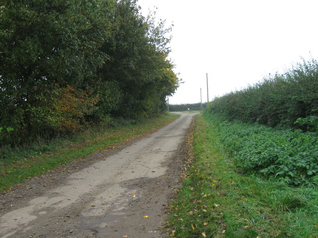
The hill itself is characterized by its gentle slopes and lush greenery, making it an ideal spot for walkers, hikers, and nature enthusiasts. The summit provides panoramic vistas of the Lincolnshire Wolds, an Area of Outstanding Natural Beauty, showcasing the rolling hills, picturesque valleys, and charming villages of the region.

Gravel Pit Hill is also home to a diverse range of flora and fauna, with several species of birds, butterflies, and wildflowers occupying its slopes. The area is protected and managed by local conservation organizations, ensuring the preservation of its natural beauty and ecological significance.

In addition to its natural attractions, Gravel Pit Hill offers various recreational activities for visitors. There are well-maintained pathways and trails that lead up the hill, providing opportunities for outdoor pursuits such as walking, jogging, and cycling. The hill is also a popular spot for picnics and family outings, with ample space for relaxation and enjoyment of the scenic surroundings.

Overall, Gravel Pit Hill is an enchanting destination that combines natural beauty, recreational opportunities, and historical significance, making it a must-visit location for those exploring Lincolnshire.

If you have any feedback on the listing, please let us know in the comments section below.

Gravel Pit Hill Images

Images are sourced within 2km of 53.202142/0.033664408 or Grid Reference TF3569. Thanks to Geograph Open Source API. All images are credited.

George and Dragon
George and Dragon
Access road
Access road
Deep Lane
Deep Lane
Church Lane
Church Lane
JJ's Cafe
JJ's Cafe
Across Cinder Hill and the A158 towards Raithby and Mavis Enderby: aerial 2016
Water Lane, from Hagworthingham to Lusby: aerial 2016 Adjacent to Snipes Dales Country Park. Two watercourses, one through trees, the other through the valley to right of road, are tributaries of River Lymn.
Water Lane, from Hagworthingham to Lusby: aerial 2016
Adjacent to Snipes Dales Country Park. Two watercourses, one through trees, the other through the valley to right of road, are tributaries of River Lymn.
Hagworthingham: aerial 2016 Across A158 and up Water Lane.
Hagworthingham: aerial 2016
Across A158 and up Water Lane.
Hagworthingham: aerial 2016 Across A158 and up Water Lane.
Hagworthingham: aerial 2016
Across A158 and up Water Lane.
Water Lane near Hagworthingham Fording a stream.
Water Lane near Hagworthingham
Fording a stream.
Through Hagworthingham towards Sausthorpe: aerial 2017
Mill Mound An oval Bronze Age barrow measuring roughly 30 metres by 20 metres, which was once used as a base for a windmill.
Mill Mound
An oval Bronze Age barrow measuring roughly 30 metres by 20 metres, which was once used as a base for a windmill.
East window, Holy Trinity Church, Hagworthingham Resurrection, Crucifixion and Ascension of Christ, by Wailes. 
The predella contains various scenes.
East window, Holy Trinity Church, Hagworthingham
Resurrection, Crucifixion and Ascension of Christ, by Wailes. The predella contains various scenes.
Stained glass window, Holy Trinity church, Hagworthingham A nativity scene in memory of William B. Cheales, d. 1883.
Glass by W. H. Constable of Cambridge.
Stained glass window, Holy Trinity church, Hagworthingham
A nativity scene in memory of William B. Cheales, d. 1883. Glass by W. H. Constable of Cambridge.
Interior, Holy Trinity church, Hagworthingham The south aisle and chancel were rebuilt in 1859 by James Fowler.
Interior, Holy Trinity church, Hagworthingham
The south aisle and chancel were rebuilt in 1859 by James Fowler.
Stained glass window, Holy Trinity church, Hagworthingham A Nativity scene, with King David above. In memory of Prince Albert, 1865
Stained glass window, Holy Trinity church, Hagworthingham
A Nativity scene, with King David above. In memory of Prince Albert, 1865
Stained glass window, Holy Trinity church, Hagworthingham "Suffer the little children to come unto me".
Details unknown.
Stained glass window, Holy Trinity church, Hagworthingham
"Suffer the little children to come unto me". Details unknown.
Holy Trinity church, Hagworthingham Grade II* listed. 11th Century onwards, the clerestory destroyed in 14th C. Restored 1859 by Fowler. In 1972 the tower collapsed!
Holy Trinity church, Hagworthingham
Grade II* listed. 11th Century onwards, the clerestory destroyed in 14th C. Restored 1859 by Fowler. In 1972 the tower collapsed!
Show me another place!

Gravel Pit Hill is located at Grid Ref: TF3569 (Lat: 53.202142, Lng: 0.033664408)

Administrative County: Lincolnshire

District: East Lindsey

Police Authority: Lincolnshire

What 3 Words

///volunteered.waking.candidate. Near Spilsby, Lincolnshire

Related Wikis

Thornbury Hill

Thornbury Hill is a hill in Hagworthingham, Lincolnshire, England.There is a "probable prehistoric enclosure" on the north slope. == References == ��2...

Hagworthingham

Hagworthingham is a village and civil parish in the East Lindsey district of Lincolnshire, England. It is on the A158, 5 miles (8 km) east of Horncastle...

Aswardby

Aswardby (pronounced "as-ard-bee") is a village situated 4 miles (6 km) north-west from Spilsby, in the East Lindsey district of Lincolnshire, England...

Lusby, Lincolnshire

Lusby is a village and former civil parish, now in the parish of Lusby with Winceby, in the East Lindsey district of Lincolnshire, England. It is situated...

Nearby Amenities

Located within 500m of 53.202142,0.033664408
Gravel Pit Hill
Ele: 73
Natural: peak
Source: Bing
Lat/Long: 53.2018569/0.0316131
Furze Farm
Place: farm
Source: Bing
Lat/Long: 53.2022422/0.0261596
The data included in this document is from www.openstreetmap.org. The data is made available under ODbL.

Have you been to Gravel Pit Hill?

Leave your review of Gravel Pit Hill below (or comments, questions and feedback).