Abridge

Settlement in Essex Epping Forest

England

Abridge

Lambourne church
Lambourne church Credit: mym

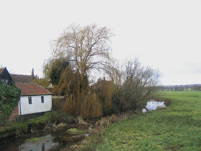
Abridge is a small village located in the county of Essex, in the eastern part of England. Situated approximately 20 miles northeast of London, it falls within the Epping Forest district. The village is bordered by the River Roding to the east and is surrounded by picturesque countryside, making it an ideal location for those seeking a peaceful and rural setting.

Abridge is known for its quaint and charming atmosphere, with a population of around 2,500 residents. The village boasts a rich history, with evidence of human settlement dating back to the Roman period. The name "Abridge" is believed to have derived from the Old English words "eab," which means "river," and "rycg," meaning "bridge," highlighting the village's historical connection to the River Roding.

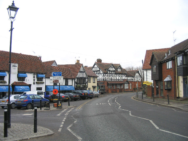
Despite its small size, Abridge offers a range of amenities and facilities for its residents. There are several local shops, including a convenience store and a post office, providing everyday essentials. The village also has a primary school, offering education for children in the local area. Additionally, Abridge is home to a number of traditional pubs and restaurants, providing a cozy and friendly atmosphere for locals and visitors alike.

The surrounding countryside offers plenty of opportunities for outdoor activities, such as walking, cycling, and horse riding, with numerous footpaths and bridleways to explore. Abridge is also within close proximity to Epping Forest, a vast woodland area renowned for its natural beauty and wildlife.

Overall, Abridge provides a tranquil and idyllic setting, combining rural charm with convenient access to nearby urban centers.

If you have any feedback on the listing, please let us know in the comments section below.
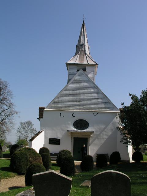
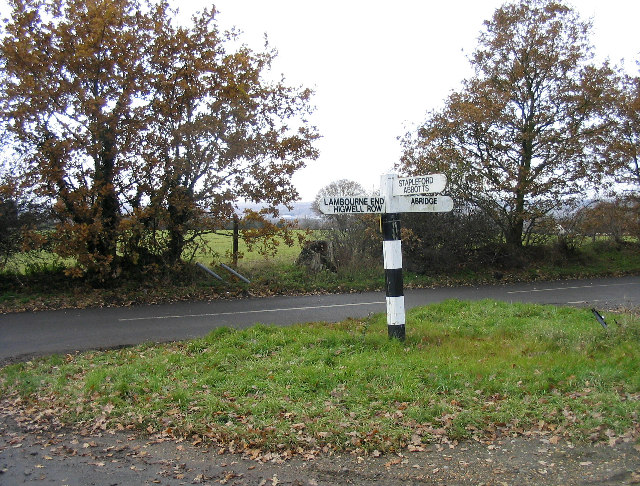
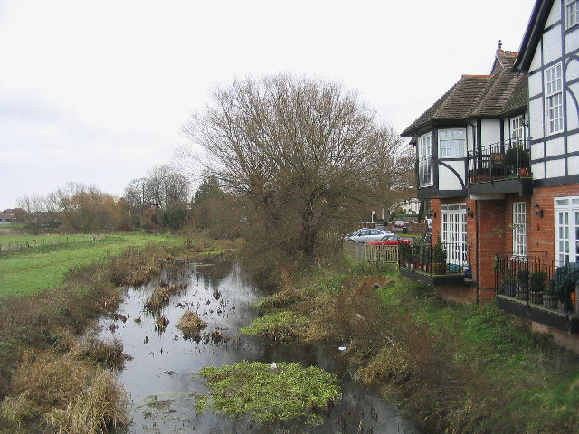
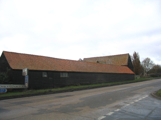
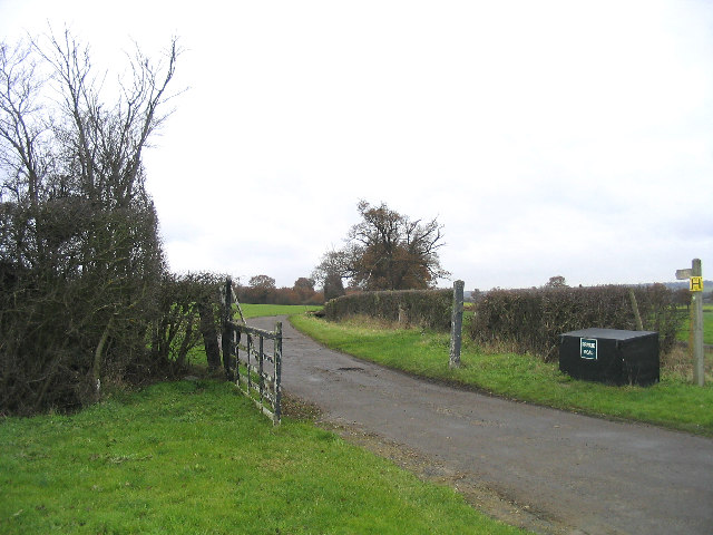
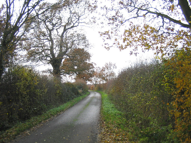
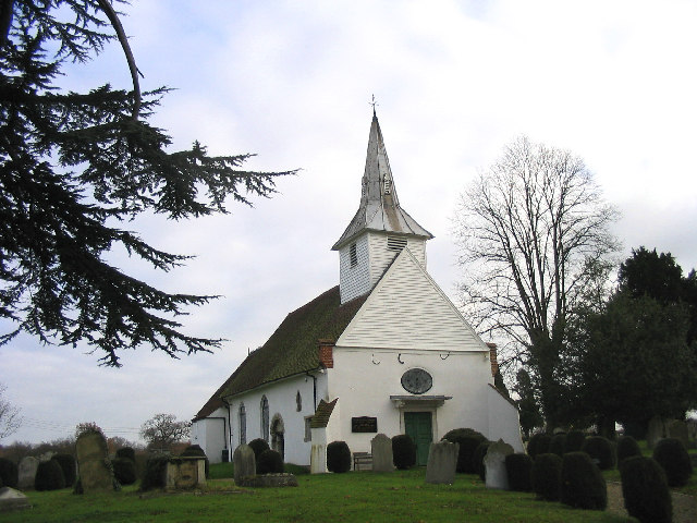
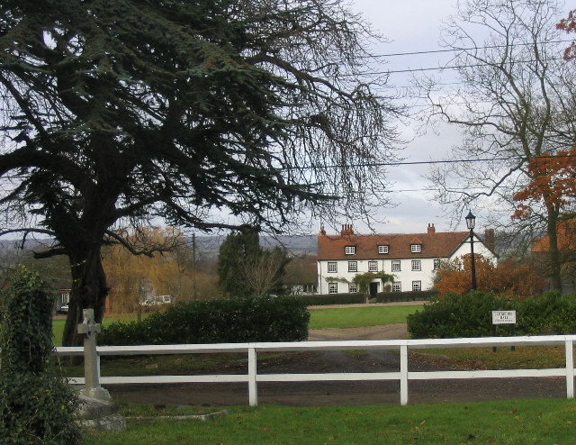
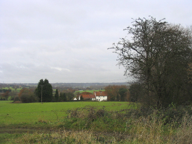
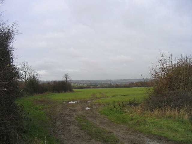
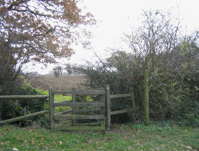
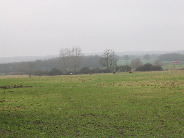
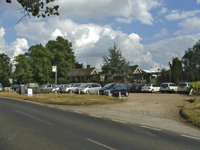
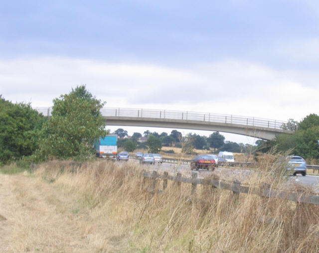
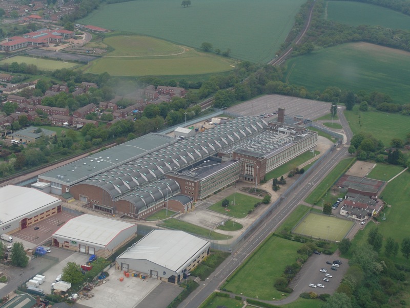
Abridge Images

Images are sourced within 2km of 51.650289/0.117948 or Grid Reference TQ4696. Thanks to Geograph Open Source API. All images are credited.

Lambourne church
Lambourne church
Crowthers Garden Centre, Abridge, Essex
Fingerpost, between Abridge and Lambourne End Situated at junction of Hoe Lane and New Road
Fingerpost, between Abridge and Lambourne End
Situated at junction of Hoe Lane and New Road
Abridge, Essex
Abridge, Essex
River Roding at Abridge A view looking west from the Roding bridge
River Roding at Abridge
A view looking west from the Roding bridge
River Roding, Abridge A view of the River Roding looking east from the Roding Bridge with Abridge Hall on right-hand side.
River Roding, Abridge
A view of the River Roding looking east from the Roding Bridge with Abridge Hall on right-hand side.
Barns, Piggotts Farm, Abridge A traditional Essex long barn - black weatherboarding and tile roof.
Barns, Piggotts Farm, Abridge
A traditional Essex long barn - black weatherboarding and tile roof.
Farm Road, Hydes Farm, Abridge
Entrance to Abridge Village Looking west along Ongar Road (the A113) towards Abridge
Entrance to Abridge Village
Looking west along Ongar Road (the A113) towards Abridge
A country lane, Abridge Church Lane is on south side of Ongar Road and leads to Lambourne Church
A country lane, Abridge
Church Lane is on south side of Ongar Road and leads to Lambourne Church
Lambourne Parish Church The church of St. Mary and All Saints dates back to middle to the 12 century. A history of church can be found at <span class="nowrap"><a title="http://www.oldlambourne.co.uk/lamchhist.htm" rel="nofollow ugc noopener" href="http://www.oldlambourne.co.uk/lamchhist.htm">Link</a><img style="margin-left:2px;" alt="External link" title="External link - shift click to open in new window" src="https://s1.geograph.org.uk/img/external.png" width="10" height="10"/></span>
Lambourne Parish Church
The church of St. Mary and All Saints dates back to middle to the 12 century. A history of church can be found at LinkExternal link
Lambourne Hall, Essex
Fields and Cottage, Abridge Looking north from Church Lane
Fields and Cottage, Abridge
Looking north from Church Lane
Farmland near Abridge
'Kissing Gate' stile near Abridge Located alongside Lambourne Church
'Kissing Gate' stile near Abridge
Located alongside Lambourne Church
Field near River Roding and M11 Taken near the Abridge Road, looking down to the M11, which runs beside the River Roding at this point.
Field near River Roding and M11
Taken near the Abridge Road, looking down to the M11, which runs beside the River Roding at this point.
Coveney Nursery, Ongar Road Coveney Nursery and Tea Shop, Ongar Road
Coveney Nursery, Ongar Road
Coveney Nursery and Tea Shop, Ongar Road
Motorway bridge- M11 Public footbridge on right of way crossing the M11 in Essex near Loughton.
Motorway bridge- M11
Public footbridge on right of way crossing the M11 in Essex near Loughton.
Show me another place!

Abridge is located at Grid Ref: TQ4696 (Lat: 51.650289, Lng: 0.117948)

Administrative County: Essex

District: Epping Forest

Police Authority: Essex

What 3 Words

///slime.giant.author. Near Abridge, Essex

Nearby Locations

Abridge

Related Wikis

Nearby Amenities

Located within 500m of 51.650289,0.117948
Maxspeed Forward: 30 mph
Traffic Sign Forward: GB:670[30 mph]
Lat/Long: 51.6518626/0.118192
Give Way
Direction: backward
Lat/Long: 51.6502822/0.1177939
Crossing
Crossing: uncontrolled
Crossing Island: no
Crossing Ref: zebra
Lat/Long: 51.6509323/0.1180249
Traffic Calming: hump
Lat/Long: 51.6459393/0.1191752
Abridge
Place: village
Wikidata: Q2215683
Wikipedia: en:Abridge
Lat/Long: 51.6509826/0.1186571
Noexit: yes
Lat/Long: 51.6487532/0.1190562
Noexit: yes
Lat/Long: 51.6504918/0.1209692
Bus Stop
Village Hall
Naptan AtcoCode: 150021002009
Naptan Bearing: NE
Naptan CommonName: Village Hall
Naptan Indicator: o/s
Naptan Landmark: Village Hall
Naptan NaptanCode: esxgapwp
Naptan Street: Ongar Road
Naptan Verified: no
Public Transport: platform
Source: naptan_import
Lat/Long: 51.6530442/0.1234928
Village Hall
Naptan AtcoCode: 150021002010
Naptan Bearing: SW
Naptan BusStopType: CUS
Naptan CommonName: Village Hall
Naptan Indicator: Opp
Naptan Landmark: Village Hall
Naptan NaptanCode: esxgapwt
Naptan Street: Ongar Road
Naptan Verified: no
Public Transport: platform
Source: naptan_import
Lat/Long: 51.6521299/0.1219362
Bus Stop
Caravan Park
Naptan AtcoCode: 150022008001
Naptan Bearing: SW
Naptan CommonName: Caravan Park
Naptan Indicator: o/s
Naptan Landmark: Caravan Park
Naptan NaptanCode: esxdgtwp
Naptan Street: London Road
Naptan Verified: no
Public Transport: platform
Source: naptan_import
Lat/Long: 51.6488583/0.1122975
Caravan Park
Naptan AtcoCode: 1500220080Y1
Naptan Bearing: NE
Naptan BusStopType: CUS
Naptan CommonName: Caravan Park
Naptan Indicator: Opp
Naptan Landmark: Caravan Park
Naptan NaptanCode: esxgptat
Naptan Street: London Road
Naptan Verified: no
Public Transport: platform
Source: naptan_import
Lat/Long: 51.6489236/0.112231
Bus Stop
Pancroft
Naptan AtcoCode: 1500220090Y2
Naptan Bearing: NE
Naptan BusStopType: CUS
Naptan CommonName: Pancroft
Naptan Crossing: Fir Trees
Naptan Indicator: E-bound
Naptan Landmark: Pancroft
Naptan NaptanCode: esxgpawt
Naptan Street: Pancroft
Naptan Verified: no
Public Transport: platform
Source: naptan_import
Lat/Long: 51.6501775/0.1219895
Bus Stop
New Farm Drive
Naptan AtcoCode: 1500220090Y3
Naptan Bearing: NE
Naptan BusStopType: CUS
Naptan CommonName: New Farm Drive
Naptan Crossing: New Farm Drive
Naptan Indicator: Towards
Naptan Landmark: New Farm Drive
Naptan NaptanCode: esxgpdad
Naptan Street: Pancroft
Naptan Verified: no
Public Transport: platform
Source: naptan_import
Lat/Long: 51.6514536/0.1240297
Bus Stop
The Blue Boar
Naptan AtcoCode: 1500ABRIDGE3
Naptan Bearing: N
Naptan CommonName: The Blue Boar
Naptan Indicator: o/s
Naptan Landmark: The Blue Boar
Naptan NaptanCode: esxgmpwp
Naptan Street: Silver Street
Naptan Verified: no
Public Transport: platform
Source: naptan_import
Lat/Long: 51.6510606/0.1179952
Bus Stop
Field Close
Naptan AtcoCode: 1500ABRIDGY4
Naptan Bearing: E
Naptan BusStopType: CUS
Naptan CommonName: Field Close
Naptan Indicator: Opp
Naptan Landmark: Field Close
Naptan NaptanCode: esxgpawp
Naptan Street: Alderwood Drive
Naptan Verified: no
Public Transport: platform
Source: naptan_import
Lat/Long: 51.648337/0.1192621
Bus Stop
Roding Hall
Naptan AtcoCode: 1500IM1048
Naptan Bearing: SW
Naptan CommonName: Roding Hall
Naptan Indicator: o/s
Naptan Landmark: Roding Hall
Naptan NaptanCode: esxgatag
Naptan Street: Ongar Road
Naptan Verified: no
Public Transport: platform
Source: naptan_import
Lat/Long: 51.6515182/0.1190791
Bus Stop
Roding Hall
Naptan AtcoCode: 1500IM1048B
Naptan Bearing: E
Naptan CommonName: Roding Hall
Naptan Indicator: Opp
Naptan Landmark: Roding Hall
Naptan NaptanCode: esxgatad
Naptan Street: Ongar Road
Naptan Verified: no
Public Transport: platform
Source: naptan_import
Lat/Long: 51.651706/0.1195165
Noexit: yes
Lat/Long: 51.651066/0.1171035
Noexit: yes
Lat/Long: 51.6492155/0.1206132
Noexit: yes
Lat/Long: 51.6505256/0.1169769
Noexit: yes
Lat/Long: 51.6494226/0.1164699
Noexit: yes
Lat/Long: 51.6510036/0.1199196
Noexit: yes
Lat/Long: 51.6511703/0.1206601
Barrier: stile
Lat/Long: 51.6519596/0.1183286
Mini Roundabout
Direction: clockwise
Lat/Long: 51.6503195/0.1179045
Restaurant
The New Roding
Addr Housenumber: 18
Addr Street: Market Place
Lat/Long: 51.6513321/0.118243
Barrier: stile
Lat/Long: 51.6540215/0.1164943
Bloody Mead
Place: locality
Lat/Long: 51.6546589/0.1196252
Barrier: stile
Lat/Long: 51.6479748/0.1155888
Barrier: stile
Lat/Long: 51.6493857/0.1158723
Barrier: stile
Lat/Long: 51.6541524/0.1155862
Noexit: yes
Lat/Long: 51.6543203/0.1160838
Addr City: Abridge
Addr Housename: Kings Cottage
Addr Street: Tree Close
Lat/Long: 51.6516481/0.1174167
Noexit: yes
Lat/Long: 51.6520448/0.1227839
Noexit: yes
Lat/Long: 51.6504892/0.1188515
Noexit: yes
Lat/Long: 51.6518495/0.1225092
Noexit: yes
Lat/Long: 51.651796/0.1165823
Noexit: yes
Lat/Long: 51.6512533/0.1168019
Noexit: yes
Lat/Long: 51.6496311/0.119972
Noexit: yes
Lat/Long: 51.6502507/0.1196869
Noexit: yes
Lat/Long: 51.6502793/0.1207212
Noexit: yes
Lat/Long: 51.6491099/0.1171934
Noexit: yes
Lat/Long: 51.6505625/0.1185
Noexit: yes
Lat/Long: 51.6504648/0.1173508
Abridge Park
Place: locality
Lat/Long: 51.6476261/0.1130543
Fuel
Addr Postcode: RM4 1XL
Brand: Shell
Brand Wikidata: Q110716465
Opening Hours: Mo-Su 06:30-22:00
Phone: +44 1992 815350
Ref Navads: NVDS353_10018939
Website: https://find.shell.com/gb/fuel/10018939-shell-abridge-service-station
Lat/Long: 51.648939/0.112849
Bus Stop
Log Cabin Cafe
Naptan AtcoCode: 1500ABRIDGE5
Naptan Bearing: SW
Naptan BusStopType: CUS
Naptan CommonName: Log Cabin Cafe
Naptan Crossing: Log Cabin Cafe
Naptan Indicator: SW-bound
Naptan NaptanCode: esxjdpga
Naptan Street: London Road
Public Transport: platform
Lat/Long: 51.6499886/0.1168588
Blue Boar Deli
Addr City: Abridge
Addr Housenumber: 1
Addr Postcode: RM4 1UA
Addr Street: Market Place
Fhrs Id: 955294
Fhrs Local Authority Id: PI/000137375
Opening Hours: Mo-Fr 07:00-16:00; Sa 08:00-16:00; Su 09:00-14:00
Phone: +44 1992 815354
Shop: deli
Lat/Long: 51.6511577/0.1178119
Abridge Florist
Phone: +44 1992 812 887
Shop: florist
Lat/Long: 51.6512265/0.1177918
Ash & Embers
Shop: fireplace
Lat/Long: 51.650905/0.1181394
Abridge/Lambourne Coal Tax Marker
Historic: boundary_stone
Lat/Long: 51.6469456/0.1188807
Bus Stop
Log Cabin Cafe
Naptan AtcoCode: 1500ABDIDGY5
Naptan BusStopType: CUS
Naptan NaptanCode: esxjpjtg
Naptan Verified: no
Public Transport: platform
Source: naptan
Lat/Long: 51.649964/0.1164311
Bus Stop
The Blue Boar
Naptan AtcoCode: 1500ABRIDGY3
Naptan BusStopType: CUS
Naptan NaptanCode: esxjpjtd
Naptan Verified: no
Public Transport: platform
Source: naptan
Lat/Long: 51.6508551/0.1180839
Noexit: yes
Lat/Long: 51.6517268/0.1235036
Give Way
Direction: forward
Lat/Long: 51.651394/0.1184257
Give Way
Direction: backward
Lat/Long: 51.6542921/0.1165197
Telephone
Booth: K6
Covered: booth
Description: K6 telephone kiosk In car park of Blue Boar Public House
He Inscription Date: 1988-04-27
Heritage: 2
Heritage Operator: Historic England
Heritage Website: https://historicengland.org.uk/listing/the-list/list-entry/1252958
Historic: building
Listed Status: Grade II
Phone: +44 1992 812005
Ref GB Nhle: 1252958
Wikidata: Q26544777
Lat/Long: 51.6507413/0.1178496
Traffic Calming: bump
Lat/Long: 51.650829/0.1178065
Noexit: yes
Lat/Long: 51.6507315/0.117011
Noexit: yes
Lat/Long: 51.6486936/0.1134034
Noexit: yes
Lat/Long: 51.6502978/0.1190392
Noexit: yes
Lat/Long: 51.6491145/0.1190525
Give Way
Direction: backward
Lat/Long: 51.6502554/0.1179833
Give Way
Direction: backward
Traffic Sign: GB:1003A
Lat/Long: 51.650186/0.1180619
Noexit: yes
Lat/Long: 51.6486256/0.119019
Give Way
Direction: backward
Traffic Sign: GB:1003A
Lat/Long: 51.6482397/0.1186717
Noexit: yes
Lat/Long: 51.6494309/0.1206195
Noexit: yes
Lat/Long: 51.6493844/0.1204194
Noexit: yes
Lat/Long: 51.6492711/0.1204697
Noexit: yes
Surface: asphalt
Lat/Long: 51.6503752/0.1217784
Noexit: yes
Lat/Long: 51.6507024/0.1215868
Give Way
Direction: backward
Traffic Sign: GB:1003A
Lat/Long: 51.6499932/0.1215823
Noexit: yes
Lat/Long: 51.6505308/0.122317
Noexit: yes
Lat/Long: 51.6506918/0.1239177
Noexit: yes
Lat/Long: 51.6504961/0.1199112
Noexit: yes
Lat/Long: 51.6516273/0.1175295
Noexit: yes
Lat/Long: 51.6516595/0.1168712
Give Way
Direction: forward
Traffic Sign: GB:1003A
Lat/Long: 51.6510734/0.1180492
Give Way
Direction: backward
Traffic Sign: GB:1003A
Lat/Long: 51.651645/0.1200324
Description: SLOW
Direction: forward
Traffic Sign: GB:1024
Lat/Long: 51.6523251/0.1225342
Traffic Signals
Crossing: no
Traffic Signals Direction: backward
Lat/Long: 51.6524746/0.1229394
Crossing
Crossing: traffic_signals
Crossing Island: no
Kerb: lowered
Lat/Long: 51.6524498/0.1228857
Traffic Signals
Crossing: no
Traffic Signals Direction: forward
Lat/Long: 51.6524284/0.1228327
Give Way
Direction: backward
Traffic Sign: GB:1003A
Lat/Long: 51.6525911/0.1232346
Noexit: yes
Lat/Long: 51.6518523/0.1202863
Noexit: yes
Lat/Long: 51.6520805/0.1210761
Noexit: yes
Lat/Long: 51.6476742/0.1168671
Crossing
Crossing: unmarked
Tactile Paving: yes
Traffic Calming: hump
Lat/Long: 51.6480891/0.1186689
Power: pole
Lat/Long: 51.6460807/0.1188168
Traffic Calming: hump
Lat/Long: 51.6492556/0.1183307
Traffic Calming: hump
Lat/Long: 51.6465259/0.1190543
Traffic Calming: hump
Lat/Long: 51.6461131/0.1191272
Noexit: yes
Lat/Long: 51.6465679/0.120113
Budgens
Addr Housenumber: 91
Addr Postcode: RM4 1XL
Addr Street: London Road
Brand: Budgens
Brand Wikidata: Q4985016
Brand Wikipedia: en:Budgens
Fhrs Id: 1023156
Shop: convenience
Website: https://www.budgens.co.uk/our-stores/abridge
Lat/Long: 51.6488391/0.1130739
Cafe
The Blue Boar
Addr City: Abridge
Addr Housename: The Blue Boar
Addr Housenumber: 1
Addr Postcode: RM4 1UA
Addr Street: Market Place
Internet Access: yes
Outdoor Seating: yes
Phone: +44 1992812110
Website: www.theblueboarabridge.co.uk
Lat/Long: 51.6510128/0.1177472
Restaurant
The Blue Boar
Addr City: Abridge
Addr Housename: The Blue Boar
Addr Housenumber: 1
Addr Postcode: RM4 1UA
Addr Street: Market Place
Cuisine: regional;burger;sandwich;american;international
Motorcycle: yes
Phone: +44 1992812110
Website: www.theblueboarabridge.co.uk
Lat/Long: 51.6509603/0.1178315
The data included in this document is from www.openstreetmap.org. The data is made available under ODbL.

Have you been to Abridge?

Leave your review of Abridge below (or comments, questions and feedback).