Beacon Hill
Hill, Mountain in Lincolnshire
England
Beacon Hill

Beacon Hill, located in Lincolnshire, England, is a prominent hill and a popular tourist attraction in the area. Rising to a height of 168 meters (551 feet) above sea level, it offers breathtaking panoramic views of the surrounding countryside and coastal areas, making it an ideal destination for nature enthusiasts and hikers.
The hill is situated within the Lincolnshire Wolds, an Area of Outstanding Natural Beauty, which contributes to its appeal. It is known for its diverse flora and fauna, with a variety of wildflowers, trees, and wildlife thriving in the area. The hill itself is covered in heather and bracken, creating a stunning purple and green landscape, particularly during the summer months.
At the summit of Beacon Hill, visitors can find an ancient beacon, which historically served as a signal point for warning of impending danger or as a communication method. Although the original beacon is long gone, a replica has been erected to honor the hill's historical significance.
The hill offers several walking trails of varying difficulty levels, allowing visitors to explore the surrounding countryside at their own pace. These trails range from short and leisurely strolls to longer hikes that challenge even the most experienced hikers. Along these paths, visitors can discover hidden valleys, woodland areas, and open fields, immersing themselves in the natural beauty of the Lincolnshire Wolds.
Beacon Hill is easily accessible, with a designated car park and picnic area available for visitors. It is a popular spot for families, couples, and individuals seeking a peaceful retreat or an active day out in nature.
If you have any feedback on the listing, please let us know in the comments section below.
Beacon Hill Images
Images are sourced within 2km of 53.554306/-0.038390768 or Grid Reference TA3008. Thanks to Geograph Open Source API. All images are credited.


Beacon Hill is located at Grid Ref: TA3008 (Lat: 53.554306, Lng: -0.038390768)
Unitary Authority: North East Lincolnshire
Police Authority: Humberside
What 3 Words
///assume.chief.voice. Near Cleethorpes, Lincolnshire
Nearby Locations
Related Wikis

Cleethorpes Academy
Cleethorpes Academy is a coeducational secondary school with academy status, based in Cleethorpes, North East Lincolnshire, England. The school opened...
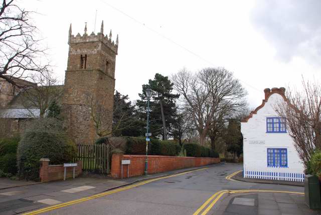
Old Clee
Old Clee is located in the Clee Road (A46) and Carr Lane area of eastern Grimsby, North East Lincolnshire, England, and adjoins the neighbouring town of...
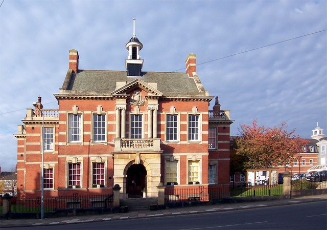
Cleethorpes Town Hall
Cleethorpes Town Hall is a municipal structure in Knoll Street, Cleethorpes, Lincolnshire, England. The town hall, which was the headquarters of Cleethorpes...
Matthew Humberstone School
Matthew Humberstone Church of England School, also known as the Matthew Humberstone School, Matthew Humberstone C of E School, Matthew Humberstone Comprehensive...
Beacon Academy, Cleethorpes
Beacon Academy is a coeducational secondary school sponsored by the Wellspring Academy Trust, in Cleethorpes, North East Lincolnshire. Beacon Academy opened...
Havelock Academy
Havelock Academy is a secondary school and sixth form with Academy status, based in Grimsby, North East Lincolnshire, England. == Admissions == It is situated...
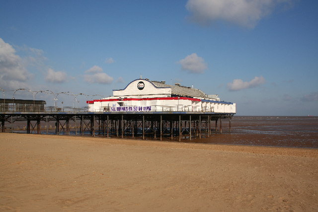
Cleethorpes Pier
Cleethorpes Pier is a pleasure pier in the town of Cleethorpes, North East Lincolnshire, England. Opened in 1873 on August Bank Holiday, it originally...

Cleethorpes railway station
Cleethorpes railway station is a railway station serving the seaside town of Cleethorpes in Lincolnshire, England. The station is managed by TransPennine...
Nearby Amenities
Located within 500m of 53.554306,-0.038390768Have you been to Beacon Hill?
Leave your review of Beacon Hill below (or comments, questions and feedback).