Bird Hill

Hill, Mountain in Hertfordshire North Hertfordshire

England

Bird Hill

Baldock bypass construction on Clothall Common Taken March 2005, you can see construction work on the Baldock bypass on the chalky landscape of Clothall Common
Baldock bypass construction on Clothall Common Credit: Paul Dixon

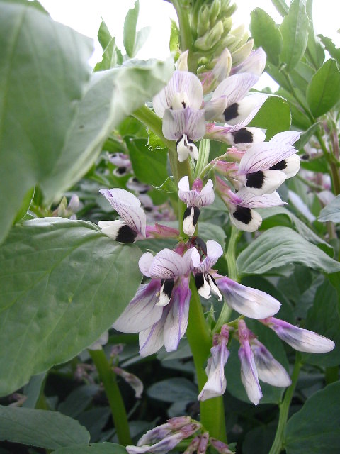
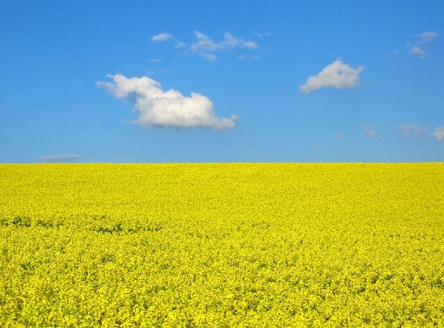
Bird Hill is a small hill located in Hertfordshire, England. Despite its name, it is not particularly known for its bird population, but rather for its picturesque views and serene atmosphere. The hill is situated in a rural area, surrounded by lush green fields and woodland, making it a popular destination for nature enthusiasts and hikers.

Standing at an elevation of approximately 200 meters, Bird Hill offers panoramic views of the surrounding countryside. On a clear day, visitors can enjoy breathtaking vistas of the rolling hills, quaint villages, and even catch a glimpse of the distant city skyline. The hilltop is a perfect spot to have a picnic, soak up the sun, or simply take in the beauty of nature.

The area surrounding Bird Hill is home to a diverse range of wildlife, including various species of birds, butterflies, and small mammals. It is not uncommon to spot rabbits, foxes, or even deer during a stroll around the hill. Birdwatchers may be able to catch sight of rare bird species that occasionally migrate through the area.

Access to Bird Hill is relatively easy, with a designated parking area available nearby. There are also well-maintained footpaths leading up to the hill, making it accessible for people of all ages and abilities. Local authorities have also installed information boards along the paths, providing interesting facts about the flora, fauna, and history of the area.

Overall, Bird Hill in Hertfordshire offers visitors a tranquil and scenic escape from urban life, allowing them to immerse themselves in the natural beauty of the English countryside.

If you have any feedback on the listing, please let us know in the comments section below.

Bird Hill Images

Images are sourced within 2km of 51.979531/-0.1549171 or Grid Reference TL2632. Thanks to Geograph Open Source API. All images are credited.

Baldock bypass construction on Clothall Common Taken March 2005, you can see construction work on the Baldock bypass on the chalky landscape of Clothall Common
Baldock bypass construction on Clothall Common
Taken March 2005, you can see construction work on the Baldock bypass on the chalky landscape of Clothall Common
Baldock bypass tunnel in the chalk hills of Weston Taken March 2005 from TL 25217 32372, this clearly shows the chalky hills above Baldock. The contour of these hills is being preserved through the construction of the cut-and-cover tunnel you see here.
Baldock bypass tunnel in the chalk hills of Weston
Taken March 2005 from TL 25217 32372, this clearly shows the chalky hills above Baldock. The contour of these hills is being preserved through the construction of the cut-and-cover tunnel you see here.
Weston Hills This shows the rolling nature of the chalk Weston Hills with Weston woods to the left. On the horizon you can see the fence marking the edge of the Baldock bypass construction as it cuts through the hill.
Weston Hills
This shows the rolling nature of the chalk Weston Hills with Weston woods to the left. On the horizon you can see the fence marking the edge of the Baldock bypass construction as it cuts through the hill.
Baldock bypass tunnel in the chalk hills of Weston Looking south from TL254329 this shows the construction of the cut-and-cover tunnel for the Baldock bypass, which preserve the contour of the chalk hills.
Baldock bypass tunnel in the chalk hills of Weston
Looking south from TL254329 this shows the construction of the cut-and-cover tunnel for the Baldock bypass, which preserve the contour of the chalk hills.
Between Weston Hills and Bush Wood This is the corner of the copse at TL257319
Between Weston Hills and Bush Wood
This is the corner of the copse at TL257319
New saplings near Newfield Hill This plantation can be found at TL 258 319 just next to the Hertfordshire Way.
New saplings near Newfield Hill
This plantation can be found at TL 258 319 just next to the Hertfordshire Way.
Clothall from Quickswood Farm Taken from halfway up the bridleway from Clothall Road to Quickswood farm, the tiny village of Clothall can be seen top right.
Clothall from Quickswood Farm
Taken from halfway up the bridleway from Clothall Road to Quickswood farm, the tiny village of Clothall can be seen top right.
Weston Hills from Quickswood Farm Looking west we see construction work on the Baldock bypass as it cuts into the Weston Hills
Weston Hills from Quickswood Farm
Looking west we see construction work on the Baldock bypass as it cuts into the Weston Hills
Flint near Quickswood A lot of the land in this area contains flint. This was taken just outside the south end of the wooded area.
Flint near Quickswood
A lot of the land in this area contains flint. This was taken just outside the south end of the wooded area.
Barn in Quickswood Taken on the Icknield Way path at TL276333, looking south west towards the wood. Can sometimes see deer running around here, but never when you have a camera!
Barn in Quickswood
Taken on the Icknield Way path at TL276333, looking south west towards the wood. Can sometimes see deer running around here, but never when you have a camera!
Rape crop near Wallington Taken at TL279334 - you can see this dip on the contours of the grid square.
Rape crop near Wallington
Taken at TL279334 - you can see this dip on the contours of the grid square.
Barley field near Wallington Barley and Wheat are a popular crops around here.
Barley field near Wallington
Barley and Wheat are a popular crops around here.
Broad beans near Wallington Half the field was wheat, the other half was broad beans. Pretty!
Broad beans near Wallington
Half the field was wheat, the other half was broad beans. Pretty!
Wallington from the Icknield Way Path Looking east towards Wallington from TL 284 337
Wallington from the Icknield Way Path
Looking east towards Wallington from TL 284 337
Fallen tree in woods near Wallington These woods on the Hertfordshire way near Wallington appear to be nameless (TL284327) but there is very pleasant and well waymarked path leading through them.
Fallen tree in woods near Wallington
These woods on the Hertfordshire way near Wallington appear to be nameless (TL284327) but there is very pleasant and well waymarked path leading through them.
Quickswood Rape Crop Taken from Icknield Way path towards Wallington.
Quickswood Rape Crop
Taken from Icknield Way path towards Wallington.
Baldock bypass tunnel in the chalk hills of Weston Taken October 2005, here you can see the line of the hill has recently been restored by filling in the area above the tunnel with chalk.
Baldock bypass tunnel in the chalk hills of Weston
Taken October 2005, here you can see the line of the hill has recently been restored by filling in the area above the tunnel with chalk.
Farm track near Clothall Farm track running north east from the bridleway
Farm track near Clothall
Farm track running north east from the bridleway
Show me another place!

Bird Hill is located at Grid Ref: TL2632 (Lat: 51.979531, Lng: -0.1549171)

Administrative County: Hertfordshire

District: North Hertfordshire

Police Authority: Hertfordshire

What 3 Words

///broadcast.forgets.scrolled. Near Baldock, Hertfordshire

Nearby Locations

Windmill Hill Bird Hill

Related Wikis

Clothall

Clothall is a village and civil parish in the county of Hertfordshire, England, with a population of 358. It is situated 2.25 miles (3.62 km) south-east...
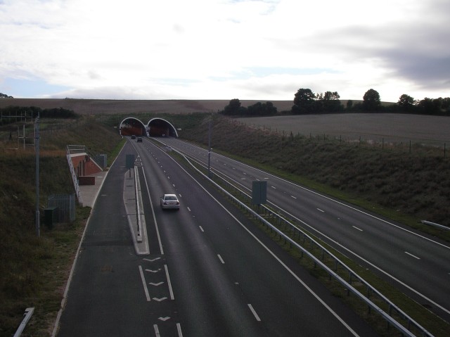
Weston Hills Tunnel

The Weston Hills Tunnel is a 230m twin road tunnel under the Weston Hills near Baldock in Hertfordshire. It was constructed as part of the A505 Baldock...
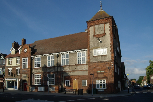
Baldock Town Hall

Baldock Town Hall is a municipal building in the High Street, Baldock, Hertfordshire, England. The structure, which now operates as an arts and heritage...

Lannock Mill, Weston

Lannock Mill is a Grade II listed tower mill at Weston, Hertfordshire, England which is derelict. == History == Lannock Mill was built in 1860. A windmill...

The Knights Templar School

The Knights Templar School is a co-educational secondary school with academy status located in the market town of Baldock in North Hertfordshire, England...

Wallington, Hertfordshire

Wallington is a small village and civil parish in the North Hertfordshire district, in the county of Hertfordshire, England, near the town of Baldock....

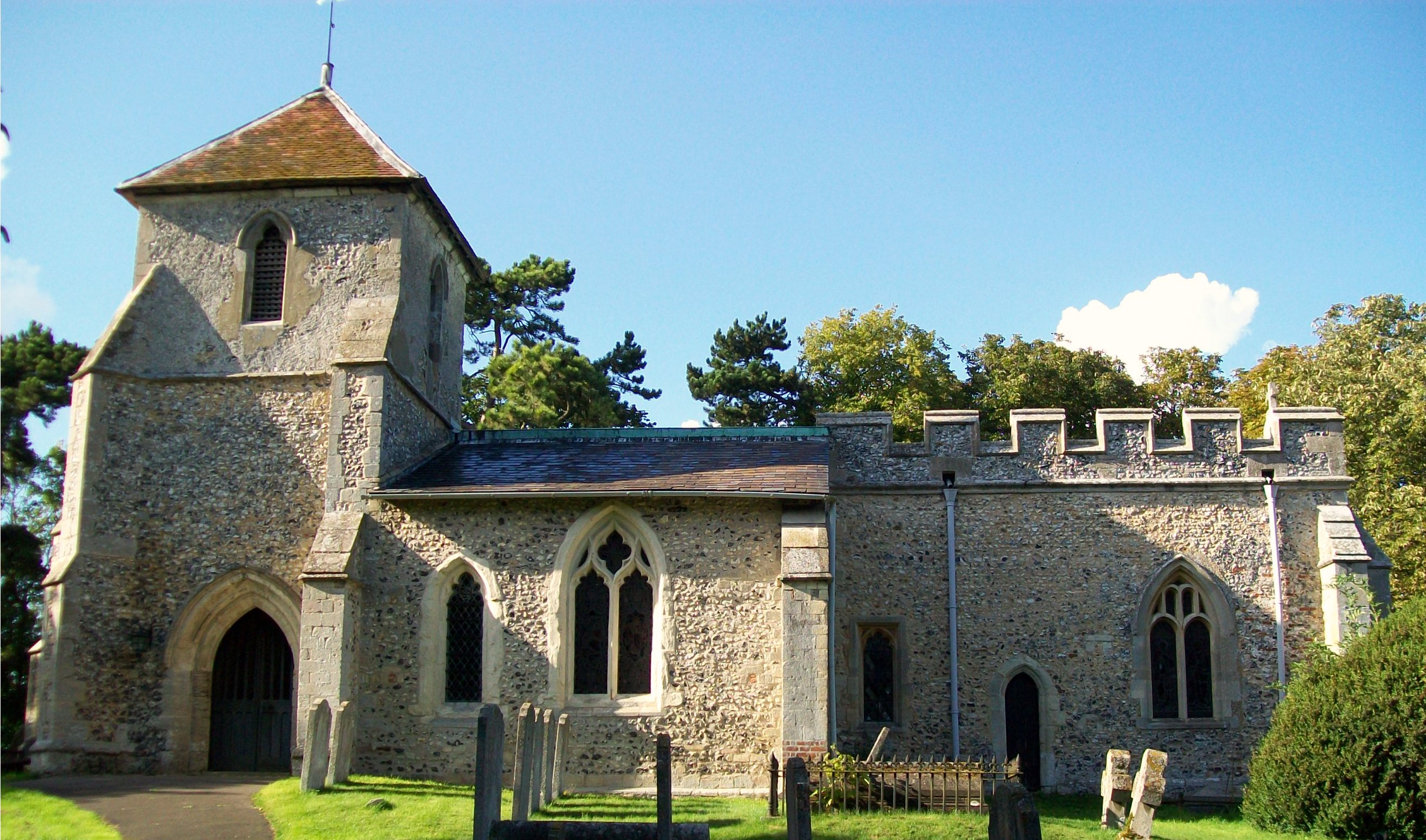
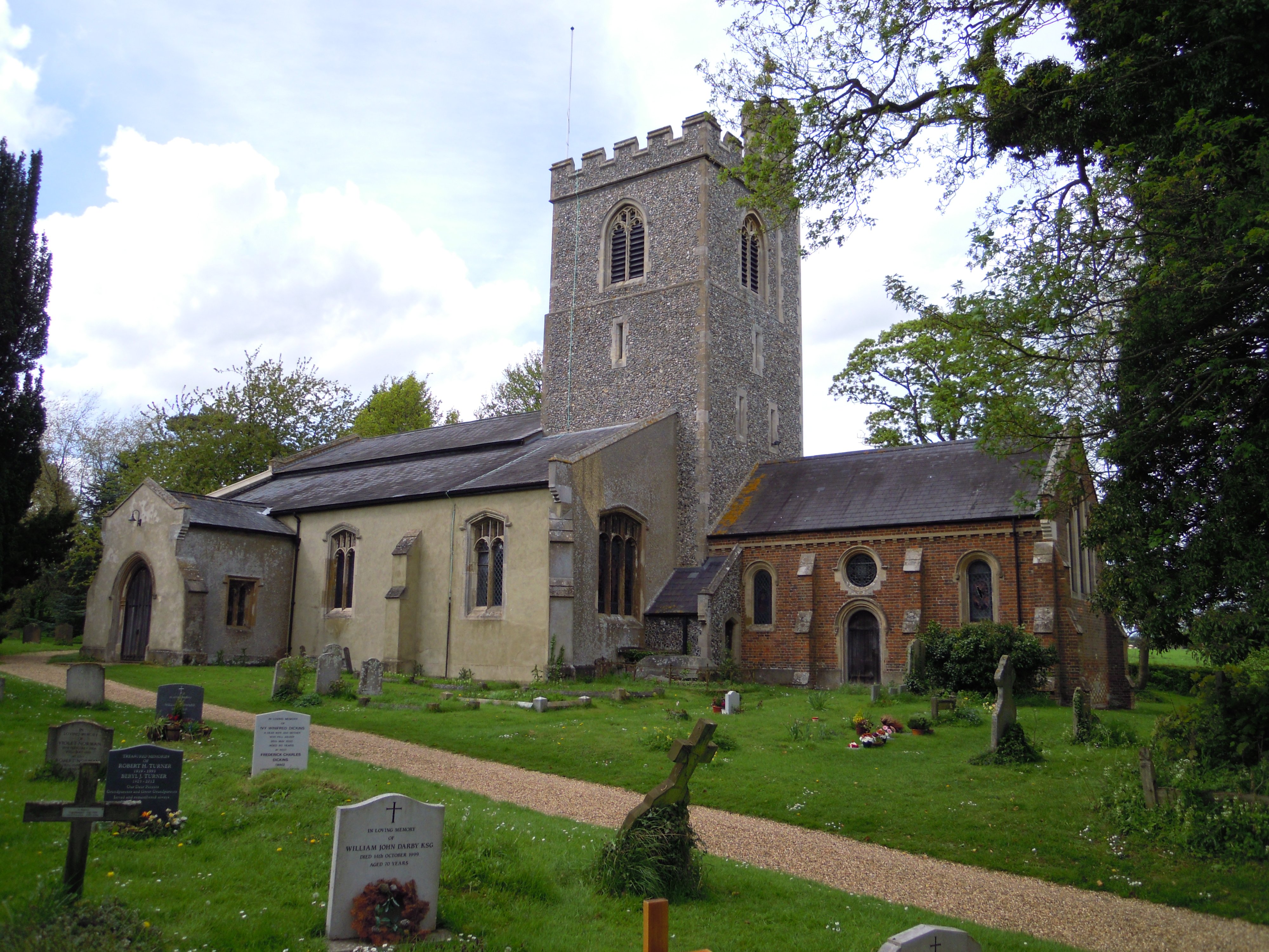
Church of St Mary the Virgin, Baldock

The Church of St Mary the Virgin is a parish church of the Church of England in Baldock in Hertfordshire. Dedicated to the Virgin Mary, the original church...

Weston, Hertfordshire

Weston is a village and civil parish in the North Hertfordshire district of Hertfordshire, England. It is located around 4 miles north of Stevenage, 2...

Nearby Amenities

Located within 500m of 51.979531,-0.1549171
Power: pole
Lat/Long: 51.9807832/-0.161496
Power: pole
Lat/Long: 51.9815464/-0.1609703
Power: pole
Lat/Long: 51.9819198/-0.158331
Power: pole
Lat/Long: 51.9800431/-0.1619949
Power: pole
Lat/Long: 51.982346/-0.1604499
Power: pole
Lat/Long: 51.979797/-0.1492837
Power: pole
Lat/Long: 51.9806092/-0.1528176
Power: pole
Lat/Long: 51.980091/-0.1505604
Power: pole
Lat/Long: 51.9793198/-0.1481828
Power: pole
Lat/Long: 51.9803953/-0.1519137
Power: pole
Lat/Long: 51.981422/-0.1564574
Colour: red
Marker: post
Material: plastic
Utility: gas
Lat/Long: 51.979828/-0.1497567
Colour: red qnd white
Marker: aerial
Material: plastic
Utility: gas
Lat/Long: 51.9798201/-0.1497755
Marker: post
Material: concrete
Utility: gas
Lat/Long: 51.979867/-0.149708
The data included in this document is from www.openstreetmap.org. The data is made available under ODbL.

Have you been to Bird Hill?

Leave your review of Bird Hill below (or comments, questions and feedback).