Festival Hill

Hill, Mountain in Lincolnshire South Holland

England

Festival Hill

The River Welland The River Welland at Spalding looking towards the twin bridges from the town side
The River Welland Credit: Peter Latham

The requested URL returned error: 429 Too Many Requests

If you have any feedback on the listing, please let us know in the comments section below.

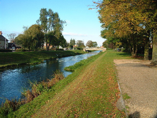
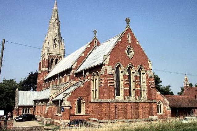
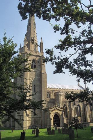
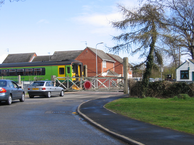
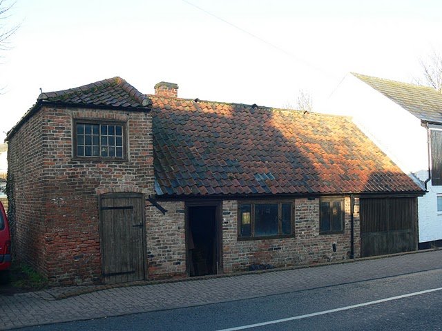
Festival Hill Images

Images are sourced within 2km of 52.797586/-0.12514065 or Grid Reference TF2623. Thanks to Geograph Open Source API. All images are credited.

The River Welland The River Welland at Spalding looking towards the twin bridges from the town side
The River Welland
The River Welland at Spalding looking towards the twin bridges from the town side
Springfields Factory Outlet and Festival Gardens Springfields in Spalding is home to over 40 outlet stores selling famous named brands in fashion and home at great discounts all year round. Also don‘t miss the beautiful landscaped festival gardens.
Springfields Factory Outlet and Festival Gardens
Springfields in Spalding is home to over 40 outlet stores selling famous named brands in fashion and home at great discounts all year round. Also don‘t miss the beautiful landscaped festival gardens.
Ditches off Delgate Bank, Weston Hills, looking W
Baytree Nurseries Garden Centre, Weston, Lincs part of the large garden centre complex and car park looking east.
Baytree Nurseries Garden Centre, Weston, Lincs
part of the large garden centre complex and car park looking east.
St. Paul, Fulney
St. Paul, Fulney
SS Mary & Nicolas, Spalding
Waiting for the train, Spalding, Lincs at the Park Road level crossing.
Waiting for the train, Spalding, Lincs
at the Park Road level crossing.
Farm track near Spalding, Lincolnshire Looking ESE from Swindler's Drove
Farm track near Spalding, Lincolnshire
Looking ESE from Swindler's Drove
Cross Gate meets the A151 There used to be an inn at this crossroads according to the 1940s map. Now there is Gate Farm to the left and Sycamore Farm to the right. The road straight ahead is Swindler's Drove. See <a href="https://www.geograph.org.uk/gridref/TF2723">TF2723</a>
Cross Gate meets the A151
There used to be an inn at this crossroads according to the 1940s map. Now there is Gate Farm to the left and Sycamore Farm to the right. The road straight ahead is Swindler's Drove. See TF2723
Fenland countryside This field alongside Swindler's Drove is criss-crossed with drains similar to the one in the picture. These drains mark the field boundaries so, although it may appear to be one giant field it is in fact several small ones joined seamlessly to the viewer's eye. Glass houses at Sycamore Farm (<a href="https://www.geograph.org.uk/gridref/TF2724">TF2724</a>) in the distance.
Fenland countryside
This field alongside Swindler's Drove is criss-crossed with drains similar to the one in the picture. These drains mark the field boundaries so, although it may appear to be one giant field it is in fact several small ones joined seamlessly to the viewer's eye. Glass houses at Sycamore Farm (TF2724) in the distance.
Countryside near Spalding Looking from Cross Gate towards High Road, the A151, just to the north east of Spalding.
Countryside near Spalding
Looking from Cross Gate towards High Road, the A151, just to the north east of Spalding.
Farmland near Spalding Looking towards the flood defence bank on the River Welland. The industrial building on the horizon is on the opposite bank of the river in <a href="https://www.geograph.org.uk/gridref/TF2625">TF2625</a>.
Farmland near Spalding
Looking towards the flood defence bank on the River Welland. The industrial building on the horizon is on the opposite bank of the river in TF2625.
Wykeham Lane near Spalding Looking northwards towards Wykeham from the junction with Rood's Lane. This is typical of many of the cross country Fenland roads once you get off the main routes.
Wykeham Lane near Spalding
Looking northwards towards Wykeham from the junction with Rood's Lane. This is typical of many of the cross country Fenland roads once you get off the main routes.
Stumps Lane, pylons and new power station The industrial plant is in <a href="https://www.geograph.org.uk/gridref/TF2625">TF2625</a> across the River Welland. The flood bank can just be made out in front of the building.
Stumps Lane, pylons and new power station
The industrial plant is in TF2625 across the River Welland. The flood bank can just be made out in front of the building.
Fenland countryside Typical scenery: large flat field crossed by pylons alleviated by shelter belt tree planting. It's the same until you get to the sea!
Fenland countryside
Typical scenery: large flat field crossed by pylons alleviated by shelter belt tree planting. It's the same until you get to the sea!
Farmland near Spalding Buildings at Home Farm. Photograph taken from Marsh Road
Farmland near Spalding
Buildings at Home Farm. Photograph taken from Marsh Road
Corrugated iron barn on Marsh Road The Welland South flood bank is clearly seen in this picture.
Corrugated iron barn on Marsh Road
The Welland South flood bank is clearly seen in this picture.
Marsh Road near Spalding The concrete mixer was probably on its way to Wragg Marsh Farm  as they were busy laying concrete in the yard here <a title="https://www.geograph.org.uk/photo/184138" href="https://www.geograph.org.uk/photo/184138">Link</a>
Marsh Road near Spalding
The concrete mixer was probably on its way to Wragg Marsh Farm as they were busy laying concrete in the yard here Link
Show me another place!

Festival Hill is located at Grid Ref: TF2623 (Lat: 52.797586, Lng: -0.12514065)

Administrative County: Lincolnshire

District: South Holland

Police Authority: Lincolnshire

What 3 Words

///stubbed.inflamed.toenail. Near Spalding, Lincolnshire

Nearby Locations

Festival Hill Fulney

Related Wikis

Spalding Power Station

Spalding Power Station is a 860 MW gas-fired power station one mile north of Spalding on West Marsh Road close to the River Welland. The current site provides...

Gleed Girls' Technology College

Gleed Girls' Technology College was a secondary school on Neville Avenue in Spalding, Lincolnshire, England. It opened on 28 April 1941 as Spalding The...

Chain Bridge Forge, Spalding

Chain Bridge Forge is an early 19th-century blacksmith's workshop, on High Street, Spalding, Lincolnshire, England. The forge, on the south bank of the...

Gleed Boys' School

Gleed Boys' School was a secondary school for boys aged 11 to 16, in Spalding, Lincolnshire, England. The school has been merged with Gleed Girls' Technology...

Nearby Amenities

Located within 500m of 52.797586,-0.12514065
Note: End of Public Highway
Lat/Long: 52.794986/-0.1270306
Bus Stop
Springfields Outlet
Bus: yes
Naptan AtcoCode: 270002700248
Naptan Bearing: S
Naptan CommonName: Springfields Outlet
Naptan Landmark: Springfields Outlet
Naptan NaptanCode: linagwga
Naptan Street: Camel Gate
Naptan Verified: no
Public Transport: platform
Source: naptan_import
Lat/Long: 52.7996744/-0.1288524
Bus Stop
St Pauls Church, adj
Bus: yes
Naptan AtcoCode: 270002700753
Naptan Bearing: NE
Naptan CommonName: St Pauls Church
Naptan Indicator: adj
Naptan Landmark: St Pauls Church
Naptan NaptanCode: linagwgp
Naptan Street: Holbeach Road
Naptan Verified: no
Public Transport: platform
Source: naptan_import
Lat/Long: 52.7968416/-0.1310952
Bus Stop
St Pauls Church, opp
Bus: yes
Naptan AtcoCode: 270002700754
Naptan Bearing: SW
Naptan CommonName: St Pauls Church
Naptan Indicator: opp
Naptan Landmark: St Pauls Church
Naptan NaptanCode: linagwgt
Naptan Street: Holbeach Road
Naptan Verified: no
Public Transport: platform
Source: naptan_import
Lat/Long: 52.7966676/-0.1314586
Barrier: lift_gate
Lift Gate Type: single
Motor Vehicle: customers
Lat/Long: 52.7989179/-0.1300792
Crossing
Crossing: unmarked
Crossing Markings: no
Lat/Long: 52.7970408/-0.1291637
Crossing
Crossing: unmarked
Crossing Markings: no
Lat/Long: 52.7969449/-0.1298211
Post Box
Collection Times: Mo-Fr 17:40; Sa 12:00
Post Box Type: pillar
Ref: PE12 303
Lat/Long: 52.7990588/-0.1284365
Fountain
Lat/Long: 52.7994177/-0.1261552
Springfields Outlet Shopping & Leisure
Information: map
Map Size: site
Map Type: scheme
Tourism: information
Lat/Long: 52.7989982/-0.1284388
Fountain
Lat/Long: 52.7991693/-0.1261144
Atm
Lat/Long: 52.7988747/-0.1283558
Crossing
Crossing: uncontrolled
Crossing Markings: yes
Lat/Long: 52.7993334/-0.1302262
Crossing
Crossing: uncontrolled
Crossing Markings: yes
Lat/Long: 52.7990826/-0.1296776
Crossing
Crossing: uncontrolled
Crossing Markings: yes
Lat/Long: 52.7998332/-0.1302604
Crossing
Crossing: uncontrolled
Crossing Markings: yes
Lat/Long: 52.7992512/-0.1300467
Crossing
Crossing: uncontrolled
Crossing Markings: yes
Lat/Long: 52.79942/-0.1304093
Crossing
Crossing: uncontrolled
Crossing Markings: yes
Lat/Long: 52.7991662/-0.1298636
Barrier: lift_gate
Lat/Long: 52.7999668/-0.1286161
Barrier: lift_gate
Lat/Long: 52.7981033/-0.1278116
Barrier: lift_gate
Lat/Long: 52.798083/-0.1279305
Crossing
Crossing: uncontrolled
Crossing Markings: yes
Lat/Long: 52.7982552/-0.1273624
Crossing
Bicycle: dismount
Crossing Island: yes
Kerb: lowered
Source: Bing
Lat/Long: 52.7978009/-0.124131
Crossing
Bicycle: dismount
Crossing Island: yes
Kerb: lowered
Source: Bing
Lat/Long: 52.7972589/-0.124718
Crossing
Bicycle: dismount
Crossing Island: yes
Kerb: lowered
Source: Bing
Lat/Long: 52.7973583/-0.1247784
Crossing
Bicycle: dismount
Crossing Island: yes
Kerb: lowered
Source: Bing
Lat/Long: 52.7976407/-0.1236247
Crossing
Bicycle: dismount
Crossing Island: yes
Kerb: lowered
Source: Bing
Lat/Long: 52.7977994/-0.1243655
Festival Hill
Natural: hill
Lat/Long: 52.7976057/-0.1251242
Toilets
Access: customers
Changing Table: yes
Female: yes
Male: yes
Operator: Blue Diamond
Toilets Disposal: flush
Wheelchair: yes
Lat/Long: 52.7999175/-0.1270557
Game
Addr City: Spalding
Addr Country: GB
Addr Housename: Springfields Outlet Centre
Addr Postcode: PE12 6EU
Addr Street: Camel Gate
Addr Unit: Unit 25
Brand: Game
Brand Wikidata: Q5519813
Brand Wikipedia: en:Game (retailer)
Fhrs Authority: South Holland
Fhrs Id: 974802
Fhrs Local Authority Id: 26877
Second Hand: yes
Shop: video_games
Lat/Long: 52.7989086/-0.1266453
Give Way
Direction: backward
Source: Maxar-Premium
Lat/Long: 52.8011314/-0.1293603
Crossing
Crossing: unmarked
Crossing Markings: no
Kerb: lowered
Source: Bing
Lat/Long: 52.8005473/-0.1288308
Traffic Signals
Traffic Signals Direction: backward
Lat/Long: 52.7991748/-0.1288258
Traffic Signals
Traffic Signals Direction: forward
Lat/Long: 52.7990857/-0.1287923
Crossing
Crossing: unmarked
Crossing Markings: no
Kerb: lowered
Source: Bing
Lat/Long: 52.8000013/-0.1288697
Crossing
Crossing: unmarked
Crossing Markings: no
Kerb: lowered
Source: Bing
Lat/Long: 52.8006293/-0.1288552
Crossing
Crossing: unmarked
Crossing Markings: no
Kerb: lowered
Source: Bing
Lat/Long: 52.8001612/-0.1288816
Crossing
Bicycle: yes
Crossing: uncontrolled
Crossing Island: yes
Kerb: lowered
Source: Bing
Lat/Long: 52.7973765/-0.1280011
Crossing
Crossing: uncontrolled
Crossing Island: yes
Kerb: lowered
Source: Bing
Lat/Long: 52.7972099/-0.1272121
Crossing
Crossing: uncontrolled
Crossing Island: yes
Kerb: lowered
Source: Bing
Lat/Long: 52.7971206/-0.1272053
Barrier: kerb
Lat/Long: 52.7966348/-0.1317581
Crossing
Crossing: unmarked
Crossing Markings: no
Kerb: lowered
Source: Bing
Lat/Long: 52.7977844/-0.1280738
Crossing
Bicycle: yes
Crossing: uncontrolled
Crossing Island: yes
Kerb: lowered
Source: Bing
Lat/Long: 52.7974081/-0.1278976
Crossing
Crossing: unmarked
Crossing Markings: no
Kerb: lowered
Source: Bing
Lat/Long: 52.7981355/-0.1281052
Crossing
Bicycle: dismount
Crossing Island: yes
Kerb: lowered
Source: Bing
Lat/Long: 52.7975495/-0.1235488
Crossing
Crossing: unmarked
Crossing Markings: no
Kerb: lowered
Source: Bing
Lat/Long: 52.7982923/-0.12218
Crossing
Bicycle: dismount
Crossing Island: yes
Kerb: lowered
Source: Bing
Lat/Long: 52.7970699/-0.1241779
Crossing
Bicycle: dismount
Crossing Island: yes
Kerb: lowered
Source: Bing
Lat/Long: 52.7970811/-0.1239317
Crossing
Crossing: uncontrolled
Crossing Island: yes
Kerb: lowered
Source: Bing
Lat/Long: 52.7971033/-0.1281368
Crossing
Crossing: uncontrolled
Crossing Island: yes
Kerb: lowered
Source: Bing
Lat/Long: 52.7971811/-0.1281617
Vending Machine
Currency GBP: yes
Payment Cards: yes
Payment Cash: yes
Payment Contactless: yes
Vending: parking_tickets
Lat/Long: 52.7992739/-0.1287556
Vending Machine
Currency GBP: yes
Payment Cards: yes
Payment Cash: yes
Payment Contactless: yes
Vending: parking_tickets
Lat/Long: 52.7992428/-0.1287502
Vending Machine
Currency GBP: yes
Payment Cards: yes
Payment Contactless: yes
Vending: parking_tickets
Lat/Long: 52.7992588/-0.1287529
Bicycle Parking
Bicycle Parking: stands
Capacity: 40
Covered: no
Fee: no
Lat/Long: 52.7991436/-0.128992
Community Centre
St. Pauls Church Hall
Addr City: Spalding
Addr Country: GB
Addr Postcode: PE12 6ER
Addr Street: Holbeach Road
Fhrs Authority: South Holland
Fhrs Id: 243077
Fhrs Local Authority Id: 5884
Lat/Long: 52.7973408/-0.1304175
Generator Method: photovoltaic
Generator Output Electricity: yes
Generator Source: solar
Generator Type: solar_photovoltaic_panel
Location: roof
Power: generator
Lat/Long: 52.7948108/-0.130058
Generator Method: photovoltaic
Generator Output Electricity: yes
Generator Source: solar
Generator Type: solar_photovoltaic_panel
Location: roof
Power: generator
Lat/Long: 52.7948238/-0.1301251
Generator Method: photovoltaic
Generator Output Electricity: yes
Generator Source: solar
Generator Type: solar_photovoltaic_panel
Location: roof
Power: generator
Lat/Long: 52.7977139/-0.1324962
Crossing
Lat/Long: 52.797728/-0.1233049
Crossing
Crossing: marked
Crossing Markings: yes
Lat/Long: 52.7983671/-0.1225867
Charging Station
John-dawn
Operator: Pod Point
Operator Wikidata: Q42888154
Lat/Long: 52.7990062/-0.1296558
Bench
Lat/Long: 52.7996259/-0.1257895
Bench
Lat/Long: 52.7985849/-0.12588
Bench
Lat/Long: 52.7988794/-0.1261563
Bench
Lat/Long: 52.7997051/-0.1258386
Bench
Lat/Long: 52.7989065/-0.1258904
Waste Basket
Lat/Long: 52.7994037/-0.1256766
Bench
Lat/Long: 52.7987618/-0.1260972
Bench
Backrest: yes
Material: wood
Lat/Long: 52.7989726/-0.1261357
Bus Stop
Springfields Outlet
Bus: yes
Public Transport: platform
Lat/Long: 52.7990352/-0.12913
Ferry Terminal
Springfields Outlet Shopping & Festival Gardens
Ferry: yes
Network: Spalding Water Taxi
Public Transport: stop_position
Lat/Long: 52.7987558/-0.1307845
Dalehead Foods
Industrial: slaughterhouse
Landuse: industrial
Lat/Long: 52.7940547/-0.1274623
Bush Tyres
Shop: tyres
Lat/Long: 52.7969238/-0.1264825
Crossing
Crossing: uncontrolled
Crossing Markings: yes
Lat/Long: 52.7982874/-0.1278133
Access: customers
Addr City: Spalding
Addr Housename: SPringfields
Addr Postcode: PE12 6EU
Addr Street: South Avenue
Entrance: secondary
Ref: Springfields South Entrance
Wheelchair: yes
Lat/Long: 52.7983045/-0.1273881
Craghoppers Outlet
Shop: outdoor
Lat/Long: 52.7993513/-0.1266755
Crossing
Crossing: uncontrolled
Crossing Markings: yes
Lat/Long: 52.7995094/-0.1287252
Crossing
Crossing: traffic_signals
Lat/Long: 52.7991449/-0.1249669
Railway: level_crossing
Lat/Long: 52.7983378/-0.1251231
Springy's Railroad
Addr City: Spalding
Addr Housename: Springfields Adventure Land
Addr Postcode: PE12 6EU
Public Transport: station
Railway: station
Train: yes
Usage: tourism
Lat/Long: 52.7989647/-0.1249298
Crossing
Crossing: uncontrolled
Crossing Markings: yes
Lat/Long: 52.7991721/-0.1294347
Crossing
Crossing: uncontrolled
Crossing Markings: yes
Lat/Long: 52.7989594/-0.1290247
Crossing
Crossing: uncontrolled
Crossing Markings: yes
Lat/Long: 52.7990117/-0.1290343
Crossing
Crossing: uncontrolled
Crossing Markings: yes
Lat/Long: 52.7989046/-0.1290135
Entrance: main
Ref: Springfields Main Entrance
Wheelchair: yes
Lat/Long: 52.799152/-0.1283422
Tulip
Artwork Type: sculpture
Material: metal
Tourism: artwork
Lat/Long: 52.7990594/-0.1285726
Railway: level_crossing
Lat/Long: 52.7988606/-0.125476
Railway: level_crossing
Lat/Long: 52.798435/-0.1253549
Barrier: lift_gate
Lat/Long: 52.7984126/-0.1288706
Crossing
Crossing: uncontrolled
Crossing Markings: yes
Lat/Long: 52.7982389/-0.1276324
Information: guidepost
Tourism: information
Lat/Long: 52.7992019/-0.1275526
Barrier: lift_gate
Lat/Long: 52.8001828/-0.1285091
Barrier: lift_gate
Lift Gate Type: single
Motor Vehicle: customers
Lat/Long: 52.7989662/-0.1299743
Barrier: lift_gate
Lift Gate Type: single
Motor Vehicle: customers
Lat/Long: 52.798889/-0.1301157
Barrier: lift_gate
Lift Gate Type: single
Motor Vehicle: customers
Lat/Long: 52.7989373/-0.1300097
Vending Machine
Vending: parking_tickets
Lat/Long: 52.7981911/-0.1273494
Vending Machine
Vending: parking_tickets
Lat/Long: 52.7996814/-0.1280288
Bus Station
Springfields Coach Parking
Bus: yes
Public Transport: station
Lat/Long: 52.7988386/-0.1291503
Playground: climbingwall
Lat/Long: 52.7992494/-0.1248448
Find Your Own Desire Line
Access: yes
Fee: no
Garden Type: botanical
Leisure: garden
Operator: Springfields Horticultural Society
Lat/Long: 52.7999444/-0.1253363
Sculpture Matrix
Access: yes
Fee: no
Leisure: garden
Operator: SPringfields Horticultural Society
Lat/Long: 52.8002843/-0.1254038
Formal Garden
Leisure: garden
Lat/Long: 52.8001488/-0.126154
Momotaro Garden
Leisure: garden
Lat/Long: 52.8001601/-0.1246713
Jungle Island (by Charlie Dimmock)
Leisure: garden
Lat/Long: 52.7979648/-0.1263642
Senses Garden
Leisure: garden
Lat/Long: 52.7978109/-0.1253204
The Wetlands
Leisure: garden
Lat/Long: 52.7982786/-0.1255298
Arboretum
Garden Type: arboretum
Leisure: garden
Lat/Long: 52.7978219/-0.1257994
Dutch Garden
Leisure: garden
Lat/Long: 52.8000065/-0.1258672
The Woodlands
Leisure: garden
Lat/Long: 52.798403/-0.1250485
A Lifetime Ahead by Kim Wilde
Leisure: garden
Lat/Long: 52.8002821/-0.1257307
Entrance: yes
Ref: Garden Centre Entrance
Lat/Long: 52.7999036/-0.1280942
Boat Rental
Adventure Paddle Boats
Lat/Long: 52.7996097/-0.1245657
Winter Wonderland Walk
Addr City: Spalding
Addr Housename: Springfields Outlet Shopping & Leisure
Addr Postcode: PE12 6EU
Addr Street: Camelgate
Tourism: attraction
Website: https://springfieldsoutlet.co.uk/winter-wonderland-walk/
Lat/Long: 52.7994555/-0.1256371
Board Type: welcome_sign
Information: board
Tourism: information
Lat/Long: 52.7985532/-0.1286388
Children's Play Area
Access: customers
Leisure: playground
Operator: Blue Diamond
Playground Theme: playground
Surface: artificial_turf
Lat/Long: 52.7998203/-0.1279757
Crossing
Crossing: traffic_signals
Crossing Ref: pelican
Kerb: lowered
Lat/Long: 52.7991259/-0.1287562
Crossing
Crossing: traffic_signals
Lat/Long: 52.7991131/-0.1288625
Crossing
Crossing: uncontrolled
Lat/Long: 52.7991204/-0.1288087
Dare2be
Shop: yes
Lat/Long: 52.7993497/-0.12677
The data included in this document is from www.openstreetmap.org. The data is made available under ODbL.

Have you been to Festival Hill?

Leave your review of Festival Hill below (or comments, questions and feedback).