Fulney

Settlement in Lincolnshire South Holland

England

Fulney

The River Welland The River Welland at Spalding looking towards the twin bridges from the town side
The River Welland Credit: Peter Latham

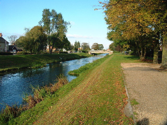
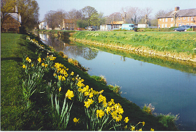
Fulney is a small village located in Lincolnshire, England. Situated in the South Holland district, it lies approximately 3 miles east of the town of Spalding. The village is surrounded by picturesque countryside, characterized by open fields and serene landscapes.

Fulney has a rich history dating back to the medieval times. It was mentioned in the Domesday Book of 1086 and has since retained its rural charm. The village is known for its quaint cottages and traditional architecture, which add to its aesthetic appeal.

Despite its small size, Fulney offers a range of amenities to its residents. The village has a local primary school, providing education to the younger population. Additionally, there are several shops and businesses that cater to the daily needs of the community.

Fulney is also home to St. Paul's Church, a beautiful historic building that serves as a place of worship for the local residents. The church holds significance in the village's religious and cultural life.

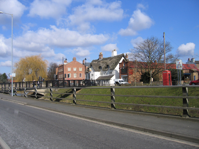
The village benefits from its proximity to the larger town of Spalding, which provides further amenities such as supermarkets, healthcare facilities, and a wider range of shops and restaurants. This makes Fulney an ideal location for those seeking a peaceful rural lifestyle while still having access to urban conveniences.

Overall, Fulney is a charming village with a rich history and a close-knit community. Its idyllic setting and range of amenities make it an attractive place to live for those seeking a tranquil and picturesque environment.

If you have any feedback on the listing, please let us know in the comments section below.
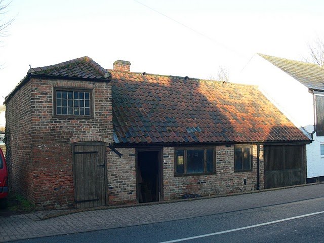
Fulney Images

Images are sourced within 2km of 52.795929/-0.13119 or Grid Reference TF2623. Thanks to Geograph Open Source API. All images are credited.

The River Welland The River Welland at Spalding looking towards the twin bridges from the town side
The River Welland
The River Welland at Spalding looking towards the twin bridges from the town side
Springfields Factory Outlet and Festival Gardens Springfields in Spalding is home to over 40 outlet stores selling famous named brands in fashion and home at great discounts all year round. Also don‘t miss the beautiful landscaped festival gardens.
Springfields Factory Outlet and Festival Gardens
Springfields in Spalding is home to over 40 outlet stores selling famous named brands in fashion and home at great discounts all year round. Also don‘t miss the beautiful landscaped festival gardens.
River Welland, Spalding. The river has been canalized in the fens and runs in straight embanked stretches.
River Welland, Spalding.
The river has been canalized in the fens and runs in straight embanked stretches.
St. Paul, Fulney
St. Paul, Fulney
SS Mary & Nicolas, Spalding
Bridge over the Welland, Spalding, Lincs – view from London Road towards Ye Olde White Horse.
Bridge over the Welland, Spalding, Lincs
– view from London Road towards Ye Olde White Horse.
Waiting for the train, Spalding, Lincs at the Park Road level crossing.
Waiting for the train, Spalding, Lincs
at the Park Road level crossing.
Farm track near Spalding, Lincolnshire Looking ESE from Swindler's Drove
Farm track near Spalding, Lincolnshire
Looking ESE from Swindler's Drove
Cross Gate meets the A151 There used to be an inn at this crossroads according to the 1940s map. Now there is Gate Farm to the left and Sycamore Farm to the right. The road straight ahead is Swindler's Drove. See <a href="https://www.geograph.org.uk/gridref/TF2723">TF2723</a>
Cross Gate meets the A151
There used to be an inn at this crossroads according to the 1940s map. Now there is Gate Farm to the left and Sycamore Farm to the right. The road straight ahead is Swindler's Drove. See TF2723
Fenland countryside This field alongside Swindler's Drove is criss-crossed with drains similar to the one in the picture. These drains mark the field boundaries so, although it may appear to be one giant field it is in fact several small ones joined seamlessly to the viewer's eye. Glass houses at Sycamore Farm (<a href="https://www.geograph.org.uk/gridref/TF2724">TF2724</a>) in the distance.
Fenland countryside
This field alongside Swindler's Drove is criss-crossed with drains similar to the one in the picture. These drains mark the field boundaries so, although it may appear to be one giant field it is in fact several small ones joined seamlessly to the viewer's eye. Glass houses at Sycamore Farm (TF2724) in the distance.
Countryside near Spalding Looking from Cross Gate towards High Road, the A151, just to the north east of Spalding.
Countryside near Spalding
Looking from Cross Gate towards High Road, the A151, just to the north east of Spalding.
Farmland near Spalding Looking towards the flood defence bank on the River Welland. The industrial building on the horizon is on the opposite bank of the river in <a href="https://www.geograph.org.uk/gridref/TF2625">TF2625</a>.
Farmland near Spalding
Looking towards the flood defence bank on the River Welland. The industrial building on the horizon is on the opposite bank of the river in TF2625.
Farmland near Spalding Buildings at Home Farm. Photograph taken from Marsh Road
Farmland near Spalding
Buildings at Home Farm. Photograph taken from Marsh Road
Corrugated iron barn on Marsh Road The Welland South flood bank is clearly seen in this picture.
Corrugated iron barn on Marsh Road
The Welland South flood bank is clearly seen in this picture.
Marsh Road near Spalding The concrete mixer was probably on its way to Wragg Marsh Farm  as they were busy laying concrete in the yard here <a title="https://www.geograph.org.uk/photo/184138" href="https://www.geograph.org.uk/photo/184138">Link</a>
Marsh Road near Spalding
The concrete mixer was probably on its way to Wragg Marsh Farm as they were busy laying concrete in the yard here Link
Entrance to Home Farm on Marsh Road
Spalding bypass The A16 crossing Marsh Road
Spalding bypass
The A16 crossing Marsh Road
Fulney Lock, Spalding The River Welland is tidal this side of Fulney Lock which helps protect Spalding from flooding in the event of a very high tide. In this photograph the level of water in the tidal part of the river is the same as in the non-tidal section and the gates are almost closed. As the tide level becomes higher the gates will close fully.
The Lincolnshire Fens used to be subject to severe flooding both from high tides and raised river levels after heavy rain. After the 1953 floods major improvement work was carried out including upgrading sluice gates, flood barriers and drainage channels. Round Spalding tidal defence on the rivers and drains is provided by doors which close on the rising tide, preventing flood water ingress, but open during low tide periods allowing rivers and drains to discharge freely into the tidal reaches and thus into the Wash. Fulney Lock on the River Welland, Marsh Road Sluice at the outfall of the Coronation Channel, Surfleet sluice at the outfall of the River Glen and the sluice on Vernatt’s Drain are examples round Spalding. See <a href="https://www.geograph.org.uk/photo/851286">TF2829 : River Glen joining the River Welland</a> and <a href="https://www.geograph.org.uk/photo/188932">TF2524 : Marsh Road Sluice, Spalding, at high tide.</a>.
Fulney Lock, Spalding
The River Welland is tidal this side of Fulney Lock which helps protect Spalding from flooding in the event of a very high tide. In this photograph the level of water in the tidal part of the river is the same as in the non-tidal section and the gates are almost closed. As the tide level becomes higher the gates will close fully. The Lincolnshire Fens used to be subject to severe flooding both from high tides and raised river levels after heavy rain. After the 1953 floods major improvement work was carried out including upgrading sluice gates, flood barriers and drainage channels. Round Spalding tidal defence on the rivers and drains is provided by doors which close on the rising tide, preventing flood water ingress, but open during low tide periods allowing rivers and drains to discharge freely into the tidal reaches and thus into the Wash. Fulney Lock on the River Welland, Marsh Road Sluice at the outfall of the Coronation Channel, Surfleet sluice at the outfall of the River Glen and the sluice on Vernatt’s Drain are examples round Spalding. See TF2829 : River Glen joining the River Welland and TF2524 : Marsh Road Sluice, Spalding, at high tide..
Show me another place!

Fulney is located at Grid Ref: TF2623 (Lat: 52.795929, Lng: -0.13119)

Division: Parts of Holland

Administrative County: Lincolnshire

District: South Holland

Police Authority: Lincolnshire

What 3 Words

///aimed.views.never. Near Spalding, Lincolnshire

Nearby Locations

Festival Hill Fulney

Related Wikis

Gleed Girls' Technology College

Gleed Girls' Technology College was a secondary school on Neville Avenue in Spalding, Lincolnshire, England. It opened on 28 April 1941 as Spalding The...

Chain Bridge Forge, Spalding

Chain Bridge Forge is an early 19th-century blacksmith's workshop, on High Street, Spalding, Lincolnshire, England. The forge, on the south bank of the...

Gleed Boys' School

Gleed Boys' School was a secondary school for boys aged 11 to 16, in Spalding, Lincolnshire, England. The school has been merged with Gleed Girls' Technology...

Spalding Academy, Lincolnshire

Spalding Academy, formerly Sir John Gleed School, is a mixed secondary school and sixth form in Spalding, Lincolnshire, England. The Sir John Gleed School...

Nearby Amenities

Located within 500m of 52.795929,-0.13119
Note: End of Public Highway
Lat/Long: 52.794986/-0.1270306
Bus Stop
St Paul's Primary School
Bus: yes
Naptan AtcoCode: 270000009143
Naptan Bearing: NE
Naptan CommonName: St Paul's Primary School
Naptan Indicator: opp
Naptan Landmark: St Paul's Primary School
Naptan NaptanCode: linjadjm
Naptan Street: Queens Road
Naptan Verified: no
Public Transport: platform
Source: naptan_import
Lat/Long: 52.7949214/-0.134767
Bus Stop
Thames Road
Bus: yes
Naptan AtcoCode: 270000009152
Naptan Bearing: S
Naptan CommonName: Thames Road
Naptan Landmark: Thames Road
Naptan NaptanCode: linjadmt
Naptan Street: Severn Road
Naptan Verified: no
Public Transport: platform
Source: naptan_import
Lat/Long: 52.7925167/-0.1316514
Bus Stop
Wensum Close
Bus: yes
Naptan AtcoCode: 270000009153
Naptan Bearing: W
Naptan CommonName: Wensum Close
Naptan Landmark: Wensum Close
Naptan NaptanCode: linjadmw
Naptan Street: Severn Road
Naptan Verified: no
Public Transport: platform
Source: naptan_import
Lat/Long: 52.7918086/-0.1329276
Bus Stop
Queens Road, opp
Bus: yes
Naptan AtcoCode: 270000009469
Naptan Bearing: E
Naptan CommonName: Queens Road
Naptan Indicator: opp
Naptan Landmark: Queens Road
Naptan NaptanCode: linjdada
Naptan Street: Holbeach Road
Naptan Verified: no
Public Transport: platform
Source: naptan_import
Lat/Long: 52.7964774/-0.1352371
Bus Stop
Springfields Outlet
Bus: yes
Naptan AtcoCode: 270002700248
Naptan Bearing: S
Naptan CommonName: Springfields Outlet
Naptan Landmark: Springfields Outlet
Naptan NaptanCode: linagwga
Naptan Street: Camel Gate
Naptan Verified: no
Public Transport: platform
Source: naptan_import
Lat/Long: 52.7996744/-0.1288524
Bus Stop
St Pauls Church, adj
Bus: yes
Naptan AtcoCode: 270002700753
Naptan Bearing: NE
Naptan CommonName: St Pauls Church
Naptan Indicator: adj
Naptan Landmark: St Pauls Church
Naptan NaptanCode: linagwgp
Naptan Street: Holbeach Road
Naptan Verified: no
Public Transport: platform
Source: naptan_import
Lat/Long: 52.7968416/-0.1310952
Bus Stop
St Pauls Church, opp
Bus: yes
Naptan AtcoCode: 270002700754
Naptan Bearing: SW
Naptan CommonName: St Pauls Church
Naptan Indicator: opp
Naptan Landmark: St Pauls Church
Naptan NaptanCode: linagwgt
Naptan Street: Holbeach Road
Naptan Verified: no
Public Transport: platform
Source: naptan_import
Lat/Long: 52.7966676/-0.1314586
Bus Stop
Queens Road, adj
Bus: yes
Naptan AtcoCode: 2700LLFP0524
Naptan Bearing: W
Naptan CommonName: Queens Road
Naptan Indicator: adj
Naptan Landmark: Queens Road
Naptan NaptanCode: linadtpm
Naptan Street: Holbeach Road
Naptan Verified: no
Public Transport: platform
Source: naptan_import
Lat/Long: 52.796403/-0.1346998
Bus Stop
St Paul's Primary School
Bus: yes
Naptan AtcoCode: 2700LSQR0416
Naptan Bearing: SW
Naptan CommonName: St Paul's Primary School
Naptan Indicator: adj
Naptan Landmark: St Paul's Primary School
Naptan NaptanCode: linadpdm
Naptan Street: Queens Road
Naptan Verified: no
Public Transport: platform
Source: naptan_import
Lat/Long: 52.7948474/-0.1346367
Bus Stop
Severn Road
Bus: yes
Naptan AtcoCode: 2700LSTR0743
Naptan Bearing: E
Naptan CommonName: Severn Road
Naptan Landmark: Severn Road
Naptan NaptanCode: linagjam
Naptan Street: Thames Road
Naptan Verified: no
Public Transport: platform
Source: naptan_import
Lat/Long: 52.793311/-0.1347024
Barrier: lift_gate
Lift Gate Type: single
Motor Vehicle: customers
Lat/Long: 52.7989179/-0.1300792
Crossing
Bicycle: yes
Crossing: unmarked
Crossing Markings: no
Kerb: lowered
Lat/Long: 52.7934249/-0.1353168
Turning Circle
Lat/Long: 52.7957469/-0.1360501
Crossing
Crossing: unmarked
Crossing Markings: no
Lat/Long: 52.7970408/-0.1291637
Crossing
Crossing: unmarked
Crossing Markings: no
Lat/Long: 52.7969449/-0.1298211
Post Box
Collection Times: Mo-Fr 17:40; Sa 12:00
Post Box Type: pillar
Ref: PE12 303
Lat/Long: 52.7990588/-0.1284365
Springfields Outlet Shopping & Leisure
Information: map
Map Size: site
Map Type: scheme
Tourism: information
Lat/Long: 52.7989982/-0.1284388
Fountain
Lat/Long: 52.7991693/-0.1261144
Atm
Lat/Long: 52.7988747/-0.1283558
Seamark Type: gate
Waterway: lock_gate
Lat/Long: 52.799437/-0.1353927
Fast Food
Jacks Fish Bar
Addr City: Spalding
Addr Country: GB
Addr Housenumber: 39B
Addr Postcode: PE11 2HX
Addr Street: Holbeach Road
Fhrs Authority: South Holland
Fhrs Id: 243271
Fhrs Local Authority Id: 13408
Lat/Long: 52.7967296/-0.1335503
Crossing
Crossing: uncontrolled
Crossing Markings: yes
Lat/Long: 52.7993334/-0.1302262
Crossing
Crossing: uncontrolled
Crossing Markings: yes
Lat/Long: 52.7990826/-0.1296776
Crossing
Crossing: uncontrolled
Crossing Markings: yes
Lat/Long: 52.7998332/-0.1302604
Crossing
Crossing: uncontrolled
Crossing Markings: yes
Lat/Long: 52.7992512/-0.1300467
Crossing
Crossing: uncontrolled
Crossing Markings: yes
Lat/Long: 52.79942/-0.1304093
Crossing
Crossing: uncontrolled
Crossing Markings: yes
Lat/Long: 52.7991662/-0.1298636
Barrier: lift_gate
Lat/Long: 52.7999668/-0.1286161
Barrier: lift_gate
Lat/Long: 52.7981033/-0.1278116
Barrier: lift_gate
Lat/Long: 52.798083/-0.1279305
Crossing
Crossing: uncontrolled
Crossing Markings: yes
Lat/Long: 52.7982552/-0.1273624
Fulney
Place: neighbourhood
Source: Bing
Lat/Long: 52.7966945/-0.1335561
Crossing
Bicycle: dismount
Crossing: uncontrolled
Crossing Island: yes
Kerb: lowered
Source: Bing
Lat/Long: 52.7972589/-0.124718
Crossing
Bicycle: dismount
Crossing: uncontrolled
Crossing Island: yes
Kerb: lowered
Source: Bing
Lat/Long: 52.7973583/-0.1247784
Festival Hill
Natural: hill
Lat/Long: 52.7976057/-0.1251242
Seamark Type: gate
Waterway: lock_gate
Lat/Long: 52.7997198/-0.1351562
Bicycle Parking
Lat/Long: 52.7972017/-0.1377883
Game
Addr City: Spalding
Addr Country: GB
Addr Housename: Springfields Outlet Centre
Addr Postcode: PE12 6EU
Addr Street: Camel Gate
Addr Unit: Unit 25
Brand: Game
Brand Wikidata: Q5519813
Brand Wikipedia: en:Game (retailer)
Fhrs Authority: South Holland
Fhrs Id: 974802
Fhrs Local Authority Id: 26877
Second Hand: yes
Shop: video_games
Lat/Long: 52.7989086/-0.1266453
Traffic Signals
Traffic Signals Direction: backward
Lat/Long: 52.7991748/-0.1288258
Traffic Signals
Traffic Signals Direction: forward
Lat/Long: 52.7990857/-0.1287923
Crossing
Crossing: unmarked
Crossing Markings: no
Kerb: lowered
Source: Bing
Lat/Long: 52.8000013/-0.1288697
Crossing
Crossing: unmarked
Crossing Markings: no
Kerb: lowered
Source: Bing
Lat/Long: 52.8001612/-0.1288816
Crossing
Bicycle: yes
Crossing: unmarked
Crossing Markings: no
Kerb: lowered
Lat/Long: 52.7954683/-0.134295
Crossing
Bicycle: yes
Crossing: uncontrolled
Crossing Island: yes
Kerb: lowered
Source: Bing
Lat/Long: 52.7973765/-0.1280011
Crossing
Crossing: uncontrolled
Crossing Island: yes
Kerb: lowered
Source: Bing
Lat/Long: 52.7972099/-0.1272121
Crossing
Crossing: uncontrolled
Crossing Island: yes
Kerb: lowered
Source: Bing
Lat/Long: 52.7971206/-0.1272053
Crossing
Bicycle: yes
Crossing: unmarked
Crossing Markings: no
Kerb: lowered
Lat/Long: 52.7944162/-0.1348771
Note: kink is from Bing, not from node dragging
Lat/Long: 52.7950124/-0.1345075
Crossing
Crossing: unmarked
Crossing Markings: no
Kerb: lowered
Lat/Long: 52.7934421/-0.1355177
Crossing
Crossing: unmarked
Crossing Markings: no
Kerb: lowered
Lat/Long: 52.793194/-0.1351781
Give Way
Source: Bing
Lat/Long: 52.7934223/-0.1353792
Crossing
Bicycle: yes
Crossing: unmarked
Crossing Markings: no
Kerb: lowered
Lat/Long: 52.793956/-0.1351271
Crossing
Bicycle: yes
Crossing: uncontrolled
Crossing Island: yes
Kerb: lowered
Source: Bing
Lat/Long: 52.7965208/-0.1336499
Barrier: kerb
Lat/Long: 52.7965715/-0.1324635
Barrier: kerb
Lat/Long: 52.7966348/-0.1317581
Crossing
Bicycle: yes
Crossing: unmarked
Crossing Markings: no
Kerb: lowered
Lat/Long: 52.7965974/-0.1334873
Crossing
Crossing: unmarked
Crossing Markings: no
Kerb: lowered
Source: Bing
Lat/Long: 52.7977844/-0.1280738
Crossing
Bicycle: yes
Crossing: uncontrolled
Crossing Island: yes
Kerb: lowered
Source: Bing
Lat/Long: 52.7974081/-0.1278976
Crossing
Crossing: unmarked
Crossing Markings: no
Kerb: lowered
Source: Bing
Lat/Long: 52.7981355/-0.1281052
Crossing
Bicycle: dismount
Crossing: uncontrolled
Crossing Island: yes
Kerb: lowered
Source: Bing
Lat/Long: 52.7970699/-0.1241779
Crossing
Crossing: uncontrolled
Crossing Island: yes
Kerb: lowered
Source: Bing
Lat/Long: 52.7971033/-0.1281368
Crossing
Crossing: uncontrolled
Crossing Island: yes
Kerb: lowered
Source: Bing
Lat/Long: 52.7971811/-0.1281617
Vending Machine
Currency GBP: yes
Payment Cards: yes
Payment Cash: yes
Payment Contactless: yes
Vending: parking_tickets
Lat/Long: 52.7992739/-0.1287556
Vending Machine
Currency GBP: yes
Payment Cards: yes
Payment Cash: yes
Payment Contactless: yes
Vending: parking_tickets
Lat/Long: 52.7992428/-0.1287502
Vending Machine
Currency GBP: yes
Payment Cards: yes
Payment Contactless: yes
Vending: parking_tickets
Lat/Long: 52.7992588/-0.1287529
Bicycle Parking
Bicycle Parking: stands
Capacity: 40
Covered: no
Fee: no
Lat/Long: 52.7991436/-0.128992
Hollywood
Shop: hairdresser
Lat/Long: 52.7963498/-0.1352022
Weston Farm Supplies
Addr Housenumber: 3
Addr Street: Holbeach Road
Office: company
Lat/Long: 52.7964985/-0.1375303
Fast Food
Riverside Chinese
Addr City: Spalding
Addr Country: GB
Addr Housenumber: 48
Addr Postcode: PE11 2HX
Addr Street: Holbeach Road
Fhrs Authority: South Holland
Fhrs Id: 243565
Fhrs Local Authority Id: 16571
Lat/Long: 52.7963039/-0.1377153
Europe Store
Addr City: Spalding
Addr Country: GB
Addr Housenumber: 46
Addr Postcode: PE11 2HQ
Addr Street: Holbeach Road
Fhrs Authority: South Holland
Fhrs Id: 708527
Fhrs Local Authority Id: 36836
Shop: convenience
Lat/Long: 52.7960168/-0.1378495
Acacia Stores
Addr City: Spalding
Addr Country: GB
Addr Housenumber: 101
Addr Postcode: PE11 2LR
Addr Street: Acacia Avenue
Fhrs Authority: South Holland
Fhrs Id: 243154
Fhrs Local Authority Id: 10948
Shop: convenience
Lat/Long: 52.7937252/-0.1376241
Lithuanian Grocery
Addr City: Spalding
Addr Country: GB
Addr Housenumber: 82
Addr Postcode: PE11 2HX
Addr Street: Holbeach Road
Fhrs Authority: South Holland
Fhrs Id: 243115
Fhrs Local Authority Id: 34137
Shop: convenience
Lat/Long: 52.7963538/-0.1351375
Community Centre
St. Pauls Church Hall
Addr City: Spalding
Addr Country: GB
Addr Postcode: PE12 6ER
Addr Street: Holbeach Road
Fhrs Authority: South Holland
Fhrs Id: 243077
Fhrs Local Authority Id: 5884
Lat/Long: 52.7973408/-0.1304175
Generator Method: photovoltaic
Generator Output Electricity: yes
Generator Source: solar
Generator Type: solar_photovoltaic_panel
Location: roof
Power: generator
Lat/Long: 52.7933382/-0.1358382
Generator Method: photovoltaic
Generator Output Electricity: yes
Generator Source: solar
Generator Type: solar_photovoltaic_panel
Location: roof
Power: generator
Lat/Long: 52.7944119/-0.1370854
Generator Method: photovoltaic
Generator Output Electricity: yes
Generator Source: solar
Generator Type: solar_photovoltaic_panel
Location: roof
Power: generator
Lat/Long: 52.79442/-0.1370264
Generator Method: photovoltaic
Generator Output Electricity: yes
Generator Source: solar
Generator Type: solar_photovoltaic_panel
Location: roof
Power: generator
Lat/Long: 52.794879/-0.1366697
Generator Method: photovoltaic
Generator Output Electricity: yes
Generator Source: solar
Generator Type: solar_photovoltaic_panel
Location: roof
Power: generator
Lat/Long: 52.7948498/-0.1367287
Generator Method: photovoltaic
Generator Output Electricity: yes
Generator Source: solar
Generator Type: solar_photovoltaic_panel
Location: roof
Power: generator
Lat/Long: 52.7960289/-0.1343469
Generator Method: photovoltaic
Generator Output Electricity: yes
Generator Source: solar
Generator Type: solar_photovoltaic_panel
Location: roof
Power: generator
Lat/Long: 52.7952958/-0.1346929
Generator Method: photovoltaic
Generator Output Electricity: yes
Generator Source: solar
Generator Type: solar_photovoltaic_panel
Location: roof
Power: generator
Lat/Long: 52.7953088/-0.1347519
Generator Method: photovoltaic
Generator Output Electricity: yes
Generator Source: solar
Generator Type: solar_photovoltaic_panel
Location: roof
Power: generator
Lat/Long: 52.7944476/-0.1351757
Generator Method: photovoltaic
Generator Output Electricity: yes
Generator Source: solar
Generator Type: solar_photovoltaic_panel
Location: roof
Power: generator
Lat/Long: 52.7944735/-0.1352562
Generator Method: photovoltaic
Generator Output Electricity: yes
Generator Source: solar
Generator Type: solar_photovoltaic_panel
Location: roof
Power: generator
Lat/Long: 52.7948108/-0.130058
Generator Method: photovoltaic
Generator Output Electricity: yes
Generator Source: solar
Generator Type: solar_photovoltaic_panel
Location: roof
Power: generator
Lat/Long: 52.7948238/-0.1301251
Generator Method: photovoltaic
Generator Output Electricity: yes
Generator Source: solar
Generator Type: solar_photovoltaic_panel
Location: roof
Power: generator
Lat/Long: 52.7953493/-0.1323084
Generator Method: photovoltaic
Generator Output Electricity: yes
Generator Source: solar
Generator Type: solar_photovoltaic_panel
Location: roof
Power: generator
Lat/Long: 52.7977139/-0.1324962
Generator Method: photovoltaic
Generator Output Electricity: yes
Generator Source: solar
Generator Type: solar_photovoltaic_panel
Location: roof
Power: generator
Lat/Long: 52.7977463/-0.1326437
Generator Method: photovoltaic
Generator Output Electricity: yes
Generator Source: solar
Generator Type: solar_photovoltaic_panel
Location: roof
Power: generator
Lat/Long: 52.797576/-0.1334027
Generator Method: photovoltaic
Generator Output Electricity: yes
Generator Source: solar
Generator Type: solar_photovoltaic_panel
Location: roof
Power: generator
Lat/Long: 52.7978501/-0.1333652
Generator Method: photovoltaic
Generator Output Electricity: yes
Generator Source: solar
Generator Type: solar_photovoltaic_panel
Location: roof
Power: generator
Lat/Long: 52.7976085/-0.1338051
Nisa Lateshopper
Addr City: Spalding
Addr Country: GB
Addr Housenumber: 37
Addr Postcode: PE11 2HX
Addr Street: Holbeach Road
Brand: Nisa
Brand Wikidata: Q16999069
Building: yes
Fhrs Authority: South Holland
Fhrs Id: 242954
Fhrs Local Authority Id: 3164
Ref Pol Id: 9298
Shop: convenience
Source: OS OpenMap Local
Lat/Long: 52.7967239/-0.1337088
Crossing
Lat/Long: 52.7993416/-0.1358323
Crossing
Lat/Long: 52.7976533/-0.1371707
Crossing
Lat/Long: 52.7975624/-0.1372438
Lidl
Addr City: Spalding
Addr Country: GB
Addr Housenumber: 29
Addr Postcode: PE11 2HX
Addr Street: Holbeach Road
Brand: Lidl
Brand Wikidata: Q151954
Brand Wikipedia: en:Lidl
Fhrs Authority: South Holland
Fhrs Id: 1214267
Fhrs Local Authority Id: 35389
Shop: supermarket
Website: https://www.lidl.co.uk/s/en-GB/store-finder/spalding/holbeach-road/
Lat/Long: 52.7972834/-0.1345933
Community Centre
Nene Court Community Centre
Addr City: Spalding
Addr Country: GB
Addr Postcode: PE11 2JT
Addr Street: Nene Court
Fhrs Authority: South Holland
Fhrs Id: 242900
Fhrs Local Authority Id: 4146
Lat/Long: 52.7931348/-0.133464
Charging Station
John-dawn
Operator: Pod Point
Operator Wikidata: Q42888154
Lat/Long: 52.7990062/-0.1296558
Bench
Lat/Long: 52.7985849/-0.12588
Bench
Lat/Long: 52.7988794/-0.1261563
Bench
Lat/Long: 52.7989065/-0.1258904
Bench
Lat/Long: 52.7987618/-0.1260972
Bench
Backrest: yes
Material: wood
Lat/Long: 52.7989726/-0.1261357
Generator Method: photovoltaic
Generator Output Electricity: yes
Generator Source: solar
Generator Type: solar_photovoltaic_panel
Location: roof
Power: generator
Lat/Long: 52.7960414/-0.134435
Bus Stop
Springfields Outlet
Bus: yes
Public Transport: platform
Lat/Long: 52.7990352/-0.12913
Ferry Terminal
Springfields Outlet Shopping & Festival Gardens
Ferry: yes
Network: Spalding Water Taxi
Public Transport: stop_position
Lat/Long: 52.7987558/-0.1307845
Dalehead Foods
Industrial: slaughterhouse
Landuse: industrial
Lat/Long: 52.7940547/-0.1274623
Bush Tyres
Shop: tyres
Lat/Long: 52.7969238/-0.1264825
Bicycle Parking
Bicycle Parking: stands
Capacity: 8
Covered: no
Fee: no
Operator: Lidl
Lat/Long: 52.7972307/-0.1340238
Crossing
Crossing: uncontrolled
Crossing Markings: yes
Lat/Long: 52.7982874/-0.1278133
Access: customers
Addr City: Spalding
Addr Housename: SPringfields
Addr Postcode: PE12 6EU
Addr Street: South Avenue
Entrance: secondary
Ref: Springfields South Entrance
Wheelchair: yes
Lat/Long: 52.7983045/-0.1273881
Craghoppers Outlet
Shop: outdoor
Lat/Long: 52.7993513/-0.1266755
Crossing
Crossing: uncontrolled
Crossing Markings: yes
Lat/Long: 52.7995094/-0.1287252
Railway: level_crossing
Lat/Long: 52.7983378/-0.1251231
Crossing
Crossing: uncontrolled
Crossing Markings: yes
Lat/Long: 52.7991721/-0.1294347
Crossing
Crossing: uncontrolled
Crossing Markings: yes
Lat/Long: 52.7989594/-0.1290247
Crossing
Crossing: uncontrolled
Crossing Markings: yes
Lat/Long: 52.7990117/-0.1290343
Crossing
Crossing: uncontrolled
Crossing Markings: yes
Lat/Long: 52.7989046/-0.1290135
Entrance: main
Ref: Springfields Main Entrance
Wheelchair: yes
Lat/Long: 52.799152/-0.1283422
Tulip
Artwork Type: sculpture
Material: metal
Tourism: artwork
Lat/Long: 52.7990594/-0.1285726
Railway: level_crossing
Lat/Long: 52.798435/-0.1253549
Barrier: lift_gate
Lat/Long: 52.7984126/-0.1288706
Crossing
Crossing: uncontrolled
Crossing Markings: yes
Lat/Long: 52.7982389/-0.1276324
Information: guidepost
Tourism: information
Lat/Long: 52.7992019/-0.1275526
Barrier: lift_gate
Lift Gate Type: single
Motor Vehicle: customers
Lat/Long: 52.7989662/-0.1299743
Barrier: lift_gate
Lift Gate Type: single
Motor Vehicle: customers
Lat/Long: 52.798889/-0.1301157
Barrier: lift_gate
Lift Gate Type: single
Motor Vehicle: customers
Lat/Long: 52.7989373/-0.1300097
Vending Machine
Vending: parking_tickets
Lat/Long: 52.7981911/-0.1273494
Vending Machine
Vending: parking_tickets
Lat/Long: 52.7996814/-0.1280288
Bus Station
Springfields Coach Parking
Bus: yes
Public Transport: station
Lat/Long: 52.7988386/-0.1291503
Jungle Island (by Charlie Dimmock)
Leisure: garden
Lat/Long: 52.7979648/-0.1263642
Senses Garden
Leisure: garden
Lat/Long: 52.7978109/-0.1253204
The Wetlands
Leisure: garden
Lat/Long: 52.7982786/-0.1255298
Arboretum
Garden Type: arboretum
Leisure: garden
Lat/Long: 52.7978219/-0.1257994
The Woodlands
Leisure: garden
Lat/Long: 52.798403/-0.1250485
Entrance: yes
Ref: Garden Centre Entrance
Lat/Long: 52.7999036/-0.1280942
Board Type: welcome_sign
Information: board
Tourism: information
Lat/Long: 52.7985532/-0.1286388
Children's Play Area
Access: customers
Leisure: playground
Operator: Blue Diamond
Playground Theme: playground
Surface: artificial_turf
Lat/Long: 52.7998203/-0.1279757
Crossing
Crossing: traffic_signals
Crossing Ref: pelican
Kerb: lowered
Lat/Long: 52.7991259/-0.1287562
Crossing
Crossing: traffic_signals
Lat/Long: 52.7991131/-0.1288625
Crossing
Crossing: uncontrolled
Lat/Long: 52.7991204/-0.1288087
Dare2be
Shop: yes
Lat/Long: 52.7993497/-0.12677
The data included in this document is from www.openstreetmap.org. The data is made available under ODbL.

Have you been to Fulney?

Leave your review of Fulney below (or comments, questions and feedback).