Juniper Hill

Hill, Mountain in Surrey Reigate and Banstead

England

Juniper Hill

Plaque, St Philip's Church Hall Plaque by the door of St Philip's Church Hall (see <a href="https://www.geograph.org.uk/photo/6908046">TQ2450 : St Philip's Church Hall</a>).  The inscription "St Mark's Mission House 1871" is a reminder that St Philip's Church, whilst privately funded, was for many years a "proprietary chapel" of St Mark's Church, only becoming a parish church in its own right around 1992.
Plaque, St Philip's Church Hall Credit: Ian Capper

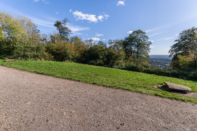
Juniper Hill is a prominent hill located in the county of Surrey, England. Situated in the southeastern part of the county, it is known for its picturesque landscape and stunning views. Juniper Hill is a part of the North Downs, a range of chalk hills that stretches across Surrey and Kent.

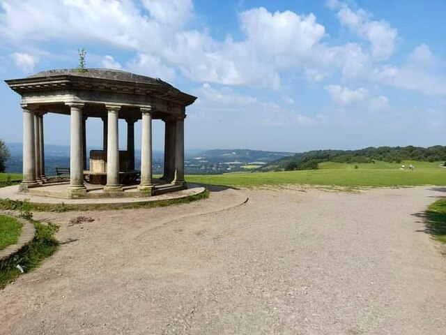
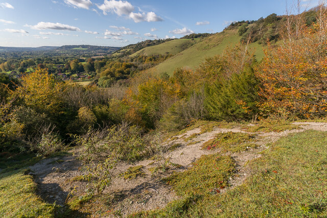
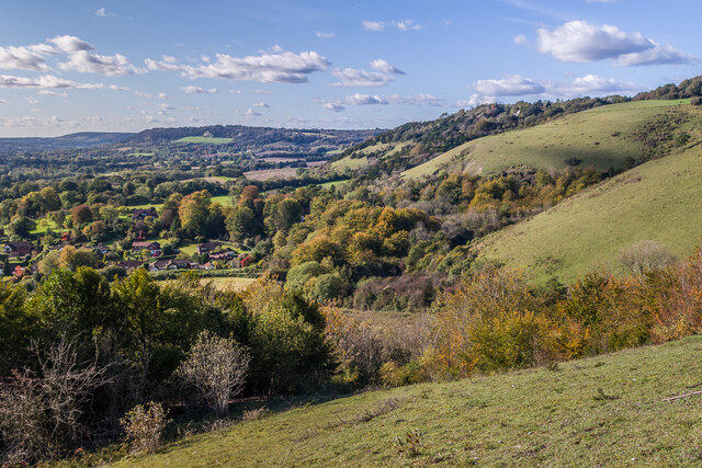
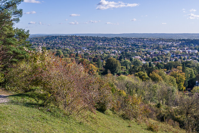
Rising to an elevation of approximately 180 meters (590 feet), Juniper Hill stands out as one of the highest points in the area. Its summit offers breathtaking panoramic views of the surrounding countryside, including the nearby towns of Dorking and Reigate. On a clear day, it is even possible to catch a glimpse of the distant London skyline.

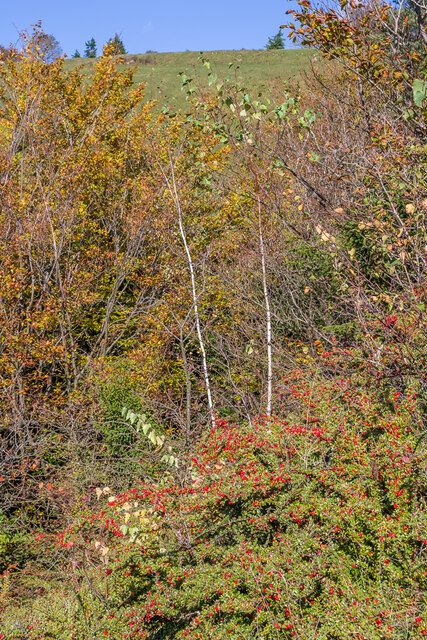
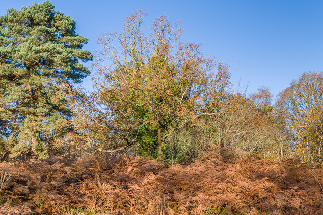
The hill derives its name from the abundance of juniper bushes that can be found along its slopes. These evergreen shrubs, known for their aromatic berries, add to the natural beauty of the area. Juniper Hill is also home to a variety of wildlife, including rare bird species such as the Dartford warbler, making it an attractive destination for nature enthusiasts and birdwatchers.

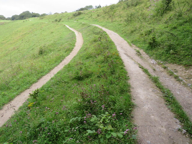
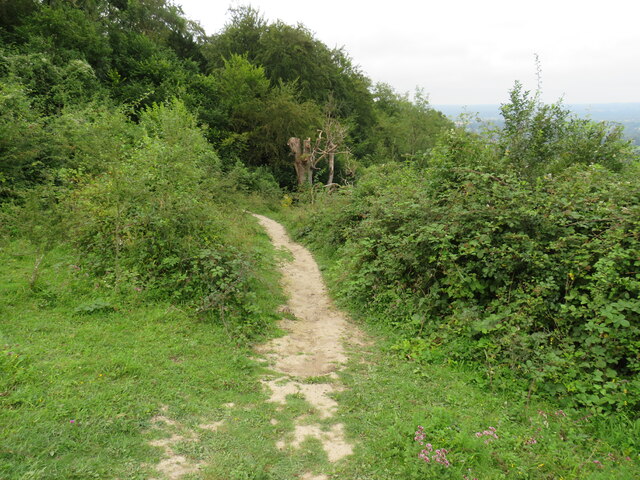
The hill is a popular spot for outdoor activities, with several footpaths and trails crisscrossing its slopes. Hikers and walkers can enjoy exploring the scenic countryside, while cyclists can tackle the challenging terrain offered by the hill. Juniper Hill is also a favored location for paragliding and hang gliding due to its favorable wind conditions.

Overall, Juniper Hill in Surrey offers a remarkable blend of natural beauty, recreational opportunities, and stunning vistas, making it a cherished destination for locals and visitors alike.

If you have any feedback on the listing, please let us know in the comments section below.
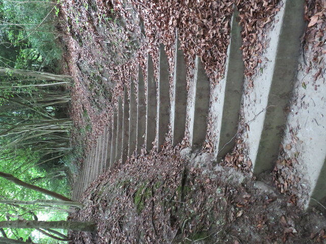
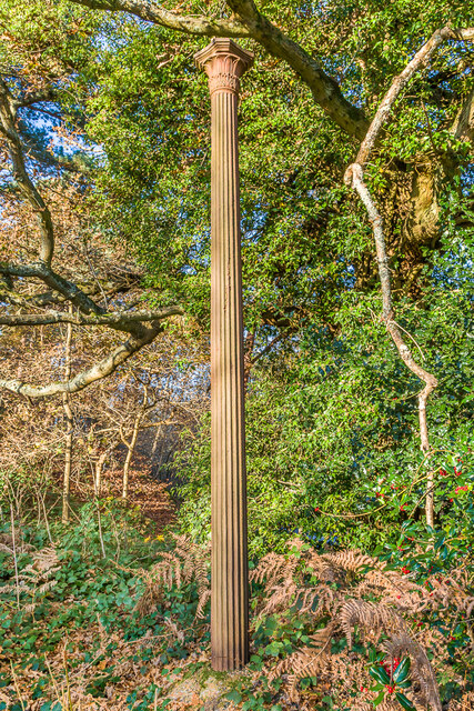
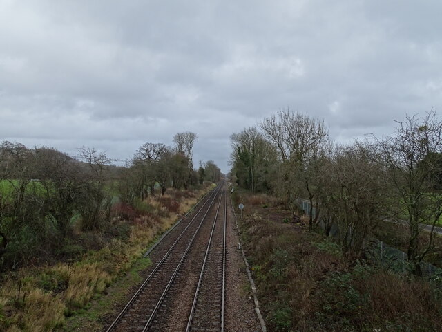
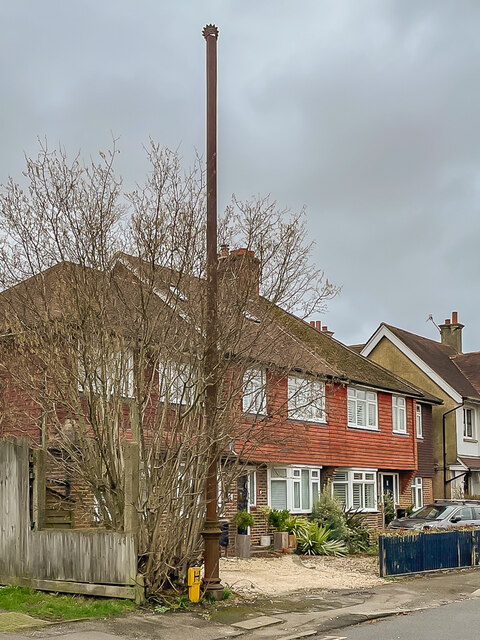
Juniper Hill Images

Images are sourced within 2km of 51.256714/-0.22802919 or Grid Reference TQ2352. Thanks to Geograph Open Source API. All images are credited.

Plaque, St Philip's Church Hall Plaque by the door of St Philip's Church Hall (see <a href="https://www.geograph.org.uk/photo/6908046">TQ2450 : St Philip's Church Hall</a>).  The inscription "St Mark's Mission House 1871" is a reminder that St Philip's Church, whilst privately funded, was for many years a "proprietary chapel" of St Mark's Church, only becoming a parish church in its own right around 1992.
Plaque, St Philip's Church Hall
Plaque by the door of St Philip's Church Hall (see TQ2450 : St Philip's Church Hall). The inscription "St Mark's Mission House 1871" is a reminder that St Philip's Church, whilst privately funded, was for many years a "proprietary chapel" of St Mark's Church, only becoming a parish church in its own right around 1992.
Steps on Colley Hill These steps eventually lead to the open space on Colley Hill and in particular the Inglis memorial <a href="https://www.geograph.org.uk/gridref/TQ2552">TQ2552</a>
Steps on Colley Hill
These steps eventually lead to the open space on Colley Hill and in particular the Inglis memorial TQ2552
Track/Path on Colley Hill This views shows the track just after it leaves woodland and reaches the open space at the top of Colley Hill on the North Downs near Reigate.
Track/Path on Colley Hill
This views shows the track just after it leaves woodland and reaches the open space at the top of Colley Hill on the North Downs near Reigate.
Path  from Colley Hill The path originates at the Inglis memorial; it leads down off the hill towards Reigate
Path from Colley Hill
The path originates at the Inglis memorial; it leads down off the hill towards Reigate
Inglis Memorial
Inglis Memorial
Aliens Cotoneaster and Buddleia plants, both aliens that have naturalised here, on a patch of bare chalk on Colley Hill, with the North Downs stretching on into the distance.
Aliens
Cotoneaster and Buddleia plants, both aliens that have naturalised here, on a patch of bare chalk on Colley Hill, with the North Downs stretching on into the distance.
Aliens A large patch of Cotoneaster, an alien that have naturalised here, on the south slope of Colley Hill.
Aliens
A large patch of Cotoneaster, an alien that have naturalised here, on the south slope of Colley Hill.
West along Colley Hill Looking along Colley Hill, with the North Downs stretching on into the distance.
West along Colley Hill
Looking along Colley Hill, with the North Downs stretching on into the distance.
Towards Reigate Looking over Reigate from the path up Colley Hill.
Towards Reigate
Looking over Reigate from the path up Colley Hill.
B17 crash memorial, Reigate Hill  On 19 March 1945, a B17G Flying Fortress crewed by 9 men from the 384th Bombardment Group of the United States Army Air Corps crashed into Reigate Hill when returning to its base at Grafton Underwood in Northamptonshire from a raid near the German/Czech border.

This clearing in the trees is the site of the crash, as the Beech trees at the spot were destroyed by the impact.  Although the site has always been marked with a seat, a new memorial was unveiled in 2015 on the 70th anniversary of the crash.  It consists of two replica wingtips, carved by sculptor Roger Day. and placed 103 ft apart, being the aircraft's wingspan.

In the distance on the right is Reigate.
B17 crash memorial, Reigate Hill
On 19 March 1945, a B17G Flying Fortress crewed by 9 men from the 384th Bombardment Group of the United States Army Air Corps crashed into Reigate Hill when returning to its base at Grafton Underwood in Northamptonshire from a raid near the German/Czech border. This clearing in the trees is the site of the crash, as the Beech trees at the spot were destroyed by the impact. Although the site has always been marked with a seat, a new memorial was unveiled in 2015 on the 70th anniversary of the crash. It consists of two replica wingtips, carved by sculptor Roger Day. and placed 103 ft apart, being the aircraft's wingspan. In the distance on the right is Reigate.
Sewer vent column A sewer vent column (or "stinkpipe") hidden among trees on a small rise on Reigate Heath.  For a wider view see <a href="https://www.geograph.org.uk/photo/7035840">TQ2350 : Sewer vent column</a>.
Sewer vent column
A sewer vent column (or "stinkpipe") hidden among trees on a small rise on Reigate Heath. For a wider view see TQ2350 : Sewer vent column.
Sewer vent column A small rise on Reigate Heath.  In the centre of the photo, part hidden by the tree, can be seen a sewer vent column (or "stinkpipe").  For a close up see <a href="https://www.geograph.org.uk/photo/7035838">TQ2350 : Sewer vent column</a>.
Sewer vent column
A small rise on Reigate Heath. In the centre of the photo, part hidden by the tree, can be seen a sewer vent column (or "stinkpipe"). For a close up see TQ2350 : Sewer vent column.
Beaufort Close Mixed age housing in Beaufort Close, with the nearest pair dating from 1968, the next pair from the early 1960s and with one of a group of three Edwardian houses situated at the start of the road in the background.  Seen here just after midday on a gloomy Christmas Day 2021.
Beaufort Close
Mixed age housing in Beaufort Close, with the nearest pair dating from 1968, the next pair from the early 1960s and with one of a group of three Edwardian houses situated at the start of the road in the background. Seen here just after midday on a gloomy Christmas Day 2021.
Railway line to Reigate
The North Downs
The North Downs
Road under railway
Road under railway
Sewer vent column A sewer vent column (or "stinkpipe") in Evesham Road North.  This photo was taken a couple of days after Storm Eunice had passed through, a major storm which saw the usual combination of fallen trees and branches, flattened fences and tiles off roofs.  This column was a further victim, with the cap at its top distorted, as seen here.
Sewer vent column
A sewer vent column (or "stinkpipe") in Evesham Road North. This photo was taken a couple of days after Storm Eunice had passed through, a major storm which saw the usual combination of fallen trees and branches, flattened fences and tiles off roofs. This column was a further victim, with the cap at its top distorted, as seen here.
Show me another place!

Juniper Hill is located at Grid Ref: TQ2352 (Lat: 51.256714, Lng: -0.22802919)

Administrative County: Surrey

District: Reigate and Banstead

Police Authority: Surrey

What 3 Words

///advice.spine.tight. Near Lower Kingswood, Surrey

Related Wikis

Mogador, Surrey

Mogador is a hamlet in the Reigate and Banstead district, in the English county of Surrey. It is at the edge of Banstead Heath, which provides it a green...

Colley Hill

Colley Hill is part of the North Downs escarpment in the North Downs, Surrey, England. It is about 1 km east of Buckland Hills and 1 km west of Reigate...

Margery

Margery is a heavily buffered, lightly populated hamlet in the Reigate and Banstead district in the English county of Surrey. It sits on the North Downs...

London Defence Positions

The London Defence Positions were a late 19th-century scheme of earthwork fortifications in the southeast of England, designed to protect London from foreign...

Nearby Amenities

Located within 500m of 51.256714,-0.22802919
Buckland Hill
Natural: peak
Lat/Long: 51.25668/-0.229656
Phone
Emergency: phone
Operator: National Highways
Operator Wikidata: Q5760006
Lat/Long: 51.2595914/-0.2301347
Phone
Emergency: phone
Operator: National Highways
Operator Wikidata: Q5760006
Lat/Long: 51.2598665/-0.2295615
Rose Cottage
Place: isolated_dwelling
Source Name: OS_OpenData_StreetView
Lat/Long: 51.2587457/-0.2224856
Coal tax post
Historic: boundary_stone
Inscription: 24 & 25 VICT CAP 42
Material: iron
Note: Coal tax boundary marker 149
Lat/Long: 51.2581452/-0.2266818
Coal tax post
Historic: boundary_stone
Inscription: 24 & 25 VICT CAP 42
Material: iron
Note: Coal tax boundary marker 150
Lat/Long: 51.2577075/-0.2264316
Coal tax post
Historic: boundary_stone
Inscription: 24 & 25 VICT CAP 42
Material: iron
Note: Coal tax boundary marker 151
Lat/Long: 51.2561334/-0.2266369
Coal tax post
Historic: boundary_stone
Inscription: 24 & 25 VICT CAP 42
Material: iron
Note: Coal tax boundary marker 152
Lat/Long: 51.2564196/-0.2244254
Traffic Sign: variable_message
Variable Message Model: AMI
Lat/Long: 51.2600509/-0.2303824
Traffic Sign: variable_message
Variable Message Model: AMI
Lat/Long: 51.2600248/-0.2304033
Traffic Sign: variable_message
Variable Message Model: AMI
Lat/Long: 51.2599947/-0.2304274
Traffic Sign: variable_message
Variable Message Model: AMI
Lat/Long: 51.2599639/-0.2304521
Camera Mount: pole
Camera Type: panning
Man Made: surveillance
Operator: National Highways
Operator Wikidata: Q5760006
Surveillance: outdoor
Surveillance Type: camera
Surveillance Zone: traffic
Lat/Long: 51.2599253/-0.2304829
Traffic Sign: variable_message
Variable Message Model: AMI
Lat/Long: 51.2598988/-0.2305042
Traffic Sign: variable_message
Variable Message Model: AMI
Lat/Long: 51.2598673/-0.2305293
Traffic Sign: variable_message
Variable Message Model: AMI
Lat/Long: 51.2598363/-0.2305541
Traffic Sign: variable_message
Variable Message Model: AMI
Lat/Long: 51.2598103/-0.2305749
Traffic Sign: variable_message
Variable Message Model: MS2
Lat/Long: 51.2597621/-0.2306135
Traffic Sign: variable_message
Variable Message Model: MS2
Lat/Long: 51.2601139/-0.230332
Golf: pin
Lat/Long: 51.260185/-0.228627
The data included in this document is from www.openstreetmap.org. The data is made available under ODbL.

Have you been to Juniper Hill?

Leave your review of Juniper Hill below (or comments, questions and feedback).