Thistle Hill

Hill, Mountain in Surrey Reigate and Banstead

England

Thistle Hill

Railway line to Reigate
Railway line to Reigate Credit: Matthew Chadwick

Thistle Hill is a prominent hill located in the county of Surrey, England. It is situated near the village of Chiddingfold, approximately 46 miles southwest of London. Rising to an elevation of 194 meters (636 feet), Thistle Hill is renowned for its picturesque landscapes and panoramic views of the surrounding countryside.

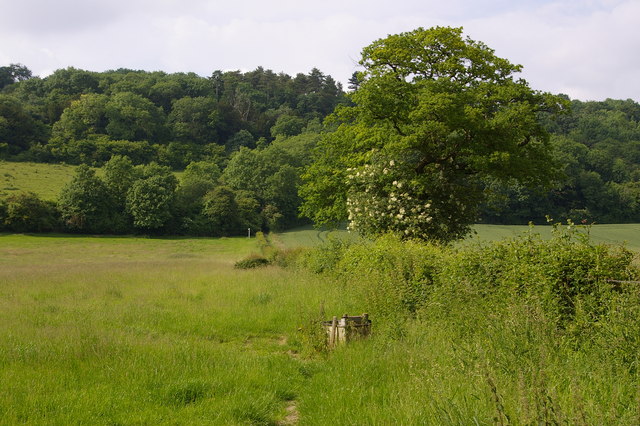
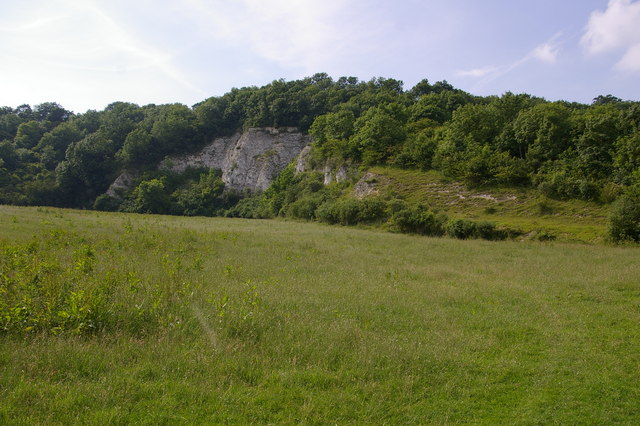
The hill is characterized by its gentle slopes, covered with lush green vegetation and dotted with numerous thistle plants, from which it derives its name. The area surrounding Thistle Hill is predominantly rural, with a mix of farmland, woodlands, and small villages, making it a popular destination for nature enthusiasts and hikers.

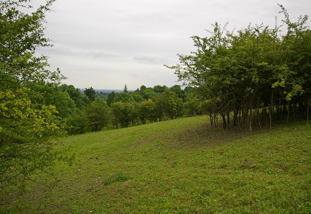
At the summit of Thistle Hill, visitors can enjoy breathtaking vistas of the surrounding Surrey Hills Area of Outstanding Natural Beauty, including the nearby hills of Black Down and Gibbet Hill. On clear days, it is even possible to catch glimpses of the distant South Downs in the south.

Thistle Hill is also home to a variety of wildlife, including deer, foxes, and a plethora of bird species. The diverse flora and fauna make it an ideal location for nature walks and birdwatching.

Access to Thistle Hill is relatively easy, with footpaths and trails leading to the summit from Chiddingfold and the surrounding areas. The hill offers a peaceful retreat from the hustle and bustle of urban life and allows visitors to reconnect with nature in an idyllic setting. Whether it's for a leisurely stroll, a picnic, or simply to admire the stunning vistas, Thistle Hill offers a serene escape for those seeking tranquility in the heart of Surrey.

If you have any feedback on the listing, please let us know in the comments section below.
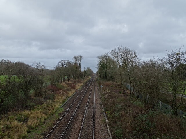
Thistle Hill Images

Images are sourced within 2km of 51.260932/-0.23934756 or Grid Reference TQ2252. Thanks to Geograph Open Source API. All images are credited.

Railway line to Reigate
The North Downs
The North Downs
Bee Orchid (Ophrys apifera) Close up of an individual flower of a Bee Orchid (Ophrys apifera), with an unopened bud above it, on the side of a small chalk pit near the foot of The Saddle Knob on Colley Hill.

One of the most iconic orchids in Britain, it is, despite its exotic appearance, one of the most adaptable species, sites ranging from traditional chalk grassland, as here, to roadsides, industrial wasteland, and other unexpected places.
Bee Orchid (Ophrys apifera)
Close up of an individual flower of a Bee Orchid (Ophrys apifera), with an unopened bud above it, on the side of a small chalk pit near the foot of The Saddle Knob on Colley Hill. One of the most iconic orchids in Britain, it is, despite its exotic appearance, one of the most adaptable species, sites ranging from traditional chalk grassland, as here, to roadsides, industrial wasteland, and other unexpected places.
M25 clockwise - Sturt's Lane Bridge Giving access to Frith Park off to the left.
M25 clockwise - Sturt's Lane Bridge
Giving access to Frith Park off to the left.
The Old School Buckland is a village on the A25 between Dorking and Reigate.
Wikipedia: <span class="nowrap"><a title="https://en.wikipedia.org/wiki/Buckland,_Surrey" rel="nofollow ugc noopener" href="https://en.wikipedia.org/wiki/Buckland,_Surrey">Link</a><img style="margin-left:2px;" alt="External link" title="External link - shift click to open in new window" src="https://s1.geograph.org.uk/img/external.png" width="10" height="10"/></span>
The Old School
Buckland is a village on the A25 between Dorking and Reigate. Wikipedia: LinkExternal link
Cottages on The Green Listed buildings and structures are officially designated as being of special architectural, historical or cultural significance. There are over half a million listed structures in the United Kingdom, covered by around 375,000 listings.
Listed status is more commonly associated with buildings or groups of buildings, however it can cover many other structures, including bridges, headstones, steps, ponds, monuments, walls, phone boxes, wrecks, parks, and heritage sites, and in more recent times a road crossing (Abbey Road) and graffiti art (Banksy 'Spy-booth') have been included.

In England and Wales there are three main listing designations;
Grade I (2.5%) - exceptional interest, sometimes considered to be internationally important.
Grade II* (5.5%) - particularly important buildings of more than special interest. 
Grade II (92%) - nationally important and of special interest. 

There are also locally listed structures (at the discretion of local authorities) using A, B and C designations.

In Scotland three classifications are also used but the criteria are different. There are around 47,500 Listed buildings.
Category A (8%)- generally equivalent to Grade I and II* in England and Wales
Category B (51%)- this appears generally to cover the ground of Grade II, recognising national importance.
Category C (41%)- buildings of local importance, probably with some overlap with English Grade II.

In Northern Ireland the criteria are similar to Scotland, but the classifications are:
Grade A (2.3%)
Grade B+ (4.7%)
Grade B (93%)

Read more at Wikipedia <span class="nowrap"><a title="http://en.wikipedia.org/wiki/Listed_building" rel="nofollow ugc noopener" href="http://en.wikipedia.org/wiki/Listed_building">Link</a><img style="margin-left:2px;" alt="External link" title="External link - shift click to open in new window" src="https://s1.geograph.org.uk/img/external.png" width="10" height="10"/></span>
Cottages on The Green
Listed buildings and structures are officially designated as being of special architectural, historical or cultural significance. There are over half a million listed structures in the United Kingdom, covered by around 375,000 listings. Listed status is more commonly associated with buildings or groups of buildings, however it can cover many other structures, including bridges, headstones, steps, ponds, monuments, walls, phone boxes, wrecks, parks, and heritage sites, and in more recent times a road crossing (Abbey Road) and graffiti art (Banksy 'Spy-booth') have been included. In England and Wales there are three main listing designations; Grade I (2.5%) - exceptional interest, sometimes considered to be internationally important. Grade II* (5.5%) - particularly important buildings of more than special interest. Grade II (92%) - nationally important and of special interest. There are also locally listed structures (at the discretion of local authorities) using A, B and C designations. In Scotland three classifications are also used but the criteria are different. There are around 47,500 Listed buildings. Category A (8%)- generally equivalent to Grade I and II* in England and Wales Category B (51%)- this appears generally to cover the ground of Grade II, recognising national importance. Category C (41%)- buildings of local importance, probably with some overlap with English Grade II. In Northern Ireland the criteria are similar to Scotland, but the classifications are: Grade A (2.3%) Grade B+ (4.7%) Grade B (93%) Read more at Wikipedia LinkExternal link
On Slough Lane Buckland is a village on the A25 between Dorking and Reigate.
Wikipedia: <span class="nowrap"><a title="https://en.wikipedia.org/wiki/Buckland,_Surrey" rel="nofollow ugc noopener" href="https://en.wikipedia.org/wiki/Buckland,_Surrey">Link</a><img style="margin-left:2px;" alt="External link" title="External link - shift click to open in new window" src="https://s1.geograph.org.uk/img/external.png" width="10" height="10"/></span>
On Slough Lane
Buckland is a village on the A25 between Dorking and Reigate. Wikipedia: LinkExternal link
Slough Lane
Slough Lane
Farmland, Buckland
Farmland, Buckland
Slough House
Slough House
Footpath
Footpath
Kemp's Farm
Kemp's Farm
Lawrence Farm Cottages
Muddy footpath
Muddy footpath
Hillview Cottages
Hillview Cottages
Lawrence Lane
Lawrence Lane
Lawrence Lane
Lawrence Lane
Harvesters Listed buildings and structures are officially designated as being of special architectural, historical or cultural significance. There are over half a million listed structures in the United Kingdom, covered by around 375,000 listings.
Listed status is more commonly associated with buildings or groups of buildings, however it can cover many other structures, including bridges, headstones, steps, ponds, monuments, walls, phone boxes, wrecks, parks, and heritage sites, and in more recent times a road crossing (Abbey Road) and graffiti art (Banksy 'Spy-booth') have been included.

In England and Wales there are three main listing designations;
Grade I (2.5%) - exceptional interest, sometimes considered to be internationally important.
Grade II* (5.5%) - particularly important buildings of more than special interest. 
Grade II (92%) - nationally important and of special interest. 

There are also locally listed structures (at the discretion of local authorities) using A, B and C designations.

In Scotland three classifications are also used but the criteria are different. There are around 47,500 Listed buildings.
Category A (8%)- generally equivalent to Grade I and II* in England and Wales
Category B (51%)- this appears generally to cover the ground of Grade II, recognising national importance.
Category C (41%)- buildings of local importance, probably with some overlap with English Grade II.

In Northern Ireland the criteria are similar to Scotland, but the classifications are:
Grade A (2.3%)
Grade B+ (4.7%)
Grade B (93%)

Read more at Wikipedia <span class="nowrap"><a title="http://en.wikipedia.org/wiki/Listed_building" rel="nofollow ugc noopener" href="http://en.wikipedia.org/wiki/Listed_building">Link</a><img style="margin-left:2px;" alt="External link" title="External link - shift click to open in new window" src="https://s1.geograph.org.uk/img/external.png" width="10" height="10"/></span>
Harvesters
Listed buildings and structures are officially designated as being of special architectural, historical or cultural significance. There are over half a million listed structures in the United Kingdom, covered by around 375,000 listings. Listed status is more commonly associated with buildings or groups of buildings, however it can cover many other structures, including bridges, headstones, steps, ponds, monuments, walls, phone boxes, wrecks, parks, and heritage sites, and in more recent times a road crossing (Abbey Road) and graffiti art (Banksy 'Spy-booth') have been included. In England and Wales there are three main listing designations; Grade I (2.5%) - exceptional interest, sometimes considered to be internationally important. Grade II* (5.5%) - particularly important buildings of more than special interest. Grade II (92%) - nationally important and of special interest. There are also locally listed structures (at the discretion of local authorities) using A, B and C designations. In Scotland three classifications are also used but the criteria are different. There are around 47,500 Listed buildings. Category A (8%)- generally equivalent to Grade I and II* in England and Wales Category B (51%)- this appears generally to cover the ground of Grade II, recognising national importance. Category C (41%)- buildings of local importance, probably with some overlap with English Grade II. In Northern Ireland the criteria are similar to Scotland, but the classifications are: Grade A (2.3%) Grade B+ (4.7%) Grade B (93%) Read more at Wikipedia LinkExternal link
Show me another place!

Thistle Hill is located at Grid Ref: TQ2252 (Lat: 51.260932, Lng: -0.23934756)

Administrative County: Surrey

District: Reigate and Banstead

Police Authority: Surrey

What 3 Words

///zest.pots.status. Near Lower Kingswood, Surrey

Related Wikis

Mogador, Surrey

Mogador is a hamlet in the Reigate and Banstead district, in the English county of Surrey. It is at the edge of Banstead Heath, which provides it a green...

Dawcombe

Dawcombe is a 23-hectare (57-acre) nature reserve north-west of Reigate in Surrey. It is managed by the Surrey Wildlife Trust. It is part of the Mole...

Betchworth Quarry and Lime Kilns

Betchworth Quarry and Lime Kilns is a 27-hectare (67-acre) nature reserve north of Betchworth in Surrey. Betchworth Quarry only is managed by Surrey Wildlife...

Colley Hill

Colley Hill is part of the North Downs escarpment in the North Downs, Surrey, England. It is about 1 km east of Buckland Hills and 1 km west of Reigate...

Fraser Down

Fraser Down is a 10-hectare (25-acre) nature reserve north of Betchworth in Surrey. It is managed by the Surrey Wildlife Trust. It is part of the Mole...

2011 Senior Open Championship

The 2011 Senior Open Championship was a senior major golf championship and the 25th Senior Open Championship, held on 21–24 July at Walton Heath Golf Club...

1981 Ryder Cup

The 24th Ryder Cup Matches were held 18–20 September 1981 at the Walton Heath Golf Club in Walton-on-the-Hill, Surrey, England, southwest of London. The...

Walton Heath Golf Club

Walton Heath Golf Club is a golf club in England, near Walton-on-the-Hill in Surrey, southwest of London. Founded in 1903, the club comprises two 18-hole...

Nearby Amenities

Located within 500m of 51.260932,-0.23934756
Phone
Emergency: phone
Operator: National Highways
Operator Wikidata: Q5760006
Lat/Long: 51.2615851/-0.2355123
Phone
Emergency: phone
Operator: National Highways
Operator Wikidata: Q5760006
Lat/Long: 51.2618496/-0.2350388
Phone
Emergency: phone
Operator: National Highways
Operator Wikidata: Q5760006
Lat/Long: 51.2648859/-0.2425868
Bench
Backrest: yes
Seats: 3
Lat/Long: 51.2599566/-0.2415694
Bench
Backrest: yes
Inscription: In Memory of PAUL HILL
Material: wood
Lat/Long: 51.259907/-0.2413801
Bench
Backrest: yes
Seats: 3
Lat/Long: 51.2599229/-0.2443836
Bench
Lat/Long: 51.2600312/-0.2457006
Traffic Sign: variable_message
Variable Message Model: AMI
Lat/Long: 51.264723/-0.2413654
Traffic Sign: variable_message
Variable Message Model: AMI
Lat/Long: 51.2646954/-0.2413983
Traffic Sign: variable_message
Variable Message Model: AMI
Lat/Long: 51.2646644/-0.241435
Traffic Sign: variable_message
Variable Message Model: AMI
Lat/Long: 51.2646408/-0.2414631
Traffic Sign: variable_message
Variable Message Model: AMI
Lat/Long: 51.2645071/-0.2416219
Traffic Sign: variable_message
Variable Message Model: AMI
Lat/Long: 51.2645296/-0.2415952
Traffic Sign: variable_message
Variable Message Model: AMI
Lat/Long: 51.2645591/-0.2415601
Traffic Sign: variable_message
Variable Message Model: AMI
Lat/Long: 51.264587/-0.2415269
Traffic Sign: variable_message
Variable Message Model: MS2
Lat/Long: 51.2647723/-0.2413069
Traffic Sign: variable_message
Variable Message Model: MS2
Lat/Long: 51.2644521/-0.2416871
The data included in this document is from www.openstreetmap.org. The data is made available under ODbL.

Have you been to Thistle Hill?

Leave your review of Thistle Hill below (or comments, questions and feedback).