Beacon Hill

Hill, Mountain in Lincolnshire East Lindsey

England

Beacon Hill

Plantations and covert, Market Stainton: aerial 2022
Plantations and covert, Market Stainton: aerial 2022 Credit: Simon Tomson

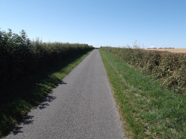
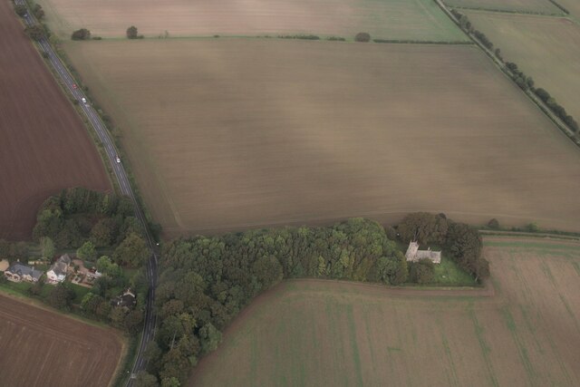
Beacon Hill is a prominent hill located in the county of Lincolnshire, England. Situated in the Lincolnshire Wolds Area of Outstanding Natural Beauty, it stands at an elevation of approximately 168 meters (551 feet) above sea level. The hill is known for its picturesque surroundings and offers stunning panoramic views of the surrounding countryside.

Covered in lush green vegetation, Beacon Hill is a haven for wildlife and plant species. The area is home to a wide range of flora and fauna, including various wildflowers, butterflies, and birds. It is a popular destination for nature enthusiasts, hikers, and photographers who come to explore the diverse landscape and capture its natural beauty.

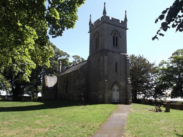
At the summit of Beacon Hill, there is a beacon tower that dates back to the 19th century. This tower was once used to light bonfires, serving as a signal for important events or warnings. Although the tower no longer functions as a beacon, it stands as a historical landmark and adds to the charm of the hill.

In addition to its natural attractions, Beacon Hill also offers recreational activities for visitors. There are well-maintained walking trails that allow visitors to explore the area at their own pace. These trails provide an opportunity to experience the tranquility of the hill and its surroundings.

Overall, Beacon Hill in Lincolnshire is a place of natural beauty, offering breathtaking views, diverse wildlife, and historical significance. Whether it's for leisurely walks or simply enjoying the serenity of the countryside, Beacon Hill provides a peaceful escape for both locals and tourists alike.

If you have any feedback on the listing, please let us know in the comments section below.
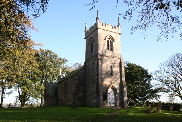
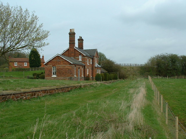
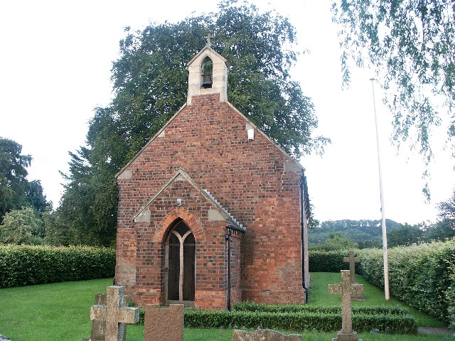
Beacon Hill Images

Images are sourced within 2km of 53.295979/-0.16328562 or Grid Reference TF2279. Thanks to Geograph Open Source API. All images are credited.

Plantations and covert, Market Stainton: aerial 2022
Market Stainton Hall: aerial 2023
Ranby Medieval Settlement: aerial 2022 See <span class="nowrap"><a title="https://www.heritagegateway.org.uk/Gateway/Results_Single.aspx?uid=MLI84929&resourceID=1006" rel="nofollow ugc noopener" href="https://www.heritagegateway.org.uk/Gateway/Results_Single.aspx?uid=MLI84929&resourceID=1006">Link</a><img style="margin-left:2px;" alt="External link" title="External link - shift click to open in new window" src="https://s1.geograph.org.uk/img/external.png" width="10" height="10"/></span>
Ranby Medieval Settlement: aerial 2022
See LinkExternal link
Rural crossroads
Rural crossroads
The road to Ranby
The road to Ranby
Entrance to Ranby Hall Farm
Church of St German, Ranby
Bridleway at Ranby Hill
Bridleway to the left and byway to the right
Stoupes Farm
Stoupes Farm
River Bain NW of Goulceby: aerial 2023 (1)
River Bain NW of Goulceby: aerial 2023 (2)
Marshy field and possible ridge and furrow, Market Stainton: aerial 2023
St Germans church, Ranby Built in 1860 by Fowler, although an original church dated back to the 12th C.
Church locked.
St Germans church, Ranby
Built in 1860 by Fowler, although an original church dated back to the 12th C. Church locked.
St German's Church and Ranby Hoe  See <span class="nowrap"><a title="https://www.heritagegateway.org.uk/Gateway/Results_Single.aspx?uid=MLI40325&resourceID=1006" rel="nofollow ugc noopener" href="https://www.heritagegateway.org.uk/Gateway/Results_Single.aspx?uid=MLI40325&resourceID=1006">Link</a><img style="margin-left:2px;" alt="External link" title="External link - shift click to open in new window" src="https://s1.geograph.org.uk/img/external.png" width="10" height="10"/></span>

To the left of the church, in the trees, is the probable site of Ranby Hoe, a Bronze Age barrow. 

See <span class="nowrap"><a title="https://www.heritagegateway.org.uk/Gateway/Results_Single.aspx?uid=MLI40391&resourceID=1006" rel="nofollow ugc noopener" href="https://www.heritagegateway.org.uk/Gateway/Results_Single.aspx?uid=MLI40391&resourceID=1006">Link</a><img style="margin-left:2px;" alt="External link" title="External link - shift click to open in new window" src="https://s1.geograph.org.uk/img/external.png" width="10" height="10"/></span>
St German's Church and Ranby Hoe
See LinkExternal link To the left of the church, in the trees, is the probable site of Ranby Hoe, a Bronze Age barrow. See LinkExternal link
St.Michael's church Grade II* listed largely 14th century church with a chancel rebuilt 1848 and restoration in 1886. Denuded of its lead roof <a title="https://www.geograph.org.uk/photo/620794" href="https://www.geograph.org.uk/photo/620794">Link</a> and barely covered with tattered tarpaulins, it languishes in a shameful state of dereliction awaiting redundancy. Ironically, the churchyard has been recently mown whilst the fabric of the church deteriorates.
St.Michael's church
Grade II* listed largely 14th century church with a chancel rebuilt 1848 and restoration in 1886. Denuded of its lead roof Link and barely covered with tattered tarpaulins, it languishes in a shameful state of dereliction awaiting redundancy. Ironically, the churchyard has been recently mown whilst the fabric of the church deteriorates.
St.Michael's church Grade II* listed largely 14th century church with a chancel rebuilt 1848 and restoration in 1886. Denuded of its lead roof <a title="https://www.geograph.org.uk/photo/620794" href="https://www.geograph.org.uk/photo/620794">Link</a> and barely covered with tattered tarpaulins, it languishes in a shameful state of dereliction awaiting redundancy.
St.Michael's church
Grade II* listed largely 14th century church with a chancel rebuilt 1848 and restoration in 1886. Denuded of its lead roof Link and barely covered with tattered tarpaulins, it languishes in a shameful state of dereliction awaiting redundancy.
St.Michael's nave South doorway, font and pews in St.Michael's nave, illustrating the sorry state of dereliction
St.Michael's nave
South doorway, font and pews in St.Michael's nave, illustrating the sorry state of dereliction
Show me another place!

Beacon Hill is located at Grid Ref: TF2279 (Lat: 53.295979, Lng: -0.16328562)

Administrative County: Lincolnshire

District: East Lindsey

Police Authority: Lincolnshire

What 3 Words

///flock.fattening.join. Near Wragby, Lincolnshire

Related Wikis

Market Stainton

Market Stainton is a village and civil parish in the East Lindsey district of Lincolnshire, England. It is situated approximately 7 miles (11 km) north...

Ranby, Lincolnshire

Ranby is a village and civil parish in the East Lindsey district of Lincolnshire, England. It is situated about 6 miles (10 km) north-west from the market...

Sotby

Sotby is a village and civil parish in the East Lindsey district of Lincolnshire, England. It is situated 15 miles (24 km) north-east from the city and...

Great Sturton

Great Sturton is a hamlet and civil parish in the East Lindsey district of Lincolnshire, England. It is situated approximately 7 miles (11 km) from the...

Donington on Bain railway station

Donington railway station was a station in the village of Donington on Bain, Lincolnshire, England. == History == The Great Northern Railway planned and...

Louth to Bardney Line

The Louth to Bardney Line was an English railway line built by the Louth and Lincoln Railway Company, in Lincolnshire, England. It opened in stages between...

Stenigot

Stenigot is a village in the East Lindsey district of Lincolnshire, England. It is in the Lincolnshire Wolds, a designated Area of Outstanding Natural...

Benniworth

Benniworth is a village and civil parish in the East Lindsey district of Lincolnshire, England. The village is situated just west of the B1225 road, and...

Nearby Amenities

Located within 500m of 53.295979,-0.16328562
Bus Stop
Sotby Road
Naptan AtcoCode: 270000009603
Naptan Bearing: NW
Naptan CommonName: Sotby Road
Naptan Landmark: NA
Naptan NaptanCode: linjdjtd
Naptan Street: Sotby Road
Naptan Verified: no
Source: naptan_import
Lat/Long: 53.2957657/-0.1696448
Power: pole
Lat/Long: 53.2928783/-0.1683413
Power: pole
Lat/Long: 53.2924046/-0.1632101
Power: pole
Lat/Long: 53.2925099/-0.1644807
Power: pole
Lat/Long: 53.2926395/-0.1658036
Power: pole
Lat/Long: 53.2926755/-0.1662137
Power: pole
Lat/Long: 53.2927394/-0.1668514
Power: pole
Lat/Long: 53.2918878/-0.160533
Power: pole
Lat/Long: 53.2921301/-0.1617636
Beacon Hill
Natural: peak
Source: Bing
Lat/Long: 53.2958868/-0.163166
Ranby Hoe
Archaeological Site: tumulus
Historic: archaeological_site
Source: Bing
Lat/Long: 53.2951691/-0.1590821
The Bungalow
Place: isolated_dwelling
Source: Bing
Lat/Long: 53.2941184/-0.1631642
The data included in this document is from www.openstreetmap.org. The data is made available under ODbL.

Have you been to Beacon Hill?

Leave your review of Beacon Hill below (or comments, questions and feedback).