Windmill Hill

Hill, Mountain in Sussex Horsham

England

Windmill Hill

Teasel - Dipsacus fullonum
Teasel - Dipsacus fullonum Credit: Ian Cunliffe

Windmill Hill is a small hill located in the county of Sussex, England. Situated in the South Downs National Park, it is part of the broader South Downs range and stands at an elevation of approximately 193 meters (633 feet) above sea level. The hill is known for its prominent windmill, which has become an iconic landmark in the area.

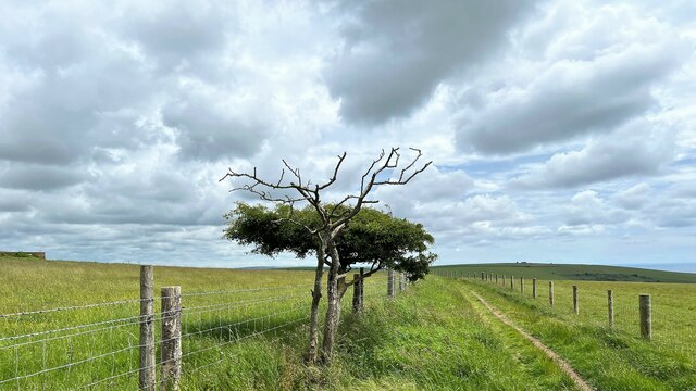
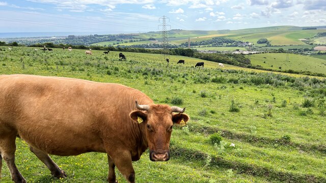
This hill offers breathtaking panoramic views of the surrounding countryside, with its gentle slopes covered in lush green grass and wildflowers during the warmer months. On clear days, visitors can enjoy vistas that stretch as far as the English Channel to the south and the rolling hills of the South Downs to the north.

Windmill Hill has a rich history dating back centuries. The windmill, after which the hill is named, was built in the early 19th century and served as a grain mill for the local community. Although the windmill is no longer operational, it stands as a reminder of the area's agricultural heritage.

The hill is a popular destination for walkers, hikers, and nature enthusiasts, who can explore the numerous footpaths and trails that crisscross the area. The South Downs Way, a long-distance footpath, passes nearby, attracting visitors from far and wide.

Windmill Hill offers a peaceful and tranquil setting, away from the hustle and bustle of urban life. With its picturesque views and historical significance, it is a must-visit location for those seeking both natural beauty and cultural heritage in Sussex.

If you have any feedback on the listing, please let us know in the comments section below.

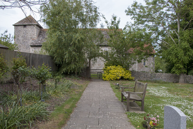
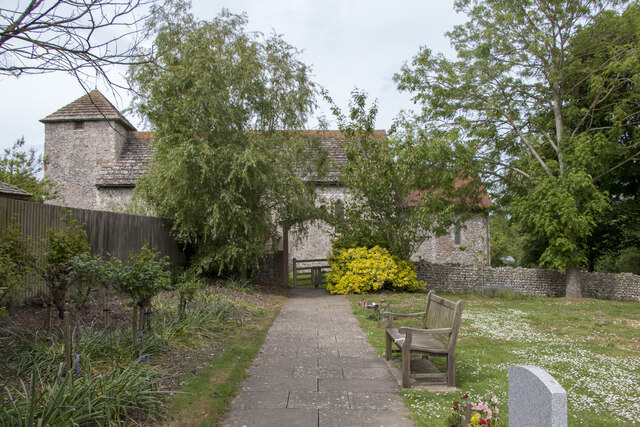
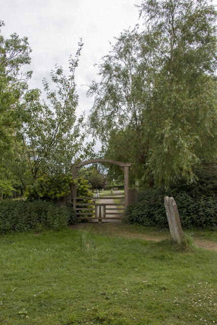
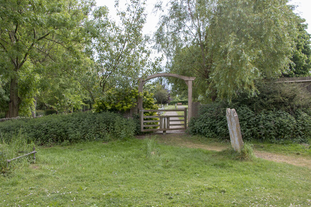
Windmill Hill Images

Images are sourced within 2km of 50.881719/-0.2917075 or Grid Reference TQ2010. Thanks to Geograph Open Source API. All images are credited.

Teasel - Dipsacus fullonum
Upper Beeding War Memorial The building on the right with a thatched roof is now a house.
Upper Beeding War Memorial
The building on the right with a thatched roof is now a house.
Tapsel gate at St Botolph's Church, West Sussex, in a closed position, This photo shows the Tapsel gate at St Botolph's church in a closed position. The photo was taken looking north and it shows the Grade I listed church in the background. The Tapsel gate links the churchyard of St Botolph's with an adjacent council burial ground. The gate was installed in late 2003 and it was consecrated in 2004 by Bishop Lindsay Urwin, who was the Bishop of Horsham between 1993 and 2009.
Tapsel gate at St Botolph's Church, West Sussex, in a closed position,
This photo shows the Tapsel gate at St Botolph's church in a closed position. The photo was taken looking north and it shows the Grade I listed church in the background. The Tapsel gate links the churchyard of St Botolph's with an adjacent council burial ground. The gate was installed in late 2003 and it was consecrated in 2004 by Bishop Lindsay Urwin, who was the Bishop of Horsham between 1993 and 2009.
Tapsel gate in an open position at St Botolph's Church, West Sussex This photo shows the Tapsel gate at St Botolph's church as seen looking north from the churchyard. The arched frame of the five bar gate is reminiscent of the Tapsel gate design at St Mary the Virgin church at Friston in East Sussex.
Tapsel gate in an open position at St Botolph's Church, West Sussex
This photo shows the Tapsel gate at St Botolph's church as seen looking north from the churchyard. The arched frame of the five bar gate is reminiscent of the Tapsel gate design at St Mary the Virgin church at Friston in East Sussex.
Closed Tapsel gate at St Botolph's church seen looking south The Tapsel gate at St Botolph's church in West Sussex is a modern one having been installed in 2003. This date is carved into the top of arched wooden frame. The gate was funded by the joint parish council of the area to enable the use of the church by visitors to the burial ground.
Closed Tapsel gate at St Botolph's church seen looking south
The Tapsel gate at St Botolph's church in West Sussex is a modern one having been installed in 2003. This date is carved into the top of arched wooden frame. The gate was funded by the joint parish council of the area to enable the use of the church by visitors to the burial ground.
Open Tapsel gate at St Botolph's Church seen looking south The Tapsel gate at St Botolph's church in West Sussex is a modern one having been installed in late 2003. Although this date is carved into the top of arched wooden frame, it is difficult to see, in this photo, without added magnification. At present, the central pivot is slightly more stiff to open than other Tapsel gates but an application of lubricant would remedy this.
Open Tapsel gate at St Botolph's Church seen looking south
The Tapsel gate at St Botolph's church in West Sussex is a modern one having been installed in late 2003. Although this date is carved into the top of arched wooden frame, it is difficult to see, in this photo, without added magnification. At present, the central pivot is slightly more stiff to open than other Tapsel gates but an application of lubricant would remedy this.
St Botolph's Church viewed looking east, West Sussex On the 15th March 1955, the Saxon Church of St Botolph's was listed as a Grade I building and by definition that means that the site was considered to be of exceptional, national importance. The building dates to about AD 950 and it is listed as one of the 500 holiest sites in Britain. Notable features of the church include three bells made, in 1536, by John Tonne which commemorate the old dedication to St Peter with the inscription “Sancte Petre ora pro nobis”;  an oak, Jacobean pulpit dating from 1630; traces of wall murals which were recorded in 1897 and a square baptism font, supported by a brick plinth, which probably dates to the 18th century. Another interesting feature, of the church, are the slanted side windows which allowed lepers, from the leper colony in Bramber, to stand outside and see the service taking place without transmitting the disease to the congregation inside the church.
St Botolph's Church viewed looking east, West Sussex
On the 15th March 1955, the Saxon Church of St Botolph's was listed as a Grade I building and by definition that means that the site was considered to be of exceptional, national importance. The building dates to about AD 950 and it is listed as one of the 500 holiest sites in Britain. Notable features of the church include three bells made, in 1536, by John Tonne which commemorate the old dedication to St Peter with the inscription “Sancte Petre ora pro nobis”; an oak, Jacobean pulpit dating from 1630; traces of wall murals which were recorded in 1897 and a square baptism font, supported by a brick plinth, which probably dates to the 18th century. Another interesting feature, of the church, are the slanted side windows which allowed lepers, from the leper colony in Bramber, to stand outside and see the service taking place without transmitting the disease to the congregation inside the church.
Monarch's Way - heading ESE
Cattle - and view SW over the Adur Valley You can see the sea and Lancing College Chapel on the left of the photo.
Cattle - and view SW over the Adur Valley
You can see the sea and Lancing College Chapel on the left of the photo.
Autumn Lady Tresses Autumn Lady Tresses, Spiranthes spiralis in flower at Anchor Bottom next to the A283 in East Sussex.
Autumn Lady Tresses
Autumn Lady Tresses, Spiranthes spiralis in flower at Anchor Bottom next to the A283 in East Sussex.
Remains of Bramber Castle: West Sussex An evening shot of a part of the ruins. This castle is situated between the centre and north eastern section of the grid square.
Remains of Bramber Castle: West Sussex
An evening shot of a part of the ruins. This castle is situated between the centre and north eastern section of the grid square.
Castle Church : Bramber (West Sussex) This church is apparently 1000 years or so old and was built as part of the castle residences and buildings. It is situated at the foot of the castle and in the centre to north eastern section of the square.
Castle Church : Bramber (West Sussex)
This church is apparently 1000 years or so old and was built as part of the castle residences and buildings. It is situated at the foot of the castle and in the centre to north eastern section of the square.
Two bridges at Bramber The road bridge and 'The Bridge' inn on the River Adur at Bramber.
Two bridges at Bramber
The road bridge and 'The Bridge' inn on the River Adur at Bramber.
Priory at Bramber Close to the Adur river this is the Sele Priory Church of St Peter in Beeding.  A single parish now combines Beeding, Bramber and Botolphs.
Priory at Bramber
Close to the Adur river this is the Sele Priory Church of St Peter in Beeding. A single parish now combines Beeding, Bramber and Botolphs.
Drainage Ditches on the Adur Flood Plain. Looking east towards the downs with Truleigh Hill in the distance. Taken in the pouring rain, but the cows don't mind.
Drainage Ditches on the Adur Flood Plain.
Looking east towards the downs with Truleigh Hill in the distance. Taken in the pouring rain, but the cows don't mind.
Drainage Ditch - After the Storm Looking south along one of the drains for the river Adur flood plain. With a drop of rain on the lens :-(
Drainage Ditch - After the Storm
Looking south along one of the drains for the river Adur flood plain. With a drop of rain on the lens :-(
Sussex Vernacular Architecture Note the small triangular roof sections on the top of the gable ends.
Sussex Vernacular Architecture
Note the small triangular roof sections on the top of the gable ends.
Bramber Castle. This is the only major remain of the Norman castle. It received very heavy damage during the English Civil War.
Bramber Castle.
This is the only major remain of the Norman castle. It received very heavy damage during the English Civil War.
Show me another place!

Windmill Hill is located at Grid Ref: TQ2010 (Lat: 50.881719, Lng: -0.2917075)

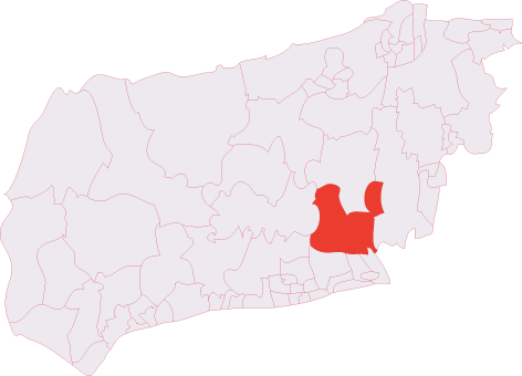
Administrative County: West Sussex

District: Horsham

Police Authority: Sussex

What 3 Words

///exit.device.loitering. Near Steyning, West Sussex

Nearby Locations

Castle Town Windmill Hill

Related Wikis

Towers Convent School

The Towers Convent School was a private Roman Catholic boarding and day school for girls aged 4–16 and boys up to age 11 in Upper Beeding near Steyning...

Upper Beeding

Upper Beeding is a village and civil parish in the Horsham District of West Sussex, England. It is located at the northern end of the River Adur gap in...

Battle of Bramber Bridge

The Battle of Bramber Bridge was a minor skirmish that took place on 13 December 1643, during the First English Civil War. A Royalist detachment from...

Sele Priory

Sele Priory was a medieval monastic house in Upper Beeding, West Sussex, England. It was a Benedictine Order priory founded before 1126 and was dedicated...

Bramber Castle (electoral division)

Bramber Castle is an electoral division of West Sussex in the United Kingdom and returns one member to sit on West Sussex County Council. == Extent... ==

Botolphs

Botolphs, formerly known as Annington, is a tiny village and former civil parish, now in the parish of Bramber, in the Horsham District of West Sussex...

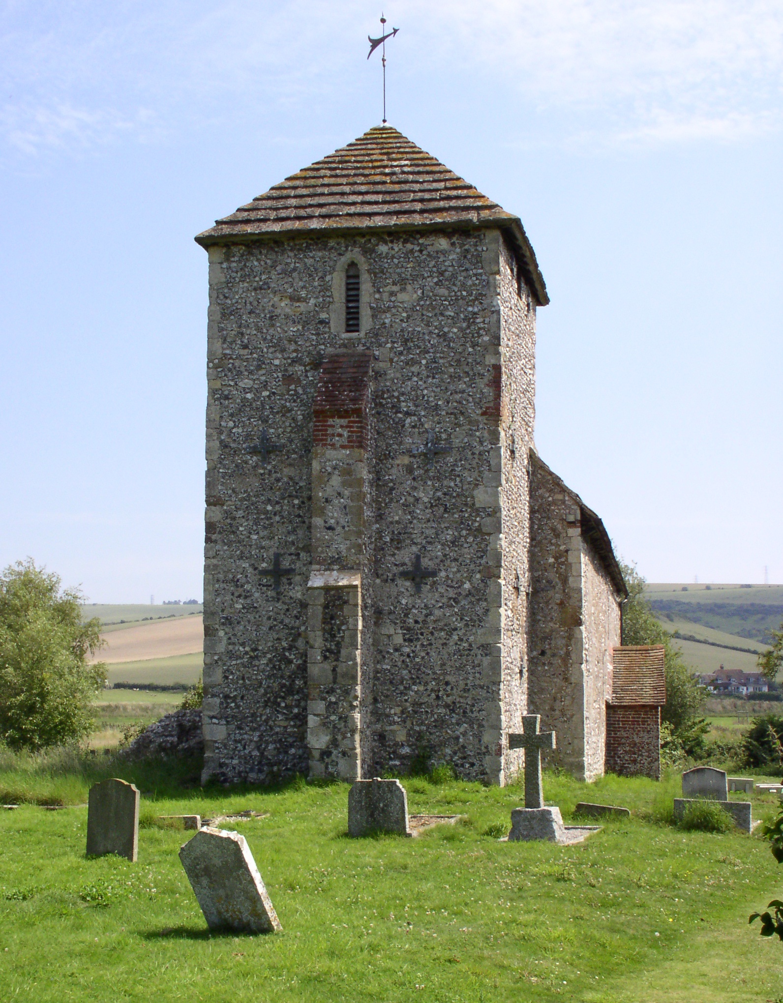
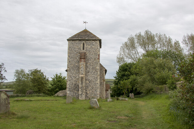
St Botolph's Church, Botolphs

The Grade I listed Saxon church of St Botolph's at Botolphs, West Sussex, England, is situated in the valley of the River Adur and is now part of the Church...

Bramber

Bramber is a former manor, village and civil parish in the Horsham District of West Sussex, England. It has a ruined mediaeval castle which was the caput...

Nearby Amenities

Located within 500m of 50.881719,-0.2917075
Upper Beeding
Is In: West Sussex, England, UK
Place: village
Source: npe
Wikidata: Q846873
Lat/Long: 50.8797596/-0.2975198
Bus Stop
Ferringdene
Naptan AtcoCode: 4400HR0236
Naptan Bearing: W
Naptan CommonName: Ferringdene
Naptan Indicator: adj Ferringdene
Naptan Landmark: Ferringdene
Naptan NaptanCode: wsxatwgp
Naptan Street: Henfield Road
Naptan Verified: no
Source: naptan_import
Lat/Long: 50.8781655/-0.2917984
Ferringdene
Naptan AtcoCode: 4400HR0237
Naptan Bearing: E
Naptan BusStopType: CUS
Naptan CommonName: Ferringdene
Naptan Indicator: opp Ferringdene
Naptan Landmark: Ferringdene
Naptan NaptanCode: wsxatwgt
Naptan Street: Henfield Road
Naptan Verified: no
Source: naptan_import
Lat/Long: 50.878284/-0.2919078
Henfiled Road
Naptan AtcoCode: 4400HR0759
Naptan Bearing: N
Naptan BusStopType: CUS
Naptan CommonName: Henfiled Road
Naptan Indicator: HAR
Naptan Landmark: Hail & Ride
Naptan NaptanCode: wsxdwgdj
Naptan Street: Henfield Road
Naptan Verified: no
Source: naptan_import
Lat/Long: 50.8809273/-0.2880645
Henfield Road
Naptan AtcoCode: 4400HR0760
Naptan Bearing: S
Naptan BusStopType: CUS
Naptan CommonName: Henfield Road
Naptan Indicator: HAR
Naptan Landmark: Hail & Ride
Naptan NaptanCode: wsxdwgdm
Naptan Street: Henfield Road
Naptan Verified: no
Source: naptan_import
Lat/Long: 50.8809217/-0.2877882
Post Box
Brand: Royal Mail
Brand Wikidata: Q638098
Brand Wikipedia: en:Royal Mail
Collection Plate: CP7D
Collection Times: Mo-Fr 09:00; Sa 07:00
Operator: Royal Mail
Operator Wikidata: Q638098
Post Box Type: lamp
Ref: BN44 1546D
Royal Cypher: EIIR
Royal Cypher Wikidata: Q33102113
Lat/Long: 50.8794474/-0.2968747
Barrier: stile
Lat/Long: 50.8832341/-0.2868527
The data included in this document is from www.openstreetmap.org. The data is made available under ODbL.

Have you been to Windmill Hill?

Leave your review of Windmill Hill below (or comments, questions and feedback).