Cock Hill

Hill, Mountain in Yorkshire

England

Cock Hill

Skeletal tree near Ganstead Ivy-clad tree to the west of Longdales Lane, close to the southern edge of Ganstead Park golf course
Skeletal tree near Ganstead Credit: Paul Harrop

Cock Hill is a prominent hill located in the county of Yorkshire, England. Situated in the northeastern part of the county, it is part of the stunning landscape that characterizes the Yorkshire Dales National Park. Rising to an elevation of approximately 450 meters (1476 feet), Cock Hill offers breathtaking panoramic views of the surrounding countryside.

The hill is composed primarily of Millstone Grit, a type of sandstone known for its durability and resistance to erosion. This geological composition has contributed to the hill's distinctive shape and rugged appearance, with craggy cliffs and rocky outcrops dotting the landscape.

Cock Hill is a popular destination for outdoor enthusiasts, attracting hikers, climbers, and nature lovers alike. Several well-marked trails and footpaths traverse the hill, providing visitors with the opportunity to explore its diverse flora and fauna, including heather moorland, grassy slopes, and scattered woodland areas.

The hill's location within the Yorkshire Dales National Park means that it is also home to a rich variety of wildlife. Visitors may catch glimpses of birds such as peregrine falcons and red kites soaring above, while mammals like hares and deer can often be spotted in the surrounding fields and woodlands.

With its picturesque setting and natural beauty, Cock Hill offers a tranquil escape from the hustle and bustle of urban life. Whether it's admiring the breathtaking views, embarking on a challenging hike, or simply enjoying a peaceful picnic in the countryside, Cock Hill is a must-visit destination for anyone exploring the Yorkshire Dales.

If you have any feedback on the listing, please let us know in the comments section below.

Cock Hill Images

Images are sourced within 2km of 53.806004/-0.22928452 or Grid Reference TA1635. Thanks to Geograph Open Source API. All images are credited.

Skeletal tree near Ganstead Ivy-clad tree to the west of Longdales Lane, close to the southern edge of Ganstead Park golf course
Skeletal tree near Ganstead
Ivy-clad tree to the west of Longdales Lane, close to the southern edge of Ganstead Park golf course
Across the golf course, Ganstead The view from Longdales Lane through the trees lining the eastern portion of Ganstead Park golf course
Across the golf course, Ganstead
The view from Longdales Lane through the trees lining the eastern portion of Ganstead Park golf course
Longdales Lane, Ganstead Seen at sunrise from close to the southern edge of Ganstead Park golf course, the lane carries large numbers of HGVs, such as the one visible here, presumably as a handy short-cut for those travelling to and from the Hedon area.
Longdales Lane, Ganstead
Seen at sunrise from close to the southern edge of Ganstead Park golf course, the lane carries large numbers of HGVs, such as the one visible here, presumably as a handy short-cut for those travelling to and from the Hedon area.
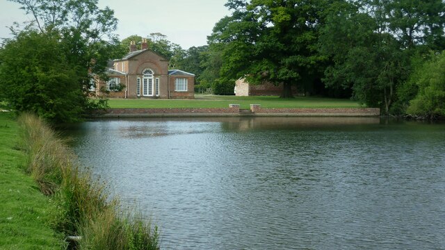
The Menagerie, Burton Constable At the north end of the lake
The Menagerie, Burton Constable
At the north end of the lake
Farmland at Four Lane Ends
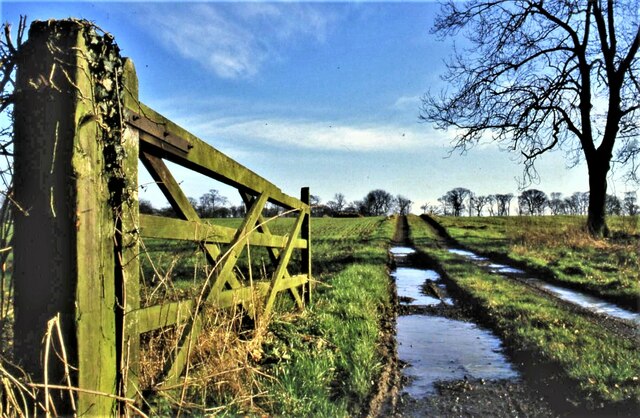
Burton Constable, Yorkshire Field gate and tracks leading from Jackey Lane to Burton Constable estate.
Burton Constable, Yorkshire
Field gate and tracks leading from Jackey Lane to Burton Constable estate.
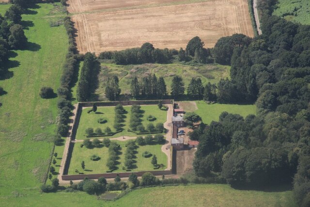
Burton Constable: aerial 2023 (3) gardens
Country bridleway. Looking south from Crab Tree Lane.
Country bridleway.
Looking south from Crab Tree Lane.
Farm Picture taken from the bridleway.
Farm
Picture taken from the bridleway.
Roe Hill Pleasant walk up here!
Roe Hill
Pleasant walk up here!
Near 'Bog Wood' Usually a very pleasant walk along the north-south bridleway here, but the field looks bare being devoid of crops this year.
Near 'Bog Wood'
Usually a very pleasant walk along the north-south bridleway here, but the field looks bare being devoid of crops this year.
Looking south down bridleway Taken from MR: TA171372 looking south.
Looking south down bridleway
Taken from MR: TA171372 looking south.
The Blue Bell at Old Ellerby Quaint pub!
The Blue Bell at Old Ellerby
Quaint pub!
Garden Nurseries at Old Ellerby At MR: TA168371
Garden Nurseries at Old Ellerby
At MR: TA168371
Burton Constable Estate. Taken from the minor road at MR: TA18353698 looking ESE.
Burton Constable Estate.
Taken from the minor road at MR: TA18353698 looking ESE.
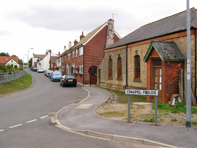
Coniston View from the west side of the village looking east. Coniston is situated on the west side of the A165 by-pass, built in 1970 running south to Hull. Within this grid square is Lane End Farm on the west edge. Seen here on the right is the now derelict Primitive Methodist Church. Coniston was known as Coningesbi in 1086, probably an Anglican, Scandinavian mixed name, possibly meaning 'Kings Farm'.
Coniston
View from the west side of the village looking east. Coniston is situated on the west side of the A165 by-pass, built in 1970 running south to Hull. Within this grid square is Lane End Farm on the west edge. Seen here on the right is the now derelict Primitive Methodist Church. Coniston was known as Coningesbi in 1086, probably an Anglican, Scandinavian mixed name, possibly meaning 'Kings Farm'.
Lay-by  on the  A165 This area is all farmland with the A165 running north, south through the grid square. This view looking north.
Lay-by on the A165
This area is all farmland with the A165 running north, south through the grid square. This view looking north.
Golf Course The A165 from Coniston cuts across the top NW corner of the grid square. The road to Bilton diagonally across the square splitting the golf course in two!
Golf Course
The A165 from Coniston cuts across the top NW corner of the grid square. The road to Bilton diagonally across the square splitting the golf course in two!
Show me another place!

Cock Hill is located at Grid Ref: TA1635 (Lat: 53.806004, Lng: -0.22928452)

Division: East Riding

Unitary Authority: East Riding of Yorkshire

Police Authority: Humberside

What 3 Words

///flip.frowns.flagpole. Near Burton Constable, East Yorkshire

Nearby Locations

Cock Hill Coniston

Related Wikis

Coniston, East Riding of Yorkshire

Coniston is a village and civil parish in the East Riding of Yorkshire, England, in an area known as Holderness. It is situated approximately 6 miles...

Thirtleby

Thirtleby is a hamlet in the civil parish of Coniston, in the East Riding of Yorkshire, England. It is situated approximately 6 miles (9.7 km) north-east...

Old Ellerby

Old Ellerby is a hamlet in the East Riding of Yorkshire, England, in an area known as Holderness. It is situated approximately 7 miles (11 km) north-east...

Burton Constable

Burton Constable is a village and civil parish in the East Riding of Yorkshire, England. It is located approximately 9 miles (14 km) north-east of Hull...

Have you been to Cock Hill?

Leave your review of Cock Hill below (or comments, questions and feedback).