Conygarth Hill
Hill, Mountain in Yorkshire
England
Conygarth Hill

Conygarth Hill is a prominent geographical feature located in Yorkshire, England. Standing at an elevation of 450 feet (137 meters), it is classified as a hill rather than a mountain due to its relatively modest height. The hill is situated within the Yorkshire Dales National Park, a region renowned for its picturesque landscapes and breathtaking natural beauty.
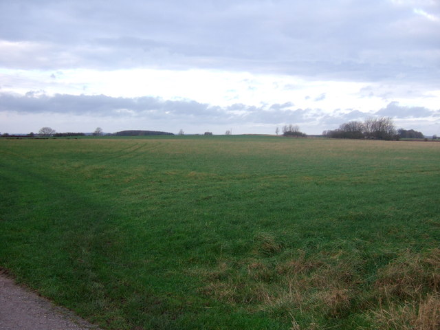
Conygarth Hill is characterized by its gentle slopes and lush vegetation, predominantly covered in grasses and heather. The hill offers a panoramic view of the surrounding countryside, providing visitors with a unique vantage point to admire the serene beauty of Yorkshire. On clear days, it is possible to see the sprawling valleys, meandering rivers, and distant peaks that dot the landscape.
The hill is a popular destination for outdoor enthusiasts who enjoy walking, hiking, and bird-watching. There are several well-marked trails that crisscross the area, allowing visitors to explore the hill and its surroundings at their own pace. The diverse flora and fauna found on Conygarth Hill make it an ideal habitat for various bird species, including peregrine falcons, red grouse, and kestrels.
In addition to its natural beauty, Conygarth Hill also has historical significance. It is believed that the hill was once used as a vantage point by ancient civilizations, providing them with a strategic location for observation and defense. Today, remnants of these ancient settlements can still be found in the form of burial mounds and stone structures.
Overall, Conygarth Hill is a captivating destination that showcases the enchanting landscapes and rich history of Yorkshire. Whether it is for a leisurely stroll or an immersive exploration, this hill offers a memorable experience for nature lovers and history enthusiasts alike.
If you have any feedback on the listing, please let us know in the comments section below.
Conygarth Hill Images
Images are sourced within 2km of 54.034734/-0.23011429 or Grid Reference TA1661. Thanks to Geograph Open Source API. All images are credited.


Conygarth Hill is located at Grid Ref: TA1661 (Lat: 54.034734, Lng: -0.23011429)
Division: East Riding
Unitary Authority: East Riding of Yorkshire
Police Authority: Humberside
What 3 Words
///compiler.charm.scooped. Near Barmston, East Yorkshire
Nearby Locations
Related Wikis

Fraisthorpe
Fraisthorpe is a village and former civil parish, now in the parish of Barmston, in the East Riding of Yorkshire, England. It is situated approximately...

A165 road
The A165 is a road that links Scarborough and Kingston upon Hull, both in Yorkshire, England. The road is designated as a Primary Route from its junction...

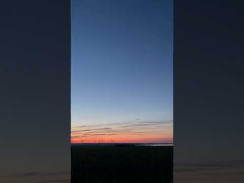
Fraisthorpe Wind Farm
Fraisthorpe Wind Farm is a wind power generating site located in the village of Fraisthorpe in the East Riding of Yorkshire, England. The site is just...

Barmston, East Riding of Yorkshire
Barmston is a village and civil parish in the East Riding of Yorkshire, England. It is situated on the Holderness coast, overlooking the North Sea and...
Related Videos

Caravans For Sale at Barmston Beach Holiday Park, Yorkshire
Take a look at what life would be like as a holiday home owner at Barmston Beach Holiday Park. Barmston beach is near the ...

Barmston Beach Holiday Park
APPLEPM #OneDayWithMe #StoryOfMyLife #LadyEsan #ชีวิตไทยในต่างแดน #Barmston #Beach #CaravanPark Holiday home ...

Our Holiday Home. Carnaby Retreat nr Bridlington to Rent
Our private holiday home for rent nr Bridlington. Take a look on Google and Facebook page Carnaby Retreat to contact me to ...
Nearby Amenities
Located within 500m of 54.034734,-0.23011429Have you been to Conygarth Hill?
Leave your review of Conygarth Hill below (or comments, questions and feedback).