St Julian's Hill

Hill, Mountain in Hertfordshire St. Albans

England

St Julian's Hill

Park Looking NE from TL138067 across the lake in the park, toward the abbey in TL1407
Park Credit: Rob Hinkley

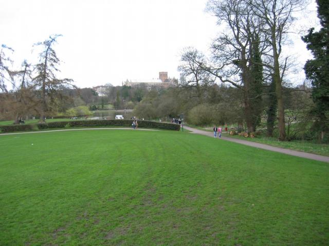
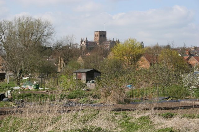
St Julian's Hill is a prominent geographical feature located in Hertfordshire, England. Situated near the town of St Albans, it is a picturesque hill that offers stunning views of the surrounding landscape. While it is commonly referred to as a hill, some locals consider it more of a small mountain due to its significant elevation.

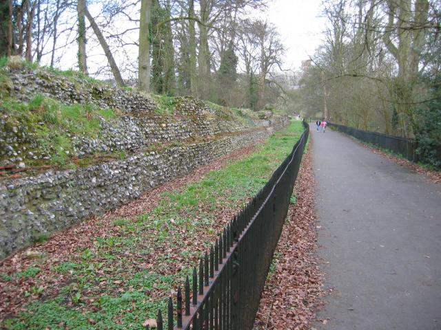
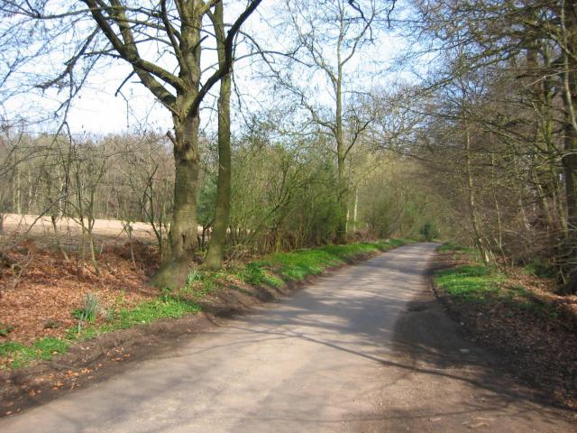
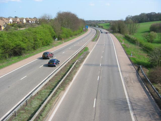
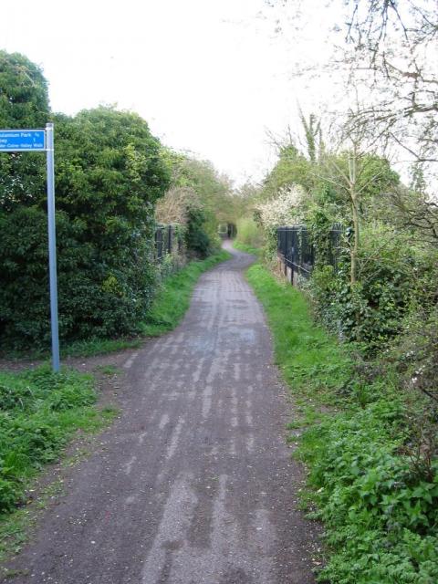
Standing at an approximate height of 144 meters (472 feet), St Julian's Hill is a popular destination for outdoor enthusiasts and nature lovers. The hill is covered in lush green vegetation, including a variety of trees such as oak, beech, and birch, which add to its natural beauty. There are also several walking trails that wind their way up the hill, providing visitors with the opportunity to explore the area.

At the top of the hill, there is a viewpoint that offers breathtaking panoramic views of the surrounding countryside. On a clear day, it is possible to see as far as the city of London, approximately 30 kilometers (18.6 miles) to the south. This viewpoint is a favorite spot for locals and tourists alike, who often visit to witness stunning sunsets or to simply enjoy the peaceful atmosphere.

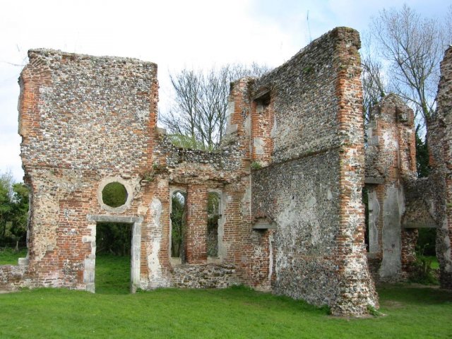
St Julian's Hill is not only known for its natural beauty but also for its historical significance. It is believed to have been a settlement site during the Iron Age, and archaeological evidence suggests that it was inhabited during this period. Today, the hill serves as a reminder of the area's rich history and offers visitors a chance to explore its ancient roots.

Overall, St Julian's Hill is a captivating destination that combines natural beauty, historical significance, and breathtaking views. Whether it is for a leisurely walk, a scenic picnic, or to explore the area's past, this hill/mountain provides a memorable experience for all who visit.

If you have any feedback on the listing, please let us know in the comments section below.

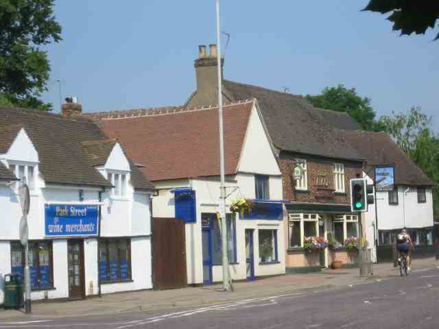
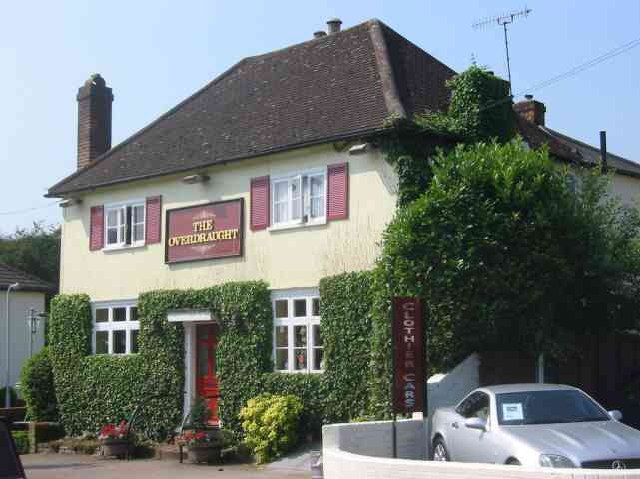
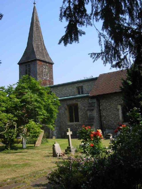
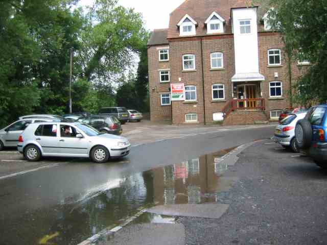
St Julian's Hill Images

Images are sourced within 2km of 51.73564/-0.34698538 or Grid Reference TL1405. Thanks to Geograph Open Source API. All images are credited.

Park Looking NE from TL138067 across the lake in the park, toward the abbey in TL1407
Park
Looking NE from TL138067 across the lake in the park, toward the abbey in TL1407
Roman city wall Looking NE from TL137066, with the old Roman city wall on the left.
Roman city wall
Looking NE from TL137066, with the old Roman city wall on the left.
Road from Potters Crouch to Chiswell Green Looking East from TL123052 with copse on the right, open field and then woods on the left.
Road from Potters Crouch to Chiswell Green
Looking East from TL123052 with copse on the right, open field and then woods on the left.
Gateway to suburbia On the Western edge of Chiswell Green, having just left the farmland behind, looking East from TL131045.
Gateway to suburbia
On the Western edge of Chiswell Green, having just left the farmland behind, looking East from TL131045.
M10, from bridge. Looking East from the bridge over the M10 at TL137055.
M10, from bridge.
Looking East from the bridge over the M10 at TL137055.
St Alban's cathedral The west front as rebuilt in the late C19 by a benefactor, Lord Grimthorpe, to his own specification. From TL143071, looking East
St Alban's cathedral
The west front as rebuilt in the late C19 by a benefactor, Lord Grimthorpe, to his own specification. From TL143071, looking East
St Albans cathedral Looking West from TL146070
St Albans cathedral
Looking West from TL146070
Cycleway bridge Looking East over the bridge over the Ver on the St Albans to Hatfield cycleway - an abandoned railway line - at TL153063.
Cycleway bridge
Looking East over the bridge over the Ver on the St Albans to Hatfield cycleway - an abandoned railway line - at TL153063.
Ruined nunnery The ruined nunnery at TL151064
Ruined nunnery
The ruined nunnery at TL151064
The Allotments Near the River Ver are the Allotments just off Cottonmill Lane.
The Allotments
Near the River Ver are the Allotments just off Cottonmill Lane.
Railway Bridge over the Alban Way Just near London Road is a pedestrian route from St.Albans to Hatfield.
Railway Bridge over the Alban Way
Just near London Road is a pedestrian route from St.Albans to Hatfield.
St Alban's R.C. Church at St Julians This church is almost at the southern edge of St Albans.
St Alban's R.C. Church at St Julians
This church is almost at the southern edge of St Albans.
A road in Chiswell Green The forest trees at least show that it has some attraction
A road in Chiswell Green
The forest trees at least show that it has some attraction
The Falcon Pub in Park Street, Herts This pub is at the centre of the village
The Falcon Pub in Park Street, Herts
This pub is at the centre of the village
The Overdraught Pub,  Park Street, Herts Is that a pun or is that a howler?
The Overdraught Pub, Park Street, Herts
Is that a pun or is that a howler?
St Stephen's Church  St Albans This church has sufficient land for car parking which is a boon as the road outside is always busy.
St Stephen's Church St Albans
This church has sufficient land for car parking which is a boon as the road outside is always busy.
The King Harry Pub St Albans This is an awkward junction with a double mini roundabout. Best avoided if possible. {see note re St Stephens Church}
The King Harry Pub St Albans
This is an awkward junction with a double mini roundabout. Best avoided if possible. {see note re St Stephens Church}
Sopwell Mill  redevelopment. The mill has been refurbished as offices but the turn to the right leads to a narrow bridge and a blind corner. Used by many commuters so rather tricky to negotiate.
Sopwell Mill redevelopment.
The mill has been refurbished as offices but the turn to the right leads to a narrow bridge and a blind corner. Used by many commuters so rather tricky to negotiate.
Show me another place!

St Julian's Hill is located at Grid Ref: TL1405 (Lat: 51.73564, Lng: -0.34698538)

Administrative County: Hertfordshire

District: St. Albans

Police Authority: Hertfordshire

What 3 Words

///gather.vest.device. Near St Albans, Hertfordshire

Nearby Locations

St Julian's Hill

Related Wikis

The Marlborough Science Academy

The Marlborough Science Academy is a secondary school and sixth form with Academy status, located in St Albans, Hertfordshire, England. It has a specialism...

Turning Forms

Turning Forms (BH 166) is a concrete sculpture by Barbara Hepworth, one of her first public commissions, made in 1950 for the Festival of Britain. It was...

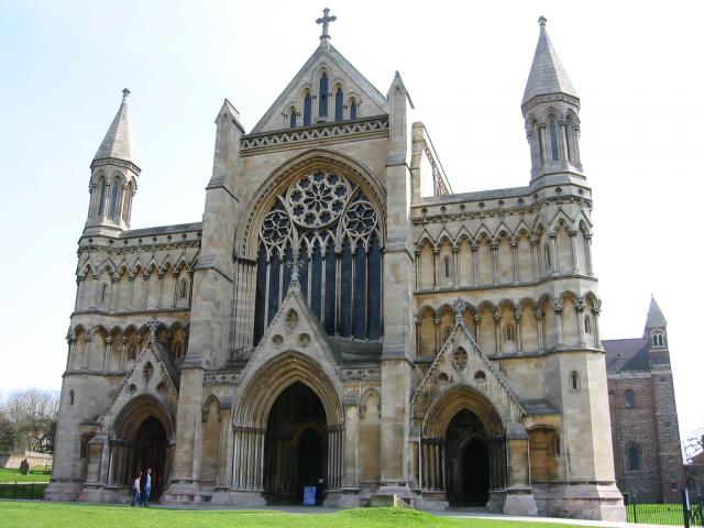
St Stephen's Church, St Albans

St Stephen's Church is a Church of England parish church in St Albans, Hertfordshire, England. It is located to the south of the town centre, at the top...

St Albans (UK Parliament constituency)

St Albans is a constituency represented in the House of Commons of the UK Parliament since 2019 by Daisy Cooper, a Liberal Democrat.This article also describes...

St Stephen, Hertfordshire

St Stephen is a civil parish in the St Albans City and District in Hertfordshire, England. It is located approximately 17 miles (27 km) north-northwest...

St Columba's College, St Albans

St Columba's College is a co-educational 4–18 private, Catholic day school and sixth form in St Albans, Hertfordshire, England. It was founded in 1939...

St Albans Abbey railway station

St Albans Abbey railway station in St Albans, Hertfordshire, England is about 0.6 miles (1 km) south of the city centre in the St Stephen's area. It is...

Chiswell Green

Chiswell Green is a village, on the southern outskirts of St Albans, in the parish of St Stephen and district of the City of St Albans in Hertfordshire...

Nearby Amenities

Located within 500m of 51.73564,-0.34698538
Mini Roundabout
Lat/Long: 51.7382334/-0.3451831
Turning Circle
Lat/Long: 51.7345804/-0.3471219
Turning Circle
Lat/Long: 51.7369703/-0.3417552
Bus Stop
Midway
Bench: yes
Bin: yes
Bus: yes
Lit: yes
Naptan AtcoCode: 210021503500
Naptan Bearing: SW
Naptan CommonName: Midway
Naptan Crossing: opp Midway
Naptan Indicator: opp
Naptan Landmark: opp Midway
Naptan NaptanCode: hrtawpwd
Naptan PlusbusZoneRef: STALBCY
Naptan ShortCommonName: NA
Naptan Street: Watford Road
Naptan Verified: no
Public Transport: platform
Shelter: yes
Source: naptan_import
Tactile Paving: yes
Lat/Long: 51.7383052/-0.352131
Bus Stop
Watling View
Bus: yes
Naptan AtcoCode: 210021503825
Naptan Bearing: SW
Naptan CommonName: Watling View
Naptan Crossing: Tavistock Close
Naptan Indicator: nr
Naptan Landmark: Tavistock Close
Naptan NaptanCode: hrtawpjd
Naptan PlusbusZoneRef: STALBCY
Naptan ShortCommonName: NA
Naptan Street: Tavistock Avenue
Naptan Verified: no
Public Transport: platform
Source: naptan_import
Lat/Long: 51.7368752/-0.3432341
Bus Stop
Watling View School
Bus: yes
Naptan AtcoCode: 210021503845
Naptan Bearing: SE
Naptan CommonName: Watling View School
Naptan Crossing: Ashby Gardens
Naptan Indicator: o/s
Naptan Landmark: Ashby Gardens
Naptan NaptanCode: hrtawpjp
Naptan PlusbusZoneRef: STALBCY
Naptan ShortCommonName: NA
Naptan Street: Watling View
Naptan Verified: no
Public Transport: platform
Shelter: no
Source: naptan_import
Lat/Long: 51.735278/-0.3428242
Bus Stop
Doggetts Way
Bus: yes
Local Ref: NR
Naptan AtcoCode: 210021503850
Naptan Bearing: SE
Naptan CommonName: Doggetts Way
Naptan Crossing: Doggetts Way
Naptan Indicator: nr
Naptan Landmark: Doggetts Way
Naptan NaptanCode: hrtawpda
Naptan PlusbusZoneRef: STALBCY
Naptan ShortCommonName: NA
Naptan Street: Tavistock Avenue
Naptan Verified: no
Public Transport: platform
Shelter: yes
Source: naptan_import
Lat/Long: 51.7388748/-0.3423381
Bus Stop
Vesta Avenue
Bin: yes
Bus: yes
Naptan AtcoCode: 210021503860
Naptan Bearing: SW
Naptan CommonName: Vesta Avenue
Naptan Crossing: Watling Street
Naptan Indicator: SW-bound
Naptan Landmark: Watling Street
Naptan NaptanCode: hrtawpdj
Naptan PlusbusZoneRef: STALBCY
Naptan ShortCommonName: NA
Naptan Street: Vesta Avenue
Naptan Verified: no
Public Transport: platform
Shelter: no
Source: naptan_import
Lat/Long: 51.7372329/-0.3457995
Bus Stop
Vesta Avenue
Bus: yes
Naptan AtcoCode: 210021507920
Naptan Bearing: NE
Naptan CommonName: Vesta Avenue
Naptan Crossing: Watling Street
Naptan Indicator: NE-bound
Naptan Landmark: Watling Street
Naptan NaptanCode: hrtawajp
Naptan PlusbusZoneRef: STALBCY
Naptan ShortCommonName: NA
Naptan Street: Vesta Avenue
Naptan Verified: no
Public Transport: platform
Source: naptan_import
Lat/Long: 51.7376675/-0.3457018
Bus Stop
Midway
Bench: yes
Bin: yes
Lit: yes
Naptan AtcoCode: 210021508280
Naptan Bearing: NE
Naptan CommonName: Midway
Naptan Crossing: Midway
Naptan Indicator: nr
Naptan Landmark: Midway
Naptan NaptanCode: hrtatwpm
Naptan PlusbusZoneRef: STALBCY
Naptan ShortCommonName: NA
Naptan Street: Watford Road
Naptan Verified: no
Public Transport: platform
Shelter: no
Source: naptan_import
Tactile Paving: no
Lat/Long: 51.7376785/-0.3528935
Marlborough School
Naptan AtcoCode: 210021585150
Naptan Bearing: E
Naptan BusStopType: CUS
Naptan CommonName: Marlborough School
Naptan Crossing: Marlborough School
Naptan Indicator: o/s
Naptan Landmark: Marlborough School
Naptan NaptanCode: hrtatgad
Naptan ShortCommonName: NA
Naptan Street: Watling Street
Naptan Verified: no
Source: naptan_import
Lat/Long: 51.7387673/-0.3491027
Noexit: yes
Lat/Long: 51.7357518/-0.3424648
Post Office
Saint Stephen's Post Office
Addr Postcode: AL1 2PD
Addr Street: Watling View
Branch: St Stephens
Brand: Post Office
Brand Wikidata: Q1783168
Check Date: 2020-02-20
Contact Website: https://www.postoffice.co.uk/branch-finder/1280333/st-stephens
Operator: Londis
Ref Pol Id: 18970
Lat/Long: 51.7383071/-0.3446077
Post Box
Brand: Royal Mail
Brand Wikidata: Q638098
Brand Wikipedia: en:Royal Mail
Operator: Royal Mail
Operator Wikidata: Q638098
Post Box Type: pillar
Ref: AL1 138
Lat/Long: 51.738228/-0.344732
Noexit: yes
Lat/Long: 51.7393456/-0.3442488
Turning Circle
Lat/Long: 51.7384754/-0.3525959
Crossing
Crossing: unmarked
Crossing Island: no
Tactile Paving: no
Lat/Long: 51.7382461/-0.3414958
Crossing
Crossing: unmarked
Crossing Island: yes
Tactile Paving: yes
Lat/Long: 51.7371785/-0.3464006
Turning Circle
Lat/Long: 51.738095/-0.3438792
Turning Circle
Lat/Long: 51.7356553/-0.3458608
St Julians
Place: suburb
Lat/Long: 51.7357065/-0.3430111
Give Way
Lat/Long: 51.7365993/-0.3478156
Place Of Worship
St Bartholomew's
Denomination: catholic
Religion: christian
Lat/Long: 51.7370419/-0.3456354
Crossing
Button Operated: yes
Crossing: traffic_signals
Crossing Island: no
Tactile Paving: yes
Lat/Long: 51.7391801/-0.3475902
Turning Circle
Lat/Long: 51.73533/-0.3403785
Turning Circle
Lat/Long: 51.7345932/-0.3414051
Turning Circle
Lat/Long: 51.7371751/-0.3493611
Noexit: yes
Lat/Long: 51.7383982/-0.3449688
Give Way
Lat/Long: 51.7391077/-0.3446814
Traffic Calming: hump
Lat/Long: 51.7393169/-0.3447441
Post Box
Brand: Royal Mail
Brand Wikidata: Q638098
Brand Wikipedia: en:Royal Mail
Operator: Royal Mail
Operator Wikidata: Q638098
Post Box Type: pillar
Ref: AL1 258D
Royal Cypher: GR
Royal Cypher Wikidata: Q33102273
Lat/Long: 51.7352551/-0.3470959
Crossing
Crossing Island: no
Priority: backward
Tactile Paving: yes
Traffic Calming: choked_table
Lat/Long: 51.7372233/-0.3441353
Crossing
Crossing: unmarked
Crossing Markings: no
Tactile Paving: incorrect
Lat/Long: 51.7320993/-0.3440718
Street Lamp
Lamp Type: high_pressure_sodium
Source: Personal memory
Lat/Long: 51.732847/-0.3453072
Street Lamp
Lamp Type: high_pressure_sodium
Source: Personal memory
Lat/Long: 51.7329202/-0.3452958
Street Lamp
Lamp Type: high_pressure_sodium
Source: Personal memory
Lat/Long: 51.7330153/-0.3457928
Street Lamp
Lamp Type: high_pressure_sodium
Source: Personal memory
Lat/Long: 51.7331198/-0.3463106
Street Lamp
Lamp Type: led
Source: Personal memory
Lat/Long: 51.7328389/-0.3451857
Turning Circle
Lat/Long: 51.7345522/-0.3440436
Crossing
Crossing: unmarked
Crossing Island: no
Tactile Paving: no
Lat/Long: 51.7398243/-0.3455234
Turning Circle
Lat/Long: 51.7345788/-0.340626
Artwork Type: sculpture
Tourism: artwork
Wikidata: Q26282973
Wikipedia: en:Turning Forms
Lat/Long: 51.738999/-0.3490528
Traffic Calming: island
Lat/Long: 51.7373875/-0.352999
Direction: 210
Generator Method: photovoltaic
Generator Output Electricity: yes
Generator Solar Modules: 13
Generator Source: solar
Generator Type: solar_photovoltaic_panel
Location: roof
Power: generator
Lat/Long: 51.7350756/-0.3498756
Direction: 165
Generator Method: photovoltaic
Generator Output Electricity: yes
Generator Solar Modules: 3
Generator Source: solar
Generator Type: solar_photovoltaic_panel
Location: roof
Power: generator
Lat/Long: 51.735974/-0.3478224
Crossing
Crossing: unmarked
Crossing Island: yes
Tactile Paving: no
Lat/Long: 51.7370246/-0.346166
Direction: 250
Generator Method: photovoltaic
Generator Output Electricity: yes
Generator Solar Modules: 9
Generator Source: solar
Generator Type: solar_photovoltaic_panel
Location: roof
Power: generator
Lat/Long: 51.7375868/-0.3480669
Traffic Calming: island
Lat/Long: 51.7386259/-0.3520494
Direction: 245
Generator Method: photovoltaic
Generator Output Electricity: yes
Generator Solar Modules: 6
Generator Source: solar
Generator Type: solar_photovoltaic_panel
Location: roof
Power: generator
Lat/Long: 51.737999/-0.3472941
Direction: 155
Generator Method: photovoltaic
Generator Output Electricity: yes
Generator Solar Modules: 13
Generator Source: solar
Generator Type: solar_photovoltaic_panel
Location: roof
Power: generator
Lat/Long: 51.737938/-0.3472674
Direction: 170
Generator Method: photovoltaic
Generator Output Electricity: yes
Generator Solar Modules: 8
Generator Source: solar
Generator Type: solar_photovoltaic_panel
Location: roof
Power: generator
Lat/Long: 51.7346982/-0.3428519
Turning Circle
Lat/Long: 51.7361352/-0.3444217
Direction: 245
Generator Method: photovoltaic
Generator Output Electricity: yes
Generator Solar Modules: 13
Generator Source: solar
Generator Type: solar_photovoltaic_panel
Location: roof
Power: generator
Lat/Long: 51.7372328/-0.3445001
Direction: 245
Generator Method: photovoltaic
Generator Output Electricity: yes
Generator Solar Modules: 10
Generator Source: solar
Generator Type: solar_photovoltaic_panel
Location: roof
Power: generator
Lat/Long: 51.737438/-0.3446427
Direction: 245
Generator Method: photovoltaic
Generator Output Electricity: yes
Generator Solar Modules: 13
Generator Source: solar
Generator Type: solar_photovoltaic_panel
Location: roof
Power: generator
Lat/Long: 51.7374914/-0.3446799
Direction: 245
Generator Method: photovoltaic
Generator Output Electricity: yes
Generator Solar Modules: 16
Generator Source: solar
Generator Type: solar_photovoltaic_panel
Location: roof
Power: generator
Lat/Long: 51.7376862/-0.3447766
Traffic Calming: table
Lat/Long: 51.7379544/-0.3446442
Turning Circle
Lat/Long: 51.7357161/-0.3426045
Direction: 245
Generator Method: photovoltaic
Generator Output Electricity: yes
Generator Solar Modules: 25
Generator Source: solar
Generator Type: solar_photovoltaic_panel
Location: roof
Power: generator
Lat/Long: 51.7372956/-0.3423508
Direction: 75
Generator Method: photovoltaic
Generator Output Electricity: yes
Generator Solar Modules: 25
Generator Source: solar
Generator Type: solar_photovoltaic_panel
Location: roof
Power: generator
Lat/Long: 51.7372419/-0.3425684
Direction: 155
Generator Method: photovoltaic
Generator Output Electricity: yes
Generator Solar Modules: 55
Generator Source: solar
Generator Type: solar_photovoltaic_panel
Location: roof
Power: generator
Lat/Long: 51.7373195/-0.3424898
Marker: post
Substance: oil
Utility: oil
Lat/Long: 51.7319888/-0.3458349
Marker: post
Substance: oil
Utility: oil
Lat/Long: 51.7318279/-0.3455245
Street Lamp
Lat/Long: 51.7319921/-0.3455732
Street Lamp
Lat/Long: 51.7322227/-0.3451923
Street Lamp
Lat/Long: 51.7322853/-0.3450556
Marker: post
Substance: oil
Utility: oil
Lat/Long: 51.7318663/-0.344081
Street Lamp
Lat/Long: 51.7321649/-0.3442203
Street Lamp
Lat/Long: 51.7322944/-0.342337
Street Lamp
Lat/Long: 51.7324597/-0.3430659
Street Lamp
Lat/Long: 51.7325872/-0.3436996
Street Lamp
Lat/Long: 51.7325582/-0.3435494
Traffic Calming: island
Lat/Long: 51.7333727/-0.3444491
Barrier: kerb
Kerb: lowered
Lat/Long: 51.7320598/-0.3443058
Crossing
Crossing: unmarked
Crossing Markings: no
Lat/Long: 51.7320798/-0.3442282
Crossing
Crossing: unmarked
Crossing Island: yes
Crossing Markings: no
Tactile Paving: yes
Lat/Long: 51.736717/-0.3534644
Crossing
Crossing: unmarked
Crossing Island: yes
Crossing Markings: no
Tactile Paving: yes
Lat/Long: 51.7367558/-0.353585
Crossing
Crossing: unmarked
Crossing Island: no
Tactile Paving: no
Lat/Long: 51.7356084/-0.3430098
Crossing
Crossing: unmarked
Crossing Island: no
Tactile Paving: no
Lat/Long: 51.7399076/-0.3455685
Crossing
Crossing: unmarked
Crossing Island: no
Tactile Paving: yes
Traffic Calming: choker
Lat/Long: 51.7386956/-0.344921
Crossing
Crossing: unmarked
Crossing Island: no
Tactile Paving: yes
Lat/Long: 51.7371119/-0.3466438
The data included in this document is from www.openstreetmap.org. The data is made available under ODbL.

Have you been to St Julian's Hill?

Leave your review of St Julian's Hill below (or comments, questions and feedback).