Winch Hill

Hill, Mountain in Hertfordshire North Hertfordshire

England

Winch Hill

Luton Airport from the air The entire airport can be seen in this view taken from a Prague to Birmingham flight 23,000 feet above Harpenden. The Vauxhall vehicle factory is to the left of the airport, with Luton Airport Parkway railway station further to the left. Copt Farm is in the foreground.
Luton Airport from the air Credit: Thomas Nugent

Winch Hill is a prominent hill located in the county of Hertfordshire, England. Situated near the town of Hitchin, it is part of the Chiltern Hills, a range of chalk hills stretching across several counties in the southeast of England.

Rising to an elevation of approximately 245 meters (804 feet) above sea level, Winch Hill offers breathtaking panoramic views of the surrounding countryside. Its location within an Area of Outstanding Natural Beauty makes it a popular destination for outdoor enthusiasts, nature lovers, and hikers. The hill is characterized by its rolling contours, covered in lush greenery and dotted with patches of woodland, providing a stunning backdrop for walkers and photographers alike.

The summit of Winch Hill features a trig point, which serves as a marker for surveyors and geographers. This point offers an excellent vantage point from which to appreciate the extensive vistas across Hertfordshire and beyond, with landmarks such as Ivinghoe Beacon and the Dunstable Downs visible on clear days.

The surrounding area of Winch Hill boasts a diverse range of flora and fauna, including various species of wildflowers, birds, and butterflies. It is also home to a rich archaeological history, with evidence of prehistoric settlements and burial mounds found in the vicinity.

Access to Winch Hill is facilitated by a network of footpaths and bridleways, allowing visitors to explore its natural beauty and enjoy the tranquility of the surroundings. Whether it is for a leisurely stroll, a challenging hike, or simply to appreciate the scenic views, Winch Hill offers a delightful escape into the heart of the Hertfordshire countryside.

If you have any feedback on the listing, please let us know in the comments section below.
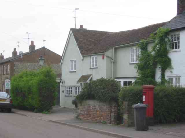
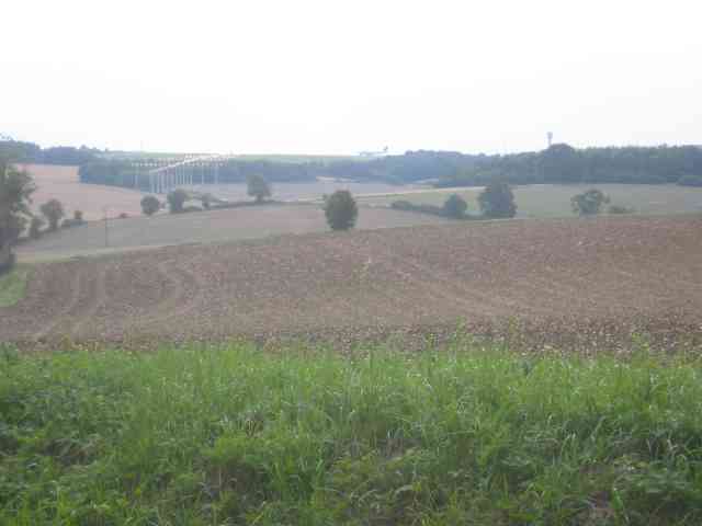
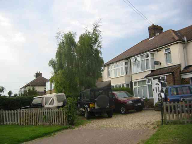
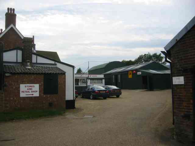
Winch Hill Images

Images are sourced within 2km of 51.882252/-0.34633505 or Grid Reference TL1321. Thanks to Geograph Open Source API. All images are credited.

Luton Airport from the air The entire airport can be seen in this view taken from a Prague to Birmingham flight 23,000 feet above Harpenden. The Vauxhall vehicle factory is to the left of the airport, with Luton Airport Parkway railway station further to the left. Copt Farm is in the foreground.
Luton Airport from the air
The entire airport can be seen in this view taken from a Prague to Birmingham flight 23,000 feet above Harpenden. The Vauxhall vehicle factory is to the left of the airport, with Luton Airport Parkway railway station further to the left. Copt Farm is in the foreground.
Wigmore Park Shopping Centre District shopping centre off Wigmore Lane.
Wigmore Park Shopping Centre
District shopping centre off Wigmore Lane.
Wigmore Park Shopping Centre District shopping centre off Wigmore Lane.
Wigmore Park Shopping Centre
District shopping centre off Wigmore Lane.
Green by Luton Road, Cockernhoe
Luton Airport DART station The Luton Airport terminus of the Direct Airport-Rail Transit connecting the airport with the Midland Mainline railway. It replaces the bus link and is markedly faster, with the 2.3km journey taking just under 4 minutes. Costing £225m, construction began in April 2018. It was planned to open in 2021 but Covid and other delays meant that it did not open until 10 March 2023, with a partial service; a full service began on 27 March, with a 4-minute frequency at peak times. <span class="nowrap"><a title="https://en.wikipedia.org/wiki/Luton_DART" rel="nofollow ugc noopener" href="https://en.wikipedia.org/wiki/Luton_DART">Link</a><img style="margin-left:2px;" alt="External link" title="External link - shift click to open in new window" src="https://s1.geograph.org.uk/img/external.png" width="10" height="10"/></span>
Luton Airport DART station
The Luton Airport terminus of the Direct Airport-Rail Transit connecting the airport with the Midland Mainline railway. It replaces the bus link and is markedly faster, with the 2.3km journey taking just under 4 minutes. Costing £225m, construction began in April 2018. It was planned to open in 2021 but Covid and other delays meant that it did not open until 10 March 2023, with a partial service; a full service began on 27 March, with a 4-minute frequency at peak times. LinkExternal link
Luton Airport DART station The Luton Airport terminus of the Direct Airport-Rail Transit connecting the airport with the Midland Mainline railway. It replaces the bus link and is markedly faster, with the 2.3km journey taking just under 4 minutes. Costing £225m, construction began in April 2018. It was planned to open in 2021 but Covid and other delays meant that it did not open until 10 March 2023, with a partial service; a full service began on 27 March, with a 4-minute frequency at peak times. <span class="nowrap"><a title="https://en.wikipedia.org/wiki/Luton_DART" rel="nofollow ugc noopener" href="https://en.wikipedia.org/wiki/Luton_DART">Link</a><img style="margin-left:2px;" alt="External link" title="External link - shift click to open in new window" src="https://s1.geograph.org.uk/img/external.png" width="10" height="10"/></span>.
Luton Airport DART station
The Luton Airport terminus of the Direct Airport-Rail Transit connecting the airport with the Midland Mainline railway. It replaces the bus link and is markedly faster, with the 2.3km journey taking just under 4 minutes. Costing £225m, construction began in April 2018. It was planned to open in 2021 but Covid and other delays meant that it did not open until 10 March 2023, with a partial service; a full service began on 27 March, with a 4-minute frequency at peak times. LinkExternal link.
Luton Airport runway This spot midway down the runway is ideal for plane spotters. Facilities are poor.
Luton Airport runway
This spot midway down the runway is ideal for plane spotters. Facilities are poor.
Dane Street Farm The amount of rubbish is quite staggering
Dane Street Farm
The amount of rubbish is quite staggering
Dane Street Farm Rubbish includes the red oil drums
Dane Street Farm
Rubbish includes the red oil drums
Wandon Green Farm The farmhouse looks quite well kept.
Wandon Green Farm
The farmhouse looks quite well kept.
Wandon Green Farm The yard looks to be unused but that is simply a surmise. It was Sunday after all.
Wandon Green Farm
The yard looks to be unused but that is simply a surmise. It was Sunday after all.
Empty showrooms at Breachwood  Green Was this once a car sales emporium?
Yes it used to sell SAAB cars.
Empty showrooms at Breachwood Green
Was this once a car sales emporium? Yes it used to sell SAAB cars.
House next door to the showrooms House and showrooms <a title="https://www.geograph.org.uk/photo/47777" href="https://www.geograph.org.uk/photo/47777">Link</a> would seem to have a relationship of owner perhaps.
House next door to the showrooms
House and showrooms Link would seem to have a relationship of owner perhaps.
End of runway lights seen from Lye Hill Breachwood Green At least the planes are on the landing approach so are relatively quiet.
End of runway lights seen from Lye Hill Breachwood Green
At least the planes are on the landing approach so are relatively quiet.
Houses in Lye Hill  Breachwood Green These houses look as if they were once local authority owned before the right to purchase was introduced. They are right in line for the airport approach.
Houses in Lye Hill Breachwood Green
These houses look as if they were once local authority owned before the right to purchase was introduced. They are right in line for the airport approach.
Buildings at Winch Hill Farm The farmyard appears unused
Buildings at Winch Hill Farm
The farmyard appears unused
Farm Machinery depot at Wandon End Parked cars means that there are people inside the buildings.
Farm Machinery depot at Wandon End
Parked cars means that there are people inside the buildings.
Farm Machinery depot at Wandon End The front loader scoops and the Cambridge roll further into the yard confirm that this is a depot for agricultural machinery.
Farm Machinery depot at Wandon End
The front loader scoops and the Cambridge roll further into the yard confirm that this is a depot for agricultural machinery.
Show me another place!

Winch Hill is located at Grid Ref: TL1321 (Lat: 51.882252, Lng: -0.34633505)

Administrative County: Hertfordshire

District: North Hertfordshire

Police Authority: Hertfordshire

What 3 Words

///swift.guilty.hats. Near Luton, Bedfordshire

Related Wikis

King's Walden

King's Walden is a civil parish in the English county of Hertfordshire. The name includes an apostrophe, but this is often omitted. The main settlement...

Breachwood Green Mill, King's Walden

Breachwood Green Mill is a Grade II listed tower mill at King's Walden, Hertfordshire, England which has been converted to residential accommodation....

Wigmore, Luton

Wigmore is a suburb of Luton about 2 miles (3.2 km) east north-east of the town centre, and a ward of the Borough of Luton, in the ceremonial county of...
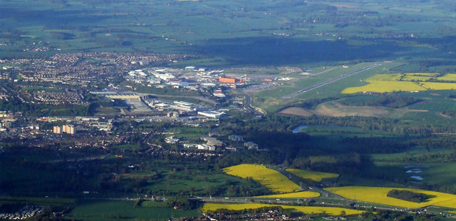
Luton Airport

London Luton Airport (IATA: LTN, ICAO: EGGW) is an international airport located in Luton, Bedfordshire, England, situated 1.7 miles (2.7 km) east of the...

Court Line Flight 95

Court Line Aviation Flight 95 was an international charter flight from London Luton Airport, Bedfordshire, England, to Munich-Riem Airport, West Germany...

Chiltern Green

Chiltern Green is a hamlet located in Bedfordshire, England. It is in the civil parish of Hyde. The settlement lent its name to Chiltern Green railway...

Vauxhall Park, Luton

Vauxhall Park is a suburb in east Luton, Bedfordshire, England. The area is roughly bounded by Crawley Green Road to the north, London Luton Airport to...
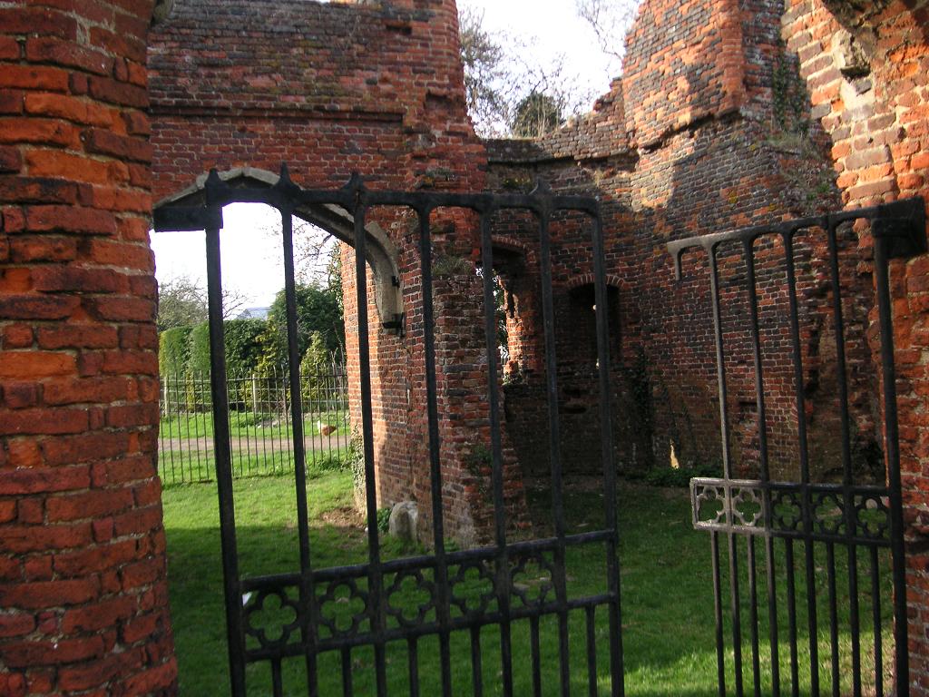
Someries Castle

Someries Castle (sometimes spelt Summeries castle) is a Scheduled Ancient Monument, in the Parish of Hyde, near the town of Luton, Bedfordshire, England...

Nearby Amenities

Located within 500m of 51.882252,-0.34633505
Aeroway: navigationaid
Navigationaid: als
Lat/Long: 51.8788358/-0.3439988
Aeroway: navigationaid
Navigationaid: als
Lat/Long: 51.8789216/-0.3435374
Aeroway: navigationaid
Navigationaid: als
Lat/Long: 51.8781338/-0.3481943
Aeroway: navigationaid
Navigationaid: als
Lat/Long: 51.8782791/-0.3473252
Aeroway: navigationaid
Navigationaid: als
Lat/Long: 51.8786302/-0.3452433
Aeroway: navigationaid
Navigationaid: als
Lat/Long: 51.8785577/-0.3456296
Aeroway: navigationaid
Navigationaid: als
Lat/Long: 51.8787759/-0.3444065
Aeroway: navigationaid
Navigationaid: als
Lat/Long: 51.8784649/-0.3460802
Aeroway: navigationaid
Navigationaid: als
Lat/Long: 51.878048/-0.3486127
Aeroway: navigationaid
Navigationaid: als
Lat/Long: 51.878193/-0.3477651
Aeroway: navigationaid
Navigationaid: als
Lat/Long: 51.8783854/-0.3465308
Aeroway: navigationaid
Navigationaid: als
Lat/Long: 51.8790478/-0.3427328
Aeroway: navigationaid
Navigationaid: als
Lat/Long: 51.8789815/-0.3431297
Aeroway: navigationaid
Navigationaid: als
Lat/Long: 51.8781316/-0.3491256
Aeroway: navigationaid
Navigationaid: als
Lat/Long: 51.8781409/-0.3468543
Aeroway: navigationaid
Navigationaid: als
Lat/Long: 51.8781873/-0.3468755
Aeroway: navigationaid
Navigationaid: als
Lat/Long: 51.8782436/-0.3468956
Aeroway: navigationaid
Navigationaid: als
Lat/Long: 51.8783227/-0.3469369
Aeroway: navigationaid
Navigationaid: als
Lat/Long: 51.8783986/-0.3469676
Aeroway: navigationaid
Navigationaid: als
Lat/Long: 51.8784574/-0.3469973
Aeroway: navigationaid
Navigationaid: als
Lat/Long: 51.8785091/-0.3470185
Aeroway: navigationaid
Navigationaid: als
Lat/Long: 51.8785139/-0.3447506
Aeroway: navigationaid
Navigationaid: als
Lat/Long: 51.8785603/-0.3447718
Aeroway: navigationaid
Navigationaid: als
Lat/Long: 51.8786166/-0.3447919
Aeroway: navigationaid
Navigationaid: als
Lat/Long: 51.8786957/-0.3448332
Aeroway: navigationaid
Navigationaid: als
Lat/Long: 51.8787716/-0.344864
Aeroway: navigationaid
Navigationaid: als
Lat/Long: 51.8788304/-0.3448936
Aeroway: navigationaid
Navigationaid: als
Lat/Long: 51.8788821/-0.3449148
The data included in this document is from www.openstreetmap.org. The data is made available under ODbL.

Have you been to Winch Hill?

Leave your review of Winch Hill below (or comments, questions and feedback).